

Description
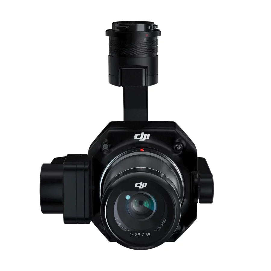
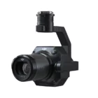
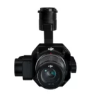
DJI Zenmuse P1 Full Frame Aerial Camera
The DJI Zenmuse P1 full frame sensor with interchangeable fixed-focus lenses on a 3-axis stabilized gimbal. Designed for photogrammetry flight missions, it takes efficiency and accuracy to a whole new level
The DJI Zenmuse P1 is a state-of-the-art photogrammetry payload designed to redefine the standards of aerial surveying and mapping. Here’s a comprehensive overview of its features:
📸 Full-Frame Sensor: The heart of the P1 is its full-frame sensor, capturing ultra-high-resolution images that provide detailed insights for various geospatial applications.
🔁 Interchangeable Lenses: Offers versatility with support for multiple lenses, allowing users to choose the perfect focal length for their specific project needs, from wide landscapes to detailed inspections.
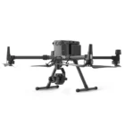
🛩️ Integration with Matrice 300 RTK: Seamlessly pairs with DJI’s Matrice 300 RTK drone, leveraging its advanced flight capabilities for efficient and accurate data collection.
📏 High Precision: Engineered for precision, the P1 enables accurate photogrammetry and mapping, making it ideal for cadastral surveying, 3D modeling, and more.
🔎 Global Mechanical Shutter: Reduces motion blur with its global mechanical shutter, ensuring sharp images even at high speeds or in windy conditions.
🌐 Smart Oblique Capture: Automatically adjusts the camera angle to capture five directions (nadir and four obliques), enhancing the efficiency and quality of 3D model reconstructions.
🔄 Efficient Workflow: Designed for an efficient workflow, from planning through execution to data processing, integrating smoothly with DJI Terra and other photogrammetry software solutions.
🌍 Large Area Mapping Capabilities: Capable of covering vast areas in a single flight, significantly reducing the time and cost associated with traditional surveying methods.
🛰️ RTK Module: Incorporates an RTK module for centimeter-level positioning accuracy, ensuring precise geotagging of aerial images for detailed and reliable mapping data.
🔄 3-Axis Stabilized Gimbal: Features a 3-axis stabilized gimbal, minimizing camera movement and enabling smooth, consistent image capture across all flying conditions.
⏱️ Fast Data Capture: With its ability to capture one photo every 0.7 seconds, the P1 maximizes efficiency, enabling rapid completion of large-scale surveying projects.
🔋 Extended Flight Time: Optimized for extended flight times when used with the Matrice 300 RTK, allowing for longer missions and fewer interruptions.
🌦️ Weather-Resistant Design: Built to operate in various weather conditions, ensuring reliability and versatility in field operations across different environments.
💾 High Storage Capacity: Supports high-capacity storage solutions to handle the large volumes of data generated during extensive mapping missions.
📈 Advanced Data Analysis: Compatible with leading photogrammetry software, enabling advanced analysis and the generation of high-precision 3D models and maps.
The DJI Zenmuse P1 is more than just a camera; it’s a comprehensive solution for aerial surveying and mapping, combining high-resolution imaging, precision, and efficiency to meet the demands of professionals in geospatial data collection, infrastructure inspection, and beyond.


Efficiency to Cover It All
Full-frame Camera
– 45MP Full-frame Sensor
– 4.4μm Pixel Size
– Low-noise, high sensitivity imaging extends daily operational time
– Take a photo every 0.7 s during the flight
– TimeSync 2.0 aligns the camera, flight controller, RTK module, and gimbal at the microsecond level

Smart Oblique Capture
Cover 7.5 km2 [4] in a single workday with the DJI Zenmuse P1. Elevate the efficiency of your oblique photography mission using Smart Oblique Capture, where the gimbal automatically rotates to take photos at the different angles needed. Only photos essential to the reconstruction will be taken at the edge of the flight area, increasing the efficiency of post-processing by 20%[5] to 50%[6].
Fieldwork Report
Verify data quality immediately post-flight by checking the position data and number of images acquired, as well as RTK status and positioning accuracy

Applications

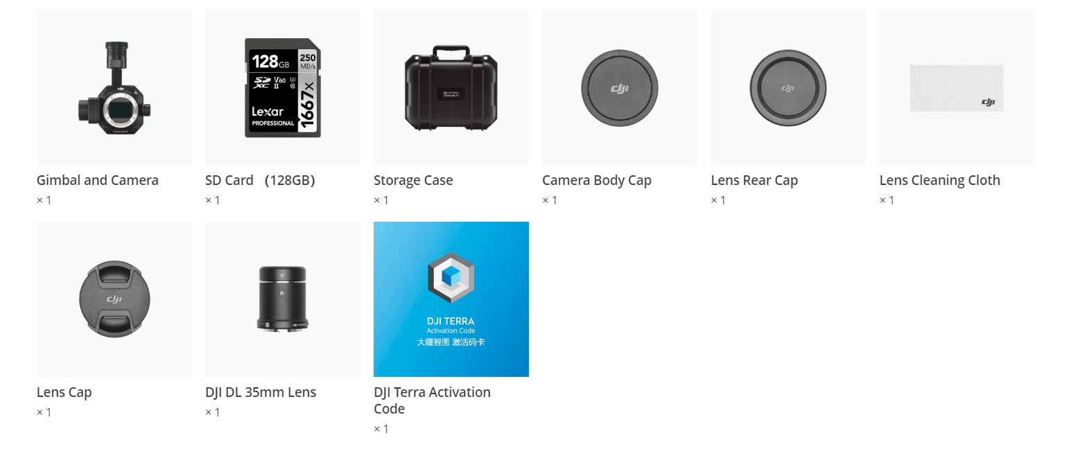
In The Box
Specifications
General
Product Name
-
ZENMUSE P1
Dimensions
-
198×166×129 mm
Weight
-
Approx. 800 g
Power
-
20W
IP Rating
-
IP4X
Supported Aircraft
-
Matrice 300 RTK
Operating Temperature Range
-
-20° to 50° C (-4° to 122° F)
Storage Temperature Range
-
-20° to 60° C (-4° to 140° F)
Absolute Accuracy
-
Horizontal: 3 cm, Vertical: 5 cm *
* Using Mapping Mission at a GSD of 3 cm and flight speed of 15 m/s, with an 75% front overlap rate and a 55% side overlap rate.
Camera
Sensor
-
Sensor size (Still): 35.9×24 mm (Full frame)
Sensor size (Max video recording area): 34×19 mm
Effective Pixels: 45MP
Pixel size: 4.4 μm
-
Supported Lenses
-
DJI DL 24mm F2.8 LS ASPH (with lens hood and balancing ring/filter), FOV 84°
DJI DL 35mm F2.8 LS ASPH (with lens hood and balancing ring/filter), FOV 63.5°
DJI DL 50mm F2.8 LS ASPH (with lens hood and balancing ring/filter), FOV 46.8°
Supported SD Cards
-
SD: UHS-I rating or above; Max capacity: 512 GB
Storage Files
-
Photo / GNSS Raw Observation Data/ Image Log File
Photo Size
-
3:2 (8192×5460)
Operation Modes
-
Photo, Video, Playback
Minimum photo interval
-
0.7 s
Shutter Speed
-
Mechanical Shutter Speed: 1/2000*-1 s
Electronic Shutter Speed: 1/8000-1 s
*Aperature value no larger than f/5.6
Aperture Range
-
f/2.8-f/16
ISO Range
-
Photo: 100-25600
Video: 100-25600
Video
Video Format
-
MP4,MOV
Video Resolution
-
16:9 (1920×1080)
16:9 (3840×2160)*
*Only 35mm lens supported
Frame Rate
-
60fps
Gimbal
Stabilized System
-
3-axis (tilt, roll, pan)
Angular Vibration Range
-
±0.01°
Mount
-
Detachable DJI SKYPORT
Mechanical Range
-
Tilt: -130° to +40°;
Roll: -55° to +55°;
Pan: ±320°
Read More
The DJI Zenmuse P1 Full Frame stands as a monumental leap in aerial camera technology, embodying precision, efficiency, and unparalleled image quality. Designed for professionals who demand the best, this full-frame aerial camera available on xboom.in, is the perfect blend of DJI’s advanced drone technology and high-end photographic capabilities. Whether it’s for detailed surveying, intricate mapping, or cinematic aerial shots, the Zenmuse P1 delivers on all fronts, making it an indispensable tool in any geospatial or cinematographic arsenal.
Elevating Aerial Photography to New Heights
The DJI Zenmuse P1 Full Frame redefines aerial photography standards, offering an unmatched combination of a high-resolution sensor, versatile lens compatibility, and advanced imaging capabilities. This powerhouse camera is designed to capture every detail with precision, making it ideal for professional applications requiring the highest level of accuracy and clarity.
Why the DJI Zenmuse P1 Full Frame?
Choosing the DJI Zenmuse P1 Full Frame means opting for the pinnacle of aerial imaging technology. With its full-frame sensor, the Zenmuse P1 captures breathtaking images with dynamic range and sharpness, even in low-light conditions. The camera’s compatibility with a wide range of lenses further enhances its versatility, allowing users to tailor their setup to specific project needs.
Precision Mapping and Surveying
The DJI Zenmuse P1 Full Frame excels in precision mapping and surveying tasks. Its full-frame sensor ensures that each photograph contains a wealth of detail, facilitating accurate measurements and high-quality data collection. Integrated with DJI’s advanced flight platforms, the Zenmuse P1 enables efficient, automated missions, significantly reducing the time and effort required for land surveying and infrastructure inspections.
Unparalleled Image Quality
The cornerstone of the DJI Zenmuse P1 Full Frame’s excellence lies in its image quality. The camera’s sensor captures images with a level of detail and clarity that surpasses conventional aerial cameras, ensuring that every pixel serves a purpose. Whether it’s for creating detailed 3D models or conducting environmental monitoring, the Zenmuse P1 provides the image quality professionals need to make informed decisions.
Enhanced Operational Efficiency
The DJI Zenmuse P1 Full Frame is not only about image quality; it’s also designed for operational efficiency. Its compatibility with DJI’s ecosystem allows for seamless integration with flight planning apps and software, enabling precise flight paths and automated data capture. This streamlined workflow results in significant time savings, making the Zenmuse P1 an efficient tool for large-scale projects.
Why xboom.in is Your Trusted Partner
Purchasing the DJI Zenmuse P1 Full Frame from xboom.in ensures that you’re not just buying a camera; you’re investing in a solution backed by comprehensive support and expertise. xboom.in is committed to providing customers with authentic DJI products, expert advice, and after-sales support, making it the ideal destination for professionals seeking the best in aerial imaging technology.
Revolutionizing Industries
The DJI Zenmuse P1 Full Frame is poised to revolutionize various industries, from geospatial surveying and urban planning to construction and agriculture. Its ability to capture detailed images from the air opens up new possibilities for analysis, planning, and monitoring, enabling businesses and researchers to achieve more with less effort.
Future-Proofing Your Aerial Imaging Capabilities
Investing in the DJI Zenmuse P1 Full Frame is an investment in the future of aerial imaging. As demands for precision and efficiency continue to grow, the Zenmuse P1 stands ready to meet and exceed these challenges, providing users with a tool that will remain relevant and valuable for years to come.
Conclusion: A New Era of Aerial Imaging
The DJI Zenmuse P1 Full Frame, available on xboom.in, marks the beginning of a new era in aerial imaging. With its unparalleled precision, efficiency, and image quality, it offers professionals a new level of capability and flexibility. Whether for mapping, surveying, or cinematic production, the Zenmuse P1 is a game-changer, empowering users to capture the world from above in ways never before possible.
Embrace the future of aerial imaging with the DJI Zenmuse P1 Full Frame. Visit xboom.in today and discover how this revolutionary aerial camera can transform your projects and elevate your professional capabilities.
FAQ’s on DJI Zenmuse P1
FAQ's
What types of projects is the DJI Zenmuse P1 best suited for? The Zenmuse P1 is ideal for a wide range of geospatial projects, including precise aerial surveying, photogrammetry, large-scale mapping, cadastral surveying, 3D modeling, and infrastructure inspections, thanks to its high-resolution full-frame sensor and interchangeable lens options.
How does the full-frame sensor of the P1 enhance aerial imaging? The full-frame sensor in the P1 captures ultra-high-resolution images, providing exceptional detail and clarity over large areas. This level of detail is crucial for accurate mapping, surveying, and inspection tasks, enabling precise measurements and high-quality photogrammetric outcomes.
Can the Zenmuse P1 be used with drones other than the Matrice 300 RTK? The Zenmuse P1 is specifically designed for integration with the DJI Matrice 300 RTK, leveraging its advanced flight capabilities and stability for optimal performance. It is not officially supported by other drone models.
What lenses are compatible with the Zenmuse P1? The P1 supports multiple DJI DL mount lenses, offering a range of focal lengths to suit different surveying and mapping needs. This flexibility allows operators to select the appropriate lens based on the specific requirements of each project.
How does the P1 handle data processing and analysis? Data captured by the P1 can be processed using DJI Terra or other compatible photogrammetry software solutions. These platforms support the generation of detailed 3D models, maps, and other geospatial outputs, facilitating advanced analysis and decision-making.
What is the advantage of the P1’s global mechanical shutter? The global mechanical shutter minimizes motion blur, ensuring sharp images even when capturing at high speeds or in windy conditions. This feature is essential for maintaining image quality and accuracy in dynamic aerial surveying environments.
Is the Zenmuse P1 weather-resistant? Yes, the P1 features a weather-resistant design, allowing it to perform reliably in a variety of environmental conditions. This durability ensures consistent operation and data quality, even in challenging weather.
How accurate is the geotagging with the Zenmuse P1? When used with the Matrice 300 RTK and its RTK module, the P1 achieves centimeter-level positioning accuracy for geotagged images. This precision is critical for creating accurate and reliable maps and models from aerial data.
Can the Zenmuse P1 capture oblique images for 3D modeling? Yes, the P1 features a smart oblique capture mode, automatically adjusting the camera angle to capture images from five directions. This capability enhances the efficiency and quality of 3D model reconstructions from aerial data.


There are no reviews yet.