

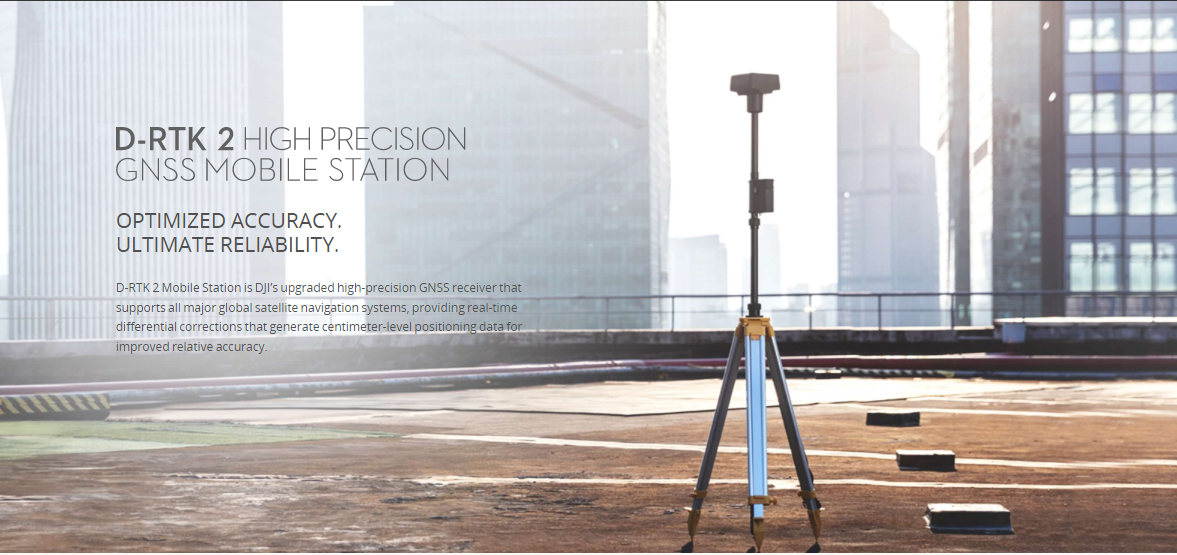
Description
DJI D-RTK 2 GNSS
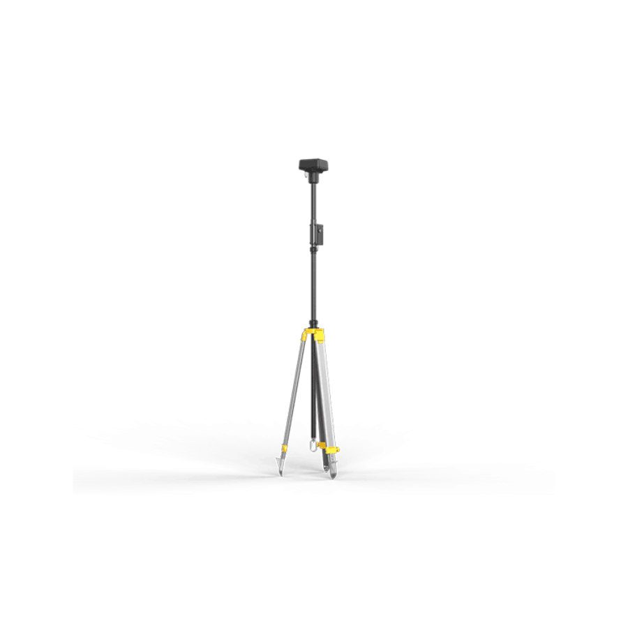
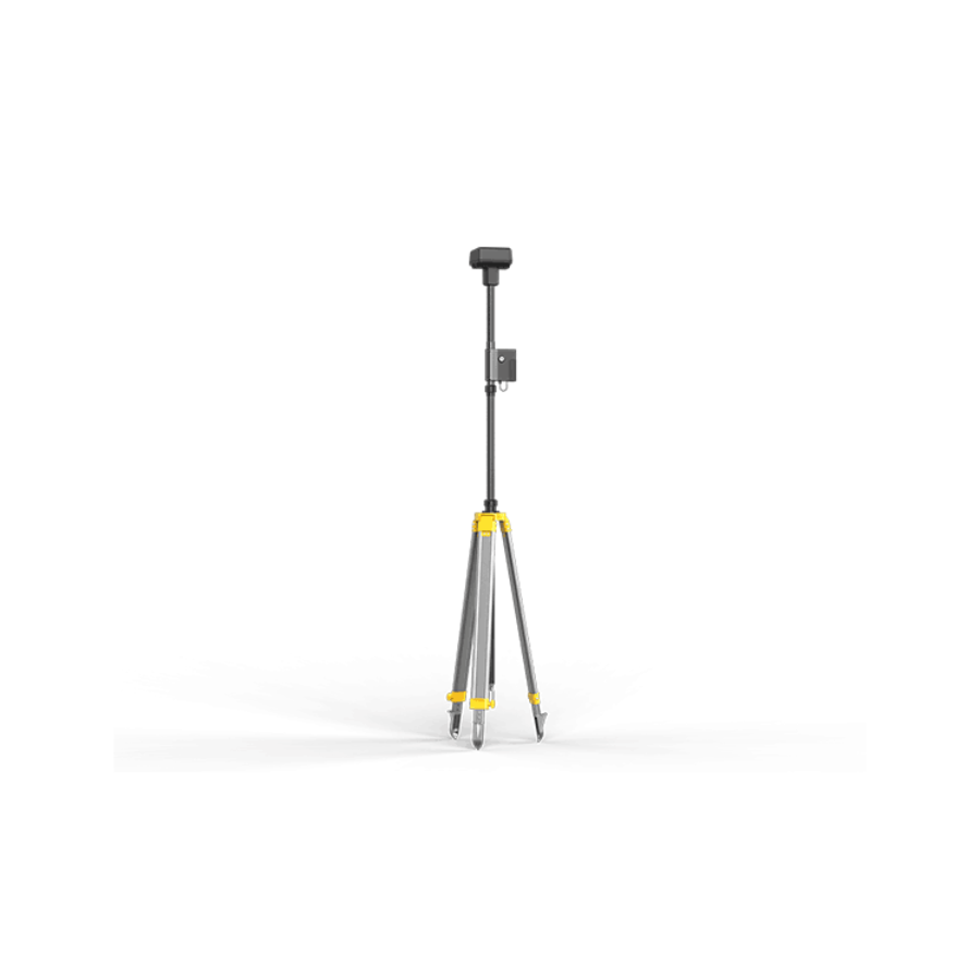
The DJI D-RTK 2 High Precision GNSS Mobile Station is an advanced differential GPS (dGPS) system designed to provide centimeter-level positioning accuracy for DJI’s range of drones and other compatible systems. Engineered to significantly reduce the impact of multi-path interference from reflective surfaces near the ground, the D-RTK 2 is tailored for surveying, mapping, construction, and agricultural applications where precision is critical. It supports GPS, GLONASS, Beidou, and GALILEO satellites, ensuring reliable global coverage and performance even in challenging environments. The system is robustly designed to withstand various weather conditions, featuring IP67 water and dust resistance. By integrating seamlessly with DJI’s enterprise drone platforms, such as the Matrice series, the D-RTK 2 enhances the efficiency and accuracy of aerial surveying and data collection missions, making it an indispensable tool for professionals seeking to leverage drone technology for high-precision GNSS data tasks.
The DJI D-RTK 2 High Precision GNSS Mobile Station stands as an epitome of technological advancement in precision navigation and data collection, tailored for professionals seeking unparalleled accuracy in their operations:
🎯 Unmatched Centimeter-Level Positioning Accuracy: Utilizes advanced differential GPS technology to achieve centimeter-level accuracy, enhancing precision in aerial mapping, surveying, and construction, ensuring high-quality data collection.
🛡️ Sophisticated Multi-path Interference Reduction: Engineered to minimize the effects of multi-path interference, guaranteeing consistent and accurate positioning information crucial for reliable data in urban and complex terrains.
🌍 Comprehensive Global Satellite Connectivity: Supports a broad array of global navigation satellite systems (GPS, GLONASS, Beidou, GALILEO), providing superior coverage and signal stability worldwide for dependable operation in various geographical settings.
🌀 Robust All-Weather Operational Capability: Boasts an IP67 rating, affirming its resilience against water and dust, ensuring it performs optimally in diverse environmental conditions from rain to desert climates.
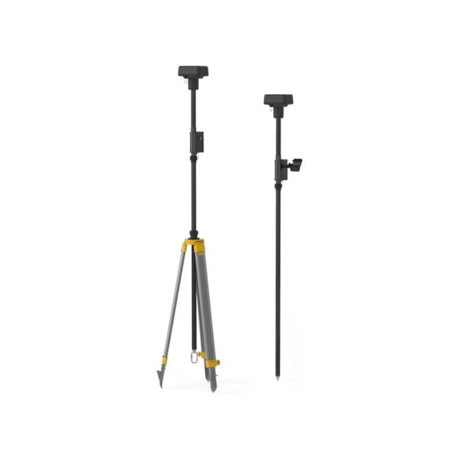
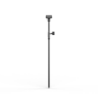
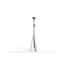
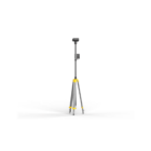
🚶 Ergonomic Portable and Rugged Design: Encased in a durable yet portable form factor, allowing for quick setup and mobility across different job sites and terrains, improving field efficiency.
🔗 Seamless Drone Integration for Enhanced GNSS Accuracy: Optimized for compatibility with DJI’s enterprise drones, like the Matrice series, to improve GNSS positioning accuracy, enabling precise flight and data capture.
⏱️ Real-Time Kinematic Processing for Maximum Precision: Provides real-time differential corrections to offer top-notch positioning accuracy, vital for tasks requiring precision like detailed mapping and inspections.
📡 Advanced OcuSync Transmission Technology: Incorporates DJI’s OcuSync to transmit precise positioning data in real-time, allowing for immediate adjustments and ensuring accuracy in navigation and data acquisition.
🌐 Comprehensive Network RTK Support: Capable of connecting to virtual reference station networks for corrections from the nearest base stations in areas without direct base station access, enhancing versatility in remote operations.
🧭 Innovative Dual-Antenna Direction Finding: Features dual antennas to improve orientation detection, providing accurate heading information regardless of the station’s physical positioning.
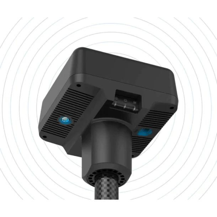
🔄 Cutting-edge Integrated IMU Monitoring: Includes an IMU to monitor station movements, compensating for any shifts to maintain consistent accuracy.
🔋 Convenient Hot-Swappable Battery System: Designed with hot-swappable batteries to support continuous operation, allowing for battery replacement without powering down, maximizing productivity.
📊 Extensive Data Logging for Post-Processing Analysis: Enables logging of GNSS raw data for comprehensive post-mission processing, invaluable for in-depth analysis and verification of collected data.
The DJI D-RTK 2 High Precision GNSS Mobile Station redefines the standards for GNSS data collection, offering a constellation of features designed to ensure unmatched accuracy, reliability, and operational flexibility for professional surveying, mapping, and construction endeavors.
Additional Features
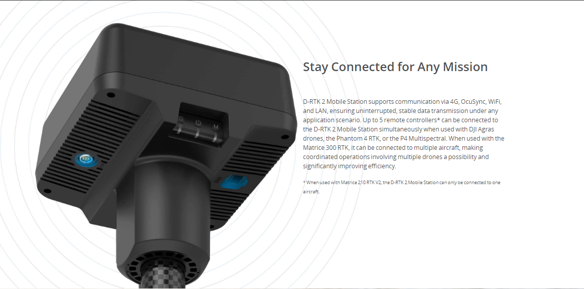
Connect controllers via 4G, OcuSync, Wi-Fi, or LAN
Connect up to 5 controllers for multi-drone operations
Supports Phantom 4 RTK and MG-1P controllers
Carbon fiber body and IP67-level weather protection
Built-in IMUs monitor movement and alerts operators of abnormalities
Can also be used as a CORS (Continuously Operating Reference Station)
Specifiations
Overview
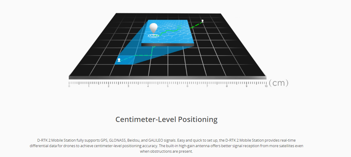
Gain improved relative accuracy with centimeter-level precision positioning data using the D-RTK 2 High Precision GNSS Mobile Station, which supports all major global satellite navigation systems and provides real-time differential corrections.
Highlights
Supports: GPS: L1 C/A, L2, L5; BEIDOU: B1, B2, B3; GLONASS: F1, F2; Galileo: E1, E5A, E5B
Connect multiple drones to conduct coordinated operations
IP65 Ingress Protection
In The Box
D-RTK 2 Body × 1
Extension Rod × 1
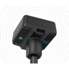
Charging Hub × 1
AC Power Adapter × 1
Intelligent Battery (WB37) × 2
Battery Cover × 1
AC Power Cable × 1
USB-C Cable × 1
USB-C OTG Cable × 1
Hex Key × 1
Specifications
Simultaneously receives: GPS: L1 C/A, L2, L5; BEIDOU: B1, B2, B3; GLONASS: F1, F2; Galileo: E1, E5A, E5B
Positioning Accuracy:
Single Point
Horizontal: 1.5 m(RMS)
Vertical: 3.0 m(RMS)
RTK
Horizontal: 1 cm+ 1 ppm(RMS)
Vertical: 2 cm+ 1 ppm(RMS)
1 ppm: For every 1 km increase in distance, the accuracy will be 1 mm less. For example, the horizontal accuracy is 1.1 cm when the receiving end is 1 km away from the base station.
Ingress Protection Rating: IP65
Operating Temperature: -20° to 55° C (4° to 131° F )
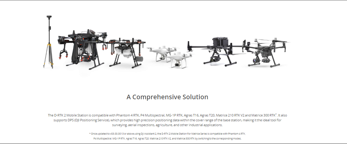
Compatibility
Matrice 300 RTK
Phantom 4 RTK
FAQ’s on DJI D-RTK 2
FAQ's
What is the DJI D-RTK 2, and how does it improve drone operations? The DJI D-RTK 2 is a high precision GNSS mobile station that provides centimeter-level positioning data for drone operations. It significantly enhances the accuracy of aerial surveying, mapping, and inspection tasks by reducing the impact of multi-path interference and supporting multiple global navigation satellite systems.
Can the DJI D-RTK 2 be used in adverse weather conditions? Yes, the DJI D-RTK 2 is designed with an IP67 rating, making it water and dust resistant. This allows it to operate reliably in a variety of environmental conditions, including rain and dusty environments.
Which DJI drones are compatible with the D-RTK 2? The DJI D-RTK 2 is compatible with several DJI enterprise drones, including the Matrice 200 series (M200, M210, M210 RTK), the Matrice 300 RTK, and the Agras series for agricultural applications. Compatibility enables enhanced positioning accuracy and stability for these drones.
How does the D-RTK 2 achieve such high positioning accuracy? The D-RTK 2 utilizes real-time kinematic (RTK) differential corrections, processing data from multiple global navigation satellite systems (GNSS), including GPS, GLONASS, Beidou, and GALILEO. This multi-system support and RTK processing eliminate common GPS inaccuracies, achieving centimeter-level precision.
Is the D-RTK 2 difficult to set up and use? The D-RTK 2 is designed for easy setup and user-friendly operation. It integrates seamlessly with compatible DJI drones and controllers, offering a straightforward workflow for users to benefit from its high-precision GNSS positioning capabilities.
Can the D-RTK 2 transmit data in real-time? Yes, the D-RTK 2 features DJI’s OcuSync transmission technology, enabling it to transmit positioning data in real-time to the drone and its operator. This ensures immediate adjustments can be made during flight for accurate positioning and data collection.
What applications benefit most from using the D-RTK 2? Applications that require high precision and accuracy, such as surveying and mapping, infrastructure inspection, precision agriculture, and construction, can greatly benefit from the enhanced positioning accuracy provided by the D-RTK 2.
How long can the D-RTK 2 operate on a single charge? The D-RTK 2 is equipped with hot-swappable batteries, allowing for extended operation times. The exact duration can vary based on usage conditions, but the hot-swappable feature ensures minimal downtime during operations.


There are no reviews yet.