-
·XBM·00


-
·XBM·01


-
·XBM·02

-
·XBM·03

-
·XBM·04

-
·XBM·05

-
·XBM·06

-
·XBM·07
-
·XBM·08
-
·XBM·09

-
·XBM·10
-
·XBM·11

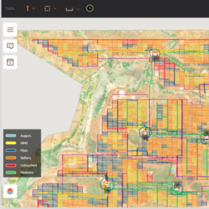
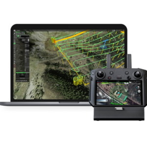
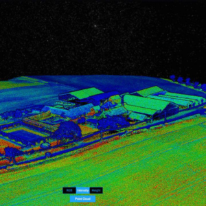 DJI Terra - 1 Year SubscriptionOriginal price was: ₹241,525.₹172,457Current price is: ₹172,457. (Excl. GST)Add to cart
 -
·XBM·12