


Description
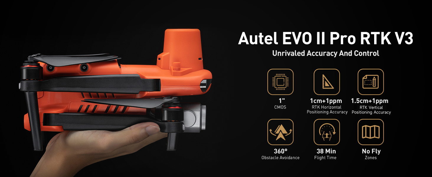
Precision, Performance, Power: Autel EVO II Pro RTK V3
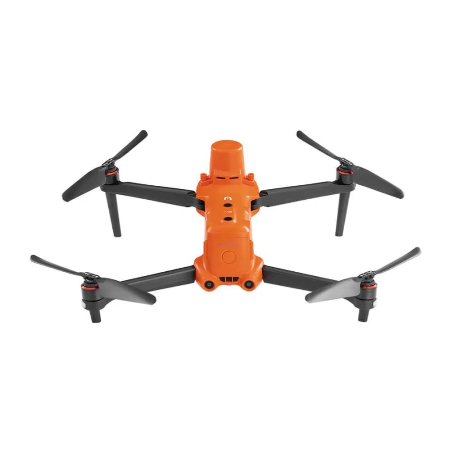
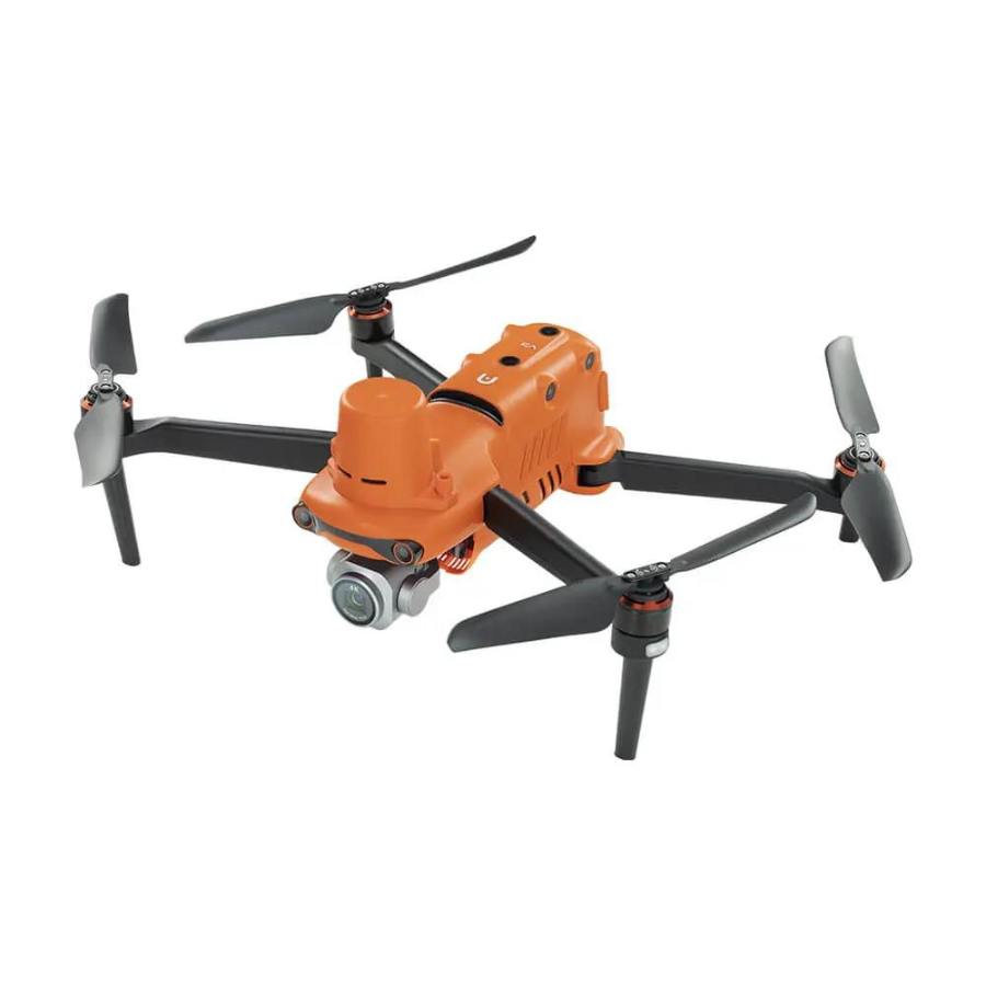
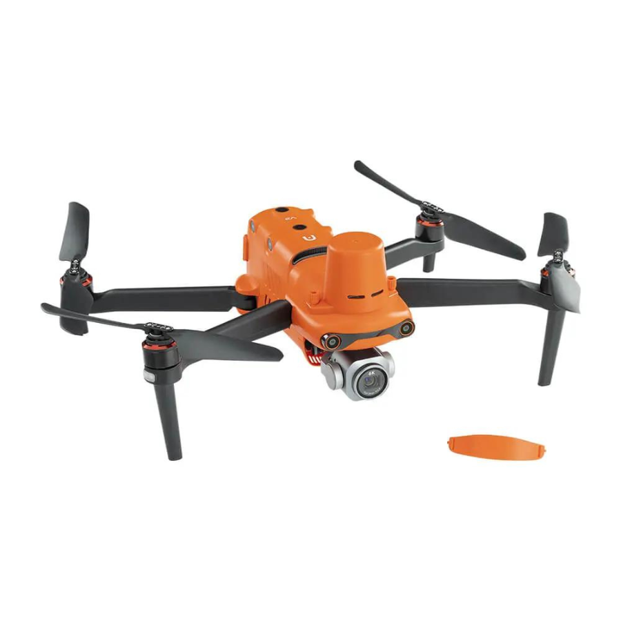
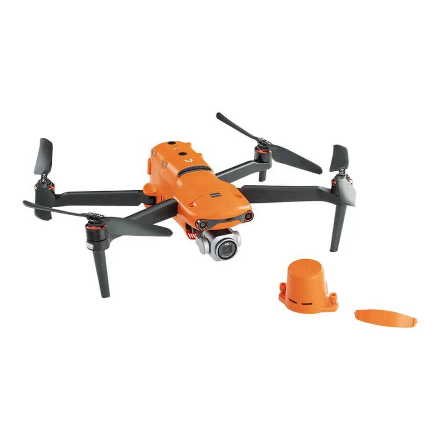
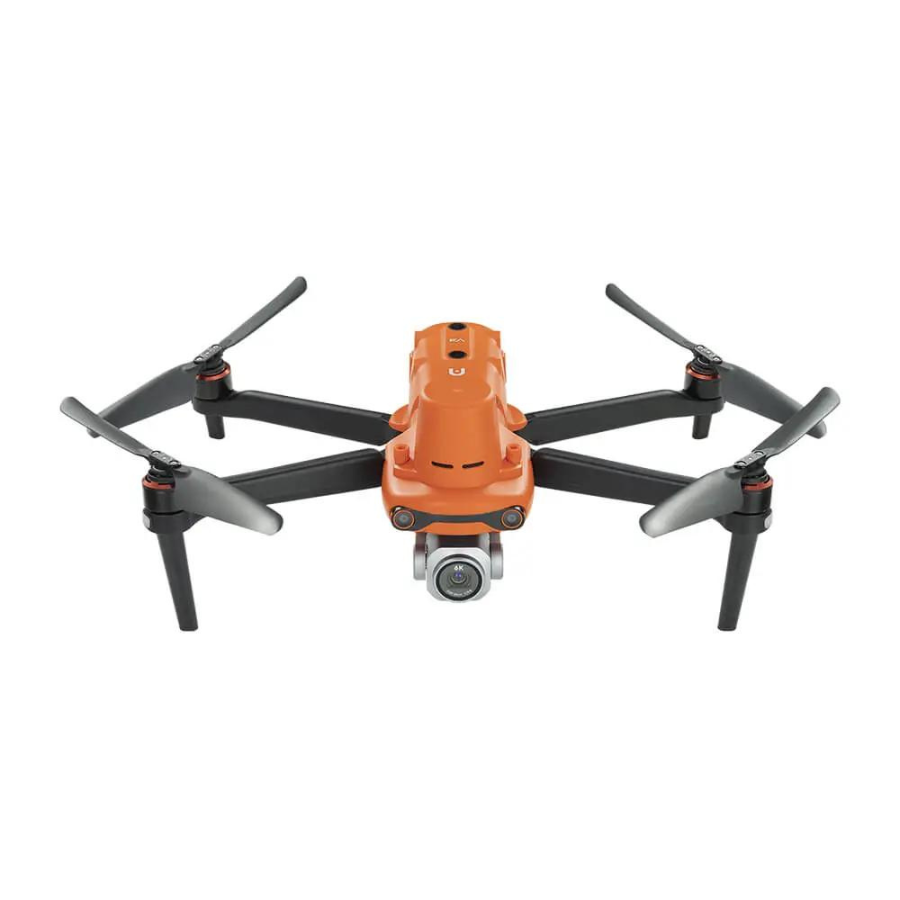
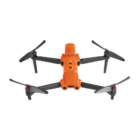
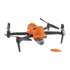
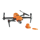
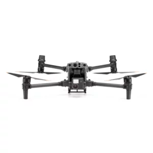
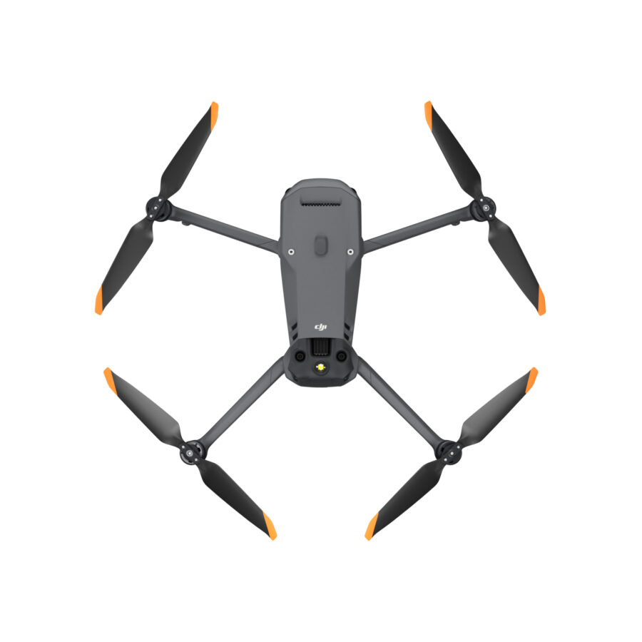
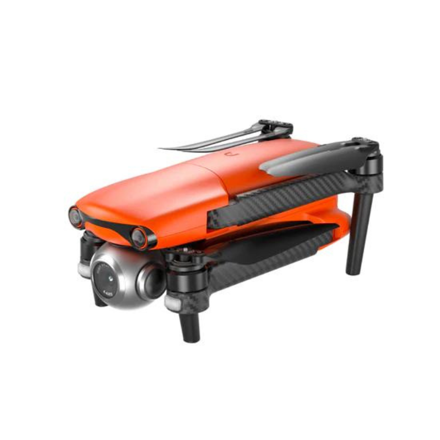
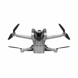
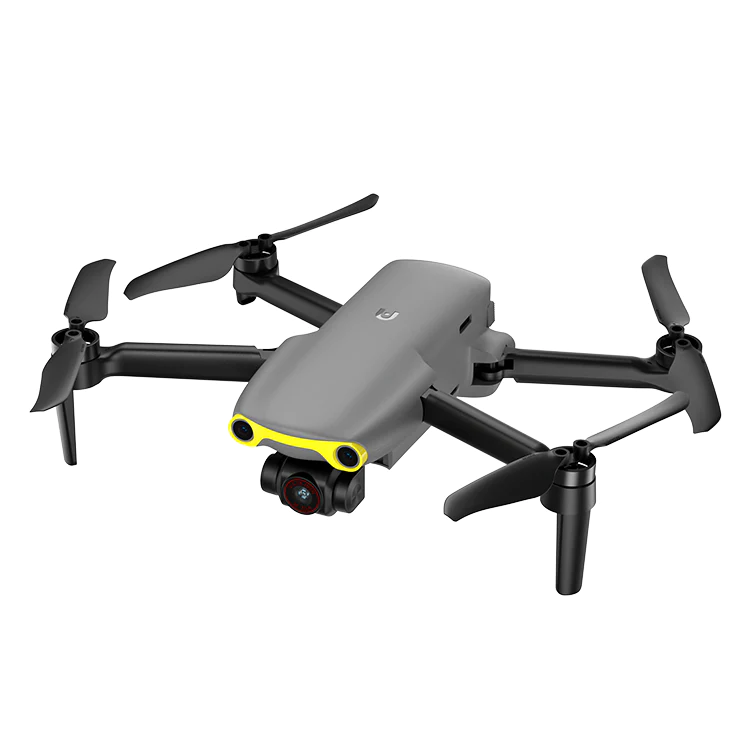
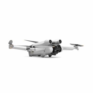
A modern drone created for expert aerial photography and surveying is the Autel Robotic EVO II Pro RTK V3 . It boasts centimeter-level positioning accuracy thanks to Real-Time Kinematic (RTK) technology, which is perfect for accurate mapping and 3D modelling. Its 20MP still image and 6K video capabilities guarantee excellent visual quality. For safety and convenience, the drone has a 360-degree obstacle avoidance system. The EVO II Pro RTK V3 is ideal for sectors including construction, agriculture, and filmmaking and raises the bar for aerial data collecting and photography.
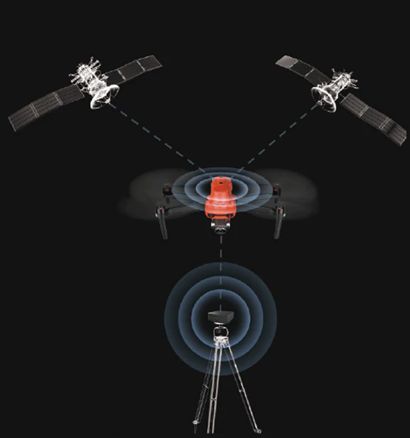
Centimeter-Level Positioning: Enjoy unparalleled precision with the EVO II Pro RTK V3’s centimeter-level positioning accuracy, enabled by its integrated RTK (Real-Time Kinematic) technology. This ensures precise mapping, surveying, and inspection tasks with exceptional accuracy and reliability.
Dual-Frequency GNSS: Experience enhanced performance in challenging environments with the dual-frequency GNSS (Global Navigation Satellite System) capabilities of the EVO II Pro RTK V3. This technology provides superior accuracy and reliability, even in dense urban areas or areas with significant foliage cover.
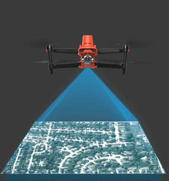
Customizable Mapping: Tailor your mapping tasks with the EVO II Pro RTK V3’s customizable mapping capabilities. Generate highly detailed 3D maps and models by adjusting data collection parameters to suit specific project requirements, ensuring comprehensive and accurate results for various applications.
Extended Flight Time: Maximize your productivity with the EVO II Pro RTK V3’s impressive flight time of up to 40 minutes on a single battery charge. This extended flight time allows for prolonged aerial missions, reducing downtime and increasing efficiency in data collection and analysis tasks.
Intelligent Flight Modes: Optimize your flight operations with the EVO II Pro RTK V3’s intelligent flight modes, including Waypoints, Orbit, and Point of Interest. These modes enable automated flight planning and precise navigation, enhancing efficiency and accuracy in aerial data collection tasks.
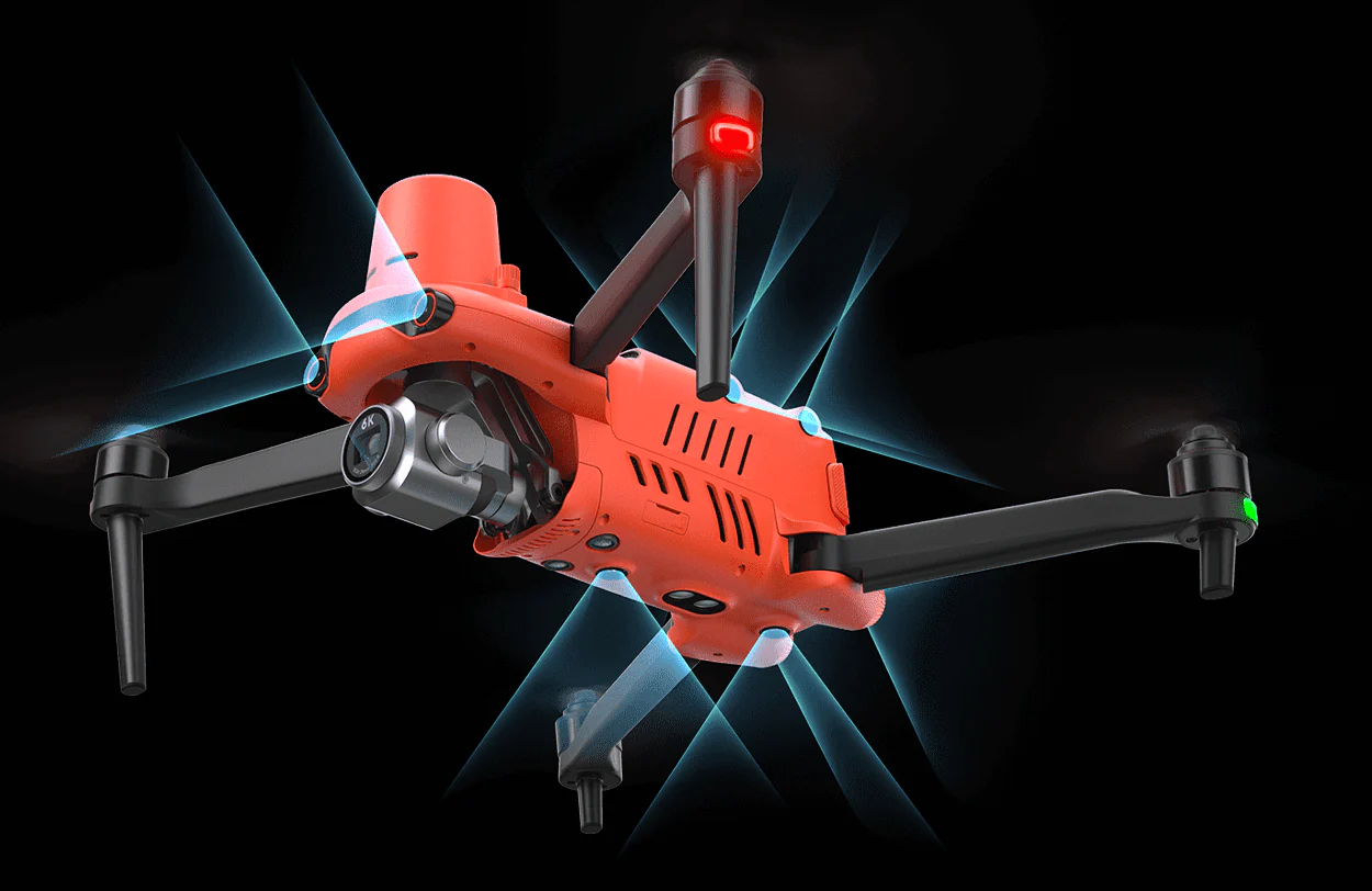
Advanced Obstacle Avoidance: Navigate safely through complex environments with the EVO II Pro RTK V3’s advanced obstacle avoidance sensors. These sensors detect and avoid obstacles in real-time, ensuring smooth and safe flight operations, even in challenging conditions.
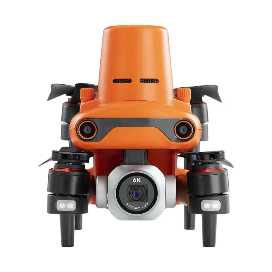
High-Resolution Camera: Capture stunning aerial imagery with the EVO II Pro RTK V3’s high-resolution 6K camera. Featuring a large 1-inch CMOS sensor and adjustable aperture, this camera delivers exceptional image quality with rich detail and clarity, ensuring superior results in various lighting conditions.
Real-Time Data Transmission: Stay connected and informed with real-time data transmission capabilities. Transmit data to ground stations or mobile devices instantly, enabling immediate analysis and decision-making during aerial missions, enhancing efficiency and productivity.
Robust and Portable Design: Designed for durability and portability, the EVO II Pro RTK V3 features a rugged yet lightweight construction. Its robust design ensures reliability in demanding environmental conditions, while its portable nature makes it easy to transport and deploy in the field, maximizing operational flexibility.
Seamless Integration: Integrate the EVO II Pro RTK V3 seamlessly with compatible software platforms and accessories. This facilitates streamlined data processing and analysis workflows, maximizing the value and versatility of the drone for various applications.
No GCP Required
For centimeter-grade accuracy, the Autel Robotic EVO II Pro RTK V3 does not require GCPs and can connect to an NTRIP network.
3rd Party Base Station Support
Autel Robotic EVO II Pro RTK V3 is compatible with all base stations that are NTRIP-ready.
360° Obstacle Avoidance
Built with 19 different sets of sensors, including 12 vision sensors, the main camera, ultrasound, inertial measurement units, and other sensors enable the construction of three-dimensional maps and real-time course planning.
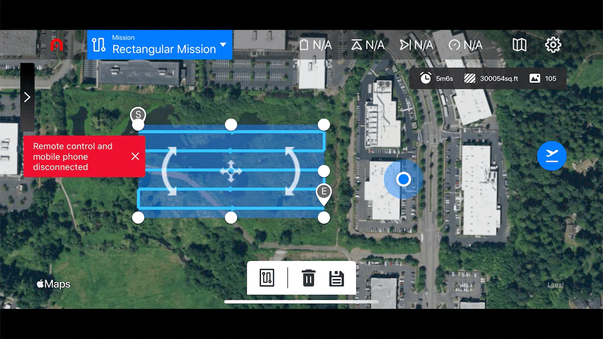
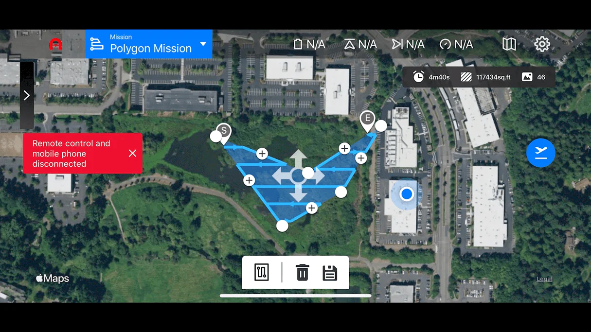
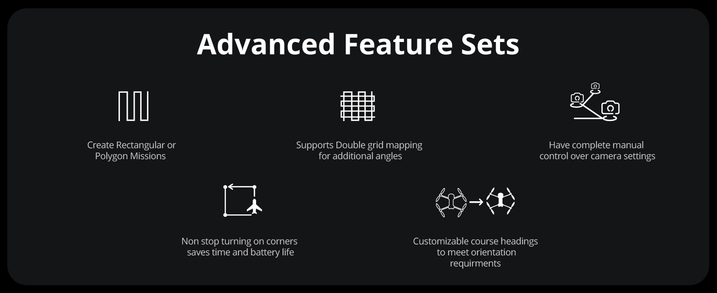
Mission Planner
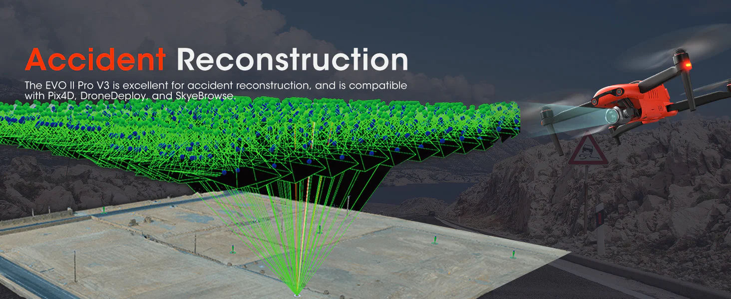
Mission planners that are both rectangular and polygonal will be of great use to anyone who is engaged in photogrammetry. Therefore, anyone who needs to be able to acquire a large number of photographs during a rectangular operation or a polygon mission will be able to do it in a manner that is completely autonomous. After that, you will be able to take the photos produced by the Autel Robotic EVO II Pro RTK V3 and submit them to your 3D mapping software.
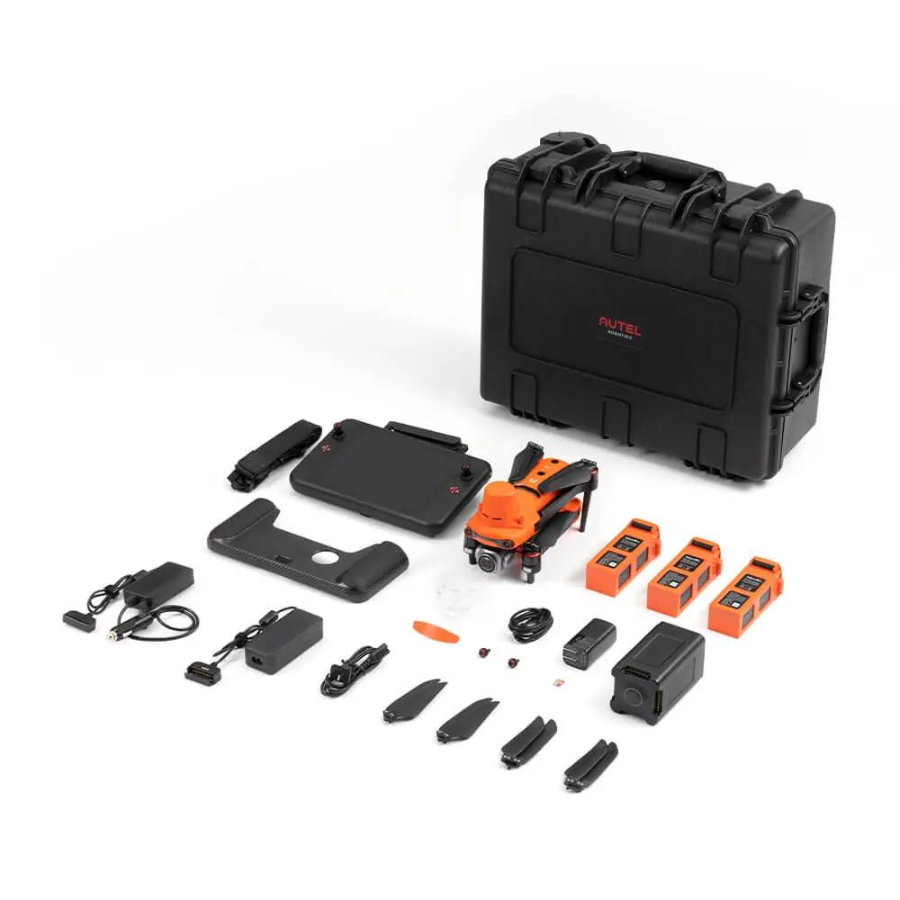
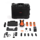
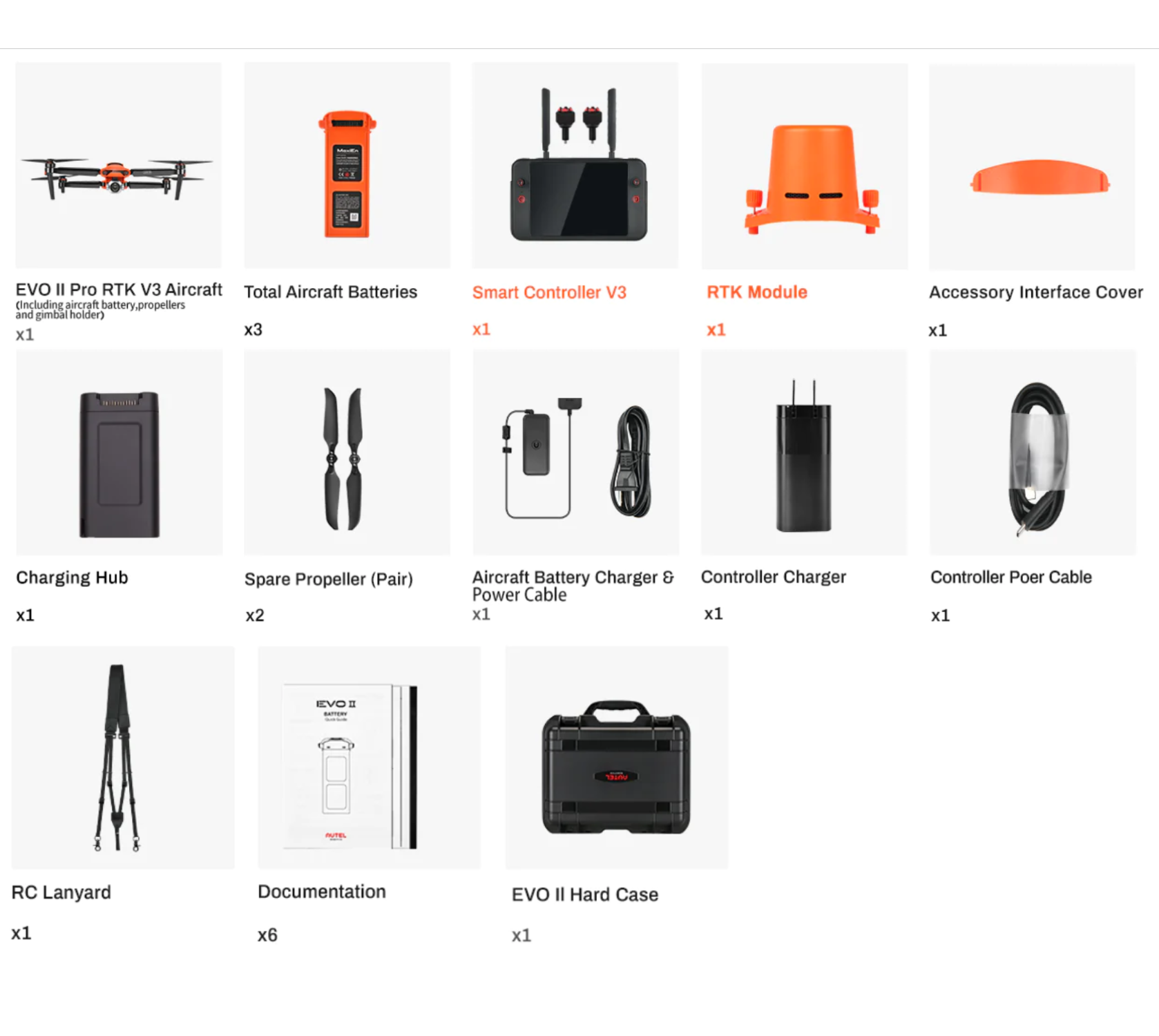
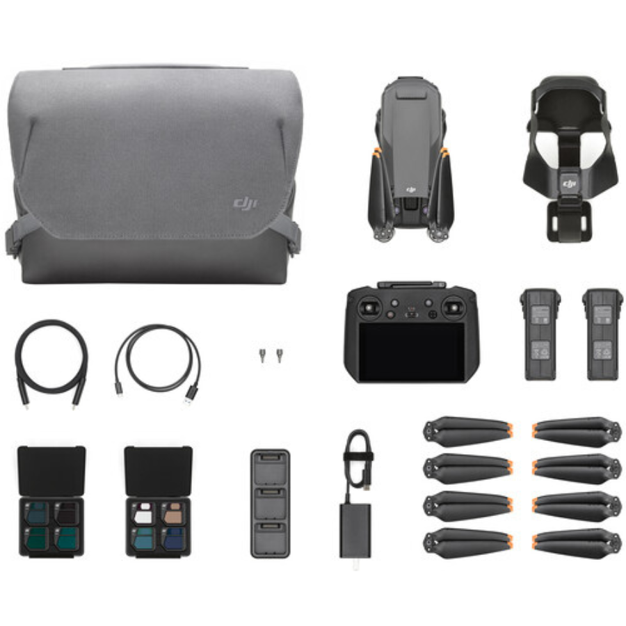
In The Box
Specifications
Camera
| Sensor | 1″ CMOS Effective Pixels: 20 MP |
| Lens | FOV: 82° Equivalent focal length: 29 mm Aperture: f/2.8 – f/11 Focus range: 0.5 m to infinity |
| ISO Range | Video: 100-44000 Photo: 100-6400 |
| Shutter Speed | Photo mode: 1/8000 ~ 8s Other: 1/8000 ~ 1/frame rates |
| Zoom | 1 ~ 16x (Max. 3x lossless zoom) |
| Photo mode | Single shot/Burst shooting/AEB/Time Lapse/HDR |
| Maximum photo size | 5472*3648 (3:2) 5472*3076 (16:9) 3840*2160 (16:9) |
| Image Format | JPG (default) / DNG / JPG+DNG |
| Photo mode | 5472x3076P30/P25/P24 3840x2160P60/P50/P48/P30/P25/P24 2720x1528P60/P50/P48/P30/P25/P24 1920x1080P60/P50/P48/P30/P25/P24 |
| Video format | MP4 / MOV (MPEG-4 AVC/H.264, HEVC/H.265) |
| Max bitrate | 80Mbps |
| Supported file system | FAT32/exFAT |
Gimbal
| Gimbal | 3-axis stabilization |
| Mechanical range | Tilt: -135° to +45°; Pan: -100° to +100° |
| Controllable rotation range | Tilt: -90° to +30°; Pan: -90° to +90° |
| Max control speed (Tilt) | 300°/s |
| Angular Vibration Range | ±0.005° |
Aircraft
| Takeoff Weight | 1237g±0.5g(EVO II Pro RTK V3) |
| Max takeoff weight | 4.41 lbs (1999 g) |
| Size(L*W*H) | 9.1*5.1*5.6 inches; 230*130*143mm(folded); 18*22*4.3 inches 457*558*143 mm(unfolded) |
| Wheelbase | 15.63 inches (397 mm) |
| Maximum Takeoff Altitude | 7000 m |
| Max ascent speed | 8 m/s (Ludicrous) |
| Max descent speed | 4 m/s (Ludicrous) |
| Max horizontal flight speed | 20m/s (Ludicrous) |
| Max flight distance (no wind) | 21 km |
| Max tilt angle | 33° (Ludicrous) |
| Max angular velocity | 120°/s |
| Max flight time (no wind) | 36 min |
| Max hovering time (no wind) | 32 min |
| Operating temperature range | 14°F to 104°F (-10℃ ~ 40℃) |
| Maximum resistance to wind | 27mph, 12 m/s (Take-off and landing) |
| Operating frequency | 902-928MHz (FCC Only) 2.400-2.4835GHz 5.725-5.850GHz |
| Transmission power | 900M FCC/ ISED:≤31dBm 2.4G FCC/ ISED:≤32dBm SRRC/CE/MIC/RCM:≤20dBm 5.8G (non-Japan) ; 5.7G (Japan) FCC/ISED/SRRC/MIC:≤33dBm CE/ RCM:≤14dBm |
| Hovering accuracy | When RTK is enabled and working normally: Vertical: ±0.1 m; Horizontal: ±0.1 m Vertical: ±0.1 m (when the visual positioning is working normally);±0.5 m (when GNSS works normally) Horizontal: ±0.3 m (when the visual positioning is working normally); ±1.5 m (when GNSS works normally) |
| Image position compensation | The position of the camera center relative to the phase center of the airborne A-RTK antenna, under the body axis system: (-2.63, 0.31, 83.5) mm, and the photo EXIF coordinates have been compensated. The positive XYZ axis of the body axis system points to the front, right, and bottom of the aircraft respectively. |
| Internal storage | 8GB |
| SD storage | max. support 256GB (UHS-3 or Class 10) |
GNSS
| Single frequency high sensitivity GNSS | GPS+BeiDou+Galileo(Asia) GPS+GLONASS+Galileo(Other areas) |
| Multi-frequency multi-system high-precision RTK GNSS | Frequency points used: GPS:L1/L2; GLONASS:L1/L2; BeiDou:B1/B2; Galileo:E1/E5 First positioning time:<50 s Positioning accuracy: vertical 1.5 cm + 1 ppm (RMS); Horizontal 1 cm + 1 ppm (RMS) 1 ppm means that the error increases by 1 mm for every 1 km the aircraft moves |
Sensing System (Obstacle Avoidance)
| Sensing System | Omnidirectional Obstacle Sensing |
| Forward | Precision Measurement Range: 0.5-20 m Detectable Range: 0.5-40m Effective Sensing Speed: <15m/s FOV: Horizontal: 60°, Vertical: 80° |
| Backward | Precision Measurement Range: 0.5-16 m Detectable Range: 0.5-32m Effective Sensing Speed: <12m/s FOV: Horizontal: 60°, Vertical: 80° |
| Upward | Precision Measurement Range: 0.5-12 m Detectable Range: 0.5-24m Effective Sensing Speed: <6m/s FOV: Horizontal: 60°, Vertical: 50° |
| Downward | Precision Measurement Range: 0.5-11 m Detectable Range: 0.5-22m Effective Sensing Speed: <6m/s FOV: Horizontal: 90°, Vertical: 70° |
| Sides | Precision Measurement Range: 0.5-12 m Detectable Range: 0.5-24m Effective Sensing Speed: <10m/s FOV: Horizontal: 60°, Vertical: 50° |
| Operating Environment | Above: The surface has rich textures and sufficient lighting conditions (>15 lux, normal indoor fluorescent lighting environment); the surface is made of diffuse reflective material and the reflectivity is >20% (such as walls, trees, people, etc.) Below: The ground has rich textures and sufficient lighting conditions (> 15 lux, indoor fluorescent lamp is normally irradiated by the environment); the surface is made of diffuse reflective material and the reflectivity is> 20% (such as walls, trees, people, etc.) |
Remote Controller and Image Transmission
| Operating Frequency | 902-928MHz (FCC Only) 2.400-2.4835GHz 5.725-5.850GHz (non-Japan) 5.650-5.755GHz (Japan Only) |
| Transmission power(E.I.R.P) | FCC:≤33dBm CE:≤20dBm@2.4G,≤14dBm@5.8G SRRC:≤20dBm@2.4G ≤33dBm@5.8G/5.7G |
| Max Transmission Distance (unobstructed, free of interference) | FCC:15km CE:8km |
| Display screen | 2048×1536 60fps |
| Battery | 5800mAh |
| Operating time | ~3 hours (Max. Brightness) ~4.5 hours (50% Brightness) |
| Charging time | 120 minutes |
| Internal Storage | ROM 128GB |
Intelligent Flight Battery
| Capacity | 7100 mAh |
| Voltage | 11.55 V |
| Max Charging Voltage | 13.2 V |
| Battery Type | LiPo 3S |
| Energy | 82 Wh |
| Net Weight | 0.81 lbs (365 grams) |
| Charging Temperature Range | 41°F to 104°F (5°C to 40°C) |
| Storage Temperature and Humidity | -10~30℃,65±20%RH |
| Recommended Storage Temperature | 22-28℃ |
| Max Charging Power | 93W |
| Charging Time | 90 minutes |
Charger
| Input | 100-240 V, 50/60 Hz, 1.5A |
| Output | 13.2 V ⎓ 5 A 5V⎓3A 9V⎓2A 12V⎓1.5A |
| Voltage | 13.2±0.1V |
| Rated power | 66W |
FAQs for Autel Robotic EVO II Pro RTK V3
1. What is the Autel Robotics EVO II Pro RTK V3?
The Autel Robotics EVO II Pro RTK V3 is a high-performance drone equipped with Real-Time Kinematic (RTK) positioning technology, designed for professional aerial photography, surveying, mapping, and precision agriculture. It features a high-resolution camera, advanced flight modes, and enhanced GPS accuracy.
2. What makes the RTK technology in EVO II Pro RTK V3 special?
RTK technology enhances the GPS positioning accuracy of the EVO II Pro RTK V3, reducing it to centimeter-level. This is crucial for applications requiring high precision, such as surveying and construction site monitoring, ensuring more accurate data collection and analysis.
3. Can the EVO II Pro RTK V3 be used for commercial cinematography?
Absolutely. The EVO II Pro RTK V3’s high-resolution camera supports up to 6K video capture, providing filmmakers and content creators with stunning image quality. The drone’s stability and precision also allow for smooth and dynamic aerial shots.
4. What is the flight time of the EVO II Pro RTK V3?
The EVO II Pro RTK V3 boasts an impressive flight time of up to 40 minutes under optimal conditions, thanks to its efficient battery and aerodynamic design. This extended flight time is beneficial for completing detailed surveys and lengthy filming sessions without frequent landings for battery changes.
5. How does the EVO II Pro RTK V3 handle data security?
Autel prioritizes data security by providing robust data encryption and ensuring that users have full control over their data. The drone does not automatically transmit flight data to any servers, allowing users to manage their information securely.
6. What are the key camera specs of the EVO II Pro RTK V3?
The drone’s camera is equipped with a 1-inch CMOS sensor, capable of capturing 20MP still images and 6K video at 30fps. It also offers adjustable aperture from f/2.8 to f/11, enabling users to achieve the perfect exposure in a variety of lighting conditions.
7. Is the EVO II Pro RTK V3 suitable for mapping and surveying?
Yes, with its RTK technology, the EVO II Pro RTK V3 is ideal for mapping and surveying tasks. It provides highly accurate geotagging of images for creating detailed 3D maps and models, making it an excellent tool for professionals in these fields.
8. How does the obstacle avoidance system work?
The EVO II Pro RTK V3 is equipped with an advanced obstacle avoidance system that utilizes 12 visual sensors to detect obstacles in its path. This system helps to prevent collisions during flights, ensuring safer operation in complex environments.
9. Can the EVO II Pro RTK V3 be flown in adverse weather conditions?
While the EVO II Pro RTK V3 is designed to be robust, flying in extreme weather conditions such as heavy rain, snow, or high winds is not recommended. Doing so could affect the drone’s performance and safety.
10. Where can I purchase the EVO II Pro RTK V3, and what does it come with?
The EVO II Pro RTK V3 can be purchased through Autel Robotics’ official website or authorized dealers. The standard package usually includes the drone, a remote controller, a battery, a charger, and a set of propellers. Additional accessories and packages may be available depending on the retailer.


There are no reviews yet.