


Description
AGISOFT METASHAPE
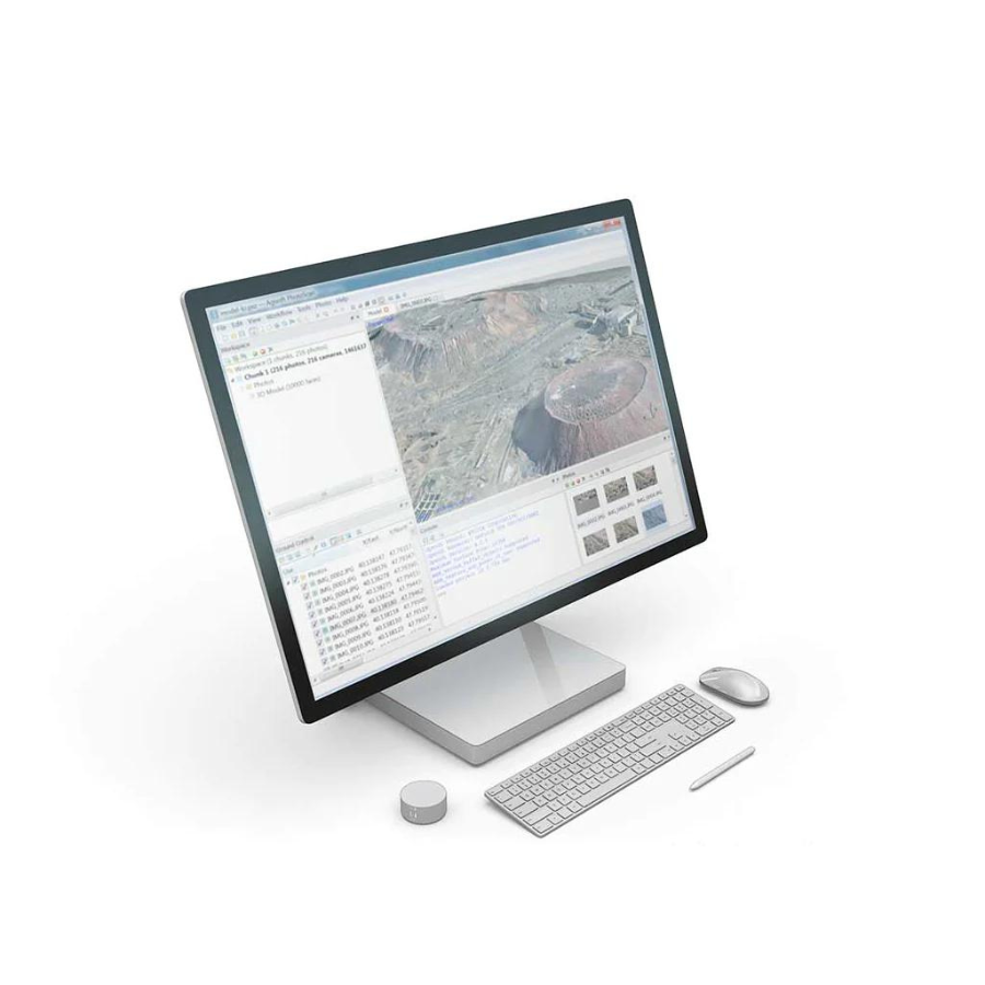
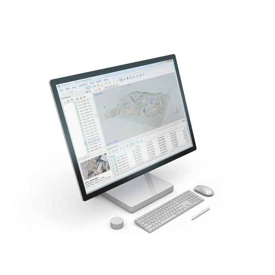
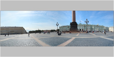
Agisoft Metashape is a sophisticated photogrammetry software designed to process digital images into detailed 3D spatial data. It offers an efficient, automated workflow that allows users to transform photos into precise 3D models, maps, and textured meshes. Ideal for professionals in GIS, archaeology, and visual effects, Metashape supports a wide range of applications, including environmental monitoring and cultural heritage documentation. With its capability to handle RGB, multispectral, and thermal imagery, the software is versatile across various fields. Its user-friendly interface, coupled with powerful tools for georeferencing, DEM creation, and high-quality orthophoto generation, makes Metashape a preferred choice for creating accurate, high-resolution spatial data. Whether for academic research, commercial projects, or hobbyist exploration, Agisoft Metashape stands out for its precision, ease of use, and comprehensive support for multiple data types and export formats.
Features of Agisoft Metashape
-
Advanced Photogrammetry Engine
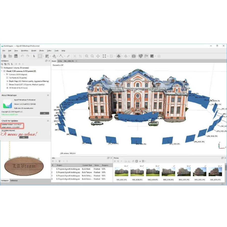
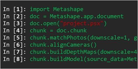
Agisoft Metashape transforms digital images into 3D spatial data using advanced photogrammetric algorithms. As a result, it produces detailed 3D models, textured meshes, and accurate maps from still photographs. -
Broad Application Scope
Moreover, the software is widely used across GIS, archaeology, visual effects, and environmental sciences. Professionals rely on Metashape for tasks ranging from cultural heritage preservation to urban planning and ecological monitoring. -
Streamlined Automation
To simplify complex workflows, Metashape offers automation from image alignment to 3D reconstruction. Consequently, it makes photogrammetry more accessible, even to users with limited technical experience. -
High-Precision 3D Modeling
In addition, Metashape delivers highly accurate, high-resolution 3D models. These are essential for applications requiring detailed spatial analysis and visualization. -
Multispectral and Thermal Imaging Support
Unlike many tools, Metashape supports not only RGB images but also multispectral and thermal data. This broadens its use in sectors such as agriculture and industrial inspections for enhanced environmental and heat analysis. -
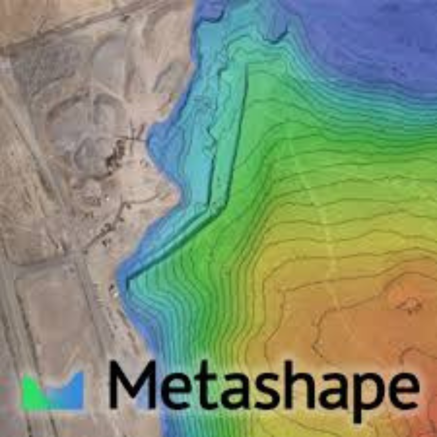
Georeferencing and DEM Capabilities
With robust georeferencing tools and digital elevation model (DEM) generation, the software enhances spatial accuracy for topographic and geospatial projects. -
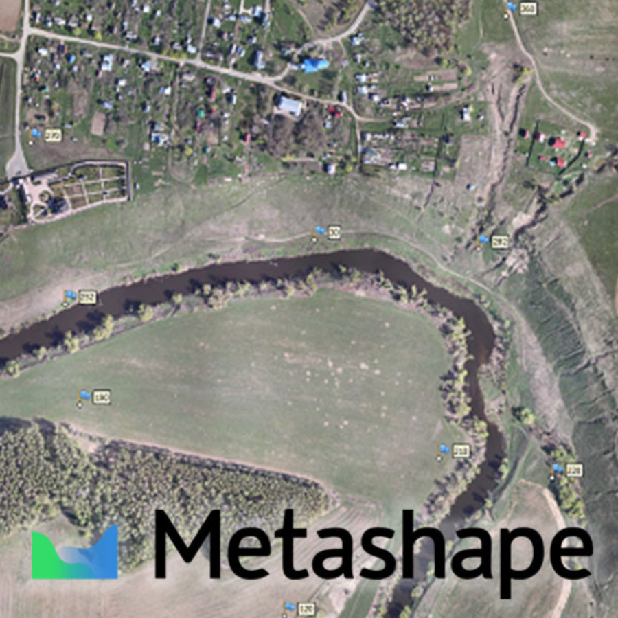
Dense Point Cloud Production
It also generates dense point clouds, enabling precise measurement and modeling. These outputs are critical for capturing the physical features of scanned environments. -
Orthophoto Generation
Furthermore, Metashape creates geometrically accurate orthomosaics. These high-quality outputs are essential for aerial surveys, mapping tasks, and GIS integration. -
User-Friendly Interface
Despite its technical power, Metashape remains easy to use. Its intuitive interface supports users at all experience levels in managing complex photogrammetric tasks efficiently. -
Versatile Export Formats
The software exports to formats such as OBJ, PLY, PDF, and GeoTIFF. Therefore, it integrates smoothly with other tools in digital modeling, GIS, and CAD workflows. -
Cloud Processing Option
For larger datasets, Metashape offers a cloud processing service. This significantly reduces the burden on local hardware and accelerates data processing. -
Device Compatibility
Another advantage is its flexibility with capture sources. Metashape supports imagery from DSLR cameras, UAVs, smartphones, and more, allowing users to work with a variety of input devices. -
Comprehensive Support and Documentation
Additionally, users benefit from detailed documentation, tutorials, and responsive customer service. This ensures smoother onboarding and effective troubleshooting. -
Regular Software Updates
Lastly, Agisoft maintains a strong development cycle. Frequent updates ensure that Metashape stays current with technological trends and user needs.
A Closer Look – Agisoft Metashape
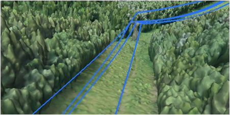
Terrestrial laser scanning (TLS) registration
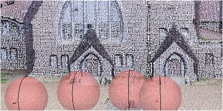
Measurements: distances, areas, volumes
The system comes equipped with inbuilt tools for measuring distances, areas, and volumes, facilitating straightforward metric analysis. For more complex assessments, the outputs of photogrammetric processing are transferable to external tools, supported by a wide array of export formats, ensuring seamless integration and versatility in data analysis applications.
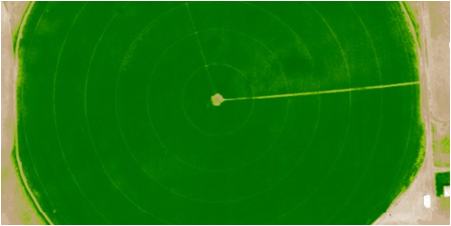
Multispectral imagery processing
Specifications of Agisoft Metashape
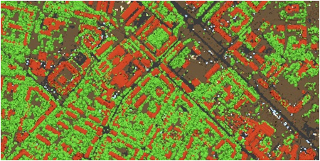
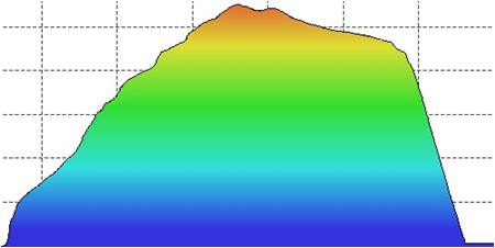
Feature Extraction and Mapping
Agisoft Metashape
Integration with point clouds
Y
Automatic texturing
Y
System Requirements:
Agisoft Metashape
- Basic Configuration: Suitable for laptops or desktops, requires a 4-12 core Intel, AMD, or Apple M1/M2 processor, 2.0+ GHz, with 16-32 GB RAM and an NVIDIA or AMD GPU with 1024+ unified shaders.
- Advanced Configuration: Aimed at desktops or workstations, it needs a 6-32 core Intel or AMD processor, 3.0+ GHz, 32-128 GB RAM, and 1-2 NVIDIA or AMD GPUs with 1920+ unified shaders.
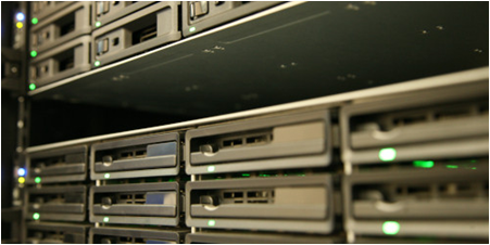
- Extreme Configuration: For servers processing extremely large datasets, a dual-socket Intel Xeon or AMD EPYC setup with 128+ GB RAM and high-end GPUs is recommended
Photogrammetric Processing
Both editions support photogrammetric triangulation, dense point cloud generation, and 3D model generation and texturing. The Professional edition adds features like support for aerial, close-range, and satellite imagery; multi-camera project support; and more elaborate model editing and classification options
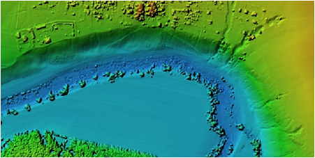
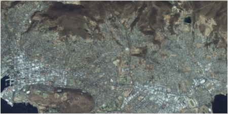
Geospatial Data Generation
Agisoft Metashape
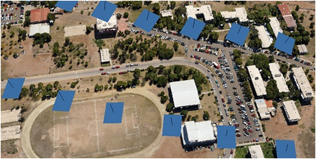
The software is designed to process digital images to generate 3D spatial data, useful in GIS applications, cultural heritage documentation, visual effects production, and for indirect measurements of various objects
Professional Edition Specific Features
This edition supports digital elevation model (DSM/DTM) generation and editing, georeferenced orthomosaic generation, LiDAR data support, and ground control points/scale bar support. It also offers advanced tools for measurements, stereoscopic measurements, hierarchical tiled model generation, 4D modeling for dynamic scenes, multispectral imagery processing, automatic powerlines detection, satellite imagery processing, Python and Java API for automation, network processing, and cloud processing
Standard Edition Specific Features
Agisoft Metashape
The Standard edition focuses on core functionalities like photogrammetric triangulation, dense point cloud generation, 3D model generation and texturing, and panorama stitching. It is tailored for simpler projects that do not require the advanced features of the Professional edition.
Agisoft Cloud
Available for Professional edition users, this online platform offers tools for site inspection, annotation, and documentation, integrated with a cloud processing service to streamline workflows and facilitate collaboration.
FAQs for AGISOFT METASHAPE Software
FAQ’S for Agisoft Metashape
- What is Agisoft Metashape?
Agisoft Metashape is a standalone software used for photogrammetric processing of digital images. It generates accurate 3D spatial data. This makes it useful in GIS, cultural heritage preservation, visual effects, and indirect object measurements across various scales. - What are the key features of the Standard Edition?
The Standard Edition includes core functions such as photogrammetric triangulation, dense point cloud generation, and 3D model creation with textures. Additionally, it supports panorama stitching and several other essential tools. - How do I get started with Agisoft Metashape?
Getting started is straightforward. Agisoft offers tutorials and manuals for both the Standard and Professional editions. The latest version, Metashape 2.1.0, is available for download on the official website. - Can I try Agisoft Metashape before buying?
Yes, you can. The software offers a demo mode. Alternatively, you can use the full-featured version with a 30-day free trial license. - What are the system requirements?
You will need a high-speed multi-core CPU and at least 16 GB of RAM. For advanced processing, 64 GB or more is recommended. Additionally, a high-end OpenCL or CUDA-compatible GPU is required for optimal performance. - How does Agisoft Metashape support cloud processing?
Metashape Professional users can access Agisoft Cloud. This platform supports cloud-based site inspection, documentation, and annotation. It also enables team collaboration and helps streamline complex workflows. - What’s the difference between the Professional and Standard editions?
The Professional Edition includes features such as support for aerial, satellite, and close-range imagery, georeferenced orthomosaics, digital elevation models, and LiDAR integration. The Standard Edition focuses mainly on core photogrammetry tools. - How do I update the software?
Updates to version 2.x are free of charge. However, when upgrading from version 1.x, you may need to re-enter your license due to changes in the activation process. - Is there an academic license available?
Yes, academic licensing options are available. For details, it’s best to contact Agisoft directly or visit the licensing section on their website. - Is user support available?
Agisoft offers a full support system. Resources include tutorials, user guides, a knowledge base, and a community support forum for both beginners and advanced users.


There are no reviews yet.