
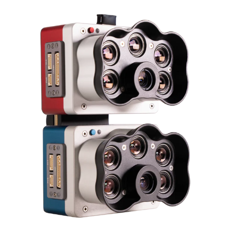
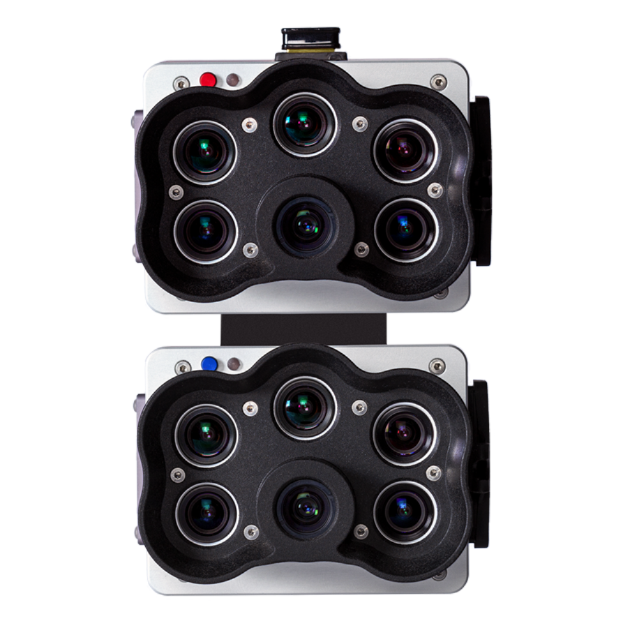
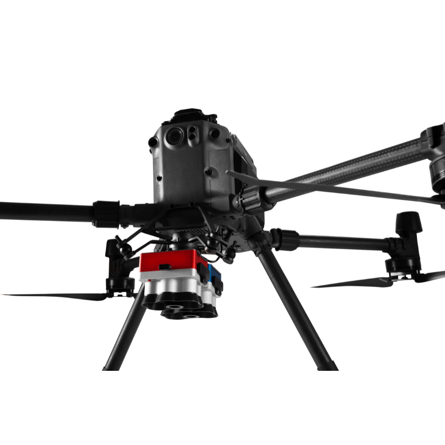
Micasense RedEdge-P Dual
- High-Resolution Imaging: 2 cm/pixel for detailed vegetation insights.
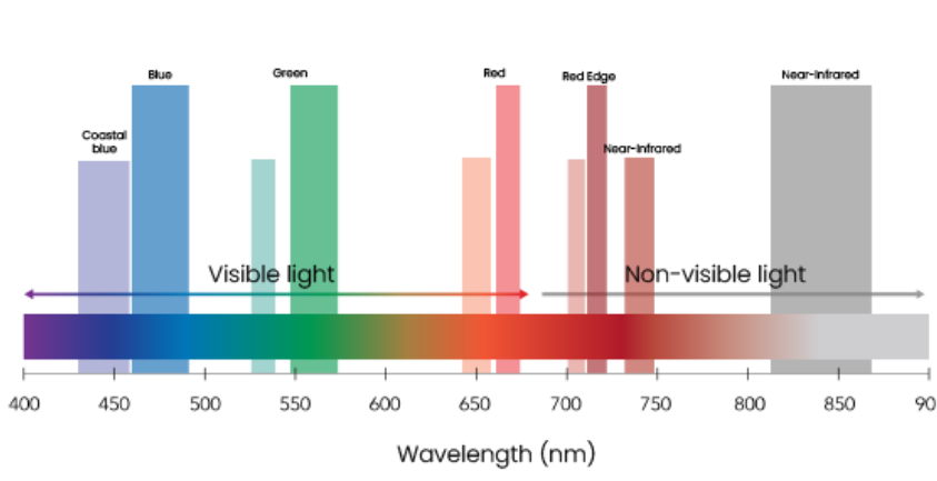
- Broad Spectral Coverage: Matches Landsat 8 and Sentinel-2 spectral bands.
- Accurate Calibration Tools: Reflectance panel and light sensor for precision.
- Consistent Time Analysis: Reliable data comparison across different time periods.
- Wide Application Range: Ideal for agriculture and environmental spectral analysis.
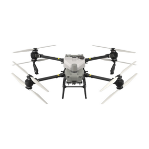
- Seamless Drone Integration: Compatible with DJI Matrice 300 and others.
- Extensive Index Support: Utilizes NDVI, NDRE, and more for analysis.
- 3 months · ₹734,464
- 6 months · ₹367,232
- 9 months · ₹244,822
Select Snapmint at checkout · Available on orders above ₹3,000 · Subject to eligibility
- Trusted dealerDirect manufacturer partnership
- Pan-India deliveryInsured shipping, all states
- Post-sale supportTraining + service included
What makes it work
Ten multispectral bands
The RedEdge-P dual bands cover Landsat 8 and Sentinel-2 satellite bands at an enhanced spatial resolution.
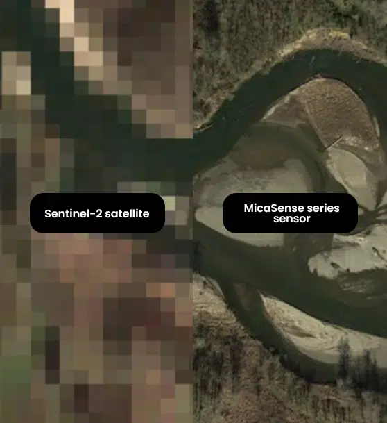
- Aim to obtain ultra-high-resolution images surpassing the clarity and detail available from satellite data sources like Landsat and Sentinel, crucial for precise environmental and geographical analysis.
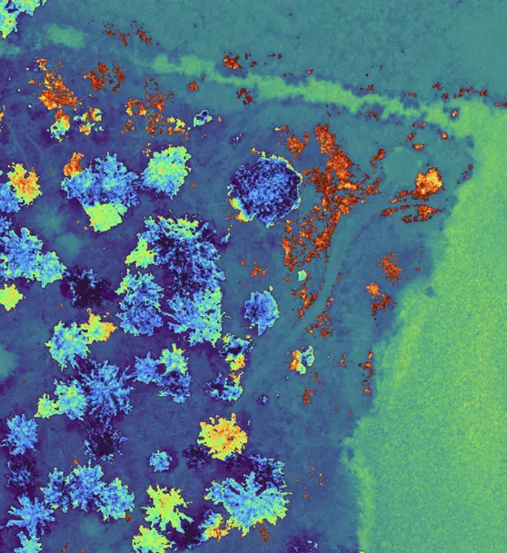
- Specialize in monitoring shallow water environments utilizing the coastal blue band for exceptional clarity, conducting thorough analyses on chlorophyll efficiency, and accurately identifying various weed species for aquatic ecosystem management.
- Implement robust, reliable time series analysis capable of adapting to fluctuating light conditions, alongside deploying advanced machine learning and AI applications tailored for precise early-stage crop counting and agricultural forecasting.
- Harness sophisticated technology to generate invaluable insights invisible to the naked eye, utilizing a comprehensive suite of results and indices such as RGB, NDVI, NDRE, OSAVI, NIT, CIR, DSM for multifaceted environmental and agricultural research. Buy the best drone camera in india.
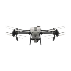
- Ensure seamless integration and compatibility with existing equipment, specifically the DJI Matrice 300 drone, alongside supporting a diverse range of post-processing and flight planning software platforms, to maintain a streamlined and efficient workflow in data collection and analysis processes.
- Correlate drone and satellite data: RedEdge-P’s dual bands cover the Landsat 8 and Sentinel-2 satellite bands (~10 m / 32 ft per pixel) with an improved spatial resolution of 2 cm / 0.8 in. Many indices already created by satellites can be used.
- Performance of time series analysis: The RedEdge-P kit features a calibrated reflectance panel and downward light sensor for radiometric calibration, adjusting for varying weather and light, ensuring reliable time series analysis and consistent result comparison over time. Buy the best drone camera in india.
- AI applications: Radiometric calibration tools adjust for diverse weather and lighting, offering data that support dependable time series analysis and consistent comparison of outcomes across different periods, enhancing the reliability of longitudinal studies.
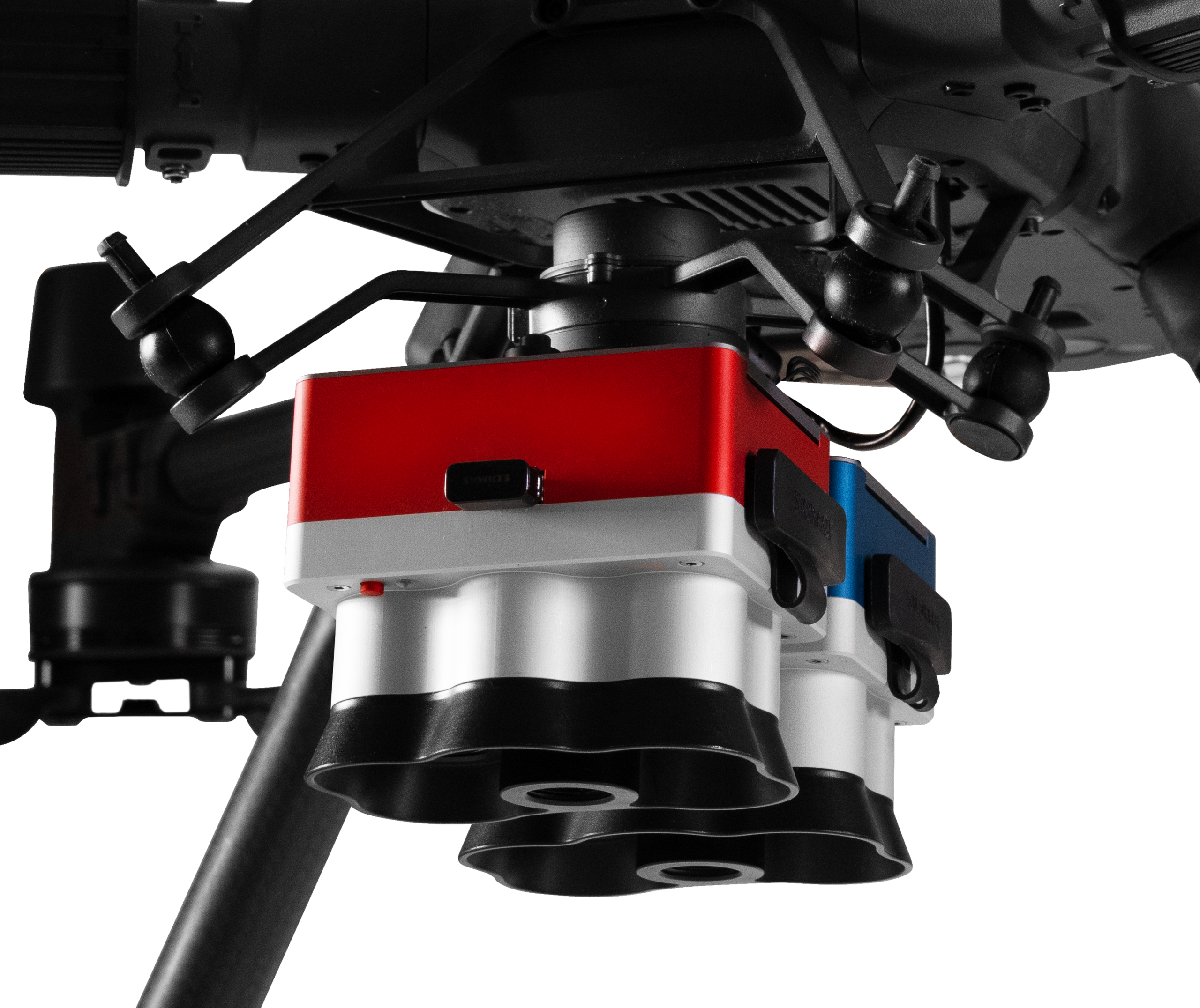
RedEdge-P Dual connected to DJI M300
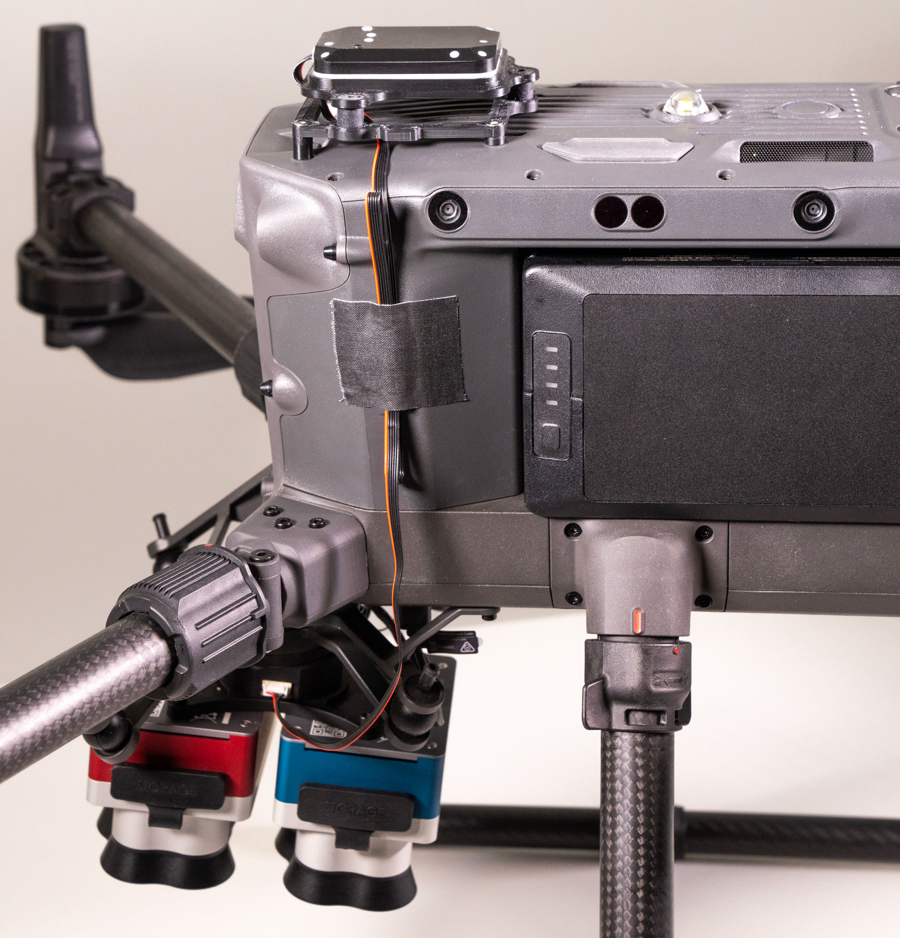
Fully connected Dual Camera Configuration on a DJI M300
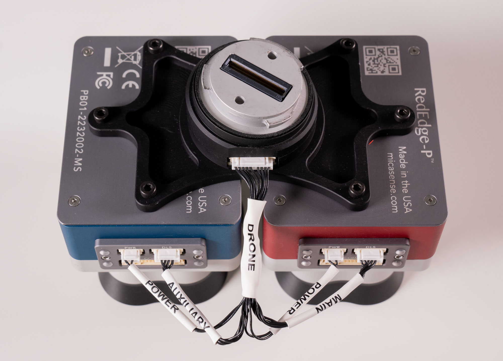
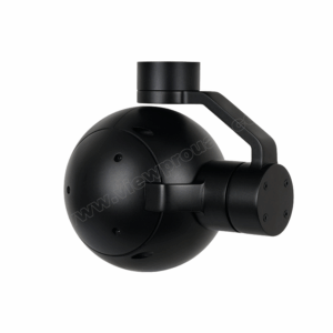
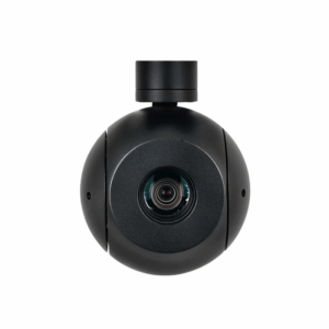
Connection between Dual Camera System Mount, RedEdge-P Red and RedEdge-P Blue
Specifications of Micasense RedEdge-P Dual
Weight
745 g / 26.2 oz (two sensors, mounting h Weight ardware, DLS2, and cable)
Dimensions
13.2 cm x 8.8 cm x 9.67 cm / 5.1 in x 3.1 in x 3.5 in
External power
7.0 V – 25.2 V
Power input
11/14.0/20W (standby, average, peak)
Spectral bands
Coastal blue 444(28)*, Blue 475(32), Green 531(14)*, Green 560(27), Red 650(16)*, Red 668(14), Red Edge 705(10)*, Red Edge 717(12), Near-IR 740(18)*, Near-IR 842(57)
RGB output
5.1 MP** (global shutter, aligned with all bands)
Sensor Resolution
1456 x 1088 (1.6 MP per multispectral band)
2464 x 2056 (5.1 MP panchromatic band)
Ground sample distance
7.7 cm / 3 in per pixel (per multispectral band) at 120 m / ~400 ft AGL
3.98 cm / 1.5 in per pixel (panchromatic band) at 120 m / ~400 ft AGL
Capture rate
Up to 3 images per second raw DNG
Storage
CFexpress card
Interfaces
Three configurable GPIO: select from trigger input, PPS input, PPS output, and top of frame signals. Host virtual button. USB 2.0 port for WiFi. Serial. 10/100/1000 Ethernet. Buy the best drone camera in india.
Field of view
50° HFOV x 38° VFOV (multispectral), 44° HFOV x 38° VFOV (panchromatic)
Heat
Ambient without airflow: 0-40 °C / 0-104 °F. Ambient with airflow >0.5 meter per second / >1.1 mph: 0-50 °C / 0-122 °F
FAQs about Micasense RedEdge-P Dual
- What is the primary use of the MicaSense RedEdge-P Dual?
- The MicaSense RedEdge-P Dual is primarily used for agricultural and environmental monitoring. It provides detailed multispectral images for crop health assessment, stress detection, and precision farming practices, helping users make informed decisions to improve yield and reduce input costs.
- Can the RedEdge-P Dual be used with any drone?
- Yes, the RedEdge-P Dual is designed to be compatible with a wide range of unmanned aerial vehicles (UAVs). Its versatile mounting options and integration capabilities make it suitable for most commercial drones used in agriculture and research.
- What makes the RedEdge-P Dual different from other multispectral cameras?
- The RedEdge-P Dual stands out for its dual camera system that captures both multispectral and high-resolution RGB images simultaneously, its enhanced calibration for accurate data across various light conditions, and its tailored software for advanced data analysis.
- How does the camera’s calibration work?
- The RedEdge-P Dual includes a radiometric calibration target and onboard sensors that measure environmental conditions, such as light intensity. These features ensure the camera’s output is consistently accurate, allowing for reliable comparison over time and under different lighting conditions.
- What resolution can I expect from the images?
- Each of the five spectral bands captured by the RedEdge-P Dual has a resolution of 5 megapixels, providing high-resolution imagery for detailed analysis and monitoring of crop health and environmental conditions.
- How are the captured images processed?
- MicaSense offers specialized data processing software that enables users to process, analyze, and visualize the multispectral data. The software supports various vegetation indices and provides tools for detailed crop health assessment and management.
- Is it difficult to integrate the RedEdge-P Dual with my drone?
- Integration is designed to be straightforward, with MicaSense providing guidance and support. The camera system is engineered for easy mounting and compatibility with many UAV platforms, facilitating quick setup and integration.
- Can the RedEdge-P Dual operate in challenging lighting conditions?
- Yes, the camera is equipped with advanced calibration capabilities, including a radiometric calibration target and environmental sensors, to ensure accurate data collection in a wide range of lighting conditions, from bright sunlight to cloudy days.
- What type of support does MicaSense offer for RedEdge-P Dual users?
- MicaSense provides comprehensive support, including detailed documentation, online resources, and customer service for technical inquiries. They also offer training materials and workshops for users to get the most out of their multispectral imaging system.
- What applications can benefit from the RedEdge-P Dual’s data?
- Beyond agriculture, the RedEdge-P Dual’s detailed multispectral imagery can benefit environmental monitoring, forestry management, water resources management, and research applications. Its precise imaging capabilities enable users to monitor vegetation health, detect stress early, and manage resources more efficiently.

There are no reviews yet.