Description
PIX4D Best Drone Mapping Software
PIX4D is a top supplier of drone software solutions for experts across numerous sectors. PIX4D Drone Mapping Software provides users with a set of potent tools for processing, analyzing, and displaying geospatial data in order to enable them to draw important conclusions from aerial imagery taken by drones.
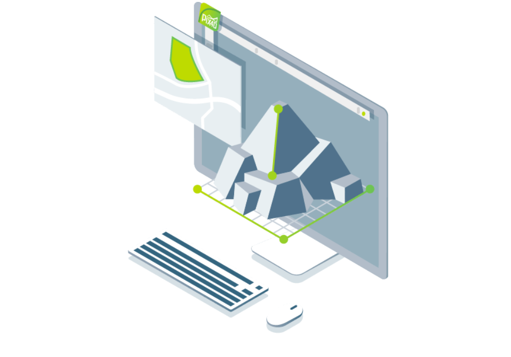
One of Pix4D’s software’s primary characteristics is its capacity to swiftly and precisely produce high-resolution 2D and 3D maps and models from imagery obtained by drones. Applications for these maps and models include surveying, mapping, agriculture, building, and asset inspection, among many others.
In addition to its mapping features, Pix4D’s software has tools for analyzing and editing data. These tools include the capacity to measure volumes, areas, and distances as well as the ability to recognize and categorize objects in photos. As a result, it becomes a crucial tool for professionals who need to base their decisions on reliable and current data.
To ensure that customers get the most out of their tools, Pix4D’s software is user-friendly and equipped with a variety of resources and support options. PIX4D Drone Mapping Software can assist you in realizing the full potential of your aerial pictures, regardless of your level of drone experience or familiarity with geographical data.

Features of PIX4D Drone Mapping Software
Feature |
Description – PIX4D Drone Mapping Software |
|---|---|
| Photogrammetric Processing | Converts images into 2D maps & 3D models |
| rayCloud™ Integration | Combines 3D point clouds with original images |
| Automatic Georeferencing | Supports GPS/GNSS data from images |
| Dense Point Cloud Generation | High-resolution point clouds for detailed analysis |
| Orthomosaic Creation | True-color, accurate 2D maps with real-world scale |
| Digital Surface & Terrain Models | DSMs and DTMs for terrain analysis |
| 3D Textured Mesh | Visualize objects and environments in 3D |
| Volume Calculation Tool | For stockpile and excavation measurement |
| GCP and Checkpoint Support | Improves map and model accuracy |
| Output Compatibility | Exports to GIS, CAD, BIM, and other platforms |
Applications of PIX4D Drone Mapping Software
It helps in making a better decision with accurate 3D maps and models in different specific industries such as:
- Surveying
- Construction
- Agriculture
- Telecom
- Mining
- Public Safety
- Inspection
- OEM & Integrators
Pix4DMapper: PIX4D Drone Mapping Software is a powerful photogrammetry software that allows users to transform images into accurate and georeferenced 2D maps and 3D models. It is a complete solution for professionals in the surveying, mapping, and GIS industries, as well as researchers, environmentalists, and other users who need to analyze and understand their data.
Selectively and securely share project data and insights, with your team, clients, and suppliers, using standard file formats.


Key Components
- Photogrammetric Engine – Core processing unit for transforming images into georeferenced outputs
- rayCloud™ Editor – For 3D visual validation and editing
- Processing Options Templates – Customizable workflows for various outputs
- GCP/Manual Tie Point Tools – For enhanced georeferencing and model refinement
- Quality Report Generator – Ensures transparency and accuracy in results
- Orthomosaic Editor – Allows for manual corrections and optimization
- Point Cloud Densifier – Produces high-quality 3D point clouds
-
Aerial Mapping & Surveying
-
Create accurate 2D maps and 3D models using drone imagery.
-
Ideal for topographic surveys without traditional ground crews.
-
-
Construction & Infrastructure Monitoring
-
Monitor site progress over time with georeferenced maps.
-
Perform volume calculations of stockpiles and excavations.
-
-
Agriculture & Precision Farming
-
Generate NDVI maps from multispectral images.
-
Analyze crop health, stress zones, and irrigation needs.
-
-
Mining & Quarrying
-
Measure volumes of extracted materials.
-
Monitor changes and safety risks across sites.
Oil, Gas, and Energy Sector
Monitor pipeline routes and energy infrastructure, Assess environmental impacts and vegetation encroachment.Buy PIX4D dBest Drone Mapping Software Online on XBOOM.
-
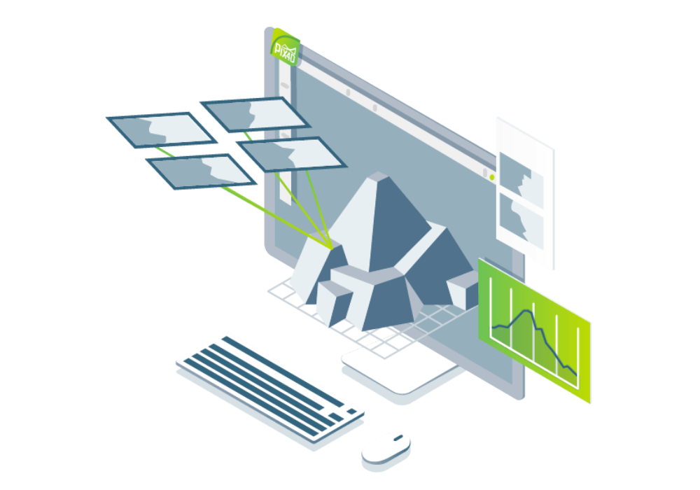
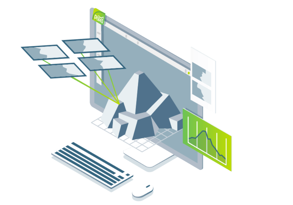
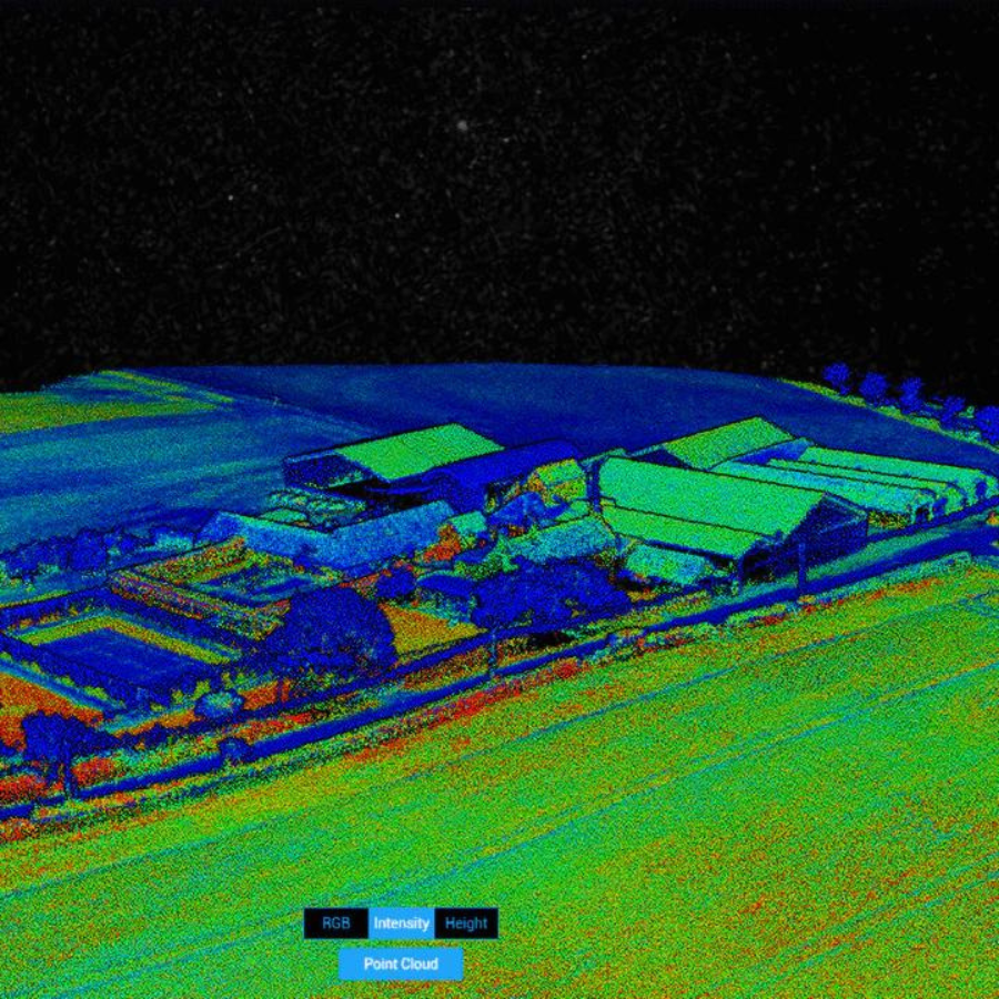
rayCloudtm
The power of photogrammetry software
A unique environment connecting your original images to each point of the 3D reconstruction to visually verify and improve the accuracy of your project. rayCloud™ is a cutting-edge photogrammetry software platform that seamlessly integrates 2D imagery with 3D point clouds to deliver accurate, georeferenced maps and models. It revolutionizes the way professionals visualize and validate data by combining photogrammetric processing with interactive 3D editing, allowing for precise measurements, quality assessment, and efficient correction—all within a single intuitive interface. Ideal for surveying, construction, mining, and agriculture, rayCloud™ enhances workflow efficiency and decision-making accuracy.
Specifications
Specification |
Details |
|---|---|
| Operating System | Windows 10+ / macOS 10.15+ |
| Input Formats | JPEG, TIFF (RGB, NIR, multispectral, thermal) |
| Output Formats | GeoTIFF, LAS, LAZ, PLY, DXF, KML, OBJ, PDF |
| Supported Cameras | RGB, multispectral, thermal, drone/UAV cameras |
| GPU Acceleration | NVIDIA CUDA-enabled GPU recommended |
| RAM Requirement | Minimum 16 GB, 32 GB+ recommended |
| Storage Requirement | SSD with 100 GB+ free space recommended |
| Internet Connection | Required for activation and updates |
| License Type | Perpetual or Subscription |
| Integration | Compatible with Pix4Dcloud, Pix4Dsurvey, etc. |
Buy PIX4D dBest Drone Mapping Software Online on XBOOM.
Includes
-
PIX4Dmapper Software (License-based)
-
rayCloud™ Editing Interface
-
Access to Pix4Dcloud (optional)
-
User Manual and Learning Resources
-
Sample Datasets for Practice
-
Technical Support and Software Updates
-
Integration with other Pix4D products (Pix4Dsurvey, Pix4Dfields)
-
Optional Add-ons for Enterprise/Team Use
-
Activation Key or Login Credentials
-
Access to Pix4D Training Academy (optional)
Buy PIX4D dBest Drone Mapping Software Online on XBOOM.
FAQ's
1. What kind of maps can PIX4D create?
PIX4D can produce high-resolution 2D maps and 3D models, including Digital Surface Models (DSM), Digital Terrain Models (DTM), point clouds, and orthomosaics from drone-captured images.
2. What is Pix4Dmapper?
Pix4Dmapper is photogrammetry software that turns images from drones, handheld cameras, or planes into accurate and georeferenced maps and 3D models. It supports features like volume measurement, cross sections, and CAD-compatible outputs.
3. What makes Pix4Dmatic special?
Pix4Dmatic is ideal for processing large image datasets quickly. It features an intuitive workflow and is perfect for users needing fast, high-quality mapping results for projects like large farms or construction sites.
4. What is Pix4Dsurvey used for?
Pix4Dsurvey helps bridge the gap between photogrammetry and CAD. It allows users to vectorize point cloud data, create TINs (Triangulated Irregular Networks), and produce CAD-ready deliverables from aerial and LiDAR data.
5. How does Pix4Dreact help in emergencies?
Pix4Dreact is designed for rapid mapping in emergency scenarios. It processes drone images into accurate 2D maps within minutes, enabling teams to mark, measure, and share critical information on the ground quickly. Get the PIX4D Drone Mapping Software now.
Buy PIX4D dBest Drone Mapping Software Online on XBOOM.


There are no reviews yet.