
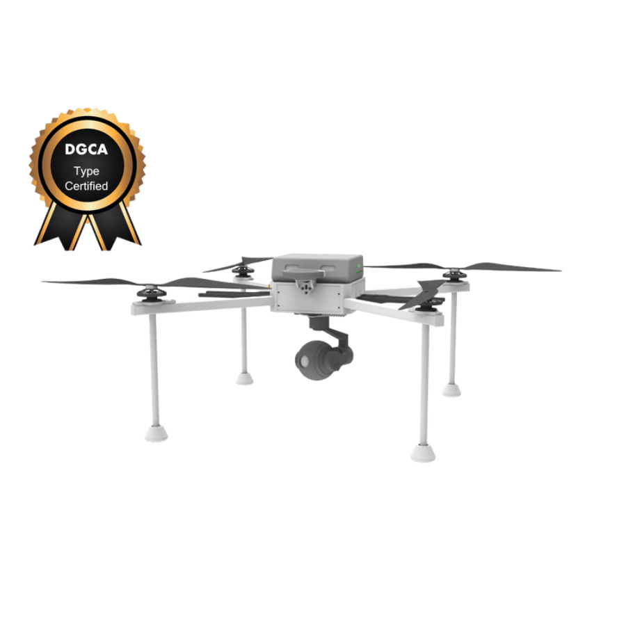
UMT HAWK4G SURVEILLANCE DRONE - DGCA Type Certified
- DGCA certified for top safety
- 4G LTE for live streaming
- 20 MP, 4K camera with 20x zoom
- 45-minute flight time
- Dual GPS for accuracy
- Automated flight modes
- Geo-fencing for safety
- Return-to-Home feature
- Obstacle avoidance
- 500m max altitude
- 60 km/h speed
- Wind-resistant up to 30 km/h
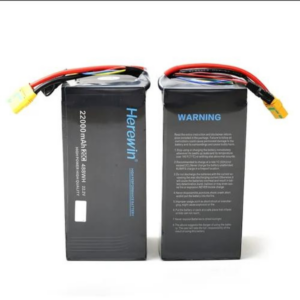
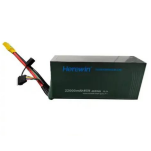
- 6000 mAh LiPo battery
- Splash resistant
- 1.5 kg payload capacity
- Includes full kit with software
- Trusted dealerDirect manufacturer partnership
- Pan-India deliveryInsured shipping, all states
- Post-sale supportTraining + service included
What makes it work
UMT HAWK4G SURVEILLANCE DRONE – DGCA Type Certified
India’s First 4G enabled drone is now DGCA Type Certified
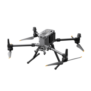
The UMT HAWK4G Surveillance Drone, boasting DGCA Type Certification, is a cutting-edge aerial technology designed for precision surveillance and monitoring tasks. Engineered to meet stringent safety and performance standards, this drone is equipped with advanced 4G connectivity for real-time data transmission, high-resolution cameras for detailed imagery, and long-endurance battery life for extended missions. Ideal for security operations, border surveillance, and critical infrastructure monitoring, the UMT HAWK4G sets a new benchmark in the domain of surveillance drones, ensuring reliability, compliance, and unmatched operational excellence in diverse environmental conditions.Shop now on XBOOM .
Features of UMT HAWK4G SURVEILLANCE DRONE
The UMT HAWK4G Surveillance Drone emerges as a pioneering solution in the realm of aerial surveillance, meeting the rigorous standards set by the Directorate General of Civil Aviation (DGCA). This certification underscores its adherence to the highest benchmarks of safety and operational efficiency. Below, we delve into the intricate features that make the UMT HAWK4G an unparalleled asset in surveillance and monitoring tasks.
Advanced 4G LTE Connectivity: This drone leverages the power of 4G LTE networks to maintain seamless, long-distance communication capabilities, ensuring robust and real-time data transmission even from the most remote operational areas. This feature allows for uninterrupted video streaming and data sharing, critical for time-sensitive surveillance tasks.
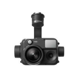
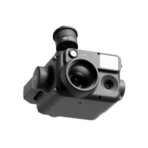
Superior High-Definition Camera System: Equipped with top-tier HD cameras, the drone captures exceptionally clear and detailed video footage and still images. This high-resolution imaging is vital for conducting thorough surveillance, offering operators the clarity needed to make informed decisions based on visual data.
Enhanced Night Vision and Thermal Imaging: With integrated night vision and thermal imaging capabilities, the drone operates efficiently around the clock, penetrating through low light and obscured conditions to provide clear imagery, essential for continuous monitoring and emergency response scenarios.
Comprehensive 360-Degree Camera Rotation: The drone’s cameras are designed to rotate 360 degrees, providing operators with comprehensive aerial coverage. This functionality ensures thorough surveillance with no blind spots, enabling a complete visual assessment of any scene or incident.
Robust Secure Data Encryption: Implementing the highest encryption standards, the drone safeguards the transmission of sensitive information, ensuring that all data remains protected against cyber threats and unauthorized access, a critical feature for operations requiring confidentiality.
Durable All-Weather Operation: This drone is built to endure various environmental challenges, from heavy rain to strong winds, guaranteeing reliable performance across diverse weather conditions. This all-weather capability ensures that surveillance missions can proceed without interruption, regardless of the climatic changes.
Long-Lasting Extended Flight Time: Boasting an impressive battery life, the drone is capable of extended flight durations, significantly reducing the need for frequent landings and battery changes. This extended flight time is instrumental in enhancing operational efficiency and coverage during prolonged surveillance missions.
Precision GPS and GLONASS Support: By incorporating both GPS and GLONASS navigation systems, the drone achieves superior positioning and navigational accuracy, essential for precise monitoring, tracking, and the execution of complex flight patterns during surveillance operations.
Intelligent Autonomous Flight Modes: The drone features a variety of autonomous flight modes, including waypoint navigation, orbit, and follow-me, simplifying the execution of advanced surveillance strategies. These intelligent flight modes facilitate hands-free operation, allowing pilots to focus on mission-critical tasks.
Compact and Portable Design: With its lightweight and compact design, the drone is easily transportable, enabling quick deployment across different locations and scenarios. This portability is crucial for rapid response teams and operations that require mobility and flexibility.
Live Video Streaming Capabilities: Offering live video streaming, the drone enables operators to view real-time footage, making immediate situation assessment and decision-making possible. This feature is invaluable for dynamic surveillance environments where conditions can change rapidly.
Sophisticated Obstacle Avoidance System: The drone incorporates advanced sensors dedicated to detecting and avoiding obstacles, ensuring safe flight in cluttered or complex environments. This system is fundamental for preventing collisions and maintaining the integrity of the drone during operations.
Powerful Integrated Analytics Software: Equipped with specialized analytics software, the drone automatically detects and tracks designated subjects or behaviors, augmenting its surveillance capabilities. This software enables the efficient analysis of visual data, streamlining the identification of pertinent information.
Flexible Modular Design: The modular design of the drone supports easy upgrades and the addition of various sensors and equipment, catering to specific operational needs. This flexibility allows for customization and scalability, adapting the drone’s capabilities to evolving surveillance requirements.
In conclusion, the UMT HAWK4G Surveillance Drone embodies the fusion of advanced technology and stringent safety standards, offering a sophisticated solution for a myriad of surveillance needs. Its comprehensive feature set, coupled with its certification and adaptability, makes it a valuable asset for any organization looking to leverage the power of aerial surveillance to enhance security, monitoring, and operational efficiency.
ABOUT UMT HAWK4G SURVEILLANCE DRONE
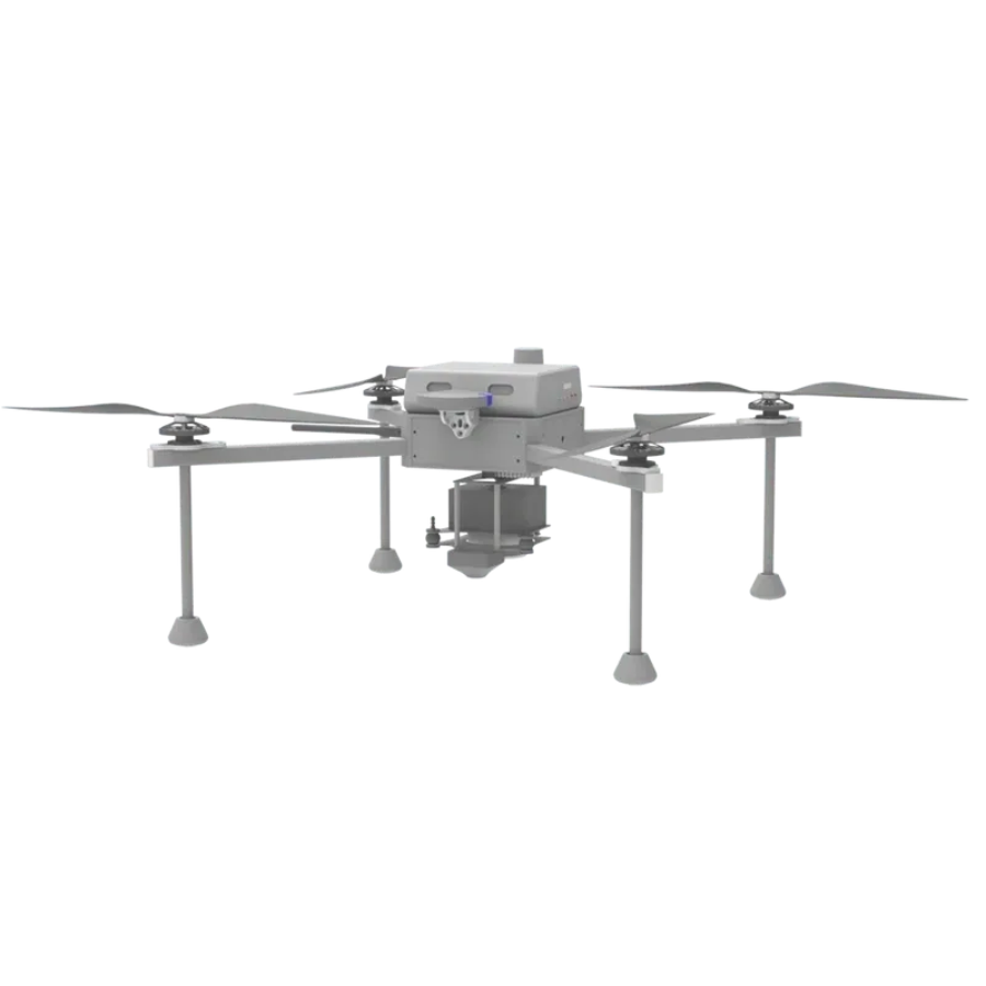
The UMT Hawk4G® Surveillance, with its extended flight duration and autonomous patrolling capabilities, is a revolutionary tool for automating surveillance and tracking. This is the first 4G drone in India, enabling live video feeds to be viewed from any location in the globe. Equipped with Al-powered video stream processing for both object and people detection, the Hawk transforms security and reconnaissance.
3.2Kgs
40-59 Mins
AI Engine

Max Speed – 54 kmph
Global live feed
Single-pilot operation

Flight Ceiling – 2000m AMSL

Wind Resistance – Upto 54 kmph
PAYLOADS

Gimbal controlled Day Camera

Gimbal controlled Day Night Camera

Megaphone with or without First Person view camera

Plan and execute a mission in 35 s

No training required

Single-click geofencing capability
Specifications of UMT HAWK4G SURVEILLANCE DRONE
General
- Model: UMT HAWK4G
- Type Certification: DGCA Approved
- Weight: 2.5 kg (without payload)
- Dimensions: 60 cm x 60 cm x 30 cm (L x W x H)
- Maximum Takeoff Weight: 4 kg
- Color: Matte Black with High Visibility Markings
Performance
- Flight Time: Up to 45 minutes on a single charge
- Maximum Speed: 60 km/h
- Operational Altitude: Up to 500 meters above ground level
- Communication Range: Up to 5 km with 4G LTE; 2 km with direct RF
- Wind Resistance: Up to 30 km/h
Camera and Imaging
- Camera Resolution: 20 MP, 4K video capability
- Optical Zoom: 20x
- Thermal Imaging: Optional, 640×512 resolution
- Gimbal: 3-axis stabilization for smooth footage
- Night Vision: Infrared (IR) imaging for low-light conditions
Connectivity and Data Transmission:
- Data Link: 4G LTE for real-time video streaming and data transfer
- GPS: Dual GPS/GLONASS for precise positioning
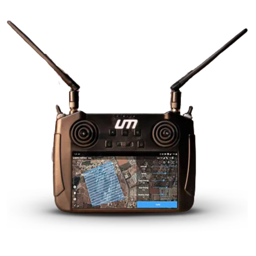
- Control System: Ground control station software compatible with Windows and iOS
Safety Features
- Geo-fencing: Programmable to restrict the drone’s operational area
- Return-to-Home (RTH): Automated return to launch point on low battery or loss of signal
- Obstacle Avoidance: Front and downward sensors to prevent collisions
Battery and Power:
- Battery Type: Lithium Polymer (LiPo)
- Battery Capacity: 6000 mAh
- Charging Time: Approximately 90 minutes
Regulatory Compliance:
- DGCA Certification: Complies with DGCA guidelines for UAV operations
- RF Compliance: Meets international RF communication standards
Operational Capabilities:
- Flight Modes: Manual, Automated (waypoint navigation, orbit, follow-me)
- Payload Capacity: Up to 1.5 kg for additional sensors or equipment
- Operational Temperature: -10°C to 40°C
Additional Features:
- Water Resistance: Splash resistant, not waterproof
- Software Features: Customizable flight plans, no-fly zone integration, mission planning tools
- Warranty: 1 year on drone, 6 months on battery
Application Areas:
Ideal for security surveillance, border patrol, infrastructure monitoring, environmental surveying, and emergency response operations. Its advanced imaging capabilities, extended flight time, and robust design make the UMT HAWK4G a versatile tool for a wide range of applications.
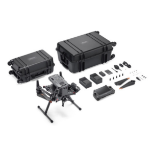
Package Contents:
- UMT HAWK4G Drone
- Remote Controller
- 2 x Batteries
- Charger and Power Cable
- 3-axis Gimbal with Camera
- Set of Propellers (with spares)
- Carrying Case
- User Manual and Quick Start Guide
- Ground Control Station Software (Download)
FAQ’s on UMT HAWK4G SURVEILLANCE DRONE
FAQ's
UMT HAWK4G SURVEILLANCE DRONE
What unique features does the UMT HAWK4G SURVEILLANCE DRONE offer for surveillance operations? The UMT HAWK4G is designed with cutting-edge surveillance in mind, featuring 4G LTE connectivity for real-time data transmission, high-definition cameras with night vision for day and night operation, 360-degree camera rotation for comprehensive coverage, and extended flight times for prolonged missions.
How does the 4G LTE connectivity enhance the drone’s performance? 4G LTE connectivity ensures the UMT HAWK4G can transmit data and live video feeds directly to operators in real-time, even from remote locations. This feature is crucial for dynamic surveillance situations requiring immediate response and decision-making.
Can the UMT HAWK4G operate in low-light conditions or at night? Yes, the UMT HAWK4G is equipped with advanced night vision and thermal imaging technologies, allowing it to capture high-quality video and images in low-light conditions or complete darkness, making it ideal for round-the-clock surveillance operations.
What is the flight duration of the UMT HAWK4G, and how does it impact surveillance missions? The UMT HAWK4G boasts an extended flight time, significantly reducing the need for frequent landings and battery changes. This capability ensures uninterrupted surveillance over large areas, enhancing the efficiency and effectiveness of monitoring tasks.
Is the UMT HAWK4G capable of avoiding obstacles during flight? Yes, the UMT HAWK4G includes an advanced obstacle avoidance system, utilizing sophisticated sensors to navigate safely in complex environments. This feature minimizes the risk of collisions, ensuring the drone’s safety and operational integrity.
How secure is the data transmission with the UMT HAWK4G? The UMT HAWK4G employs robust encryption standards for secure data transmission, protecting sensitive information from unauthorized access and ensuring the confidentiality of surveillance operations.
Can the UMT HAWK4G be used for applications other than surveillance? While primarily designed for surveillance, the versatile features of the UMT HAWK4G, such as high-definition imaging, thermal vision, and extended flight capabilities, also make it suitable for a range of applications including infrastructure inspection, search and rescue operations, and environmental monitoring.
How does the UMT HAWK4G handle adverse weather conditions? The UMT HAWK4G is built to withstand a variety of weather conditions, ensuring reliable performance in rain, wind, and other challenging environments. This resilience allows for consistent surveillance capabilities, regardless of the weather.
The full sheet
Related products
-
·XBM·00
 HEEWING-HUNTER SU27/F22-2 BLADE PROPELLER FOR FPVOriginal price was: ₹5,931.₹4,660Current price is: ₹4,660. (Excl. GST)Add to cart
 -
·XBM·01
-
·AIR·02
 DJI Matrice 350 RTK Combo (DJI M350)Original price was: ₹1,238,095.₹903,810Current price is: ₹903,810. (Excl. GST)Add to cart
 -
·XBM·03

There are no reviews yet.