
")


Description
Introducing DJI Terra
The world’s top commercial drone manufacturer, DJI, created DJI Terra, a professional-grade drone mapping software. DJI Terra is a PC application software with features such 2D multispectral reconstruction, LiDAR point cloud processing, and thorough inspection missions. It mostly uses 2D orthophotos and 3D model reconstruction. With thorough reconstruction models catering to verticals including land mapping, power transmission, emergency services, construction, transportation, and agriculture, it is a one-stop solution that offers industry users unmatched efficiency.
-
DJI Terra – Advanced Mapping & Industry Applications
Agricultural Capabilities
In addition to mapping tools, DJI Terra offers features tailored for agriculture. These include tools for yield forecasting, irrigation optimization, and crop health monitoring. As a result, farmers and agronomists can quickly gain a bird’s-eye view of their land. They can also make smarter, data-driven decisions for better farm management.
Cross-Industry Utility
DJI Terra isn’t just for agriculture. In fact, it serves professionals across surveying, construction, and public safety. Regardless of your industry, the platform delivers powerful tools to help you analyze aerial data and complete projects with precision.
Core Functionalities
Area Mapping & 3D Models
DJI Terra automatically imports images captured from different angles to build detailed 3D models. You can choose from high, medium, or low reconstruction resolutions depending on the task—whether you’re mapping a city block or inspecting a power grid.
-
Supports 400 photos per GB on one device
-
Can process up to 30,000 photos in 3 days on a single system
2D Mapping
Need flat maps? Terra creates high-resolution orthomosaics that support precise measurements.
-
Efficiently processes 5,000 photos in 2 hours on a single computer
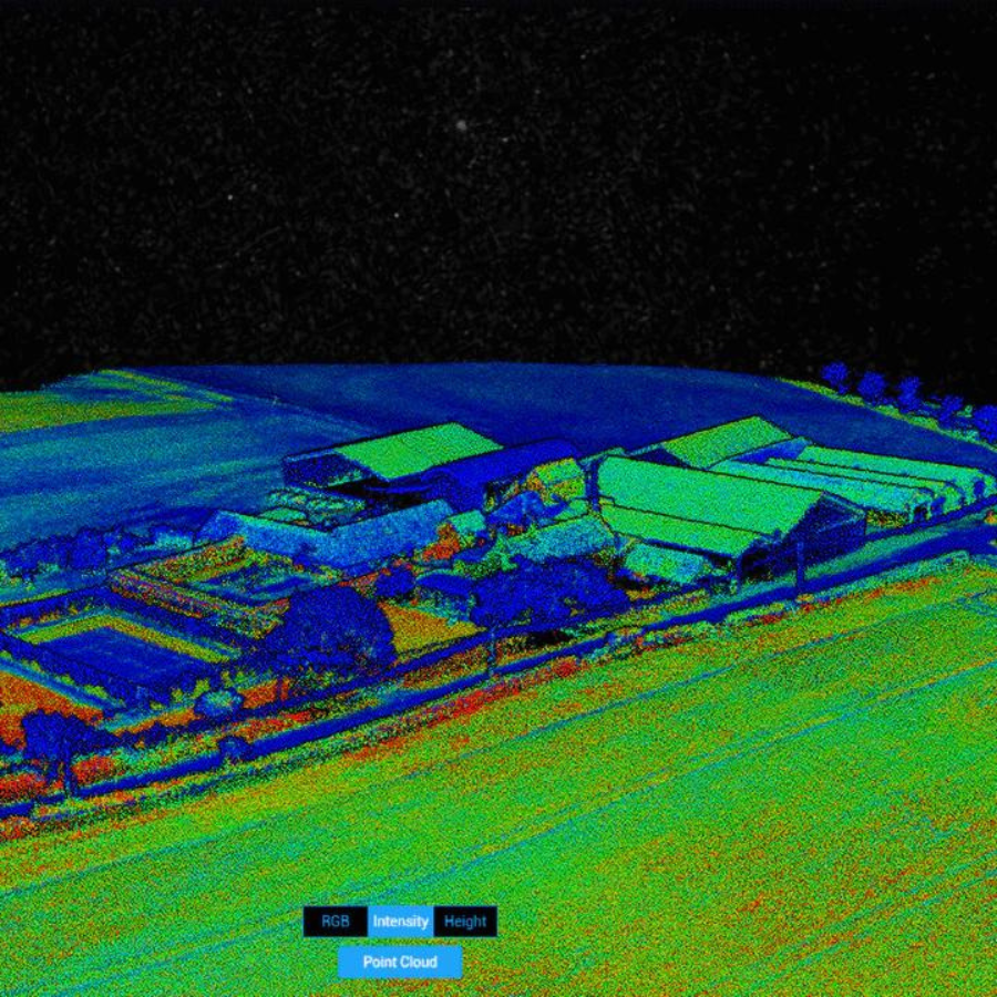
LiDAR Processing
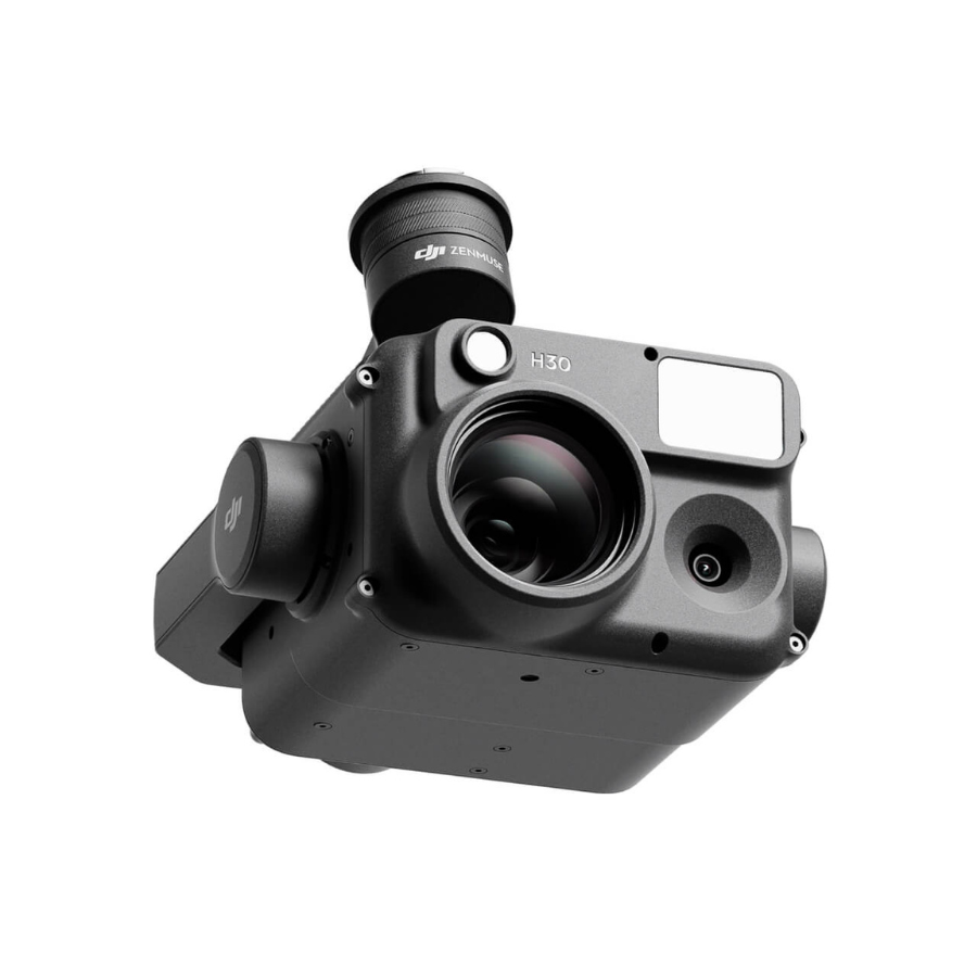
When paired with the Zenmuse L1, DJI Terra processes point cloud data with just one click. It also merges visible light and LiDAR for deeper analysis. Export point clouds, generate reports, and calculate POS data—all seamlessly.
Multispectral Mapping
Using DJI’s P4 Multispectral, Terra creates radiometrically calibrated reflectance maps. It also supports vegetation indices like NDVI and NDRE. You can even generate prescription maps for variable-rate applications with DJI’s Agras drones, cutting costs while boosting yield.
User Experience
DJI Terra stands out for its user-friendly interface. You can easily navigate tools for measuring area, volume, and distance. The software also lets you classify objects, making aerial data easier to interpret. In turn, you gain actionable insights—faster.
Version Overviews
DJI Terra – Agriculture Version
Perfect for professionals who want to turn real-world conditions into digital data.
-
Model Reconstruction: Import images to create detailed 2D and 3D maps
-
Real-Time Reconstruction: Generate maps live during drone flights
-
LiDAR Processing: Quickly build true-color point clouds with DJI L1
-
Inspection Tools: Create automated flight routes from 3D models
-
Model Application: Measure coordinates, distances, and volumes, then export with ease
DJI Terra – Pro Version
Designed for professionals who require robust data outputs and inspection tools.
-
Includes all features from the Agriculture Version
-
Ideal for surveyors, engineers, and infrastructure analysts
DJI Terra – Electricity Version
Engineered for professionals in powerline inspection and grid analysis.
-
Includes all core and Pro features
-
Optimized for electrical asset management and inspection
System Requirements
-
OS: Windows 7 or later (64-bit)
-
Memory: Minimum 16 GB RAM
-
Graphics: NVIDIA GPU with compute capability 3.0 or above (min 4 GB VRAM)
-
Real-Time 3D Reconstruction: Only supported by Phantom 4 Series under these specs
Device and License Management
-
After purchase, you’ll receive an activation code via email
-
For a single-device license, you may request one unbind per calendar year
-
For a three-device license, you may request two unbinds annually
-
Once unbound, all devices tied to that license become free
-
The bound user account cannot be changed
-
FAQ's
1. What is DJI Terra used for?
DJI Terra is a 3D mapping and data processing software. It transforms drone imagery into accurate maps and 3D models. Moreover, it serves industries like construction, agriculture, public safety, and infrastructure inspection.
2. Which drones are compatible with DJI Terra?
DJI Terra works with several DJI drones. For example, it supports the Phantom 4 RTK, Matrice 300 RTK, Matrice 30 Series, and other enterprise drones. These drones typically feature RTK positioning and high-resolution cameras.
3. Does DJI Terra require an internet connection?
Not always. DJI Terra runs offline for most tasks like mission planning and data processing. However, you do need internet access for software activation, updates, and loading map tiles.
4. What types of missions can I plan in DJI Terra?
You can plan a wide variety of missions. These include 2D mapping, 3D modeling, oblique capture, and linear route planning. In addition, it offers advanced tools for inspection workflows tailored to specific industries.
5. Can DJI Terra process RTK/PPK data?
Yes. DJI Terra fully supports RTK and PPK data. This capability helps deliver centimeter-level precision in mapping and modeling projects.
6. What output formats does DJI Terra support?
The software exports results in standard formats. These include DSM, DTM, LAS point clouds, OBJ mesh models, and GeoTIFF orthophotos. Therefore, you can easily integrate the outputs into your existing GIS or CAD workflows.
7. Is DJI Terra a subscription-based software?
Yes. DJI offers multiple licensing options. You can choose between annual subscriptions or perpetual licenses. Furthermore, different versions—Advanced, Pro, and Electricity—let you match the toolset to your specific needs.
8. Can DJI Terra be used for agriculture mapping?
Absolutely. DJI Terra includes agriculture-specific features. These include vegetation index analysis and field segmentation tools. As a result, it’s perfect for crop monitoring and precision farming.
9. Does DJI Terra support real-time 3D reconstruction?
Yes, with compatible hardware. DJI Terra can perform real-time 3D modeling. This allows fast terrain visualization and better situational awareness during active missions.
10. Is technical support available for DJI Terra?
Yes. DJI and authorized partners—such as XBoom—offer technical support. They also provide tutorials, guides, and help with installation and troubleshooting.


There are no reviews yet.