


Description
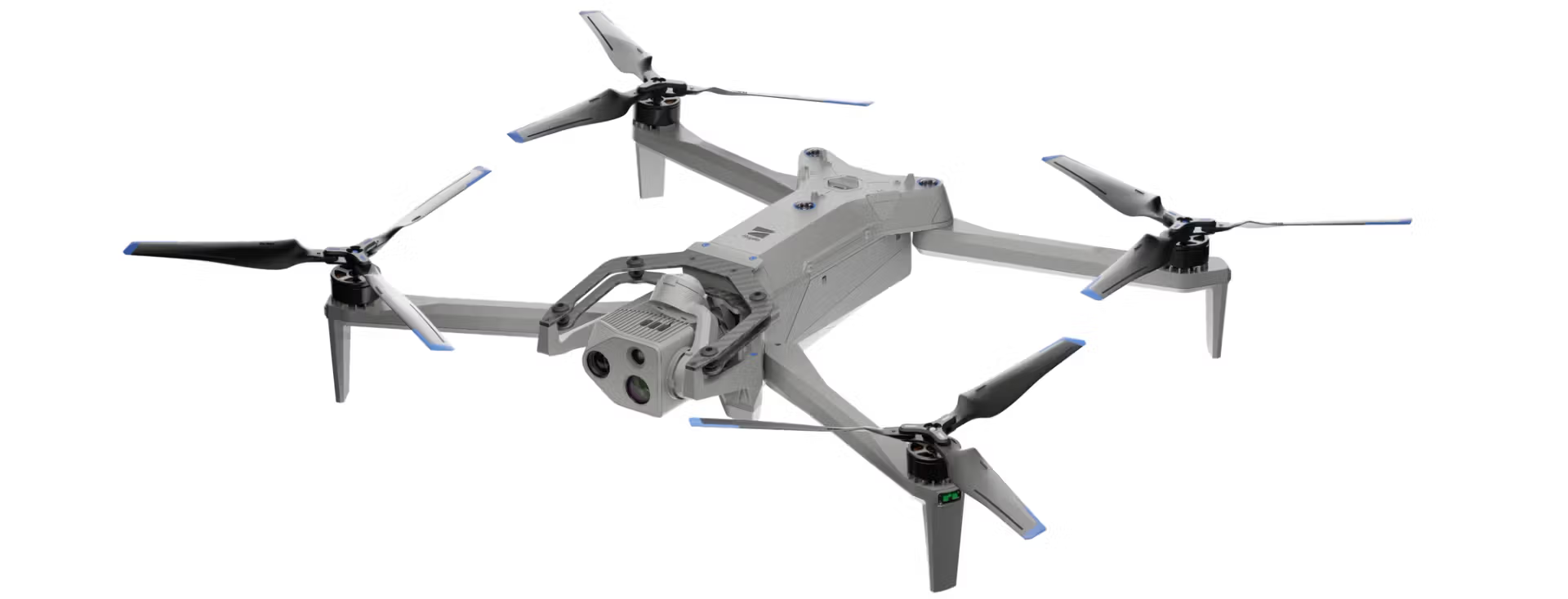
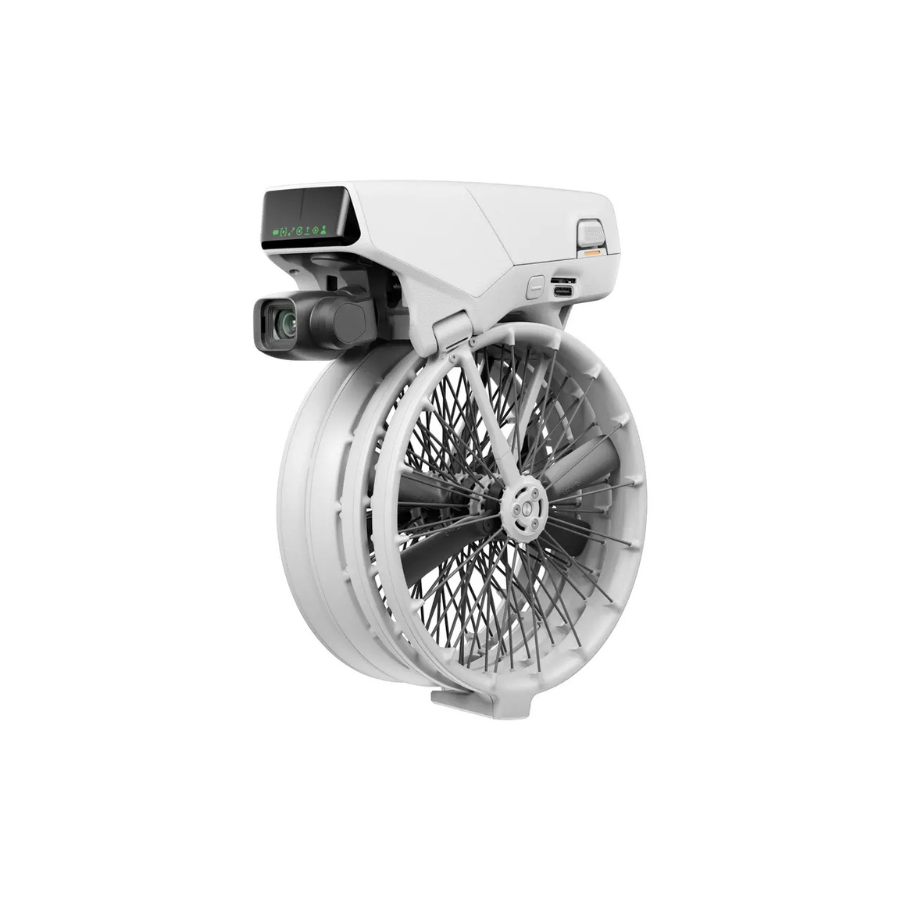
Introducing The Skydio X10D
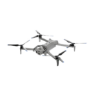
The Skydio X10D is the cutting-edge, intelligent drone that combines powerful sensors and advanced AI to deliver unparalleled performance for critical missions. It’s designed for operators who demand exceptional image clarity, precision, and reliability. With its high-resolution cameras, including thermal imaging, the X10D provides real-time data to make rapid, accurate decisions. Whether it’s for asset inspection, public safety, or tactical ISR, this drone offers seamless operation with minimal cognitive load. The onboard AI enhances flight capabilities, ensuring safety and efficiency. Built for extreme conditions, the X10D supports nighttime and challenging environments, redefining what’s possible in drone operations. Get the best drone in india now.
Features of Skydio X10D
| Feature | Details |
|---|---|
| Max Flight Speed | 45 mph |
| Deployment Time | <40 seconds |
| IP Rating | IP55 (dust and water resistant) |
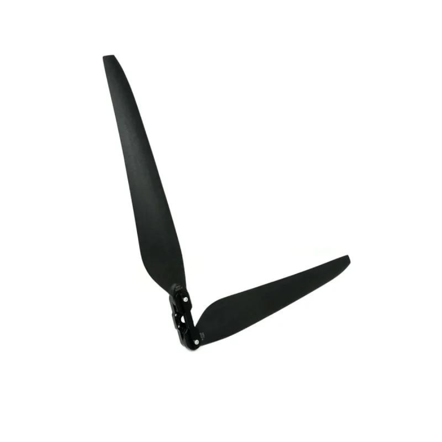
| Thermal Sensor | Teledyne FLIR Boson+ (640×512 resolution, <30mK sensitivity) |
| Camera Options | Modular, 64 MP narrow camera, 48 MP telephoto camera, radiometric thermal |
| AI & Autonomy | 360-degree obstacle avoidance, autonomous mission management |
| Night Vision | NightSense mode for zero-light navigation |
| Image Signal Processor | Spectra 480 for optimized image quality |
| Sensors | 6 custom-designed navigation lenses for 360-degree visibility |
| Use Case | Asset Inspection, Public Safety, Military, and more. Get the best AI drone in india now. |
Unmatched Performance and Durability of Skydio X10 Drone
The smartest AI-powered drone designed to deliver critical, real-time insights. Featuring the most advanced sensors in a compact UAS, it combines cutting-edge dual-use innovation with scalability and resilience.
45 mph Max flight speed | 40 min Max flight time | <40 sec Deployment time | IP55 Certified against dust and water – Skydio X10D
Visionary Skydio X10D Cameras for Precise Capture
Skydio is designed with advanced cameras, featuring high-resolution visuals and radiometric capabilities. Its modular sensor packages provide superior optics, enabling detailed image capture even in demanding environments. With these features, the X10 ensures precision and clarity, making it an ideal choice for professional tasks.
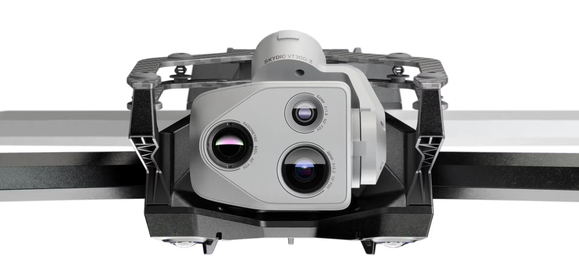
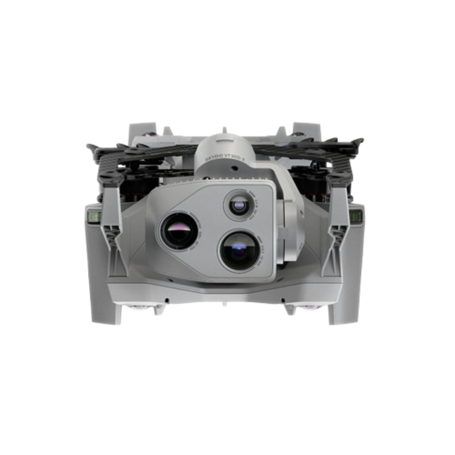
The right sensors for your mission
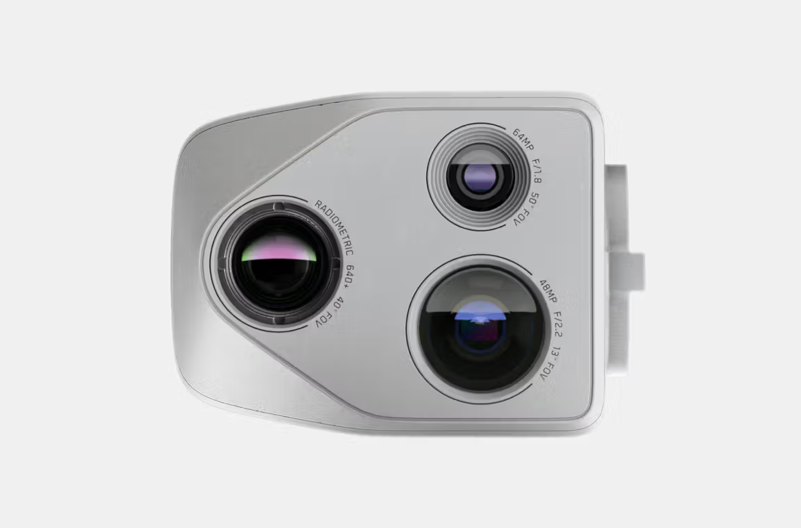
VT300-Z
| Feature | Narrow Camera | Telephoto Camera | Radiometric Thermal Camera |
|---|---|---|---|
| Focal Length (eq.) | 46 mm | 190 mm | 60 mm |
| Resolution | 64 MP | 48 MP | 640 x 512 px |
| Aperture | f/1.8 | f/2.2 | – |
| Field of View | 50° | 13° | 41° |
| Thermal Sensitivity | – | – | <30 mK |
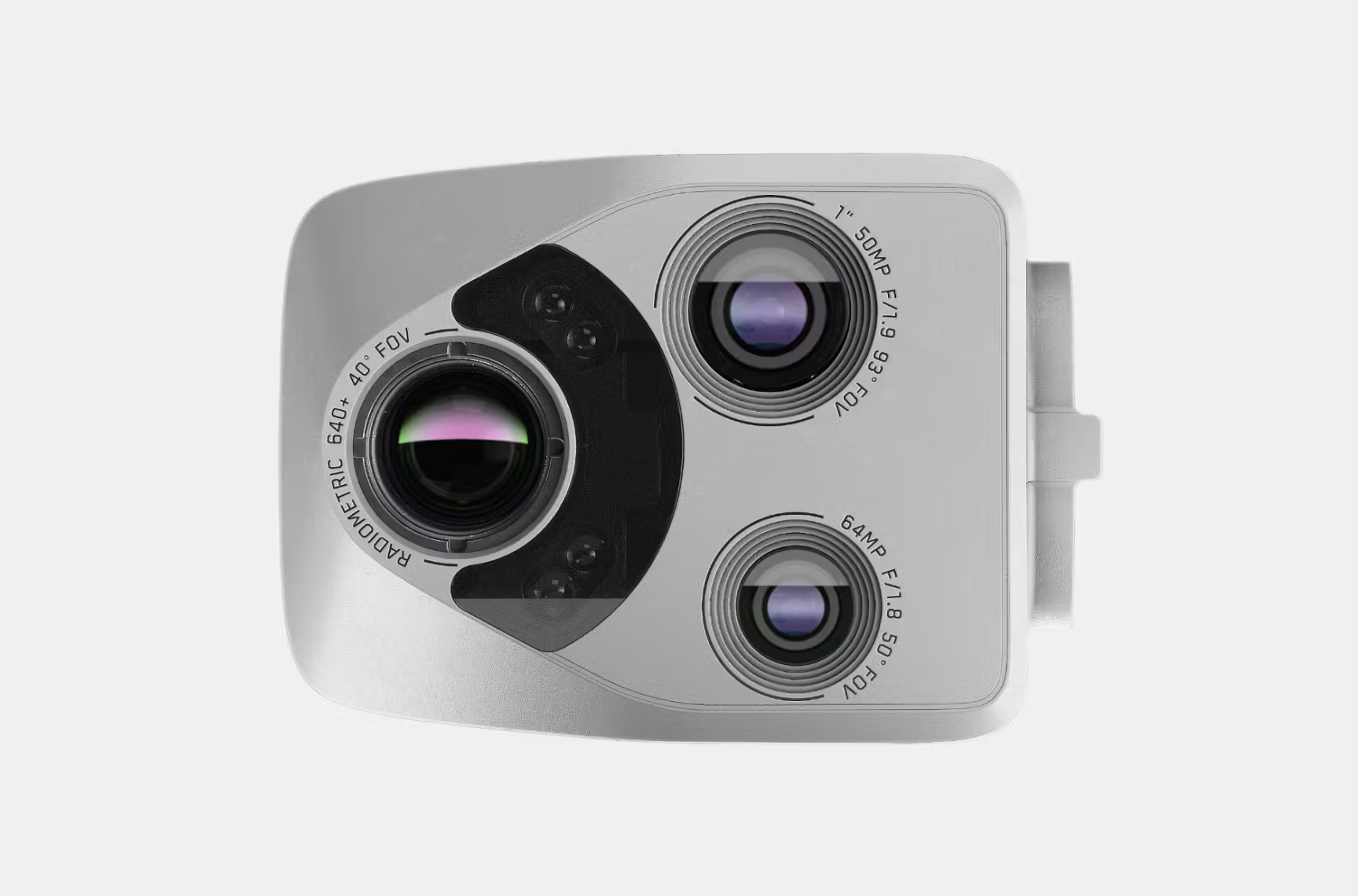
VT300-L
| Feature | Narrow Camera | 1″ Wide Camera | Radiometric Thermal Camera |
|---|---|---|---|
| Focal Length (eq.) | 46 mm | 20 mm | 60 mm |
| Resolution | 64 MP | 50 MP | 640 x 512 px |
| Aperture | f/1.8 | f/1.95 | – |
| Field of View | 50° | 93° | 41° |
| Thermal Sensitivity | – | – | <30 mK |
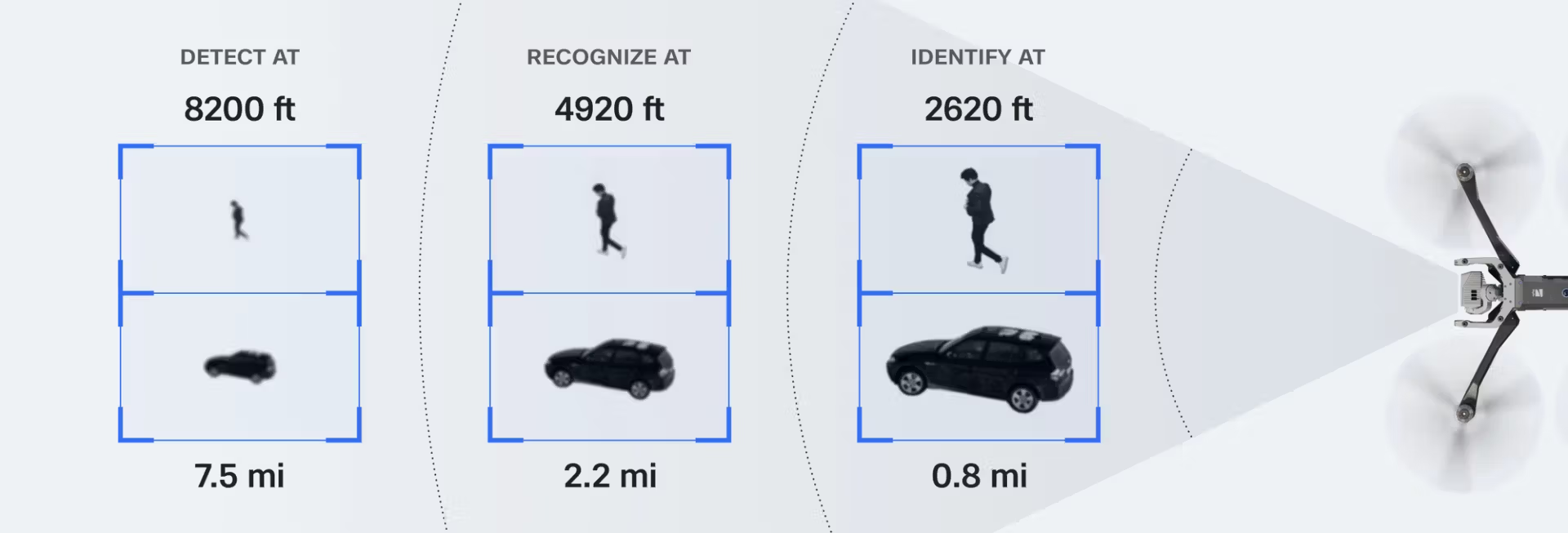
Capture precise details from afar
The VT300-Z sensor package features a telephoto camera that allows you to identify objects, vehicles, and people the moment they appear in your field of view, providing the visual clarity needed to make swift and informed decisions
Put an Entire Operational Area in Focus for Mission Coordination
Focus on the entire operational area to streamline mission coordination.
Image captured with VT300-Z: Narrow camera module, 46 mm, f/1.8, 64 MP, 50° field of view
Capture Sub-Millimeter Precision in Corrosion Inspections
Achieve unmatched accuracy during inspections with high-resolution imaging.
Image captured with VT300-L: 1” wide module & onboard light, 20 mm, f/1.95, 50 MP, 93° field of view
Observe Subjects at a 1km Range
Identify potential threats or suspicious activity with precision optics.
Image captured with VT300-Z: Telephoto lens, 190 mm, f/2.2, 48 MP, 13° field of view
Unmatched thermal imaging capabilities.
The Skydio X10 is the first drone to feature a Teledyne FLIR Boson+ sensor, providing superior thermal imaging quality. With a resolution of 640×512 and enhanced sensitivity down to <=30mK, the X10 ensures more precise radiometric measurements, anytime and anywhere.
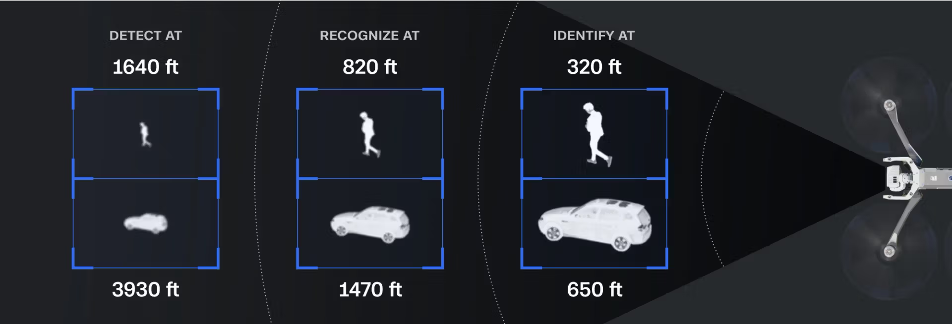
Exceptional thermal sensitivity
The Boson+ sensor offers 40% greater sensitivity compared to other thermal units available on the market.
Unrivaled image clarity
With a 640×512 thermal resolution, radiometry, and advanced AGC, it delivers the clearest thermal imagery.
Crisper, more detailed visuals
Onboard image enhancement algorithms refine distant objects and improve overall image quality, making interpretation easier.
Detect temperature differences even on a hot day
Detect a person on a roof in complete darkness
Fly with Ease
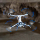
Confidently handle complex missions, even in challenging environments. With advanced AI flight assistance and obstacle avoidance, the Skydio X10D minimizes operator workload and requires significantly less training compared to traditional drones.
Automate Mission-Critical Tasks
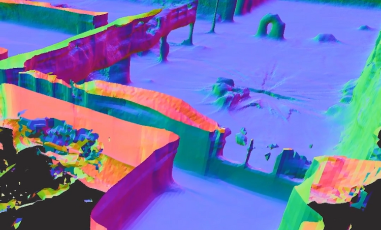
Powerful onboard computing enhances the speed and precision of essential tasks. Identify points of interest using Crosshair Coordinates, track individuals with Subject Tracking, and provide mobile surveillance with Scout. Effortlessly create 2D maps and 3D models in real-time without the need for additional systems.
Evolving Intelligence
Equipped with powerful computing, the Skydio X10’s AI capabilities continually improve. Its data capture and synthesis features evolve over time, ensuring smarter performance with every mission.
Master control with ease
Fly however you want
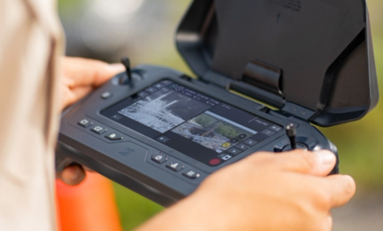
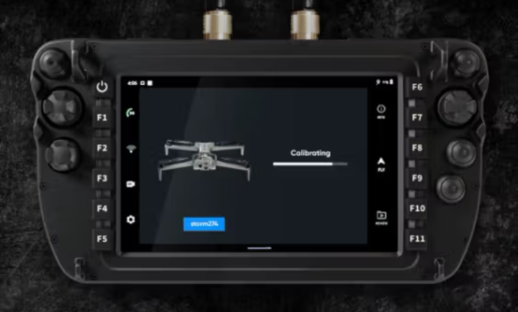
Fly with a Skydio Controller
Plan, execute, and review missions seamlessly with the Skydio X10D Controller and Flight Deck, a robust flight management application. With its intuitive interface, the controller offers precise control and real-time mission tracking, making it easier to focus on your objectives. The integrated Flight Deck provides detailed insights and enhances operational efficiency.
Fly with a Third-Party Controller
The Skydio X10D seamlessly integrates with a wide range of third-party controllers, offering greater customization for your flight setup. Whether you’re using a traditional controller or a specialized device, the X10D ensures a smooth and responsive flight experience with enhanced control options. This flexibility allows users to tailor their controls to meet specific mission requirements or personal preferences. Get the best AI drone in india now.

Fly in Diverse EM Environments with Skydio Connect
Equipped with a multiband radio, the X10D provides unmatched versatility by allowing users to select frequencies based on local regulations and operating needs. With support for multiple bands and dynamic channel switching, Skydio Connect ensures reliable performance even in challenging environments with interference or bandwidth limitations.
Seamless Integration for Enhancing collaboration between humans and technology.
Crosshair Coordinates
Shows real-time ground-level coordinates on video overlay using DTED maps.
Scout
Securely detect and identify potential threats to your convoy.
Onboard Modeling
Access 2D and 3D models instantly in real time.
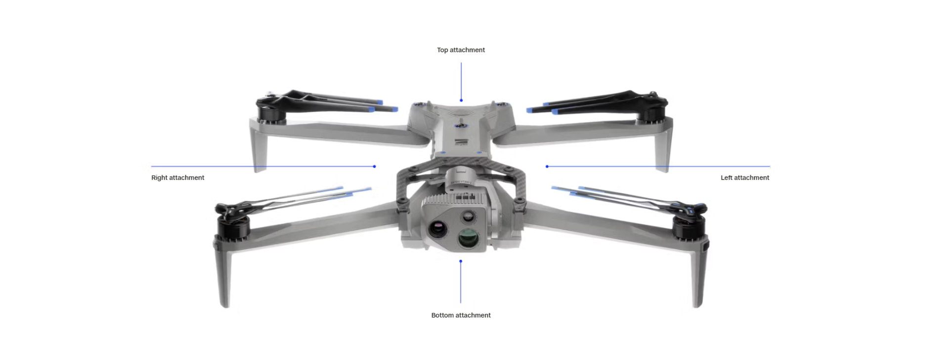
An open modular platform
FAQ's
1. What is the Skydio X10D designed for?
The Skydio X10D is a next-generation autonomous drone built for defense, tactical ISR, and government operations, offering superior AI, imaging, and security features.
2. Is the Skydio X10D NDAA-compliant?
Yes, the X10D is fully NDAA-compliant and approved for use in sensitive government and defense missions, with robust cybersecurity and data protections.
3. What camera systems does it include?
The X10D features a modular imaging system with multiple payload options, including:
-
50MP wide-angle camera
-
64MP narrow telephoto lens
-
640×512 FLIR Boson+ thermal sensor, ideal for night and heat-based detection.
4. What is the flight time per battery?
The Skydio X10D offers up to 40 minutes of flight time, depending on payload and flight conditions.
5. Can it operate in GPS-denied environments?
Yes, thanks to its onboard AI and visual navigation, the X10D can fly fully autonomously in GPS-denied or signal-blocked areas.


There are no reviews yet.