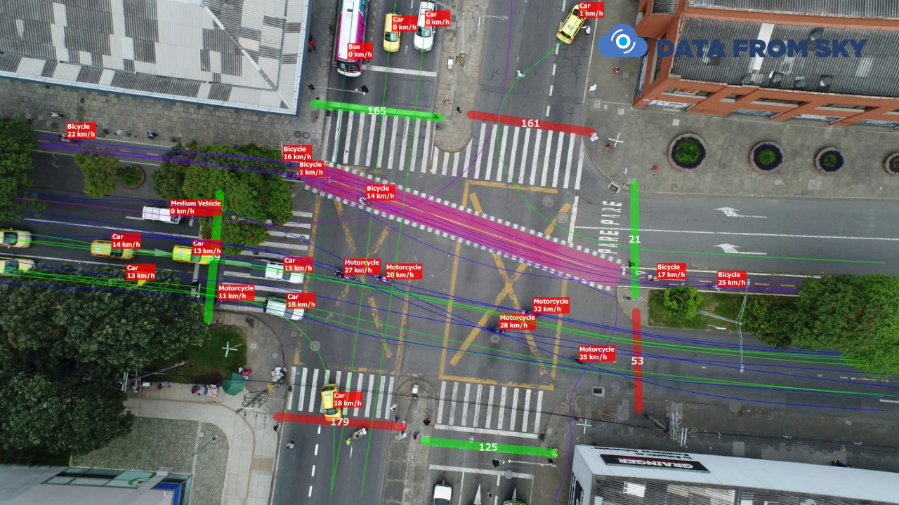
Efficient, Safe, and Smart Traffic Management with Drones
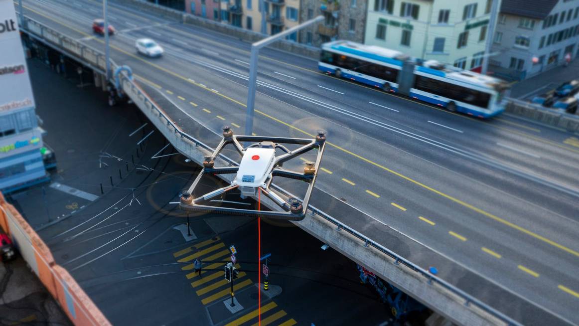
A promising approach to traffic control and surveillance is the monitoring and management of traffic using drones as a service. Drones can record real-time traffic data, identify traffic congestion, and improve traffic flow thanks to their sophisticated sensors, cameras, and machine learning algorithms.
Drones allow traffic controllers to effectively monitor and control traffic without upsetting other road users. To gather traffic data from various vantage points, such as crossroads, highways, and bridges, drones can be swiftly and simply deployed. They can operate in hazardous or difficult-to-reach regions and cover wider areas than conventional monitoring techniques.
Traffic managers can locate bottlenecks, foresee accidents, and design the best traffic flow patterns using data supplied by drones. The data can be analyzed using machine learning algorithms to produce insights that improve decision-making and traffic management.
Drone traffic monitoring and management is also economical and environmentally responsible. Drones use less labor, fuel, and maintenance than conventional techniques like helicopters and ground-based sensors. They are an environmentally responsible choice because they also emit less noise and air pollution.
Utilizing drones to monitor and manage traffic is a viable approach that could increase the effectiveness, safety, and sustainability of our roads. We may anticipate more sophisticated and creative solutions that will revolutionize traffic management as technology continues to improve.
Maximizing the Accuracy of Drone Survey Data with Xboom’s Advanced Techniques
- Equipment and Technology
- At Xboom, we use the latest equipment and software to ensure that the data we collect is of the highest quality.
- Our drones are equipped with high-resolution cameras and sensors that can capture detailed images and data.
- We use advanced post-processing software like Pix4D, DJI Terra and other to create highly accurate and precise 3D models and maps.
2. Pilot Expertise and Flight Planning
- Our team of pilots are highly trained and experienced in flying drones, and they use their expertise to ensure that the data collection is completed safely and efficiently.
- We use a flight plan that is optimized for data collection, which ensures that the data we collect is accurate and reliable.
3. Quality Control
- Additionally, we use Quality Control checks and procedures to verify the accuracy and precision of the data we collect.
- We use Ground Control Points (GCPs) and check points to ensure the accuracy of the data.
- Standards and Commitment
- At Xboom, we strive to meet and exceed industry standards in terms of accuracy and precision.
- Our Commitment to providing high-quality, accurate and precise data collection services is at the forefront of our business.