


Description
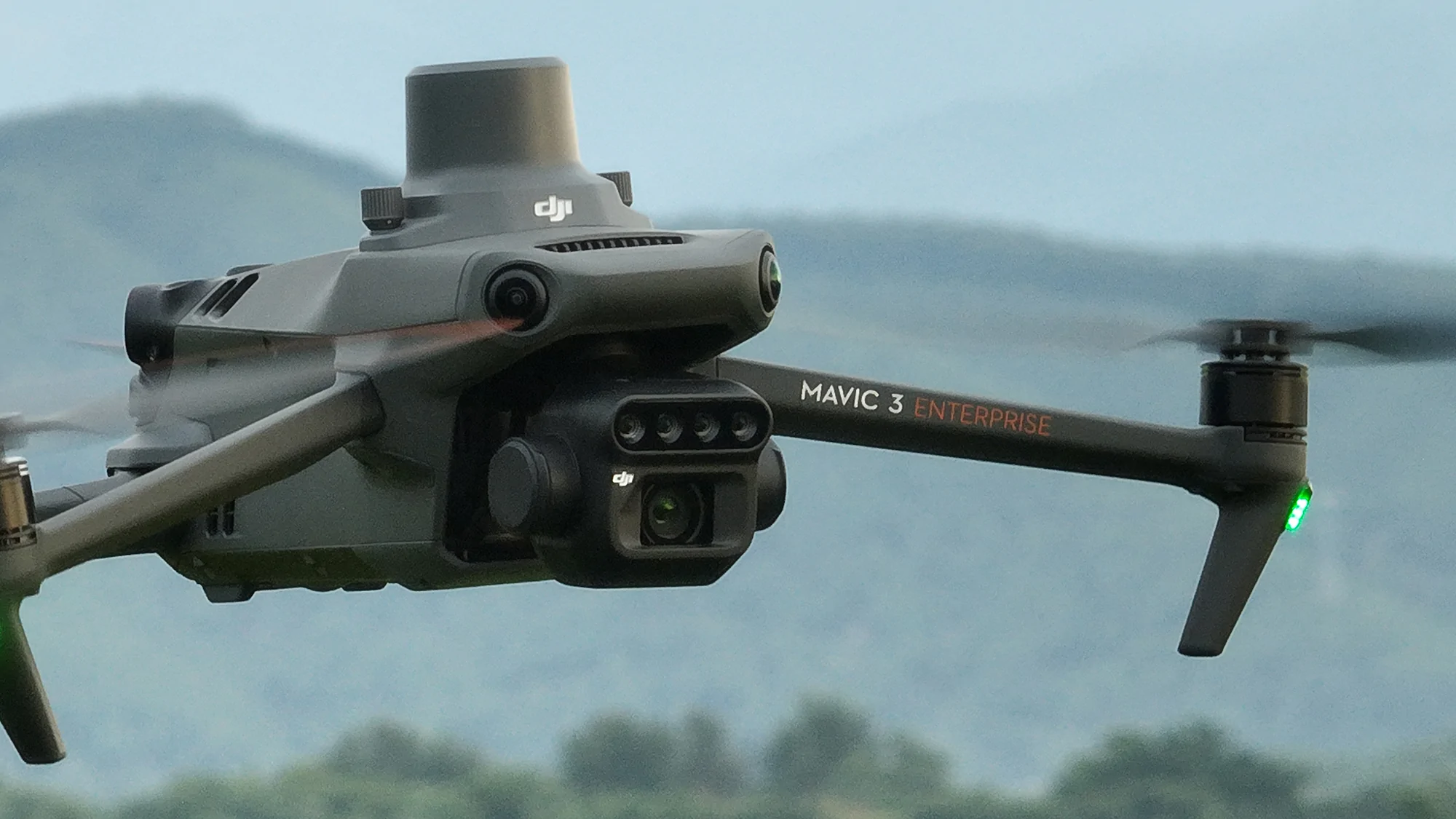
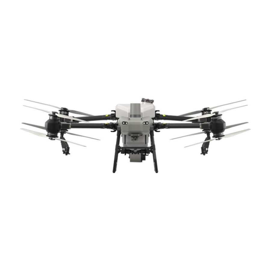
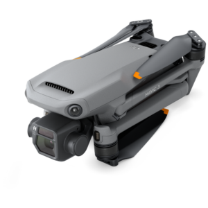
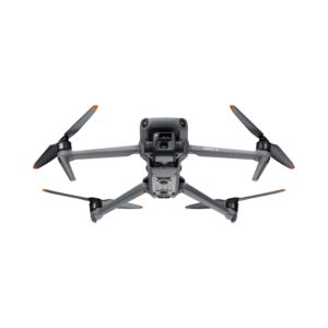
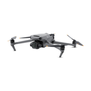
DJI Mavic 3 Multispectral
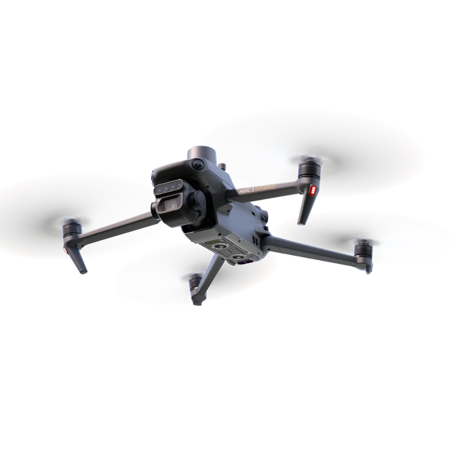
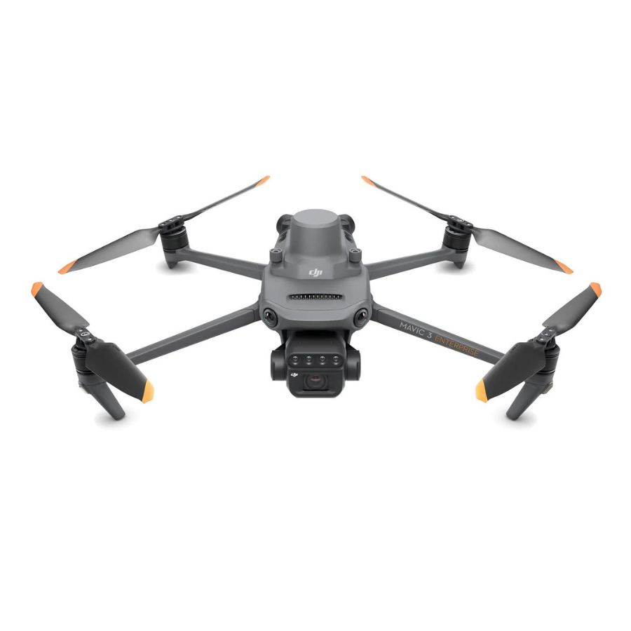
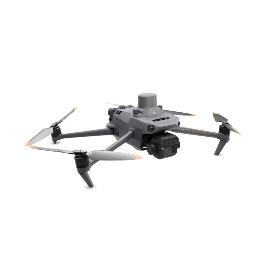
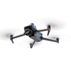
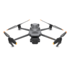
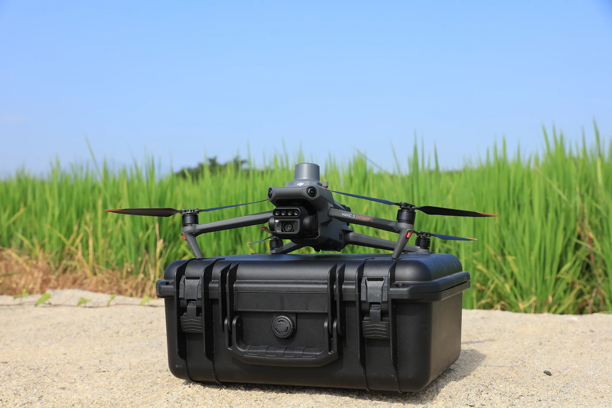
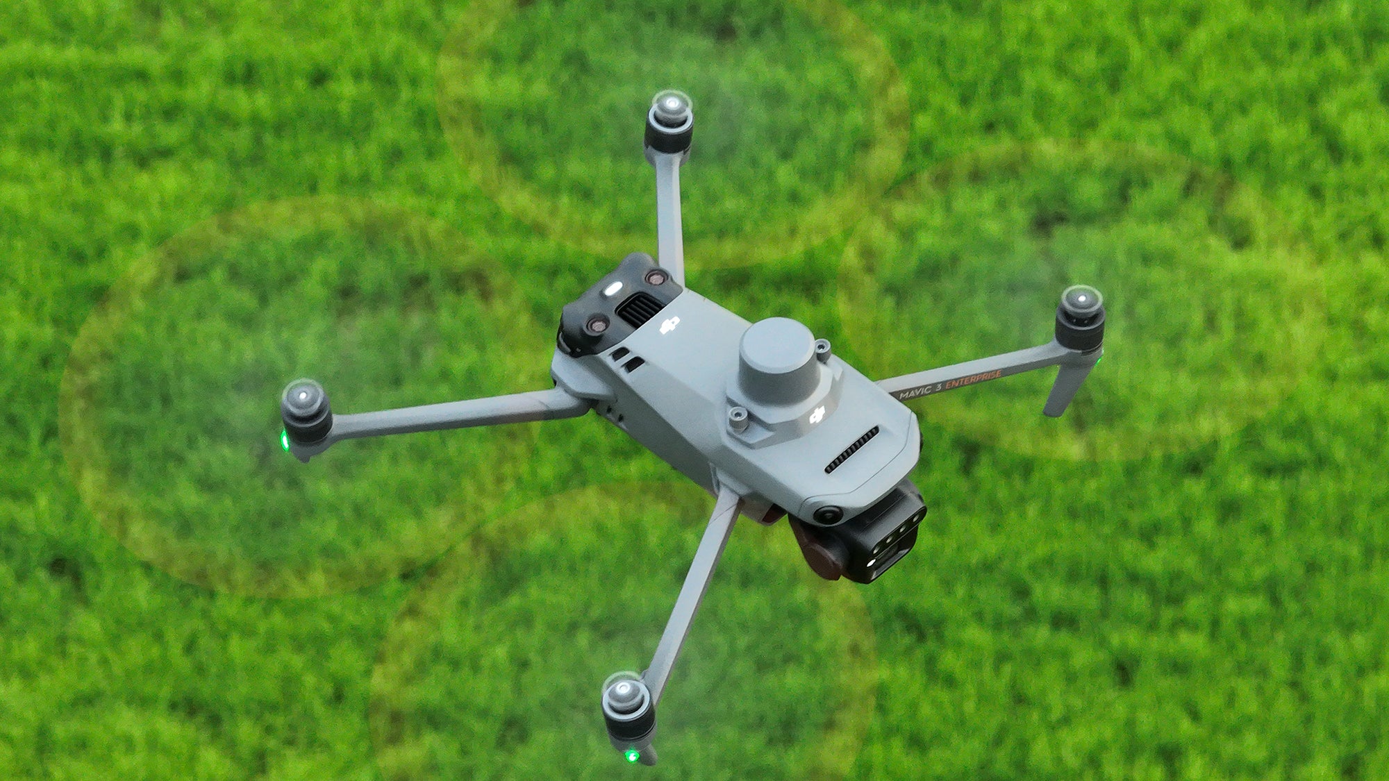
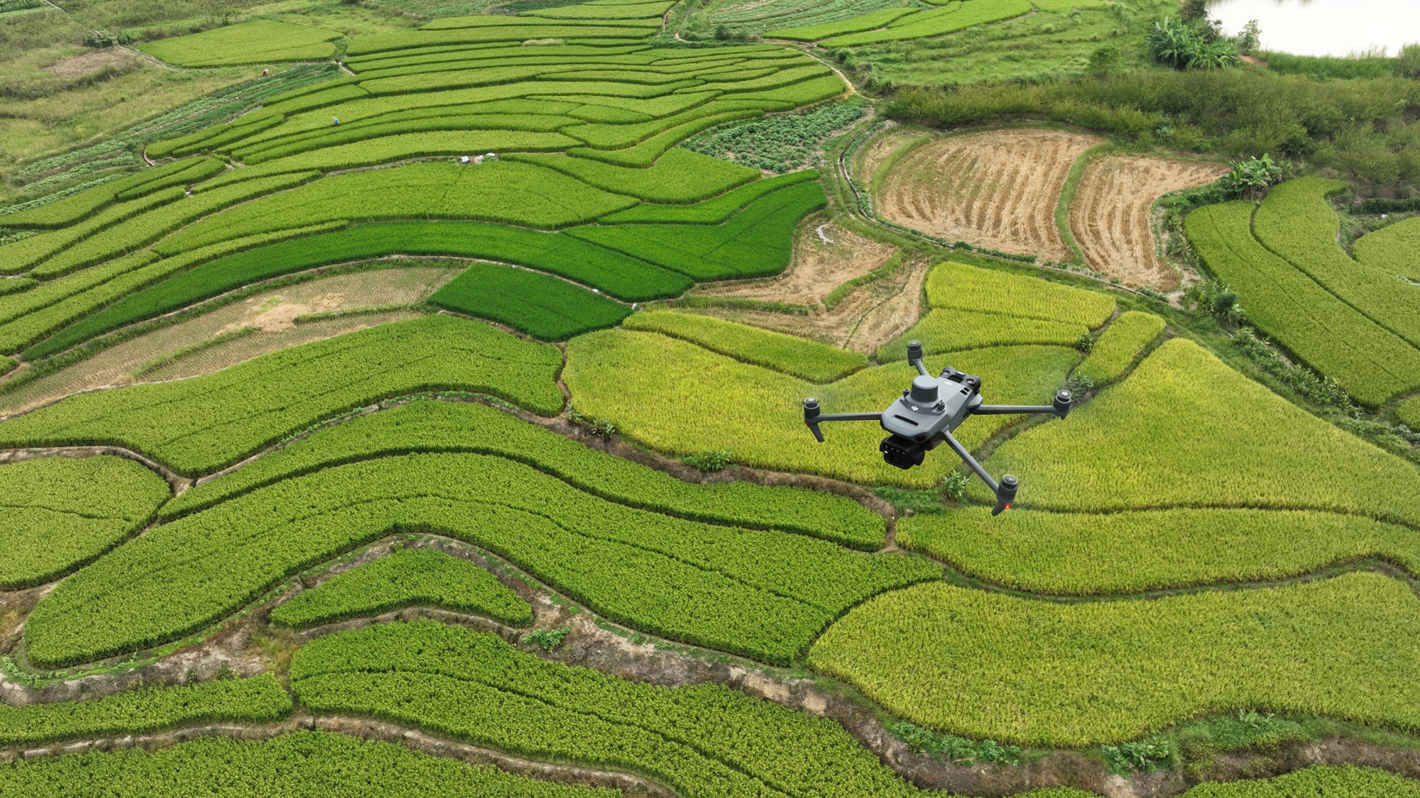
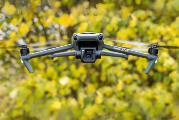
The DJI Mavic 3 Multispectral is designed for precision agriculture and environmental monitoring. It is equipped with a multispectral imaging system that quickly captures crop growth information to achieve more effective crop production. The Mavic 3M includes an RTK module that achieves centimeter-level positioning. The Mavic 3 Multispectral is a highly portable drone. It’s foldable design and 951-gram weight mean it can be carried in a bag to enable farmers to carry out operations at any time. It has 43 minutes of flight time and can complete the surveying and mapping operations of an area as vast as 2 square kilometers in a single flight.
| Feature | Description |
|---|---|
| Multispectral Imaging Technology | The DJI Mavic 3 Multispectral captures data across multiple spectral bands, essential for assessing crop health, monitoring growth, and optimizing agricultural practices by analyzing vegetation indices like NDVI and NDRE. |
| Precision Agriculture Flight Modes | Specialized flight modes automate data collection over farmland, ensuring comprehensive coverage and consistent data gathering for effective crop monitoring. |
| Integrated Data Analysis Tools | Powerful tools process multispectral images to provide insights into crop health, soil condition, and water needs, aiding informed decisions to improve yield and reduce resource waste. |
| Real-Time Data Transmission | Allows immediate insights into crop conditions, facilitating quick decision-making and intervention to enhance crop management strategies. |
| Extended Flight Time | Ensures large areas of farmland can be surveyed in a single flight, key for regular and thorough monitoring. |
| GPS Precision Farming | Integrates GPS technology for accurate mapping, field boundary detection, and targeted treatment areas, reducing overlap and saving resources. |
| Enhanced Connectivity for Remote Operations | Features 4G and Wi-Fi for remote operations and management, allowing operation from a distance for versatile agricultural tasks. |
| Weather-Resistant Design | Built to withstand various environmental conditions, ensuring reliable operation in diverse climates typical of agriculture. |
| Portable and Easy to Deploy | Compact and foldable design for easy transport and deployment across multiple fields, essential for monitoring various locations. |
| Global Shutter Mechanism for High-Quality Imaging | Captures sharp, distortion-free multispectral images for accurate analysis, ensuring reliable data reflective of actual crop conditions. |
| Obstacle Avoidance System | Advanced system prevents collisions with obstacles, enhancing safety during flights for both the drone and crops. |
| Automated Data Processing Workflow | Streamlines the analysis of multispectral data, facilitating quick turnaround from data collection to actionable insights. |
| Seamless Integration with Farm Management Software | Integrates with leading farm management software for seamless data transfer and analysis, enhancing decision-making and overall efficiency. |
| Free DJI Pilot 2 | A professional flight control app designed for enterprise drones, offering mission planning, real-time data collection, and integration with other DJI software platforms. Basic features are free, while advanced functionalities may require additional licenses. |
The DJI Mavic 3 Multispectral drone is a game-changer for precision agriculture, offering advanced features tailored to the needs of modern farming. From its multispectral imaging capabilities to its durability and ease of use, it provides comprehensive solutions for monitoring, analysis, and management of crops, leading to optimized agricultural practices and improved crop yields.
Multispectral Cameras
The DJI Mavic 3 Multispectral is designed for precision agriculture and environmental monitoring.
It is equipped with a multispectral imaging system that quickly captures crop growth information to achieve more effective crop production.
The Mavic 3M includes an RTK module that achieves centimeter-level positioning.
The Mavic 3 Multispectral is a highly portable drone. It’s foldable design and 951-gram weight mean it can be carried in a bag to enable farmers to carry out operations at any time.
It has 43 minutes of flight time and can complete the surveying and mapping operations of an area as vast as 2 square kilometers in a single flight.
RTK Module Included
Equipped with an RTK module, the Mavic 3M offers agricultural experts the ability to perform precise aerial surveys efficiently and carefully. This advanced capability eliminates the necessity for Ground Control Points, streamlining the data collection process. This makes the Mavic 3M an indispensable tool for those in agriculture seeking to enhance their surveying practices with accuracy, speed, and without the traditional reliance on ground-based markers.
The RTK module offers precision down to the centimeter, seamlessly integrating with flight control and the camera. This synchronization happens in microseconds, ensuring the exact location of the imaging center for each photo is recorded with pinpoint accuracy. This advanced feature is essential for applications requiring highly precise data, enhancing the drone’s capabilities in mapping, surveying, and other tasks where accuracy is paramount.
Enhanced Safety Features
Advanced Pilot Assistance System (APAS 5.0): state-of-the-art obstacle sensing and navigation. Data from six vision and two wide-angle sensors is assessed in real-time to detect obstacles in every direction and, when using Avoid mode – reroute your flight path accordingly.
Advanced Return to Home:
This intelligent function automatically adjusts your flight route to conserve battery power, ensuring your drone returns home securely with just a simple press. It’s designed to enhance safety and reliability by optimizing battery usage during flight.
AirSense: The integrated AirSense system delivers preemptive alerts about approaching manned aircraft emitting ADS-B signals. This feature enhances safety by notifying drone operators of potential airspace conflicts, allowing for timely adjustments to avoid close encounters.
Smart Terrain Follow
The Mavic 3M offers Terrain Follow, helping you maintain an even altitude as you fly a survey mission across varying terrain.
By seamlessly adapting to changes in terrain during flight, the system ensures the accuracy and integrity of collected data, eliminating the need for adjustments during post-processing. This approach not only streamlines the data acquisition process but also enhances the quality of the information gathered, providing reliable and precise outcomes without the necessity for later corrections. Such efficiency is crucial for professionals who rely on accurate data for analysis and decision-making.
In scenarios where importing a Digital Surface Model (DSM) or local elevation data before flight isn’t possible, the Mavic 3M’s advanced collision avoidance sensors step in. These sensors actively scan the terrain beneath the drone, automatically modifying its flying altitude to adapt to the ground’s undulations. This ensures a safer flight by preventing potential collisions with the earth, highlighting the drone’s ability to navigate complex environments without pre-loaded elevation information.
Intelligent Field Scouting
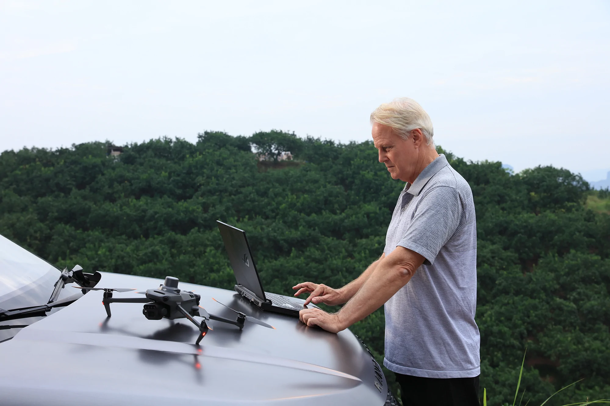
The Mavic 3M can carry out automatic field scouting. The field scout images can be uploaded to the DJI Smart Farm Platform in real time through a 4G network.
It can find abnormalities, such as emergence deficiencies, weed pressure, and crop lodging, in a timely manner.
Equipped with AI identification capabilities, the system excels in intelligent analyses like cotton seedling detection and rice yield assessments. This allows for the real-time exchange of vital crop growth data, provides actionable insights for farming operations, and streamlines the management process, enabling a single individual to efficiently oversee up to 70 hectares of agricultural land. Through advanced AI applications, it revolutionizes agricultural practices by enhancing productivity and simplifying large-scale farm management.
Mavic 3E Customisation
Build a solution tailored to your needs with Cloud API and MSDK.
Cloud API
The Mavic 3M can be directly connected to a third-party cloud platform via Pilot 2’s built-in DJI Cloud API based on the MQTT protocol. There is no need to develop an app separately to enable the transmission of UAV equipment information, live streaming, photo data, and other information.
MSDK
The Mavic 3M supports Mobile SDK 5 (MSDK5) with a fully open-source production code sample. The MSDK5 makes it possible to develop a proprietary control app for UAV field patrol, smart surveying, and other scenarios, making it more user-friendly.
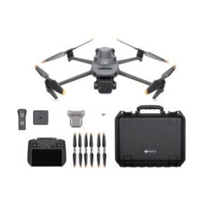
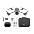
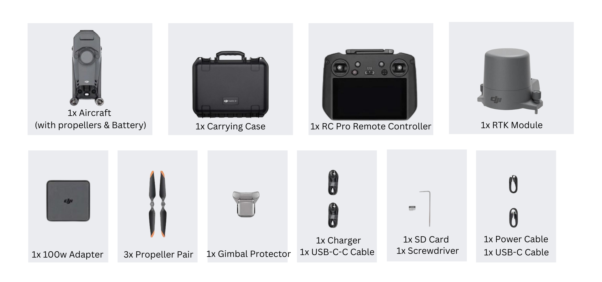
In The Box
Full Software Suite
The Mavic 3 Multispectral is fully compatible with the DJI SmartFarm app, allowing agriculture professionals to coordinate any data gathered with spraying and spreading operations. SmartFarm comes with a range of features for streamlined workflows, including intuitive mission planning, a full fleet overview, field management, data assessment, and effortless collaboration between teams. Data captured by Mavic 3M is also fully compatible with DJI Terra, so you can easily and efficiently create maps and models of your targets. The Mavic 3M comes with a three-month DJI Terra Full licence (one device) and one-year access to the DJI SmartFarm Platform.
Specifications of DJI Mavic 3 Multispectral
In The Box
- 1x DJI Mavic 3 Multispectral Aircraft (with propellers)
- 1x RTK Module
- 1x Micro SD Card
- 1x DJI Mavic 3 Enterprise Battery
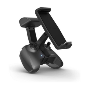
- 1x RC Pro Enterprise Remote Controller
- 3x Spare Propeller Pair
- 1x Charger
- 1x Carrying Case
- 1x USB-C to USB-C Cable
- 1x Power Cable
- 1x USB-C Cable
- 1x Screwdriver
- 1x Manuals
- 1x DJI Care Enterprise Basic, 1-Year
Aircraft
Net Weight (with propellers and RTK module) [1]
Max Takeoff Weight
Dimensions (Folded/Unfolded)
Unfolded (without propellers): 347.5×283×139.6 mm (Length×Width×Height)
Diagonal Length
Max Ascent Speed
8 m/s (Sport Mode)
Max Descent Speed
6 m/s (Sport Mode)
Max Flight Speed (at sea level, no wind)
Flying forward: 21 m/s, flying sideways: 20 m/s, flying backwards: 19 m/s (Sport mode) [2]
Max Wind Speed Resistance
Max Take-off Altitude Above Sea Level
Max Flight Time (without wind)
Max Hover Time (without wind)
Max Flight Distance
Max Tilt Angle
35° (Sport Mode)
Max Angular Velocity
GNSS
Hovering Accuracy Range
Horizontal: ±0.3 m (Vision Positioning enabled); ±0.5 m (HD Positioning enabled); ±0.1 m (RTK enabled)
Operating Temperature
Internal Storage
Motor Model Number
Propeller Model Number
Light Sensor
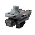
RGB Camera
Image Sensor
Effective Pixels: 20 MP
Lens
Equivalent focal length: 24 mm
Aperture: f/2.8 to f/11
Focus: 1 m to ∞
ISO Range
Shutter speed
Mechanical shutter: 8-1/2000 s
Max Image Size
Photo Shooting Mode
Timelapse: 20 MP
JPEG: 0.7/1/2/3/5/7/10/15/20/30/60 s
JPEG + RAW: 3/5/7/10/15/20/30/60 s
Panorama: 20 MP (original material)
Video Resolution
4K: 3840×2160@30fps
FHD: 1920×1080@30fps
Max Video Bitrate
FHD: 70Mbps
Supported File System
Image Format
Video Format
Multispectral Camera
Image Sensor
Lens
Equivalent focal length: 25 mm
Aperture: f/2.0
Focus: Fixed Focus
Multispectral Camera Band
Red (R): 650 ± 16 nm;
Red Edge (RE): 730 ± 16 nm;
Near infrared (NIR): 860 ± 26 nm;
Gain Range
Shutter Speed
Max Image Size
Image Format
Video Format
Photo Shooting Mode
Timelapse: 5 MP
TIFF: 2/3/5/7/10/15/20/30/60 s
Video Resolution
FHD: 1920 x 1080@30fps
Video content: NDVI/GNDVI/NDRE
Max Video Bitrate
Gimbal
Stabilization System
Mechanical Range
Roll: -45° to 45°
Pan: -27° to 27°
Controllable Range
Pan: Uncontrollable
Max Control Speed (tilt)
Angular Vibration Range
Sensing System
Sensing System Type
Forward
Detection Range: 0.5 m to 200 m
Effective Obstacle Avoidance Speed: Flight Speed ≤15 m/s
FOV: Horizontal 90°, vertical 103°
Backward
Effective Obstacle Avoidance Speed: Flight speed ≤12 m/s
FOV: Horizontal 90°, vertical 103°
Lateral
Effective Obstacle Avoidance Speed: Flight speed ≤15 m/s
FOV: Horizontal 90°, vertical 85°
Upward
Effective Obstacle Avoidance Speed: Flight Speed ≤6 m/s
FOV: Front and rear 100°, left and right 90°
Downward
Effective Obstacle Avoidance Speed: Flight speed ≤6 m/s
FOV: Front and rear 130°, left and right 160°
Operating Environment
Below: Surfaces with diffuse reflection material and a reflectivity of >20% (such as walls, trees, people, etc.); Adequate lighting (>15 lux, environments with normal indoor fluorescent light exposure)
Video Transmission
Video Transmission System
Live View Quality
Operating Band [7]
5.725-5.850 GHz
Max Effective Signal Distance (Unobstructed, No interference) [8]
CE: 8 km
SRRC: 8 km
MIC: 8 km
Max Transmission Distance (Obstructed) [9]
Medium Interference (suburban landscapes, city parks, etc.): 3-9 km (FCC), 3-6 km (CE/SRRC/MIC)
Weak Interference (remote fields, open farmland, etc.): 9-15 km (FCC), 6-8 km (CE/SRRC/MIC)
Max Download Speed
Latency (depending on environment and mobile device)
Antennas
Transmitter Power (EIRP)
5.8 GHz: <33 dBm (FCC), <30 dBm (SRRC), <14 dBm (CE)
Other
DJI RC Pro Enterprise Edition
Image Transmission System
Max Effective Signal Distance (Unobstructed, No interference) [8]
CE: 8 km
SRRC: 8 km
MIC: 8 km
Operating Band of Image Transmission [7]
5.725-5.850 GHz
Antennas
Operating Band of Image Transmission and Transmitter Power (EIRP)
5.8 GHz: <33 dBm (FCC); <14 dBm (CE); <23 dBm (SRRC)
Wi-Fi Protocol
Support 2×2 MIMO Wi-Fi
Wi-Fi Operating Band [7]
5.150-5.250 GHz
5.725-5.850 GHz
Wi-Fi Operating Band and Transmitter Power (EIRP)
5.1 GHz: <26 dBm (FCC); <23 dBm (CE/SRRC/MIC)
5.8 GHz: <26 dBm (FCC/SRRC); <14 dBm (CE)
Bluetooth Protocol
Bluetooth Operating Band
Bluetooth Transmitter Power (EIRP)
Screen Resolution
Screen Size
Screen Frame Rate
Screen Brightness
Touch-Screen
Battery
Charging Type
Rated Power
Storage Capacity
Supports microSD card usage to increase storage capacity
Charging Time
Approximately 2 hours (measured using a 12V USB charger)
Approximately 2 hours and 50 minutes (measured using the 100W Battery Charging Hub to charge the aircraft and remote control at the same time)
Operating Time
Video Output Port
Operating Temperature
Storage Temperature Range
One to three months: -30° to 45° C (-22° to 113° F)
Three to six months: -30° to 35° C (-22° to 95° F)
More than six months: -30° to 25° C (-22° to 77° F)
Charging Temperature
Supported DJI Aircraft [10]
DJI Mavic 3T
DJI Mavic 3M
GNSS
Dimensions
183.27×137.41×47.6 mm (Length×Width×Height)
Antenna unfolded and control sticks are installed:
183.27×203.35×59.84 mm (Length×Width×Height)
Weight
Model Number
Storage
Supported microSD Cards
Please use a memory card with a speed rating of V30 or higher, or use a memory card from the recommended list
Recommended microSD Cards
SanDisk Extreme PRO 64GB V30 A2 microSDXC
SanDisk High Endurance 64GB V30 microSDXC
SanDisk Extreme 128GB V30 A2 microSDXC
SanDisk Extreme 256GB V30 A2 microSDXC
SanDisk Extreme 512GB V30 A2 microSDXC
Lexar 667x 64GB V30 A2 microSDXC
Lexar High-Endurance 64GB V30 microSDXC
Lexar High-Endurance 128GB V30 microSDXC
Lexar 667x 256GB V30 A2 microSDXC
Lexar 512GB V30 A2 microSDXC
Samsung EVO Plus 64GB V30 microSDXC
Samsung EVO Plus 128GB V30 microSDXC
Samsung EVO Plus 256GB V30 microSDXC
Samsung EVO Plus 512GB V30 microSDXC
Kingston Canvas Go! Plus 128GB V30 A2 microSDXC
Kingston Canvas React Plus 128GB V90 A1 microSDXC
Aircraft:
SanDisk Extreme 32GB V30 A1 microSDHC
SanDisk Extreme PRO 32GB V30 A1 microSDHC
SanDisk Extreme 512GB V30 A2 microSDXC
Lexar 1066x 64GB V30 A2 microSDXC
Kingston Canvas Go! Plus 64GB V30 A2 microSDXC
Kingston Canvas React Plus 64GB V90 A1 microSDXC
Kingston Canvas Go! Plus 128GB V30 A2 microSDXC
Kingston Canvas React Plus 128GB V90 A1 microSDXC
Kingston Canvas React Plus 256GB V90 A2 microSDXC
Samsung PRO Plus 256GB V30 A2 microSDXC
Battery
Capacity
Standard Voltage
Max Charging Voltage
Battery Type
Chemical System
Energy
Weight
Charging Temperature
Battery Charger
Input
Output Power
Output
When both the ports are used, the maximum output power of one interface is 82 W, and the charger will dynamically allocate the output power of the two interfaces according to load power.
Charging Hub
Input
Output
Rated Power
Charging Type
Charging Temperature
RTK Module
Dimensions
Weight
Interface
Power
RTK Position Accuracy
Horizontal: 1 cm + 1 ppm; Vertical: 1.5 cm + 1 ppm
FAQs for DJI Mavic 3 Multispectral for Precision Agriculture Drone Camera
1. What is the DJI Mavic 3 Multispectral Drone Camera?
The DJI Mavic 3 Multispectral is a high-precision agricultural drone equipped with a multispectral imaging system. It’s designed to capture detailed data across different light spectra, aiding in crop monitoring, health assessment, and land management by providing valuable insights into crop health and vegetation management.
2. How can the DJI Mavic 3 Multispectral help in precision agriculture?
This drone camera helps in precision agriculture by providing data for crop monitoring, identifying stressed areas, optimizing pesticide use, improving crop yields, and managing resources more efficiently. It captures images in various spectral bands, enabling the analysis of vegetation health, moisture levels, and nutrient presence.
3. What spectral bands does the Mavic 3 Multispectral capture?
Typically, multispectral drones like the Mavic 3 capture images in the visible and near-infrared spectra, including bands such as blue, green, red, red-edge, and near-infrared (NIR). These bands are crucial for assessing plant health and vigor through vegetation indices like NDVI and SAVI.
4. Can the Mavic 3 Multispectral detect water stress in crops?
Yes, by capturing images in specific spectral bands, the Mavic 3 Multispectral can help detect water stress in crops. The near-infrared (NIR) and red-edge bands are particularly useful for identifying areas of moisture stress before they become visible to the naked eye.
5. How accurate is the data captured by the Mavic 3 Multispectral?
The accuracy of data captured by the Mavic 3 Multispectral is very high, thanks to its precise imaging capabilities and advanced sensors. The drone is equipped with calibration tools to ensure that the data is reliable for making informed decisions in precision agriculture.
6. Is it easy to operate the DJI Mavic 3 Multispectral?
Yes, the DJI Mavic 3 Multispectral is designed with user-friendliness in mind. It features automated flight planning, easy-to-use controls, and intuitive software for data analysis, making it accessible even to those new to drone technology.
7. How long can the Mavic 3 Multispectral fly on a single charge?
The flight time of the Mavic 3 Multispectral varies based on conditions but generally ranges around 30 minutes on a single charge. This allows users to cover substantial areas in a single flight, making it efficient for agricultural monitoring.
8. Can the Mavic 3 Multispectral be used in all types of weather conditions?
While the Mavic 3 Multispectral is designed to be robust, its operation in adverse weather conditions such as heavy rain, strong winds, or extreme temperatures may be limited. It’s best to consult the user manual for specific operating conditions.
9. What software is compatible with the Mavic 3 Multispectral for data analysis?
Data captured by the Mavic 3 Multispectral can be analyzed with DJI’s own software solutions as well as other popular agricultural data management platforms. These tools help translate the multispectral images into actionable insights for crop management.
10. Where can I purchase the DJI Mavic 3 Multispectral, and what does it cost?
The DJI Mavic 3 Multispectral can be purchased directly from DJI, authorized dealers, and various online platforms specializing in drone technology. Pricing varies based on the package, accessories, and any ongoing promotions, so it’s advisable to check the official DJI website or authorized dealers for the most current pricing information.
Read More
In the evolving landscape of modern agriculture, the DJI Mavic 3 Multispectral emerges as a pivotal tool for farmers, agronomists, and environmental scientists aiming to enhance crop management, increase yields, and conserve resources. Available on xboom.in, this cutting-edge drone camera is engineered to provide detailed insights into crop health, soil conditions, and more, enabling precision agriculture practices that were once out of reach for the average farm operation.
Introducing the DJI Mavic 3 Multispectral
The DJI Mavic 3 Multispectral is not just a drone; it’s a comprehensive solution for precision agriculture. By combining the portability and ease of use DJI is known for with advanced multispectral imaging technology, the Mavic 3 Multispectral offers unparalleled insights into the health and vitality of crops. This drone is designed to make precision agriculture accessible and actionable, providing data-driven insights that lead to informed decision-making.
Why Choose the Mavic 3 Multispectral for Precision Agriculture?
Opting for the Mavic 3 Multispectral means embracing a future where agriculture is guided by precision and efficiency. This drone camera captures both RGB and multispectral images, including bands specifically tailored for agricultural applications, such as NDVI (Normalized Difference Vegetation Index) and NDRE (Normalized Difference Red Edge). These capabilities allow for the early detection of plant stress, optimization of water usage, and targeted application of fertilizers and pesticides, ensuring sustainable and profitable farming practices.
Unmatched Aerial Insights
The Mavic 3 Multispectral stands out for its ability to provide detailed aerial insights that are critical for precision agriculture. With its high-resolution multispectral sensor, the drone captures data across different wavelengths of light, offering a comprehensive view of crop health that goes beyond what the human eye can see. This information is crucial for identifying issues early on, allowing for timely interventions that can significantly impact crop yields and farm profitability.
Streamlining Farm Management
The DJI Mavic 3 Multispectral streamlines farm management by simplifying data collection and analysis. Equipped with DJI’s advanced flight planning software, the drone automates the data acquisition process, covering large areas quickly and efficiently. The collected data can then be easily integrated into farm management systems, providing actionable insights that help optimize crop production cycles, reduce waste, and maximize efficiency.
Enhancing Sustainable Farming Practices
Sustainability is at the heart of precision agriculture, and the Mavic 3 Multispectral plays a key role in promoting environmentally friendly farming practices. By enabling precise monitoring and management of crops, the drone helps minimize the overuse of water, fertilizers, and pesticides, reducing the environmental footprint of farming operations. This not only benefits the planet but also supports the long-term viability of farms.
Why xboom.in is Your Trusted Partner
Choosing xboom.in for your Mavic 3 Multispectral purchase ensures not only a competitive price but also the peace of mind that comes with buying from a trusted source. xboom.in is committed to providing top-quality DJI products, expert advice, and unparalleled customer service, making it the ideal destination for professionals seeking to integrate advanced drone technology into their precision agriculture practices.
Investing in the Future of Farming
Investing in the Mavic 3 Multispectral is an investment in the future of farming. As the agricultural industry continues to evolve, the demand for precise, data-driven farming practices will only grow. The Mavic 3 Multispectral positions farms at the forefront of this technological revolution, offering a competitive edge in an increasingly challenging market.
Conclusion: A New Era of Precision Agriculture with Mavic 3 Multispectral
The DJI Mavic 3 Multispectral, available on xboom.in, represents a significant advancement in the field of precision agriculture. With its advanced multispectral imaging capabilities, ease of use, and integration with farm management systems, this drone camera is a game-changer for farmers, agronomists, and environmental scientists. Whether you’re looking to optimize crop health, conserve resources, or enhance sustainability, the Mavic 3 Multispectral provides the tools you need to achieve your goals and revolutionize your farming practices.
Embrace the future of precision agriculture with the DJI Mavic 3 Multispectral. Visit xboom.in today and discover how this innovative drone camera can transform your approach to farming and help you grow smarter, not harder.
Popular tags
DJI agriculture drone, agriculture drone uses, agriculture drone benefits, agriculture drone price in India


Amit Pal –
It has become an indispensable partner in my precision farming journey. The initial investment in the Mavic 3 Multispectral is undoubtedly significant, but the returns in terms of increased efficiency, reduced resource usage, and enhanced crop yields make it a wise and essential investment for any farmer committed to navigating the complexities of modern agriculture.
WORTH IT….!!!
Ashish Mehta –
The Mavic 3’s multispectral camera, above all, offers previously unheard-of insights into the health and vitality of my crops. I can identify areas of stress or disease, detect small differences in vegetation health, and conduct targeted interventions to boost crop production thanks to the drone’s ability to record numerous bands of light beyond what the human eye can see.
Raghav Jain –
I am amazed with this. I recently got to know about this and I ordered on the same day. Once i got this, I found this very helpful. The drone has also proven invaluable in crop scouting. The drone’s ability to cover large areas efficiently means that I can quickly identify potential issues such as disease outbreaks, pest infestations, or uneven crop growth. This early detection allows for timely and targeted interventions, minimizing the impact on overall crop health.
Deepak Pratap –
My Honest opinion on this product:
I am having recently integrated this drone into my precision agriculture toolkit, I can confidently say that it has revolutionized the way I approach crop management. This compact drone, purpose-built for agricultural applications, offers an impressive suite of features that truly set it apart. I AM HAPPY WITH THE PURCHASE.
Aayush Bhaskar –
I am so Happy with this.!!!!!!!!
The level of detail it provides goes beyond the capabilities of traditional cameras, allowing me to identify subtle changes in plant health, detect early signs of stress, and make informed decisions to improve overall crop yields.
Thankssssssss……
Mavesh –
My attitude to farming and land management has entirely changed as a result of the DJI Mavic 3 Multispectral for Precision Agriculture Drone Camera. In order to maximize crop yields and make better judgments regarding my fields, I’m a farmer, and the Mavic 3 Multispectral has proven to be a very useful instrument in accomplishing those objectives.
Raja Kumar –
JUST WONDERFUL…..
THE best part about this drone according to me is its real-time data feedback allows for on-the-spot decision-making. As I fly the drone over my fields, the multispectral data is processed in real-time, providing instant insights into crop conditions. This immediate feedback loop is a game-changer for making timely adjustments to farming practices, ultimately maximizing crop yield and minimizing losses.
Deepanshu Verma –
Operating the Mavic 3 Multispectral is a pleasure for me when it comes to flying performance. Even in difficult weather, it is easy to control, responsive, and stable. AirSense technology and obstacle avoidance sensors give me additional safety and peace of mind, letting me concentrate on data collection rather than airspace awareness or collisions.