
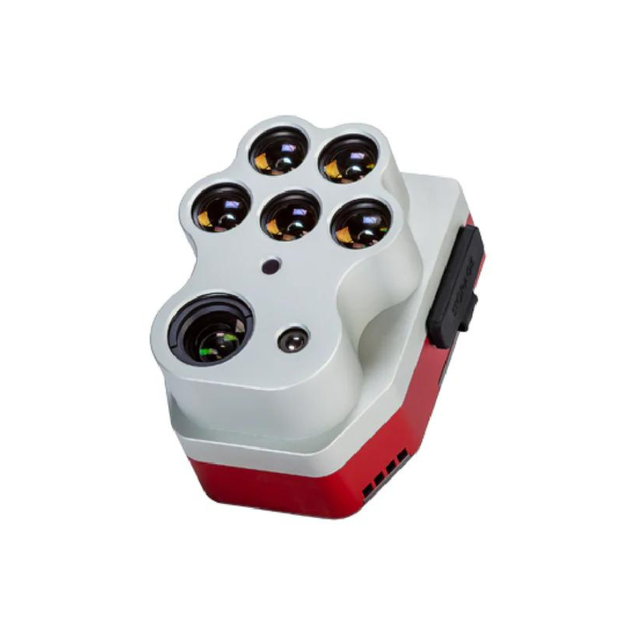
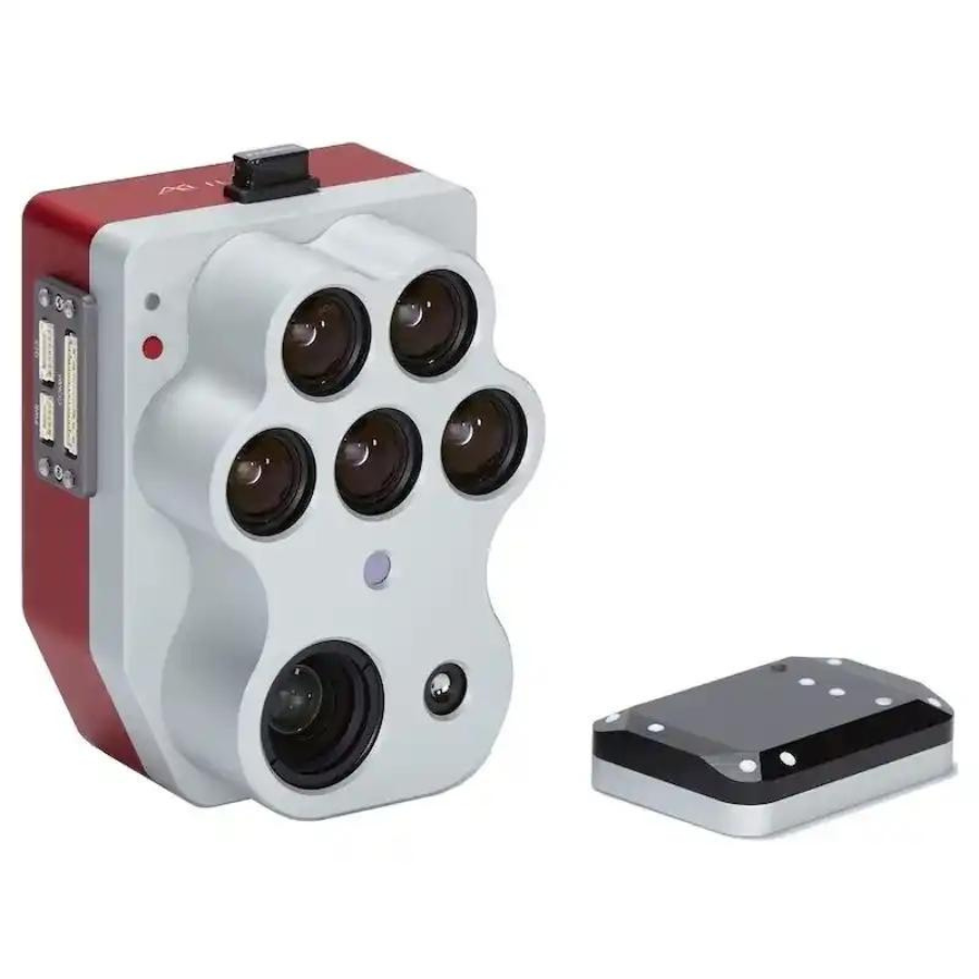
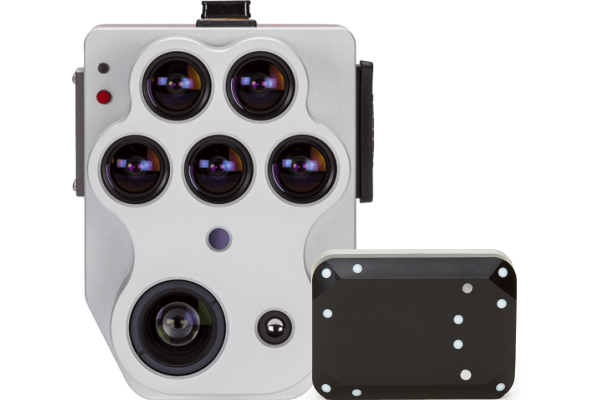
Micasense Altum-PT Multispectral Sensor
- 12 MP & Thermal Sensors: Advanced sensors for high-resolution imagery, ideal for machine learning in agriculture.
- Synchronized Capture: Streamlines data with multispectral, thermal, and RGB outputs, eliminating post-process alignment.
- Accurate Data: Ground-level calibration and light sensing for precise, adaptable agricultural analysis.
- AI Insights: Enhances crop counting and vegetation research with high-resolution imagery.
- Agricultural Optimization: Aids in irrigation, disease detection, and yield estimation through thermal and multispectral imaging.
- Light & Compatible: Easy UAV integration at 577g, with open APIs for broad software support.
- 3 months · ₹668,927
- 6 months · ₹334,464
- 9 months · ₹222,976
Select Snapmint at checkout · Available on orders above ₹3,000 · Subject to eligibility
- Trusted dealerDirect manufacturer partnership
- Pan-India deliveryInsured shipping, all states
- Post-sale supportTraining + service included
What makes it work
Altum-PT Multispectral Sensor – For Drones
The MicaSense Altum-PT Multispectral Sensor marks a major advancement in precision agriculture technology. Moreover, it delivers exceptional data quality for professional use. Specifically, this advanced sensor combines high-resolution multispectral imaging across six spectral bands with integrated thermal imaging. As a result, it captures plant health imagery and temperature data at the same time. Consequently, users can assess crop health, water stress, and disease with greater accuracy. Furthermore, the radiometric thermal camera maps temperature variations across entire fields. This added capability enhances analytical precision and decision-making. Additionally, the sensor seamlessly integrates with many commercial drones. Because of this, agronomists, researchers, and farmers can deploy it with minimal effort. Therefore, they can optimize crop management strategies efficiently. In turn, this helps improve yield outcomes and reduce overall input costs. Undoubtedly, the Altum-PT stands out as a powerful, versatile tool for modern agriculture. Buy the best drone camera in India today.
The MicaSense Altum-PT Multispectral Sensor stands as a pinnacle in agricultural technology. It empowers precision farming through advanced imaging and analytics. Moreover, it redefines how growers and researchers collect, process, and understand field-level crop data. Here’s a detailed look at its standout features:
Six Spectral Bands
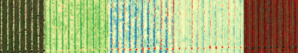
The sensor captures six targeted spectral bands: blue, green, red, red edge, near-infrared, and an additional vegetation band. Consequently, it delivers deeper insights into crop health and supports accurate vegetation monitoring.
Thermal Imaging
It features a radiometric thermal camera that measures field-level temperature variations. Therefore, users can detect water stress, disease, and irrigation inefficiencies with ease.
High-Resolution Imagery
Altum-PT delivers crisp multispectral and thermal imagery. As a result, users can assess crop vigor and field conditions precisely.
Synchronized Capture
The sensor captures multispectral and thermal images simultaneously. This synchronization allows for efficient flights and comprehensive data collection in one go.
Advanced Data Analysis
It supports robust analytics like vegetation indices and thermal mapping. Hence, users can make data-driven decisions quickly and confidently.
GPS Integration
Each image includes embedded GPS data. In turn, this supports accurate mapping and monitoring of crop performance over time.
Low-Light Performance
The sensor performs exceptionally well in various lighting conditions. Consequently, it provides consistent image quality throughout the day.
Easy Integration
The Altum-PT integrates easily with many drone platforms. Moreover, it offers flexible mounting options for smooth installation across UAV models.
Efficient Power Consumption
Its efficient power usage reduces battery strain. As a result, users enjoy longer drone flights and improved field coverage.
Durable and Rugged
MicaSense engineered the sensor to endure harsh field conditions. Therefore, it performs reliably in tough agricultural environments.
Real-Time Data Processing
It enables real-time processing with supported software tools. Consequently, users receive immediate insights for in-the-moment decision-making.
Wi-Fi Connectivity
The Altum-PT supports wireless data transfer. Additionally, it allows remote configuration and easier sensor management during field operations.
Global Operation
Engineered for global compatibility, it supports multiple languages and standards. As a result, users can operate it anywhere without limitations.
Data Security
The sensor includes robust data protection features. Therefore, users can trust it to safeguard sensitive agricultural and operational data.
User-Friendly Software Support
It pairs with intuitive software for processing and analytics. Thus, users of all experience levels can work efficiently with it.
Comprehensive Educational Resources
MicaSense backs the sensor with extensive learning materials and guides. Accordingly, users can maximize the system’s capabilities over time.
Flexible Configuration Options
Users can adjust imaging settings to suit specific project goals. As a result, the sensor supports a wide range of missions.
The MicaSense Altum-PT Multispectral Sensor elevates precision agriculture with unmatched integration of multispectral and thermal imaging. By combining rich spectral data and real-time thermal imagery, it enables growers to pinpoint plant stress, detect disease, and optimize irrigation faster. Additionally, its user-friendly design and software support make it accessible for researchers and professionals alike. Whether you manage large fields or conduct targeted crop studies, the Altum-PT delivers reliable performance and detailed insights that drive smart agricultural decisions.
Ultimately, the Altum-PT offers an all-in-one aerial sensing solution. With durable construction, accurate data, and flexible integration, it proves indispensable in today’s data-driven farming. Choose the Altum-PT to gain deeper visibility into your crops, streamline operations, and boost yields using intelligent field data.
Optimized Irrigation Scheduling:
Disease, Pest, and Nutrient Deficiency Detection:
Altum-PT’s high-resolution multispectral imaging offers enhanced visibility into plant canopy physiology. It aids in early detection of diseases, pests, and nutrient deficiencies that may not be visible in standard RGB imagery. Various multispectral indices and composite data facilitate the early identification of these issues.
Efficient Plant Phenotyping:
Altum-PT streamlines plant characteristic measurements by capturing comprehensive data in less time. Researchers gain deeper insights into how different traits respond to varying growth conditions, reducing the time and effort required for manual assessments.
Accurate Fruit Yield Estimations:
Traditional fruit yield estimation methods like manual counting and time-consuming analyses are resource-intensive. Altum-PT’s combination of high-resolution RGB, multispectral, and thermal imagery enables more precise yield predictions through algorithm-based fruit counting and temperature analysis, offering a more efficient and cost-effective approach.
Water Stress Prediction:
Canopy temperature serves as a reliable indicator of plant stress, especially related to water availability. Altum-PT’s thermal imaging allows farmers to periodically assess plant physiological status and detect subtle changes in canopy temperature, aiding in early water stress prediction and mitigation.
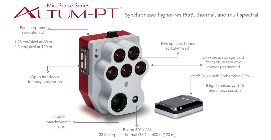
Specifications
Weight
460 g (16.2 oz.) Altum-PT + DLS2
Dimensions
11.0 x 8.0 x 6.9 cm (4.3 in x 3.1 in x 2.7 in)
External Power
7.0 V - 25.2 V
Power Input
5.5/7.0/10W (standby, average, peak)
Sensor Resolution
4112 x 3008 (12MP per PAN band) 2064 x 1544 (3.2MP per MS band) 320 × 256 thermal infrared
Spectral Bands
Blue 475(32), Green 560(27), Red 668(14), Red Edge 717(12), NIR 842(57)
RGB Color Output
12.4 MP (global shutter, aligned with all bands)
Thermal
FLIR LWIR thermal infrared 7.5-13.5um radiometrically calibrated
Interfaces
3 configurable GPIO: select from trigger input, PPS input, PPS output, and top of frame signals. Host virtual button. USB 2.0 port for WiFi. Serial. 10/100/1000 Ethernet. CFexpress for storage
Field of View
50° HFOV x 38° VFOV (multispectral) 46° HFOV x 35° VFOV (panchromatic) 48o x 39o (thermal)
FAQs for Micasense Altum-PT Multispectral Sensor
- What spectral bands does the Altum-PT capture?
- Altum-PT captures imagery in six spectral bands: blue, green, red, red edge, near-infrared (NIR), and thermal, providing comprehensive data for detailed analysis.
- How does the Altum-PT benefit precision agriculture?
- It enables detailed monitoring of crop health, irrigation efficiency, disease detection, and stress analysis, facilitating informed decision-making for optimized agricultural practices.
- Can the Altum-PT integrate with any drone model?
- While designed for easy integration with many UAV systems, it’s specifically compatible with DJI’s M300 RTK drones via the Altum-PT SkyPort, alongside open API support for broader adaptability.
- What is the image resolution of the Altum-PT?
- The Altum-PT offers high-resolution multispectral imagery, with the thermal band providing twice the ground resolution compared to previous models, enhancing the detail and usability of the data.
- How does Altum-PT’s thermal imaging support irrigation management?
- By identifying temperature variances indicative of moisture levels, it helps in detecting irrigation inefficiencies, guiding precise water distribution for optimal crop hydration.
- What makes the Altum-PT suitable for machine learning applications?
- Its high-resolution panchromatic and multispectral imagery is ideal for developing and training machine learning algorithms for applications such as crop counting and health assessment.
- How does the global shutter feature of the Altum-PT improve image quality?
- The global shutter captures distortion-free images, essential for accurate mapping and analysis, especially in fast-moving UAV applications.
- What are the storage capabilities and capture rates of the Altum-PT?
- The Altum-PT features an all-new storage device enabling data capture rates of up to 2 frames per second, facilitating efficient large-scale data collection.
- Can the Altum-PT detect plant diseases and nutrient deficiencies?
- Yes, its multispectral imaging capabilities allow for early detection of diseases and nutrient deficiencies by analyzing plant physiology and stress indicators.
- How does the Altum-PT aid in water stress prediction and management?
- Its thermal camera can detect subtle changes in canopy temperature, serving as an early indicator of water stress, enabling timely adjustments to irrigation practices for stress mitigation.
The full sheet
Related products
-
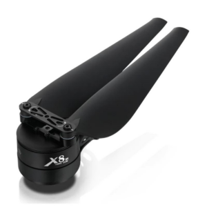
·XBM·00
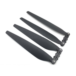 HobbyWing X8 3011 Folding Propeller For Agriculture DroneOriginal price was: ₹2,414.₹2,170Current price is: ₹2,170. (Excl. GST)Add to cart
 -
·XBM·01
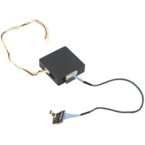
 SIYI Air Unit HDMI Input Converter for MK32 HM30 MK15 MK32E MK15E Air UnitOriginal price was: ₹24,034.₹21,608Current price is: ₹21,608. (Excl. GST)Add to cart
 -
·XBM·02
-
·XBM·03

There are no reviews yet.