Thermal drone cameras- models and application
Today’s Thermal drones are no longer just for Media production and hobby use. In fact, many drones are being used for professional applications apart from filmmaking and real estate. But before we dig into the many uses of thermal drone cameras, let’s talk about what thermal cameras are and why they are essential today.
A thermal camera is just like a regular camera in how it displays and produces a film or digital copy of what the lens sees. Still, thermal cameras use red radiation or heat and no visible light to form the picture. The resulting photocopy looks a lot less like how we see things because thermal cameras are designed to detect and display heat zones invisible to the eyes.

We see on thermal cameras blue to red spots, with each shade of colour representing varied temperatures released by humans, materials, and objects. Blue typically indicates colder zones, while red represents hot zones. However, some thermal drone cameras use other colour schemes.
Depending on the user and application, the cameras’ thermal scale may be confined and altered to lower or increase the colour contrast for more specific temperature analyses.
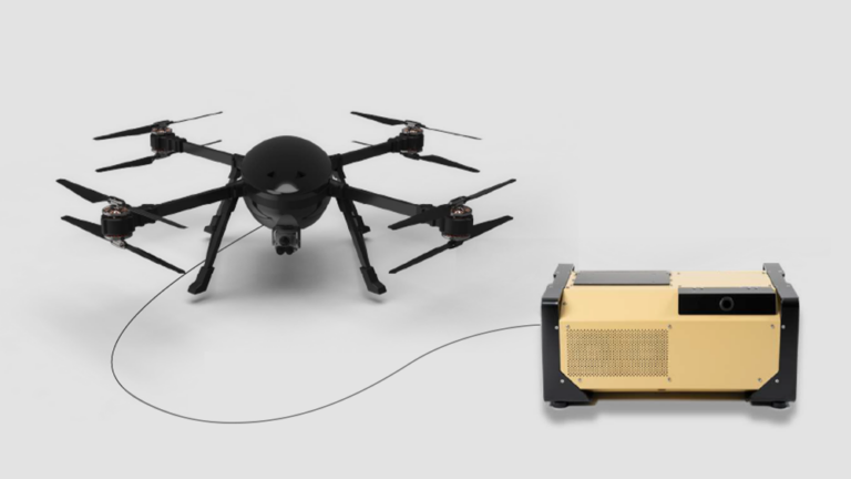
Thermal cameras have been around for many decades, with the first ones being part of military equipment used to see and target enemies at night. But now, thermal drone cameras are developed into handheld and mountable devices to arrange thermal drone cameras solutions for various demanding industrial, enterprise, military, and security applications.
Common Uses for Thermal Drone Cameras
We already know we can use that thermal drone camera in different ways; let check out the most popular uses as we divide them by category below.
Public Safety and Security
The essential benefit of thermal drones is public safety and security in many specific uses for rescue operations, surveillance, and firefighting. Due to drone cameras, we can spot people even in dark areas. It’s the most efficient way to find the location of lost people.
Thermal drones can also help find sources of explosions and wildfires by seeing through smoke and pictures of the area from up high.
The no-contact operation also can keep operators and firefighters safer until they need to enter the scene. It can transmit footage from drones in real-time for monitoring assistance and television broadcast.
Agriculture
In this sector, drones are increasing in the agriculture field. It is very effective in providing precise temperature measurements to quantify crop diseases, insects, salinity, and other external factors that can decrease yield. Castles also use thermal drones to keep track of their land.
Building Sector
You can imagine, Thermal drone is incredibly best for Building Inspections and commercial exterior. It’s good for scanning leaks and finding sources of energy wasteful and exterior problems. It can save you a lot of money in heating and more extensive repair costs resulting from delayed water detection and structural damage.
Drones also shorten inspections of large roof decks to just a few minutes, especially if the drone will fly high enough, to get a view of the entire roof or building and fly lower if there are problem areas that need more detailed visuals.

Thermal vision camera technology
Thermal vision cameras take pictures or video from heat, which is not visible light. Heat infrared light and thermal radiation are both parts of the electromagnetic spectrum. But, a camera that can detect visible light will not see by thermal radiation and inversely. Also, thermal cameras detect more than just heat, even as small as 0.01° Celsius. It also displays various colours on display in thermal software or apps.
Thermal Radiation And Heat Signatures
Everything in our living things gives thermal energy, even ice. The hotter things are, the more thermal energy it emits, also called a heat signature. The hotter the item, the more it radiates. The Sun radiates more energy than a hot cup of coffee. The temperature also affects the wavelength & frequency of the radiated ring.
Things at average room temperatures radiate energy as infrared waves. Once you see thermal photographs or videos of the radiation surrounding an individual, animal or hot cup of coffee, the energy radiated from the thing is typically a variety of wavelengths. It’s generally mentioned as a spectrum. Because the temperature of an item will increase, the wavelengths inside the emitted radiation ranges also decrease. Hotter things emit shorter-wavelength, higher frequency radiation.
For example, the coils of an electric toaster are considerably hotter than temperature and emit electromagnetic waves within the colour spectrum. The waves on the toaster glow red, and we can feel the warmth by putting our hands near the waves, providing us with a convenient warning that the waves are hot. Thermal radiation can occur through matter or through a part of space that’s barren of the value of a vacuum. The warmth received on Earth from the Sun results from electromagnetic waves travelling through the void or emptiness of space between the land and the Sun.
Recommended Thermal Drone Camera:
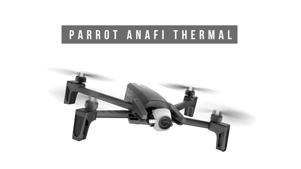
ANAFI Thermal
ANAFI Thermal balances the resolutions of the thermal image and visible image and benefits from information not visual in thermal. The displayed image is a fusion of the data from the two cameras to be maintained on three axes. The electro-optic unit of ANAFI Thermal combines a red infrared sensor with the electro-optical, making it possible to identify temperatures between -10° and +400°. With appreciation of the FLIR Lepton 3.5 module, it is possible to set the absolute temperature of each element.

Key Features:
- Sensor: FLIR Lepton 3.5 microbolometer
- Sensor resolution: 160×120
- HFOV: 57°
- Pixel pitch: 12µm
- Spectral band: 8-14µm
- Video format: MP4 (H264)
- Video recording resolution: 1440×1080, 9fps
- Precision: ±5% max.(High-gain) or ±10% max.
- Scene Dynamic Range: -10° to +140°C or -10° to +400°C
- Video: MP4
- Thermal sensitivity: <50mK (0.050°C)
- Photo format: JPEG
- Resolution: 3264×2448 (4/3)
- Photo modes: Single / Time-lapse / GPS Lapse
Imaging system
- Sensor: CMOS 1/2.4″, 21MP
- Photo formats: JPEG, DNG (RAW)
- Photo modes: single, burst, bracketing, timer and panorama
- Shutter speed: from 1 to 1/10000s
- ISO: from 100 to 3200
- EV compensation: [-3, +3]
- Maximum video sampling rate: 100Mbps
- Video format: MP4 (H264)
- HDR: 4K UHD, 2.7K et 1080p videos, JPEG photos
Digital zoom
- Lossless: up to x2.8 (FHD), up to x1.9 (2.7K), up to x1.4 (4K UHD)
- Standard: up to x3 (all resolutions)
LD-ASPH Lens
- f/2.4 aperture
- Depth of focus: 26mm (35mm equivalent)
- Depth of field: 1.5m to infinity
ANAFI Thermal drone
- Maximum vertical speed: 4m/s
- Wind resistance: 31mph
- Maximum working altitude: 4,500m above sea level
- Operating temperature: from -10°C to 40°C
- GNSS: GPS + GLONASS
- Barometer and magnetometer
- Vertical camera and ultrasound sensor
- 2×6-axis IMU
- 2×3-axes accelerometer
- 2×3-axes gyroscope
- Size folded: 218x69x64mm
- Size unfolded: 242x315x64mm
- Weight: 315 g
- Maximum transmission distance: 4km with the Parrot Skycontroller 3
- Flight time: 26min
- Maximum horizontal speed: 34mph