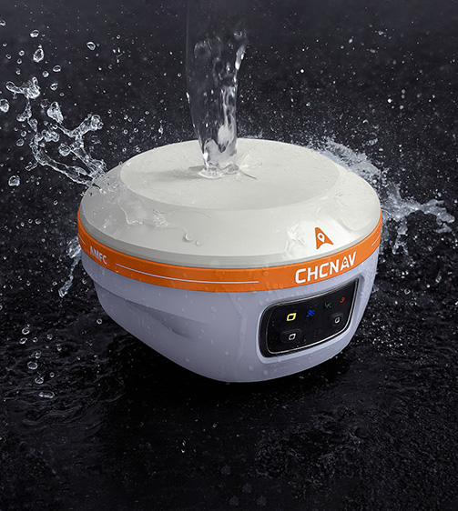
CHCNAV i85 Pocket-Sized Laser IMU-RTK GNSS Receiver
-
Compact “pocket-sized” GNSS rover combining GNSS, IMU and laser range-finder for land surveying.
-
1,408-channel multi-constellation GNSS module with advanced IMU tilt-compensation for high accuracy even when pole is tilted.
-
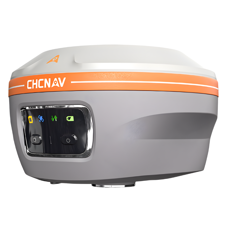
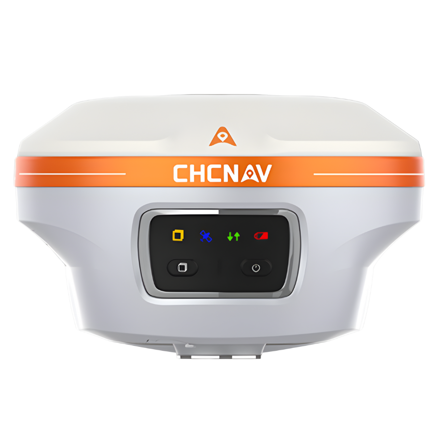
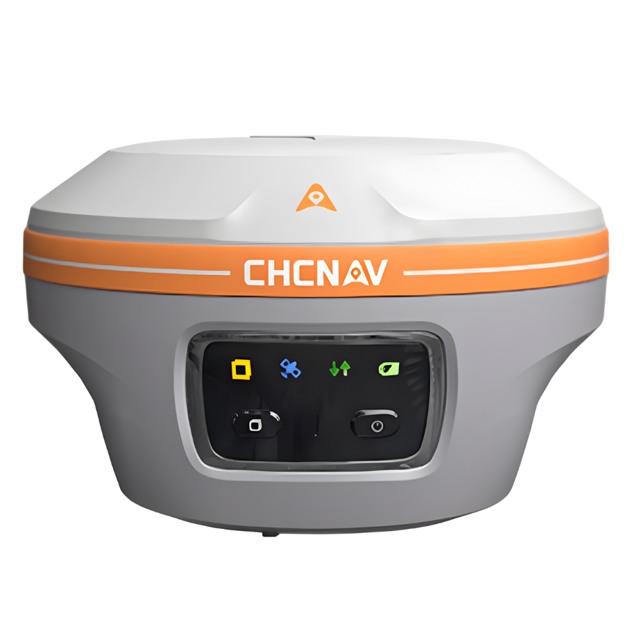
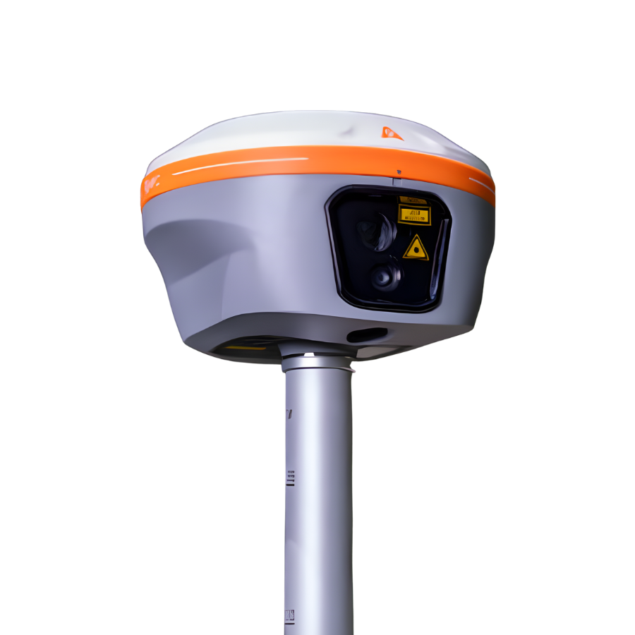
Integrated dual cameras (8 MP + 2 MP) and a visible green laser for remote/obstructed-point measurement and AR navigation/ stakeout.
-
Rugged, field-ready design: weighs ~0.8 kg, IP68 rated, drop resistance, built for up to ~20 hours of RTK operation.
-
Ideal for surveying workflows where access is difficult, GNSS conditions are challenging or speed and efficiency are important.
- Trusted dealerDirect manufacturer partnership
- Pan-India deliveryInsured shipping, all states
- Post-sale supportTraining + service included
What makes it work
CHCNAV i85 Pocket-Sized Laser IMU-RTK GNSS Receiver
| Parameter | Specification |
|---|---|
| GNSS Channels | 1,408 channels, multi-constellation (GPS, GLONASS, Galileo, BeiDou, QZSS, SBAS) |
| IMU | 200 Hz Auto-IMU, tilt-compensation (no manual calibration) |
| Laser Rangefinder Accuracy | ~2 cm at 5 m, ~3 cm at 10 m (typical) |
| Weight | ~0.800 kg (800 g) |
| Dimensions | ~133 mm × 85 mm (Ø133 × 85) |
| Battery Life | Up to ~20 hours (RTK rover) |
| Protection / Durability | IP68 rated (dust & water resistant), drop from 2 m pole drop rated |
| Wireless / Communication | Wi-Fi (2.4/5.8 GHz), Bluetooth v4.2, NFC |
| Modem / Radio | UHF 410-470 MHz internal Tx/Rx (typical 3 km, up to 8 km in optimal conditions) |
| Data Storage | 8 GB high-speed memory built-in |
| Laser & Camera | Green laser class 3R; front dual-camera: 8 MP + 2 MP, 91° FOV |
| Operating Temperature | –40 °C to +65 °C |
| GNSS RTK Accuracy | Horizontal: 8 mm + 1 ppm RMS, Vertical: 15 mm + 1 ppm RMS (typical) |
| Static / PPK Accuracy | H: 3 mm + 1 ppm RMS, V: 5 mm + 1 ppm RMS (PPK) |
CHCNAV i85Highlights
The CHCNAV i85 redefines portable precision with its compact and powerful GNSS receiver built for modern land surveying. Equipped with a 1,408-channel multi-constellation GNSS engine, advanced IMU tilt compensation, dual integrated cameras, and a high-accuracy laser rangefinder, it delivers consistent, pinpoint positioning — even in environments with poor visibility or strong solar interference.
Weighing just 800 g, the i85 combines lightweight portability with rugged reliability, featuring an IP68-rated design and up to 20 hours of battery life. From dense urban sites to remote fieldwork, the CHCNAV i85 Laser IMU-RTK GNSS Receiver empowers surveyors to work faster, smarter, and with greater confidence in every condition.
CHCNAV i85 Features
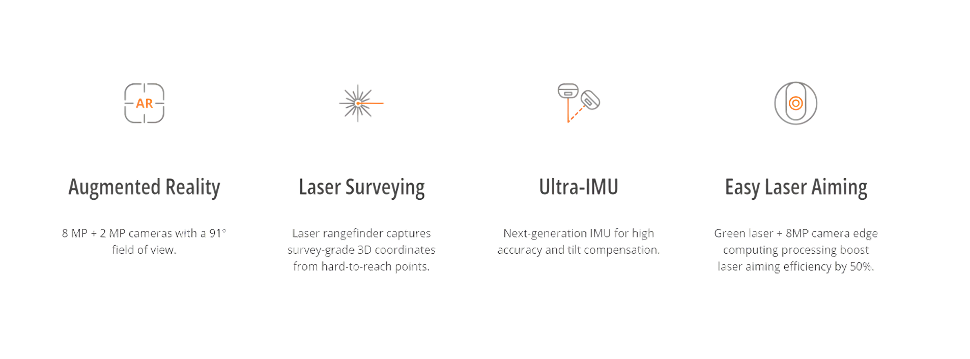
Expand Your Reach with Precision – The i85 GNSS Receiver
Measure Inaccessible Points with Ease
The i85 redefines precision surveying with advanced laser technology and high-accuracy heading data. Effortlessly capture points that are otherwise out of reach — no compromise on accuracy, no extra steps required.
Unmatched GNSS Performance
Powered by the cutting-edge iStar2.0 algorithm and advanced ionospheric interference rejection, the i85 delivers a remarkable 96% fix reliability, even in low-latitude regions impacted by solar activity. Expect consistent, reliable signal tracking in the toughest environments.
Smart Aiming with Adaptive Imaging
An intelligent 8-megapixel front-facing camera with edge computing and 6x adaptive zoom helps you clearly identify and measure distant or low-visibility points. Every image is optimized for clarity, helping you make faster and more accurate decisions in the field.
AR-Powered Visual Navigation and Stakeout
Take your surveying workflow to the next level with the i85’s AR-based navigation and stakeout system. Simplify operations and reduce field effort by up to 50%, while achieving up to 10x higher accuracy than traditional gyroscope systems — even for less experienced operators.
High-Precision Auto-IMU Technology
The i85’s 200Hz Auto-IMU delivers instant tilt compensation without any manual calibration. Work confidently within a 60° tilt range and maintain a 3 cm accuracy, ensuring consistent results on every project.
Compact, Durable, and Field-Ready
Engineered for demanding field conditions, the i85 combines all core components into one lightweight 800 g unit. Built tough with an IP68 water and dust resistance rating, it easily withstands a 2-meter pole drop, guaranteeing reliability wherever you go.
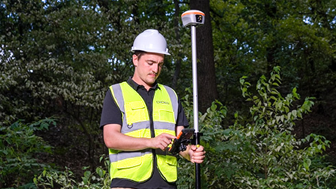
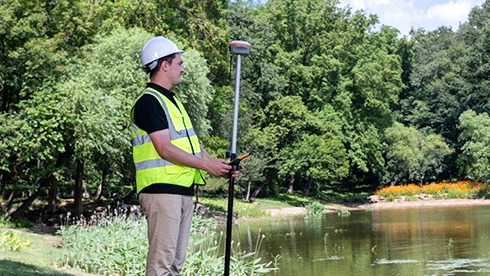
CHCNAV i85 Use Cases


The full sheet
Related products
-
·XBM·00
-
·XBM·01

-
·XBM·02
Out of stock
-
·XBM·03

There are no reviews yet.