
Description
DJI Matrice 400: The Ultimate Enterprise Drone for India’s Industrial Needs
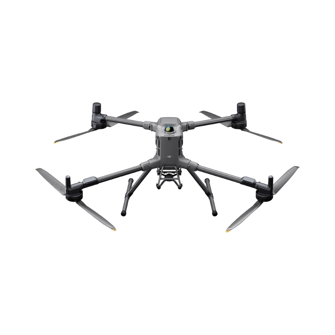
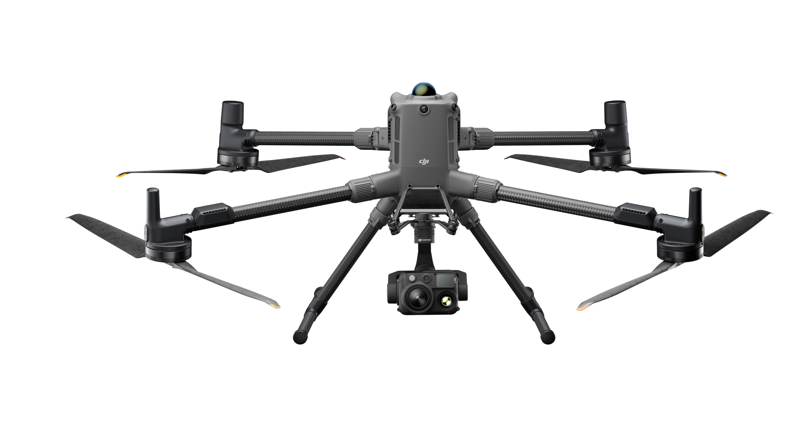
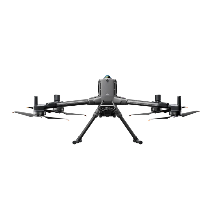
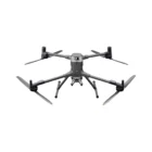
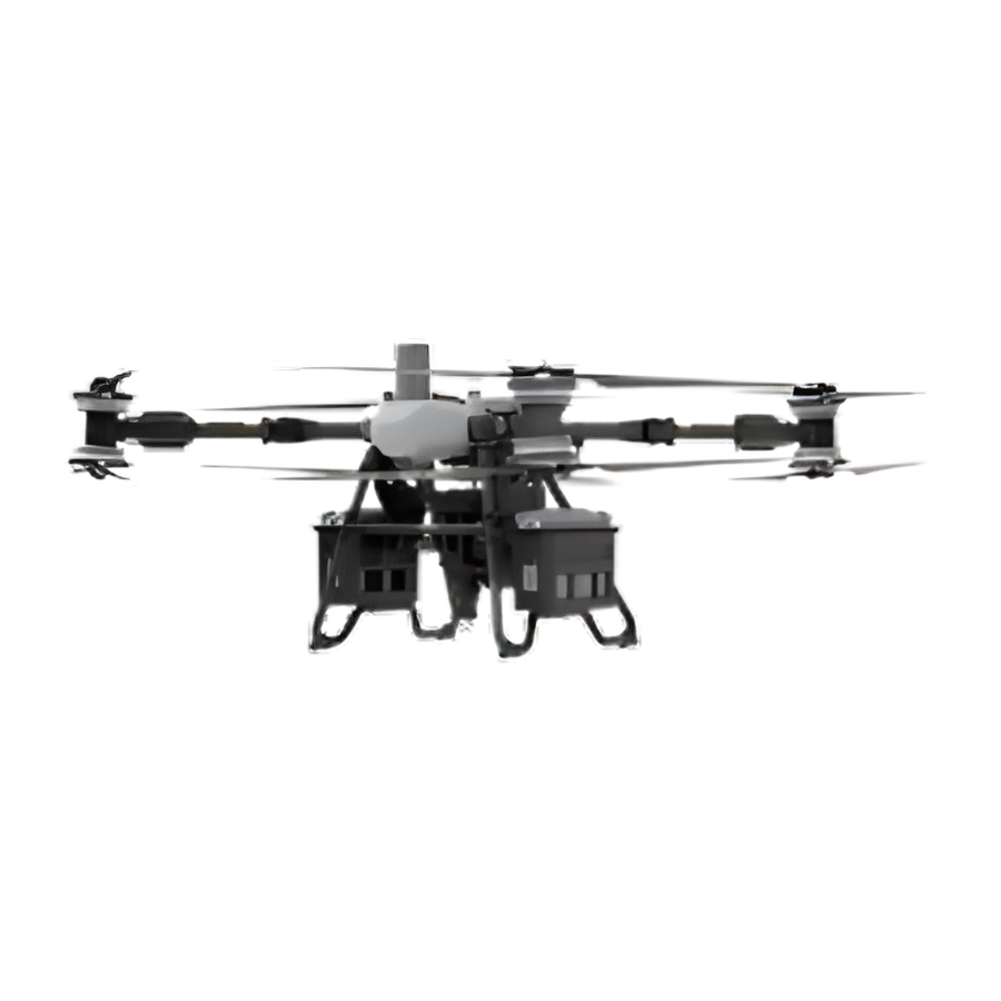
The DJI Matrice 400 is DJI’s flagship enterprise drone platform, engineered for powerful performance and mission-critical operations. It offers an extended 59-minute flight time, 6 kg maximum payload capacity, and features integrated rotating LiDAR and mmWave radar for precise obstacle detection—even around power lines. With O4 Enterprise Enhanced Video Transmission and Airborne Relay capabilities, it ensures stable connectivity and improved operational safety. Designed for versatility, it supports visible and thermal imaging, Smart Detection, AR projections, ship-based takeoffs and landings, and automated workflows—making it ideal for emergency response, power line inspections, aerial mapping, and AEC (Architecture, Engineering, and Construction) applications.
Introducing DJI Matrice 400
DJI Matrice 400 | Enterprise Drone Platform for Long‑Endurance Missions
Enterprise-Grade Aerial Capability Redefined
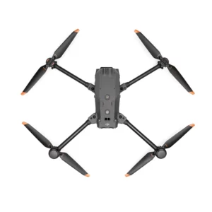
The DJI Matrice 400 (M400) is DJI’s newest flagship drone platform for professional inspection, mapping, public safety, and heavy-duty enterprise missions, combining unmatched endurance, high payload versatility, and advanced obstacle sensing.
Key Features & Benefits
Long-Endurance Performance: Up to 59-Minute Flight Time
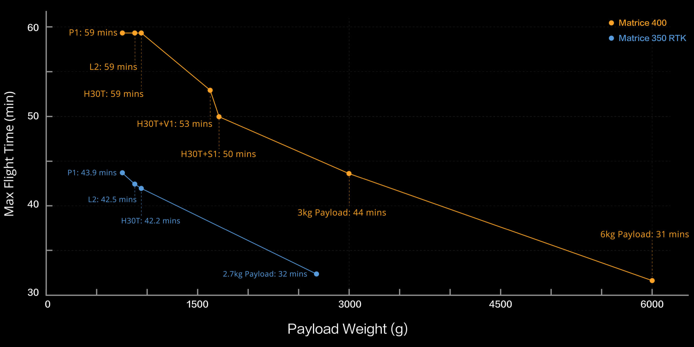
Flight time with a Zenmuse H30T payload can reach an impressive 59 minutes, or 31 minutes with maximum payload (~6 kg) . With hover capacity of 53 minutes, the M400 supports long corridor inspections, large-area surveys, and time-critical emergency missions .
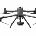
Heavy-Lift Payload Capacity: Up to 6 kg , Supports 7 Mounts
The M400 can lift up to 6 kg (13.2 lb)—more than double the Matrice 350’s capacity—and supports up to 7 payloads simultaneously via multiple E-Port V2 connectors and dual downward gimbals . Compatible payloads include:
-
Zenmuse H30/H30T (zoom, thermal, laser-range)
-
L2 LiDAR (3D mapping)
-
P1 photogrammetry camera
-
S1 spotlight and V1 speaker
-
Manifold 3 onboard computer for AI processing .
Robust Obstacle Sensing: LiDAR + mmWave + Vision
Avalable LiDAR, mmWave radar, and full‑color fisheye vision sensors detect powerlines, wires, and obstacles—even in low light or harsh weather. The rotating LiDAR scans 360°, identifying obstacles as small as 21.6 mm in diameter .
Enhanced Data Link:
O4 Enterprise Transmission + Relay Mode
The M400 uses O4 Enterprise Enhanced Video Transmission with sub‑2 GHz support for up to 40 km range (FCC) or 20 km (CE). An airborne relay mode allows one unit to extend coverage for another—ideal for expansive BVLOS (Beyond Visual Line of Sight) operations .
All-Weather Resilience:
IP55 Build , Wide Temp Range : With an IP55 rating, the M400 resists dust and water—making it suitable for rainy, dusty, or maritime environments. It also operates in extreme temperatures from –20 °C to +50 °C .
Built‑In Intelligence:
Manifold 3, Smart Flight Modes
Manifold 3 onboard computing delivers real-time AI processing (100 TOPS), enabling intelligent detect‑and‑track, infra-red thermal analysis, edge analytics, and automation without relying on ground control .
Smart flight modes like Power Line Follow, Geometric Route, AR Projection, Terrain Follow, and Ship Launch/Landing simplify complex missions .
Ideal Use Cases & Applications
-
Utility and Powerline Inspection: Safely span wide-area corridors while detecting power lines and infrastructure in real time.
-
Geomatics, Surveying & Mapping: Capture LiDAR, photogrammetry, and imaging data with extended flight time and multi-sensor payload integration.
-
Public Safety & Search & Rescue: Respond faster with long endurance, thermal imaging, and relay-enabled BVLOS coordination.
-
Industrial Inspection: Use multiple payloads (e.g. thermal, visual, spotlight) during single sorties in construction or infrastructure projects.
-
Maritime and Offshore Operations: Launch from ships with launch/landing mode, operate over open water, and transmit over broad distances.
Payloads Supported by DJI Matrice 400

The Matrice 400 supports a range of payloads—including the Zenmuse H30 Series, L2, P1, S1 Spotlight, V1 Speaker, Manifold 3, and third-party options—allowing it to adapt to various tasks and fully leverage the DJI ecosystem’s capabilities.
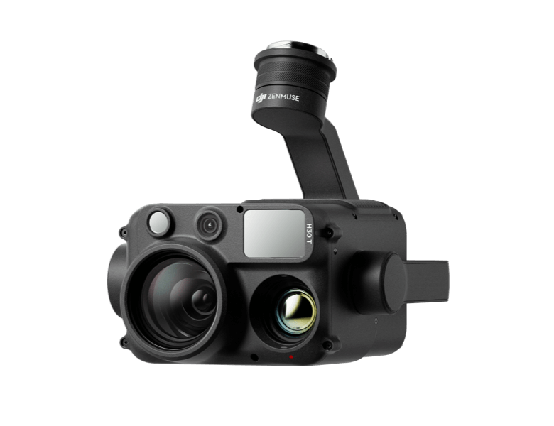
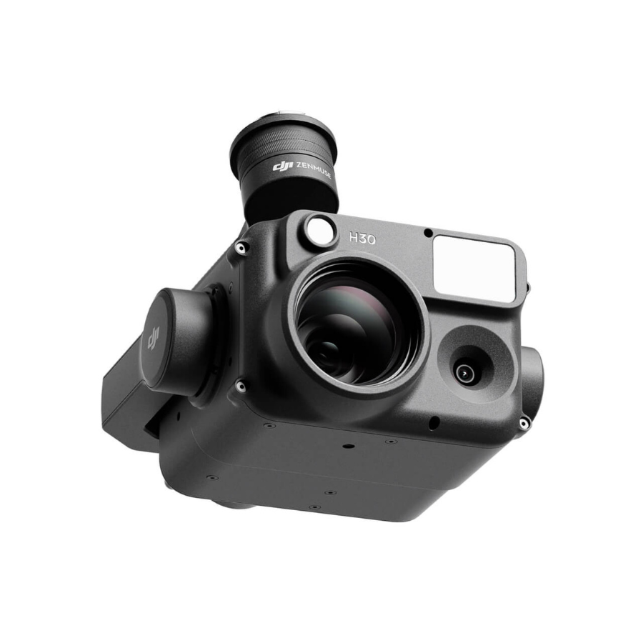
Zenmuse H30 series
The Zenmuse H30 Series combines a wide-angle, zoom, thermal camera, laser range finder, and NIR light in one powerful payload. Powered by advanced AI algorithms, it sets a new standard in aerial imaging, delivering exceptional performance in operations.
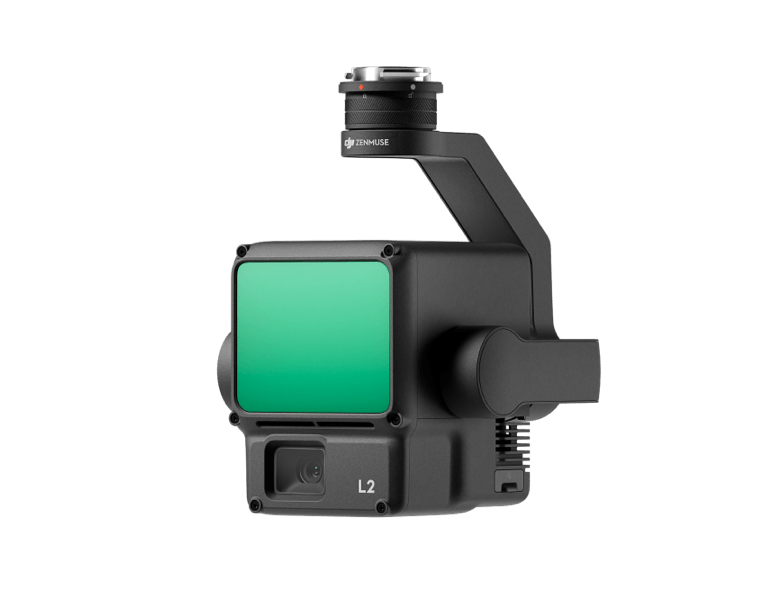
Zenmuse L2
The Zenmuse L2 features a frame-based LiDAR, high-precision IMU, and 4/3 CMOS RGB mapping camera, delivering accurate, efficient, and reliable geospatial data for DJI’s multi-payload drones—enhancing mapping performance across various industrial applications.
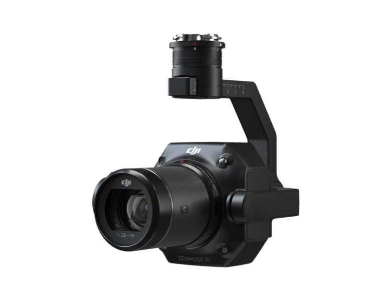
Zenmuse P1
The Zenmuse P1 features a full-frame sensor, interchangeable fixed-focus lenses, and a 3-axis stabilized gimbal. Built for photogrammetry, it delivers unmatched efficiency and precision, making it ideal for high-accuracy aerial surveying missions.
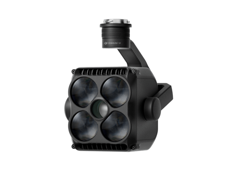
Zenmuse S1
The Zenmuse S1, DJI’s first spotlight for multi-payload drones, uses LEP tech to deliver high brightness, long-range illumination, and multiple lighting modes—making it perfect for public safety, emergency response, inspections, and other night-time operations.
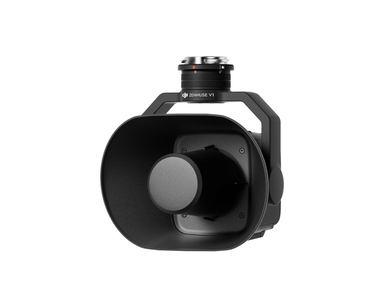
Zenmuse V1
The Zenmuse V1 is DJI’s first loudspeaker for multi-payload drones, offering powerful volume, long-range broadcasting, and multiple modes—ideal for public safety, emergency response, and other critical communication scenarios.
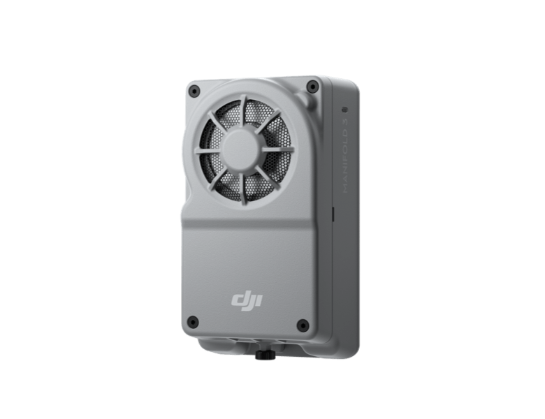
Mainfold 3
Manifold 3 packs an impressive 100 TOPS of computing power into a compact unit weighing about 120 g. It can be mounted onto Matrice 400 drone platform, optimizing efficiency across various operational missions with its robust processing.
Flight Time
DJI Matrice 400 – Safe and Reliable Flight
Built to Withstand Harsh Environments
With an IP55 protection rating, the Matrice 400 is engineered to perform reliably in harsh environmental conditions, including heavy rain, dust, and strong winds. Its wide operating temperature range of -20°C to 50°C (-4°F to 122°F) ensures consistent performance in extreme climates—whether flying through freezing cold or under intense heat. This makes it the ideal choice for demanding missions across diverse terrains and weather conditions.
Power-Line-Level Obstacle Detection
The Matrice 400 sets a new benchmark in obstacle sensing by combining rotating LiDAR, high-precision mmWave radar, and full-color low-light fisheye vision sensors. This advanced system detects even thin, high-voltage power lines in complex terrains—day or night. Capable of penetrating fog and rain, it ensures superior situational awareness and flight safety in the most challenging environments.
Robust Video Transmission
O4 Enterprise
With a 10-antenna setup and high-gain phased array controller, the O4 system enables 40 km video transmission. Matrice 400 also supports sub-2G bands and dual DJI Cellular Dongle 2 for seamless network switching in urban or remote areas.
Airborne Relay
Enhanced Intelligence and Efficiency
Real-Time Terrain Follow
The Matrice 400 enables Real-Time Terrain Follow in any horizontal direction, available in both manual and automated flight modes. It maintains a stable altitude relative to the ground, ensuring consistent subject size during search and rescue and uniform GSD in mapping missions—reducing zoom adjustments and enhancing data accuracy and operational efficiency.
Takeoff and Landing on Ships
The Matrice 400 is built for maritime tasks like patrols and wind turbine inspections, with the ability to take off from stationary ships and land on moving vessels. It uses deck pattern recognition for safe, precise landings, ensuring reliable performance at sea.
Specifications of DJI Matrice 400
Aircraft Specifications
Specification |
Details |
|---|---|
| Takeoff Weight (Without Batteries) | 5020±20 g |
| Takeoff Weight (With Batteries) | 9740±40 g |
| Max Takeoff Weight | 15.8 kg |
| Dimensions (Unfolded) | 980×760×480 mm |
| Dimensions (Folded) | 490×490×480 mm |
| Carrying Case Dimensions | 779×363×528 mm |
| Max Payload | 6 kg |
| Propeller Size | 25 inches |
| Diagonal Wheelbase | 1070 mm |
| Max Ascent Speed | 10 m/s |
| Max Descent Speed | 8 m/s |
| Max Horizontal Speed | 25 m/s |
| Max Takeoff Altitude | 7000 m |
| Max Flight Time (no wind) | 59 minutes |
| Max Hover Time (no wind) | 53 minutes |
| Max Flight Distance (no wind) | 49 km |
| Max Wind Speed Resistance | 12 m/s |
| Max Yaw Angular Velocity | 100°/s |
| Max Pitch Angle | 35° |
| Operating Temperature | -20° to 50° C |
| Ingress Protection Rating | IP55 |
Battery Specifications
Specification |
Details |
|---|---|
| Model | TB100 |
| Capacity | 20254 mAh |
| Standard Voltage | 48.23 V |
| Max Charging Voltage | 54.6 V |
| Cell Type | Li-ion 13S |
| Energy | 977 Wh |
| Weight | 4720 ± 20 g |
| Charging Temperature | 5° to 45° C |
| Discharging Temperature | -20° to 75° C |
| Battery Heating | Supported (Single, Onboard, Station) |
| Discharge Rate | 4C |
| Max Charging Power | 2C |
| Cycle Count | 400 |
Gimbal Specifications
Specification |
Details |
|---|---|
| Max Payload (Single Gimbal Connector) | 1400 g |
| Max Payload (Dual Gimbal Connector) | 950 g |
| Max Payload (Third Gimbal Connector) | 3 kg (quick-release), 6 kg (screw lock) |
Sensing System
Specification |
Details |
|---|---|
| Type | Omnidirectional vision, LiDAR, infrared, mmWave radar |
| Forward Range | 0.4–200 m |
| Backward Range | 0.4–200 m |
| Lateral Range | 0.5–200 m |
| Downward Range | 0.5–19 m |
| Rotating LiDAR | 0.5–100 m (360° x 58° FOV) |
| Upper LiDAR | 0.5–25 m |
| Downward Infrared | 0.3–8 m |
| mmWave Radar | Up to 50 m for power lines |
Video Transmission & Control
Specification |
Details |
|---|---|
| System | DJI O4 Enterprise |
| Max Transmission Distance | 40 km (FCC), 20 km (CE) |
| Live View | 3-channel 1080p/30fps |
| Download Speed | 80 Mbps |
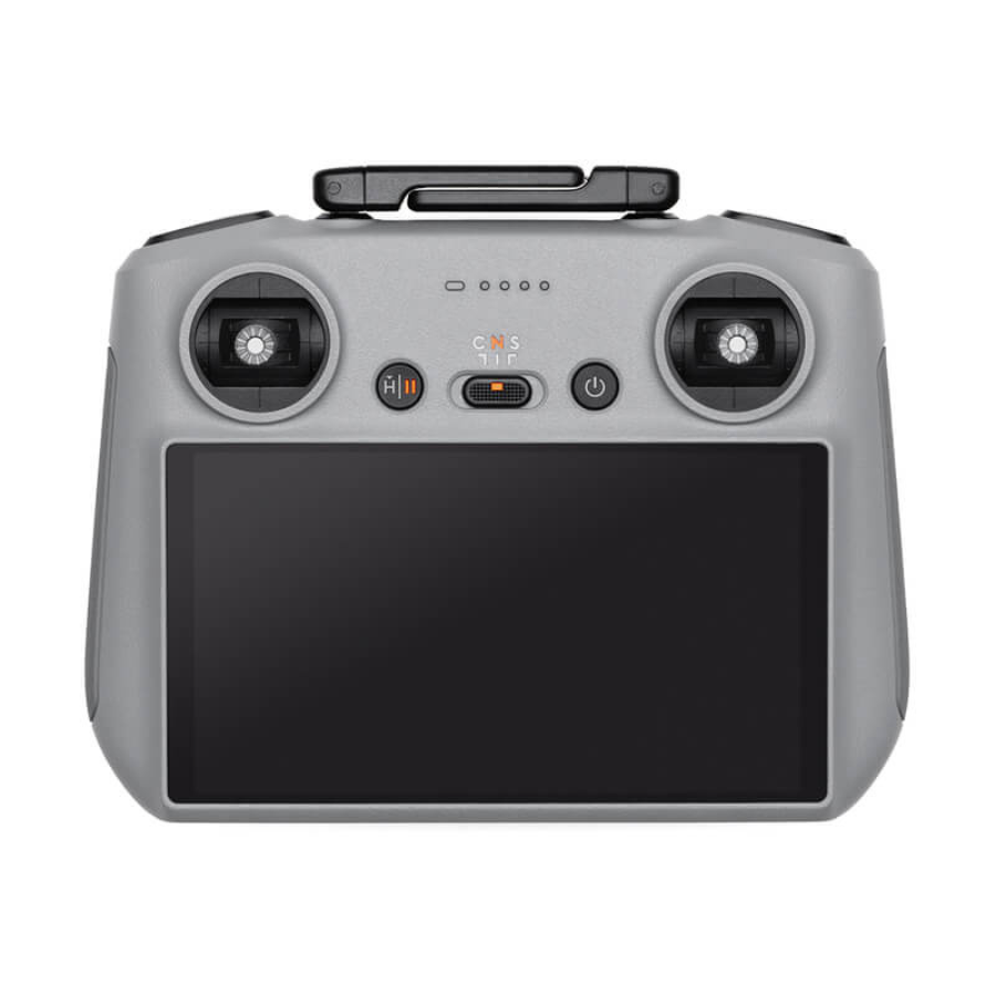
| Remote Controller | DJI RC Plus 2 |
| Screen | 7.02″ 1920×1200 @ 60fps, 1400 nits |
DJI RC Plus 2 Enterprise
Specification |
Details |
|---|---|
| Video Transmission | DJI O4 Enterprise Enhanced |
| Max Transmission Range | 40 km (FCC), 20 km (CE/SRRC/MIC) |
| Live View Quality | 3-channel 1080p/30fps |
| Operating Frequencies | 902-928 MHz, 2.4 GHz, 5.1 GHz, 5.8 GHz (regional restrictions apply) |
| Antenna | 2T4R dual-band high-gain antenna; Sub2G: 2T2R |
| Cellular Dongle Support | Supports DJI Cellular Dongle 2 |
| Wi-Fi Protocol | Wi-Fi Direct, IEEE 802.11 a/b/g/n/ac/ax (dual-band) |
| Wi-Fi Speed | Up to 1774.5 Mbps (2×2 + 2×2 dual-band simultaneous) |
| Bluetooth | Bluetooth 5.2 |
| Screen | 7.02″, 1920×1200, 60fps, 1400 nits brightness |
| Touch Input | 10-point multi-touch |
| Built-in Battery | 6500 mAh @ 7.2V (46.8 Wh), lithium-ion |
| External Battery Option | WB37 (4920 mAh @ 7.6 V) |
| Charging Time | 2 hours (internal), 2 hours (internal + external, off) |
| Runtime | 3.8 hrs (internal), 3.2 hrs (external) |
| OS & Storage | Android 11, 8 GB RAM + 128 GB ROM + microSD expandable |
| Output Ports | HDMI 1.4, USB-C (PD up to 65W), USB-A, SD card |
| Operating Temp | -20° to 50° C |
| Weight | 1.15 kg (without external battery) |
Supported DJI Products for Matrice 400 RTK
Gimbal Cameras
-
Zenmuse H30
-
Zenmuse H30T
-
Zenmuse L2
-
Zenmuse P1
Accessories
-
Zenmuse S1 – High-powered drone spotlight
-
Zenmuse V1 – Drone loudspeaker
-
Manifold 3 – Edge computing unit
-
DJI RC Plus 2 Sub2G SDR Module
-
DJI Cellular Dongle 2
RTK Modules
-
D-RTK 3 Multifunctional Station
-
D-RTK 2 Mobile Station
Payload & Expansion Ecosystem
-
DJI X-Port – For custom payload development
-
DJI E-Port V2 Development Kit
-
DJI E-Port V2 Coaxial Cable Kit
-
DJI SKYPORT V3 Adapter Set
-
DJI SKYPORT V3 Coaxial Cable Kit
FAQ’s on DJI Matrice 400
What is the maximum payload capacity of the DJI Matrice 400 RTK?
The Matrice 400 RTK supports a maximum payload of 6 kg, measured at the third gimbal connector under sea-level conditions. Payload capacity may reduce at higher altitudes.
How long can the Matrice 400 RTK fly on a full charge?
Under ideal conditions with no wind, the M400 can achieve a maximum flight time of 59 minutes and a hover time of up to 53 minutes, using TB100 batteries and carrying the H30T payload.
Is the DJI Matrice 400 RTK waterproof?
Yes, the drone has an IP55 ingress protection rating, making it resistant to dust and water jets from any direction. However, it is not fully waterproof or submersible.
What is the maximum flight altitude and wind resistance of the M400?
The drone can operate at a maximum takeoff altitude of 7,000 meters and can withstand wind speeds up to 12 m/s during takeoff and landing.
What types of sensors and positioning systems are included?
The M400 is equipped with omnidirectional sensing, including binocular vision, LiDAR, infrared, and mmWave radar. It supports RTK GNSS (GPS, Galileo, BeiDou, and GLONASS when RTK is active), enabling centimeter-level positioning accuracy.
Which payloads and gimbal cameras are compatible with the DJI Matrice 400?
It supports Zenmuse H30, H30T, P1, and L2 gimbal cameras. Additionally, it is compatible with Zenmuse accessories like S1 (spotlight) and V1 (loudspeaker), as well as DJI’s custom payload ecosystem via E-Port V2 and SkyPort V3.
What is the video transmission range of the DJI M400 RTK?
With the DJI O4 Enterprise Transmission System, the M400 RTK offers up to 40 km transmission range (FCC) and 20 km (CE/SRRC/MIC) under ideal, unobstructed conditions.


There are no reviews yet.