
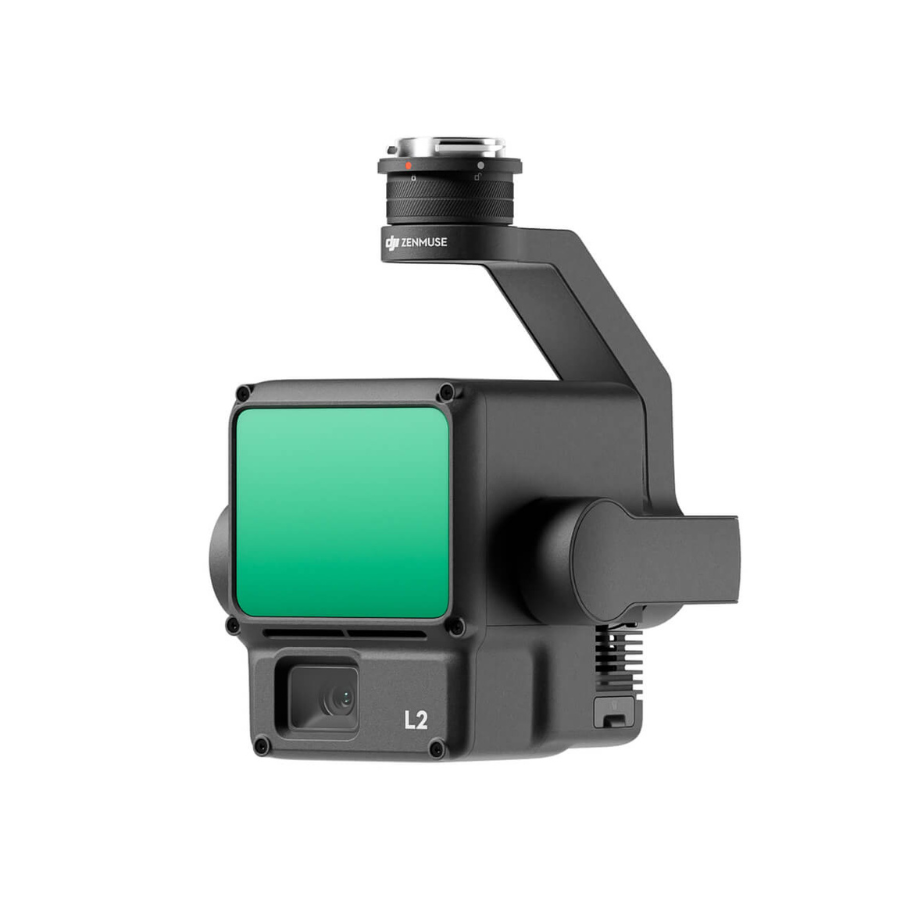
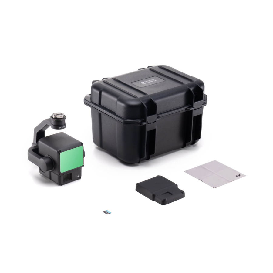
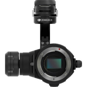
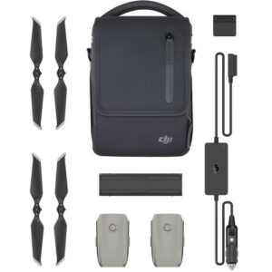
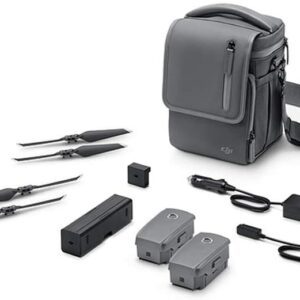
Zenmuse L2 Worry-Free Basic Combo - LiDAR Camera
- LiDAR and RGB Imaging Combo: The Zenmuse L2 Worry-Free Basic Combo includes the Zenmuse L2 payload.
- Effective Data Capture: For aerial surveying and mapping, delivering precise and thorough data for various applications.
- The complete combination package includes all the necessary components for worry-free aerial surveying.
- The Zenmuse L2 payload uses modern LiDAR technology to collect data efficiently and precisely.
- High-Resolution RGB Imaging: Supplement LiDAR data with detailed RGB photos for complete surveying.
- Construction, infrastructure monitoring, and environmental surveying are suitable applications.
Get Free DJI Terra Software for 3 Months.
Price is excl. of GST.
- 3 months · ₹283,000
- 6 months · ₹141,500
- 9 months · ₹94,334
Select Snapmint at checkout · Available on orders above ₹3,000 · Subject to eligibility
- Trusted dealerDirect manufacturer partnership
- Pan-India deliveryInsured shipping, all states
- Post-sale supportTraining + service included
What makes it work
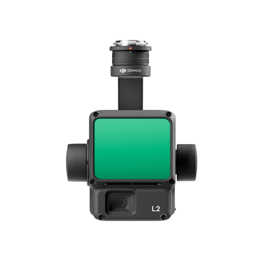
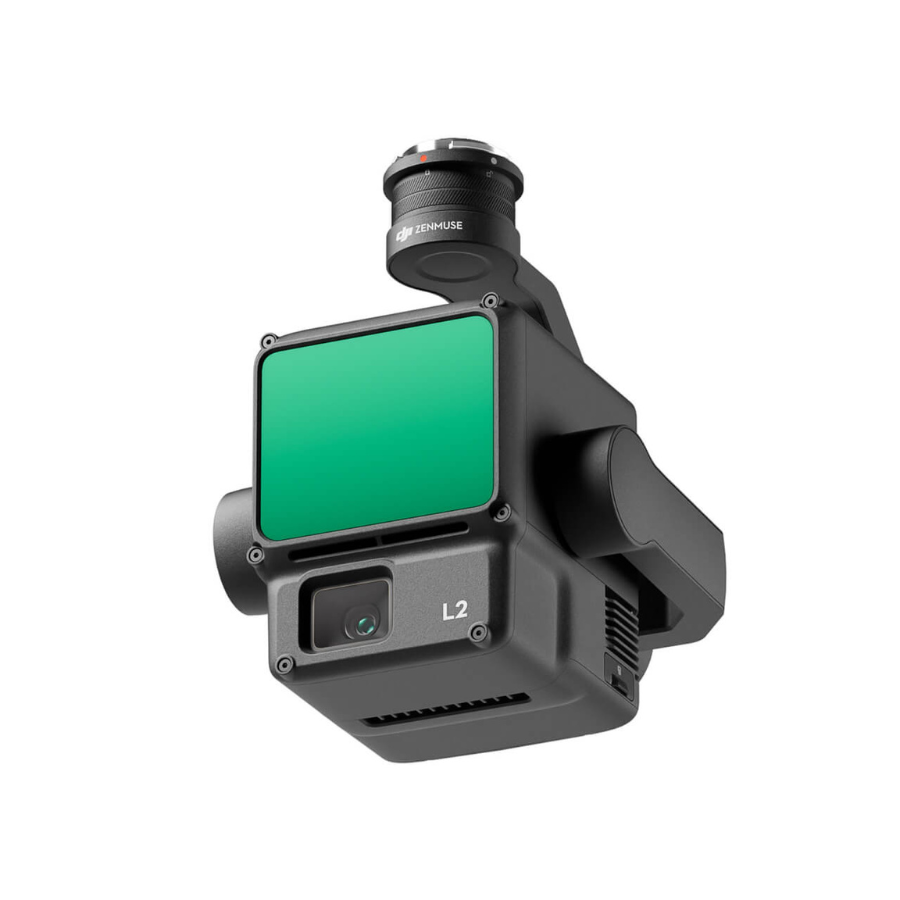
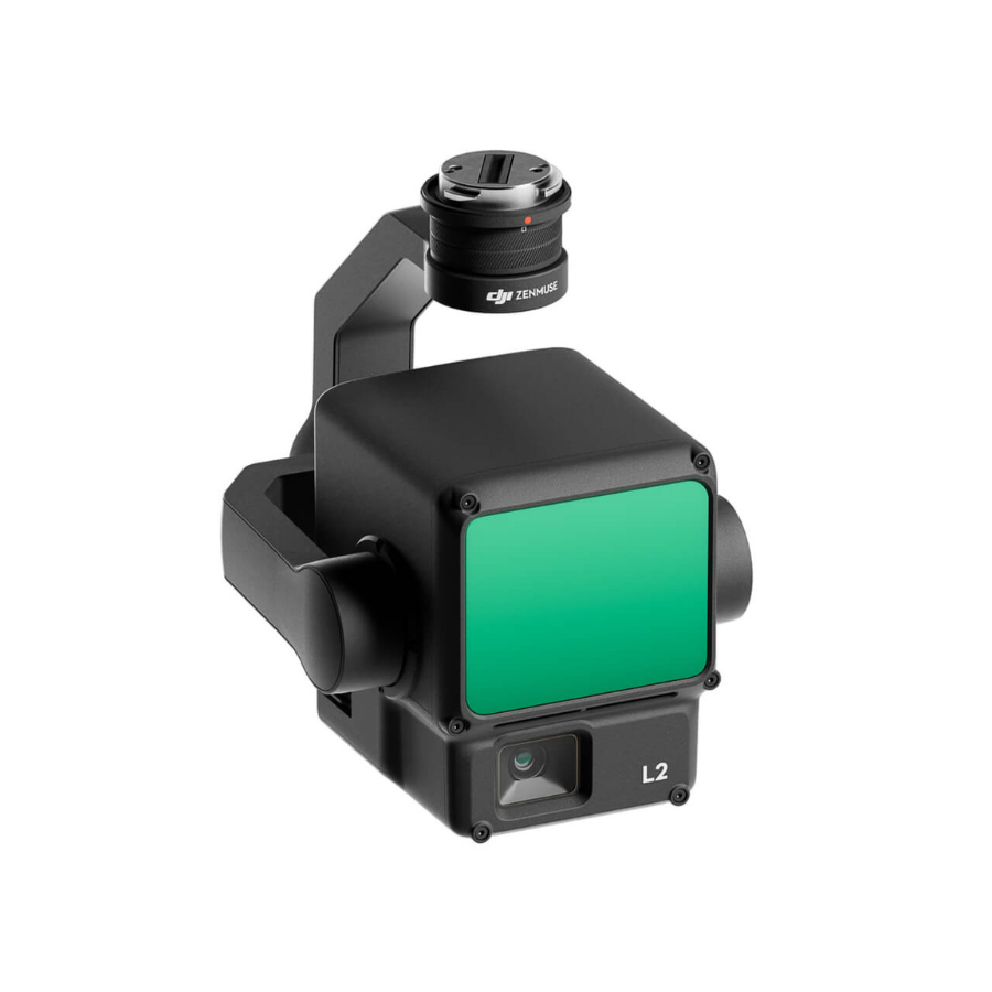
Zenmuse L2 Worry-Free Basic Combo
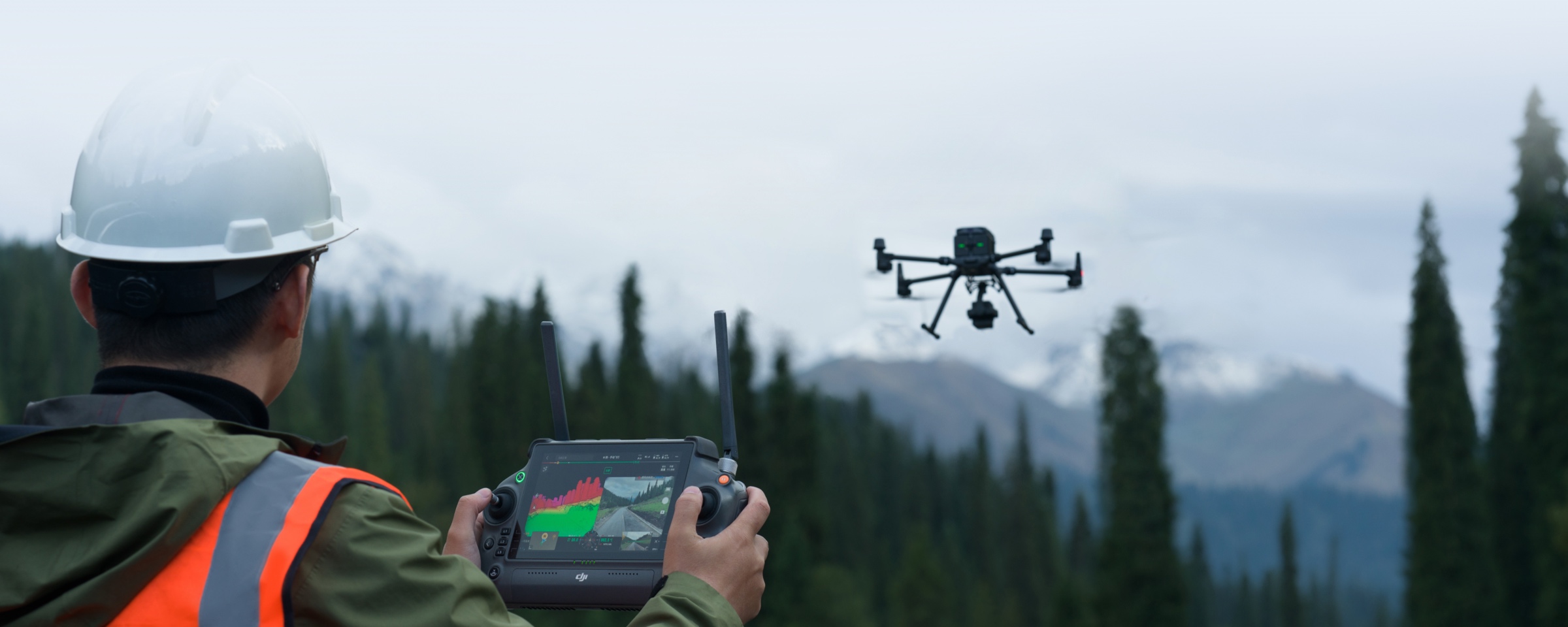
For worry-free aerial mapping and surveying, the Zenmuse L2 Worry-Free Basic Combo is the best option. This all-inclusive package comes with the Zenmuse L2 payload, which is optimized for effective LiDAR and RGB data collection, as well as necessary add-ons to improve your drone surveying experience. The Zenmuse L2 guarantees precise and thorough data collection for a range of applications, from environmental surveying to construction and infrastructure monitoring, thanks to its sophisticated LiDAR capabilities and high-resolution RGB photography. This combination is designed to offer a smooth and worry-free aerial surveying experience, making it the perfect option for professionals looking for accuracy and productivity in their mapping projects.

Exceptional Efficiency
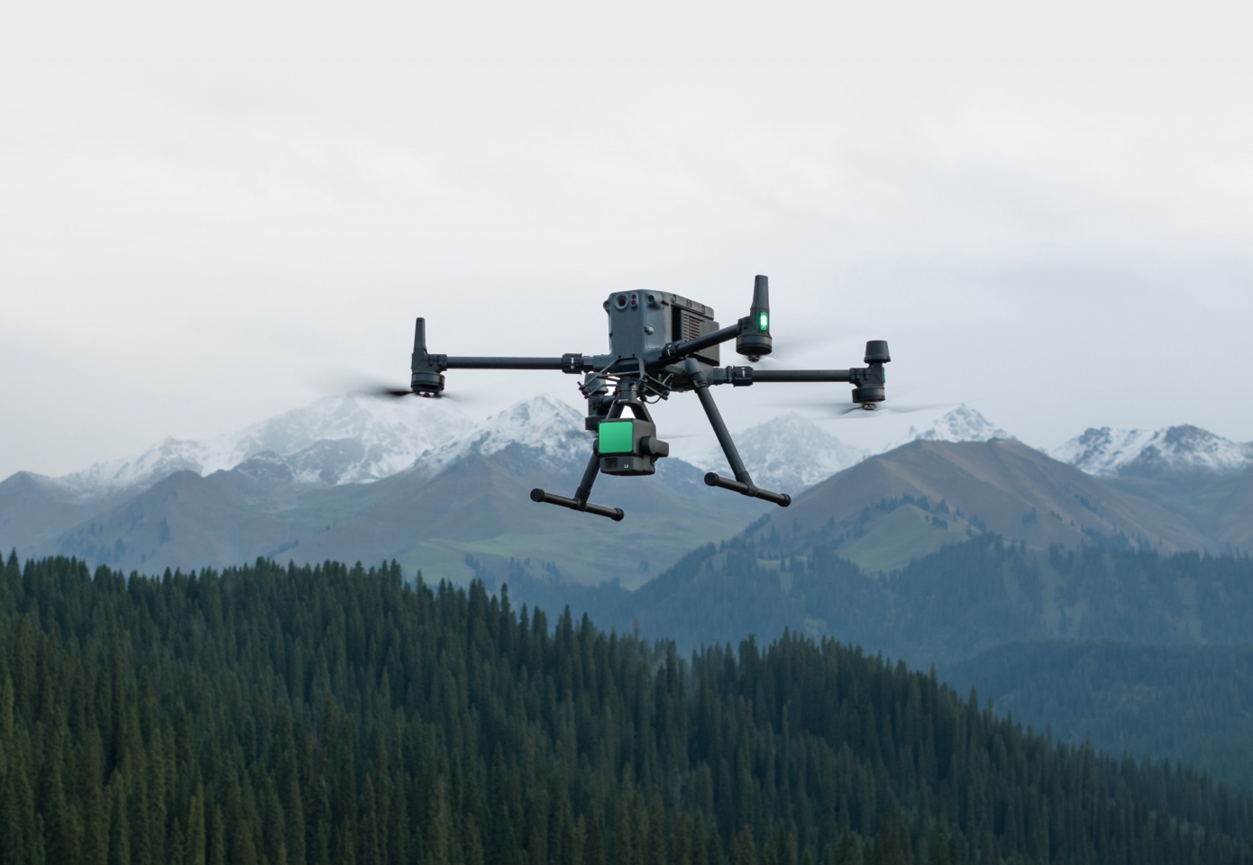
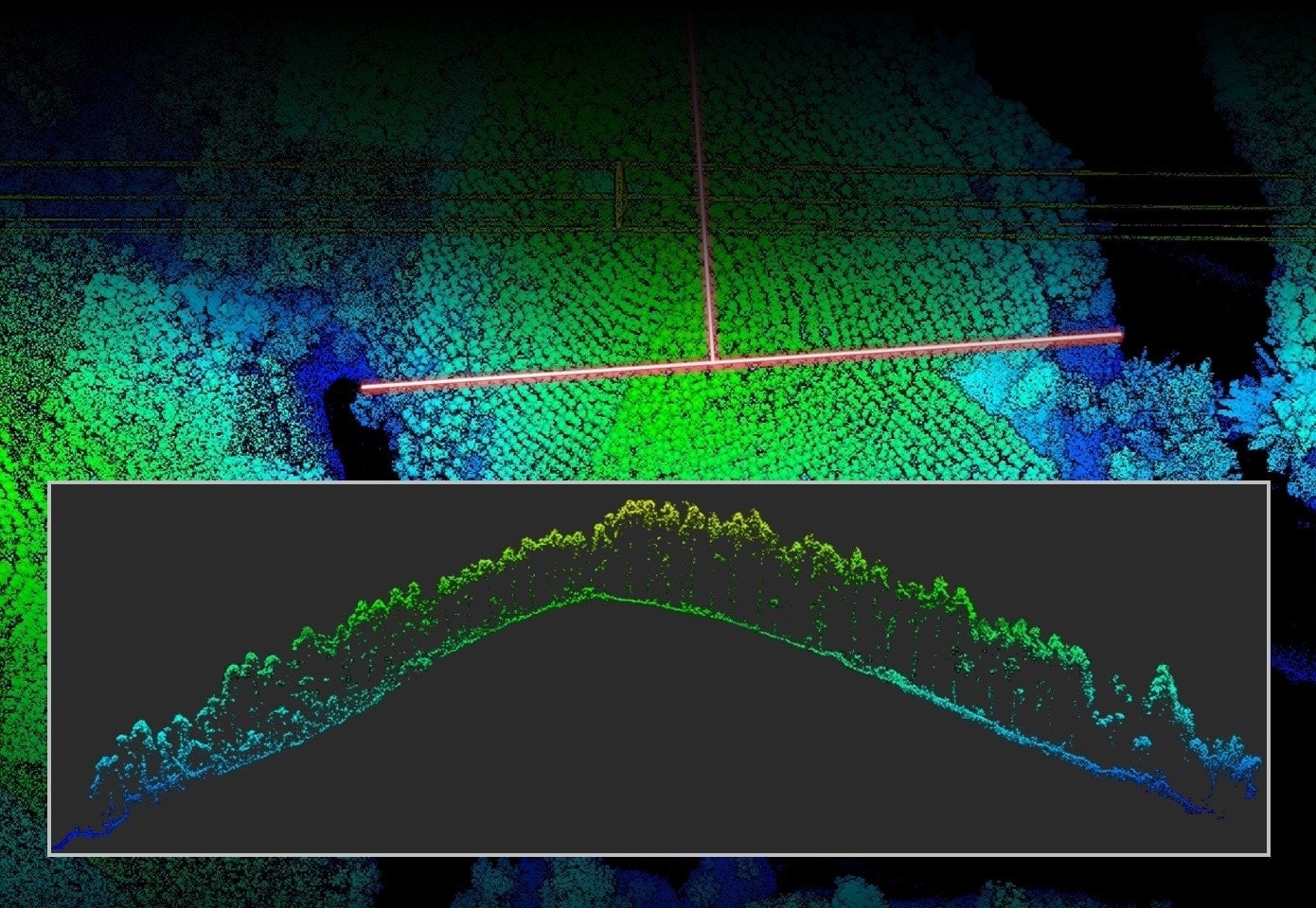
Upon activation, the device swiftly becomes operational, efficiently collecting point cloud data across a vast 2.5 square kilometer area in just a single flight. This immediate readiness and extensive coverage capability ensure that large-scale surveys can be conducted quickly and effectively, maximizing productivity and data collection efficiency.
One-Click Processing on DJI Terra
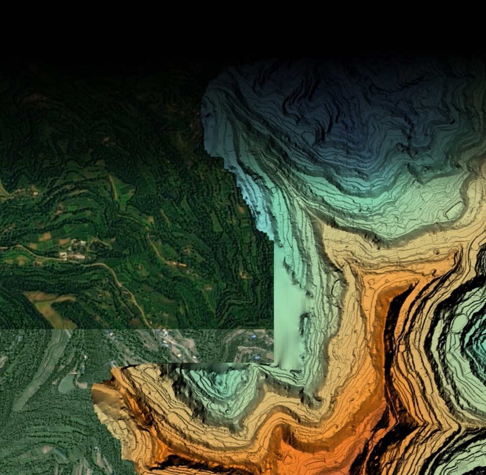
Effortlessly generate a Digital Elevation Model (DEM) and a 3D point cloud model in a universally accepted format with just a single click. Utilizing DJI Terra, the integrity and precision of the point cloud data can be thoroughly evaluated, ensuring high-quality outputs for detailed analysis and application across various projects.
30% Detection Range Increase
The L2 sensor achieves detection ranges up to 250 meters with 10% reflectivity under 100 klx lighting conditions, and up to 450 meters with 50% reflectivity in complete darkness (0 klx). Currently, it operates optimally at a standard flying altitude of 120 meters, balancing range and resolution for effective data capture.
Superior Penetration
At 100 meters, the L2 sensor’s spot size is just one-sixth that of the L1, enabling it to detect smaller objects with higher precision. This capability allows for the creation of more detailed models and Digital Elevation Models (DEMs), significantly enhancing the quality and utility of the data collected.
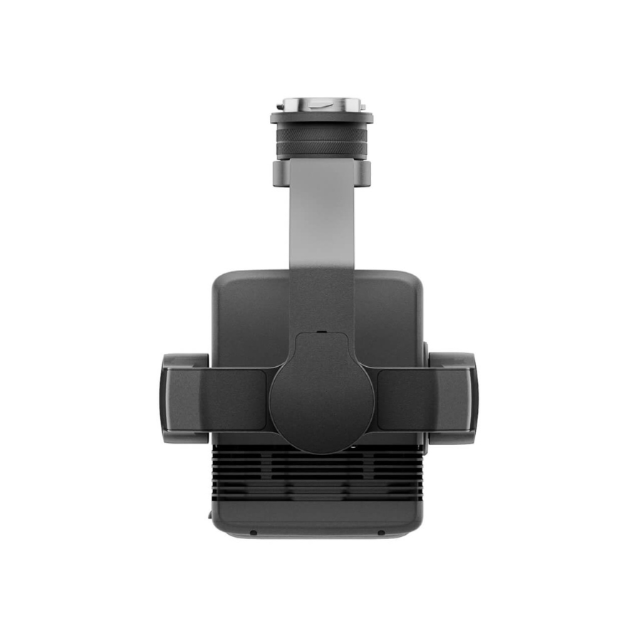
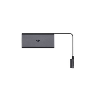
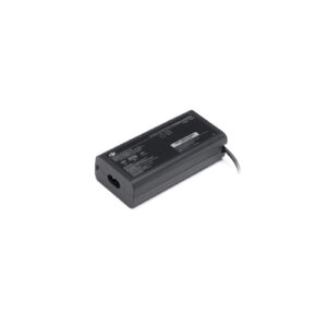
In The Box

Specifications of Zenmuse L2 Worry-Free Basic Combo
General
-
Product Name
-
Zenmuse L2 Worry-Free Basic Combo
-
Dimensions
-
155×128×176 mm (L×W×H)
-
Weight
-
905±5 g
-
Power
-
28 W (typical)
58 W (max.)
-
IP Rating
-
IP54
-
Supported Aircraft
-
Matrice 300 RTK (requires DJI RC Plus)
Matrice 350 RTK
-
Storage Temperature
-
-20° to 60° C (-4° to 140° F)
-
General Operating Temperature
-
-20° to 50° C (-4° to 122° F)
System Performance
-
Zenmuse L2 Worry-Free Basic Combo
-
Detection Range
-
450m @50% reflectivity, 0 klx
250m @10% reflectivity, 100 klxTypical data. Measured using a flat subject with a size larger than the laser beam diameter, perpendicular angle of incidence, and an atmospheric visibility of 23 km. In low-light environments, the laser beams can achieve the optimal detection range. If a laser beam hits more than one subject, the total laser transmitter power is split, and the achievable range is reduced. The maximum detection range is 500 m.
-
Point Cloud Rate
-
Single return: max. 240,000 pts/s
Multiple returns: max. 1,200,000 pts/s
-
System Accuracy
-
Horizontal: 5 cm @ 150 m
Vertical: 4 cm @ 150 mMeasured under the following conditions in a DJI laboratory environment: Zenmuse L2 mounted on a Matrice 350 RTK and powered up. Using DJI Pilot 2’s Area Route to plan the flight route (with Calibrate IMU enabled). Using repetitive scanning with the RTK in the FIX status. The relative altitude was set to 150 m, flight speed to 15 m/s, gimbal pitch to -90°, and each straight segment of the flight route was less than 1500 m. The field contained objects with obvious angular features, and used exposed hard ground check points that conformed to the diffuse reflection model. DJI Terra was used for post-processing with Optimize Point Cloud Accuracy enabled. Under the same conditions with Optimize Point Cloud Accuracy not enabled, the vertical accuracy is 4 cm and the horizontal accuracy is 8 cm.
-
Real-Time Point Cloud Coloring Coding
-
Reflectivity, Height, Distance, RGB
LiDAR
-
Zenmuse L2 Worry-Free Basic Combo
Ranging Accuracy (RMS 1σ)
-
2 cm @ 150 m
Measured in an environment of 25° C (77° F) with a subject of 80% reflectivity at a distance of 150 m. The actual environment may differ from the testing environment. The figure listed is for reference only.
-
Maximum Returns Supported
-
5
-
Scanning Modes
-
Non-repetitive scanning pattern, Repetitive scanning pattern
-
FOV
-
Repetitive scanning pattern: Horizontal 70°, Vertical 3°
Non-repetitive scanning pattern: Horizontal 70°, Vertical 75°
-
Minimum Detection Range
-
3 m
-
Laser Beam Divergence
-
Horizontal 0.2 mrad, Vertical 0.6 mrad
Measured at full width at half maximum (FWHM) conditions. 0.6 mrad signifies that for every 100m increase in distance, the diameter of the laser beam expands by 6 cm.
-
Laser Wavelength
-
905 nm
-
Laser Spot Size
-
Horizontal 4 cm, vertical 12 cm @ 100 m (FWHM)
-
Laser Pulse Emission Frequency
-
240 kHz
-
Laser Safety
-
Class 1 (IEC 60825-1:2014)
-
Accessible Emission Limit (AEL)
-
233.59 nJ
-
Reference Aperture
-
Effective Aperture: 23.85 mm (equivalent to circular)
-
Max Laser Pulse Emission Power Within 5 Nanoseconds
-
46.718 W
Inertial Navigation System
Zenmuse L2 Worry-Free Basic Combo
-
IMU Update Frequency
-
200 Hz
-
Accelerometer Range
-
±6 g
-
Angular Velocity Meter Range
-
±300 dps
-
Yaw Accuracy (RMS 1σ)
-
Real-time: 0.2°, Post-processing: 0.05°
Measured under the following conditions in a DJI laboratory environment: Zenmuse L2 mounted on a Matrice 350 RTK and powered up. Using DJI Pilot 2’s Area Route to plan the flight route (with Calibrate IMU enabled). RTK in the FIX status. The relative altitude was set to 150 m, flight speed to 15 m/s, gimbal pitch to -90°, and each straight segment of the flight route was less than 1500 m.
-
Pitch/Roll Accuracy (RMS 1σ)
-
Real-time: 0.05°, Post-processing: 0.025°
Measured under the following conditions in a DJI laboratory environment: Zenmuse L2 mounted on a Matrice 350 RTK and powered up. Using DJI Pilot 2’s Area Route to plan the flight route (with Calibrate IMU enabled). RTK in the FIX status. The relative altitude was set to 150 m, flight speed to 15 m/s, gimbal pitch to -90°, and each straight segment of the flight route was less than 1500 m.
-
Horizontal Positioning Accuracy
-
RTK FIX: 1 cm + 1 ppm
-
Vertical Positioning Accuracy
-
RTK FIX: 1.5 cm + 1 ppm
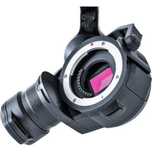
RGB Mapping Camera
-
Sensor
-
4/3 CMOS, Effective Pixels: 20 MP
-
Lens
-
FOV: 84°
Format Equivalent: 24 mm
Aperture: f/2.8-f/11
Focus Points: 1 m to ∞ (with autofocus)
-
Shutter Speed
-
Mechanical Shutter: 2-1/2000 s
Electronic Shutter: 2-1/8000 s
-
Shutter Count
-
200000
-
Photo Size
-
5280×3956 (4:3)
-
Still Photography Modes
-
Single shot: 20 MP
Timed: 20 MP
JPEG Timed Interval: 0.7/1/2/3/5/7/10/15/20/30/60 s
RAW/JPEG + RAW Timed Interval: 2/3/5/7/10/15/20/30/60 s
-
Video Codec and Resolution
-
H.264
4K: 3840×2160@30fps
FHD: 1920×1080 @30fps
-
ISO
-
Video: 100-6400
Photo: 100-6400
-
Video Bitrate
-
4K: 85Mbps
FHD: 30 Mbps
-
Supported File System
-
exFAT
-
Photo Format
-
JPEG/DNG (RAW)
-
Video Format
-
MP4 (MPEG-4 AVC/H.264)
Gimbal
-
Stabilization System
-
3-axis (tilt, roll, pan)
-
Angular Vibration Range
-
0.01°
-
Mounting
-
Detachable DJI SKYPORT
-
Mechanical Range
-
Tilt: -143° to +43°
Pan: ±105°* Structural limit, not controllable range.
-
Controllable Range
-
Tilt: -120° to +30°
Pan: ±90°
-
Operation Mode
-
Follow/Free/Re-center
Data Storage
Zenmuse L2 Worry-Free Basic Combo
-
Raw Data Storage
-
Photo/IMU/Point cloud/GNSS/Calibration files
-
Point Cloud Data Storage
-
Real-time modeling data storage
-
Supported microSD Cards
-
microSD: Sequential writing speed 50 MB/s or above and UHS-I Speed Grade 3 rating or above; Max capacity: 256 GB. Use the recommended microSD cards.
-
Recommended microSD Cards
-
Lexar 1066x 64GB U3 A2 V30 microSDXC
Lexar 1066x 128GB U3 A2 V30 microSDXC
Kingston Canvas Go! Plus 128GB U3 A2 V30 microSDXC
Lexar 1066x 256GB U3 A2 V30 microSDXC
Read More
Zenmuse L2 Worry-Free Basic Combo
The Zenmuse L2 LiDAR Worry-Free Basic Combo represents a significant leap forward in aerial surveying and mapping technology. Available on xboom.in, this advanced LiDAR camera system is engineered for professionals who demand precision, efficiency, and versatility in their projects. Whether it’s for construction, agriculture, environmental monitoring, or urban planning, the Zenmuse L2 LiDAR is designed to deliver unparalleled data accuracy, transforming how we understand and interact with the world around us.
Revolutionizing Aerial Data Collection with Zenmuse L2 LiDAR
The Zenmuse L2 LiDAR system stands at the forefront of aerial surveying technology, offering an integrated solution that combines a high-precision LiDAR sensor with a full-frame RGB camera and a high-accuracy IMU. This combination allows for the capture of detailed 3D point clouds alongside high-resolution imagery, providing a comprehensive overview of surveyed areas with unmatched clarity and depth.
Why Choose Zenmuse L2 LiDAR?
Opting for the Zenmuse L2 LiDAR means choosing a tool that elevates your aerial data collection capabilities. The system’s advanced LiDAR technology penetrates vegetation and other obstructions to capture the bare earth structure beneath, making it invaluable for topographic mapping, forestry management, and geological surveys. With its high-accuracy IMU and integration with DJI drones, the Zenmuse L2 ensures that data collection is not only precise but also efficient and user-friendly.
Precision Engineering for Unmatched Accuracy
The heart of the Zenmuse L2 LiDAR’s capabilities lies in its precision-engineered LiDAR sensor, which emits thousands of laser pulses per second to accurately measure distances and generate detailed 3D models of the environment. This level of detail supports a wide range of applications, from creating digital elevation models to conducting volumetric measurements, ensuring that professionals have the data they need to make informed decisions.
Enhanced Operational Efficiency
The Zenmuse L2 LiDAR Worry-Free Basic Combo is designed for operational efficiency, enabling quick deployment and data capture over large areas. This efficiency is critical for projects with tight deadlines or those covering extensive geographic regions, allowing for faster turnaround times and significant cost savings.
Seamless Integration and Workflow
Integrating the Zenmuse L2 LiDAR into your workflow is seamless, thanks to its compatibility with DJI’s ecosystem and various GIS software solutions. The system’s ease of use and flexible data output formats facilitate smooth data processing and analysis, ensuring that the transition from field data collection to actionable insights is straightforward and efficient.
Empowering Industries with LiDAR Technology
The Zenmuse L2 LiDAR is a game-changer for multiple industries, offering solutions that were previously unattainable. For construction professionals, it provides precise site surveys and progress monitoring. In agriculture, it enables detailed terrain analysis for precision farming. Environmental scientists benefit from its ability to monitor changes in natural landscapes, while urban planners can use it to model cityscapes in 3D, enhancing planning and development strategies.
Why xboom.in is Your Premier Destination
Choosing xboom.in for your Zenmuse L2 LiDAR purchase not only guarantees a competitive price but also ensures access to a trusted source of DJI products. xboom.in is committed to providing customers with authentic, high-quality solutions, backed by expert advice and comprehensive support. Whether you’re an experienced professional or new to LiDAR technology, xboom.in is dedicated to helping you achieve your project goals with the Zenmuse L2.
Investment in the Future of Aerial Surveying
Investing in the Zenmuse L2 LiDAR Worry-Free Basic Combo is an investment in the future of aerial surveying and mapping. As the demand for more accurate and efficient data collection methods continues to grow, the Zenmuse L2 stands ready to meet these challenges, offering users a tool that remains at the cutting edge of technology.
Conclusion: A New Paradigm with Zenmuse L2 LiDAR
The Zenmuse L2 LiDAR Worry-Free Basic Combo, available on xboom.in, marks a new paradigm in aerial surveying and mapping. With its unparalleled precision, efficiency, and versatility, it offers a comprehensive solution for professionals across various industries. Whether you’re mapping vast landscapes, surveying construction sites, or analyzing agricultural land, the Zenmuse L2 LiDAR is the key to unlocking new levels of understanding and insight.
Embark on a journey of discovery with the Zenmuse L2 LiDAR. Visit xboom.in today and explore how this advanced LiDAR camera can transform your aerial surveying and mapping projects.
FAQ’s on Zenmuse L2 Worry-Free Basic Combo
FAQ's
What is the Zenmuse L2, and how does it differ from the Zenmuse L1? The Zenmuse L2 is presumed to be an advanced lidar camera system, offering enhanced detection capabilities and precision in generating detailed models and Digital Elevation Models (DEMs) compared to its predecessor, the Zenmuse L1, thanks to its smaller spot size at distances up to 100 meters.
What applications are best suited for the Zenmuse L2? Assuming improved capabilities, the Zenmuse L2 would be ideal for surveying, construction monitoring, precision agriculture, environmental research, and any application requiring detailed 3D mapping and object detection.
Can the Zenmuse L2 operate in low-light conditions? While specific capabilities would depend on official product specifications, lidar systems like the hypothetical Zenmuse L2 typically do not rely on ambient light, making them suitable for night-time operations or low-light conditions.
What is the detection range of the Zenmuse L2? Based on the premise, the Zenmuse L2 can achieve detection ranges up to 250 meters with 10% reflectivity and up to 450 meters with 50% reflectivity, offering flexible operational capabilities across various environments.
What is the typical operating altitude of the Zenmuse L2? The optimal operating altitude for the Zenmuse L2 is around 120 meters, balancing the need for range and the resolution of data captured for effective surveying and modeling.
How does the Zenmuse L2 enhance model and DEM creation? Thanks to its smaller spot size at 100 meters, the Zenmuse L2 is capable of detecting smaller objects and producing models with greater detail, resulting in more accurate Digital Elevation Models and 3D reconstructions.
Is the Zenmuse L2 compatible with all DJI drones? Compatibility would likely be focused on higher-end DJI platforms such as the Matrice series, designed to support advanced payloads for professional applications. Specific compatibility details would depend on official DJI product information.
The full sheet
Related products
-
·XBM·00
Out of stock
-
·XBM·01
 Fly More Kit for Mavic 2Original price was: ₹49,152.₹37,288Current price is: ₹37,288. (Excl. GST)Add to cart
 -
·XBM·02
 Battery Charger - Mavic 2 Pro & DJI Mavic 2Original price was: ₹8,474.₹5,592Current price is: ₹5,592. (Excl. GST)Add to cart
 -
·XBM·03
 360° Propeller Guard - Mini 2Original price was: ₹4,745.₹4,067Current price is: ₹4,067. (Excl. GST)Add to cart

There are no reviews yet.