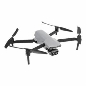
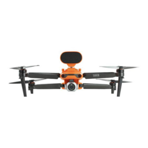
The Autel Enterprise Drones deliver powerful solutions for professional drone applications across various industries. They are designed for precision and performance, these drones feature advanced imaging systems, long flight times, and robust obstacle avoidance. Equipped with thermal cameras, RTK modules, and AI-powered tracking, Autel drones support high-accuracy missions in fields like public safety, infrastructure inspection, agriculture, and surveying. Models like the Autel EVO II Dual 640T RTK offer 8K visual and thermal imaging, making them ideal for search and rescue, utility inspection, and disaster response. The drones can operate in tough weather conditions, deliver centimeter-level accuracy, and integrate seamlessly with mission planning software.
These drones also support encrypted data transmission, ensuring secure operations for defense and critical infrastructure projects. With the smart flight modes, modular payloads, and reliable customer support, Autel is becoming a trusted name in enterprise the UAV solutions. Explore these drones at Xboom and upgrade your workflow with intelligent flight technology.
-
·XBM·00
 Autel EVO Lite 640T Enterprise Standard Bundle (6-inch Smart Controller)₹542,857 (Excl. GST)Add to cart
 -
·AIR·01
-
·AIR·02
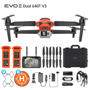
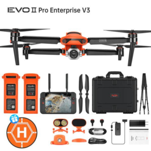
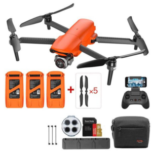
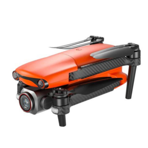
 Autel Robotics EVO II Dual 640T V3 Thermal Drone Rugged BundleOriginal price was: ₹876,190.₹714,286Current price is: ₹714,286. (Excl. GST)Add to cart
 -
·AIR·03
Featured
 Autel EVO Nano+ Drone Premium BundleOriginal price was: ₹209,524.₹125,714Current price is: ₹125,714. (Excl. GST)Add to cart
 -
·AIR·04
 Autel EVO Lite+ Drone Premium BundleOriginal price was: ₹237,143.₹190,475Current price is: ₹190,475. (Excl. GST)Add to cart
FAQ’s on Autel Enterprise Series
What industries use Autel Enterprise Drones?
Industries like public safety, agriculture, infrastructure, and construction rely heavily on these drones for efficient data collection and monitoring.
How long can these drones fly on a single charge?
Most models offer up to 40 minutes of flight time. This allows users to complete complex missions without frequent interruptions.
Do these drones support RTK for precise mapping?
Yes. RTK modules ensure centimeter-level accuracy, making them perfect for surveying, land mapping, and construction planning.
Can the drone capture both thermal and visual data simultaneously?
Definitely. Dual-camera systems deliver real-time thermal and 8K visual imagery, improving performance in rescue and inspection tasks.
Are these drones suitable for rough environments?
Absolutely. With wind resistance and weather-rated durability, they perform well even in challenging field conditions.
What flight planning tools work with these drones?
You can use Autel Explorer, Autel Mapper, and several third-party apps for smooth, automated mission planning and data syncing.
Is the data transmission from Autel drones secure?
AES-256 encryption protects all flight and imaging data, ensuring complete security during critical operations.
Can I swap payloads or cameras on Autel drones?
Yes. Modular design allows quick swapping of payloads, helping teams adapt to different mission needs instantly.
