
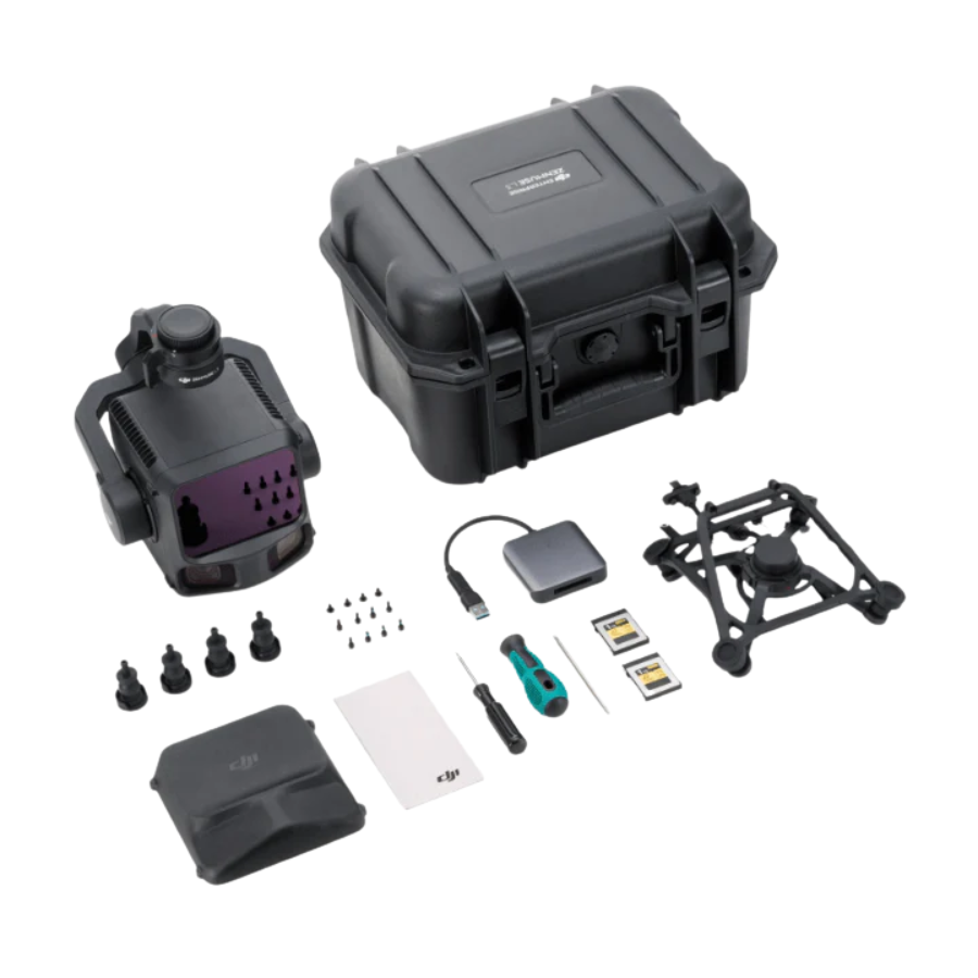

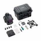


Description
Product Specifications
Feature |
Details |
|---|---|
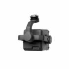
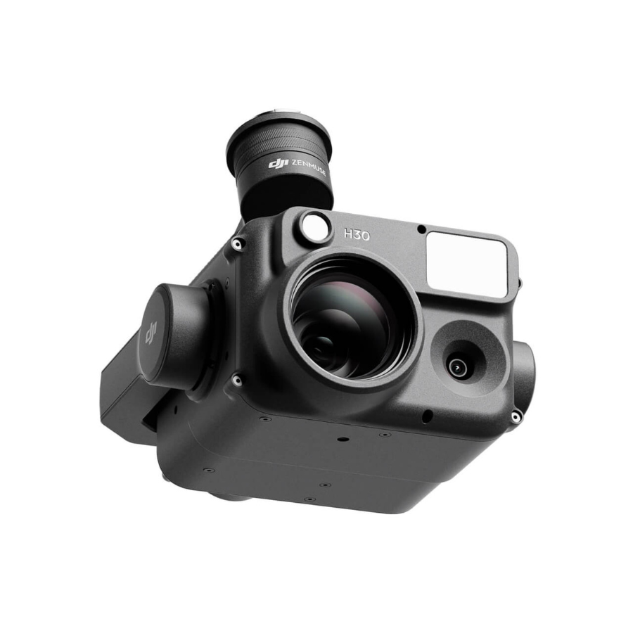
| Model | DJI Zenmuse L3 |
| Type | Aerial LiDAR + RGB Mapping System |
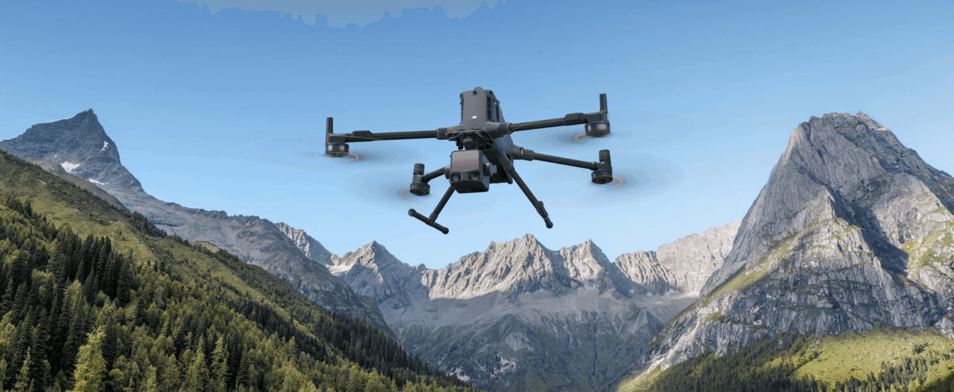
| Compatible Drones | DJI Matrice 350 RTK, DJI Matrice 300 RTK |
| LiDAR System | Integrated Livox LiDAR module |
| Detection Range | Up to 450 m @ reflectivity > 80% |
| Accuracy | ±5 cm vertical / ±10 cm horizontal |
| Scanning Rate | Up to 480,000 pts/sec |
| Field of View (FOV) | 70° (Horizontal) × 77° (Vertical) |
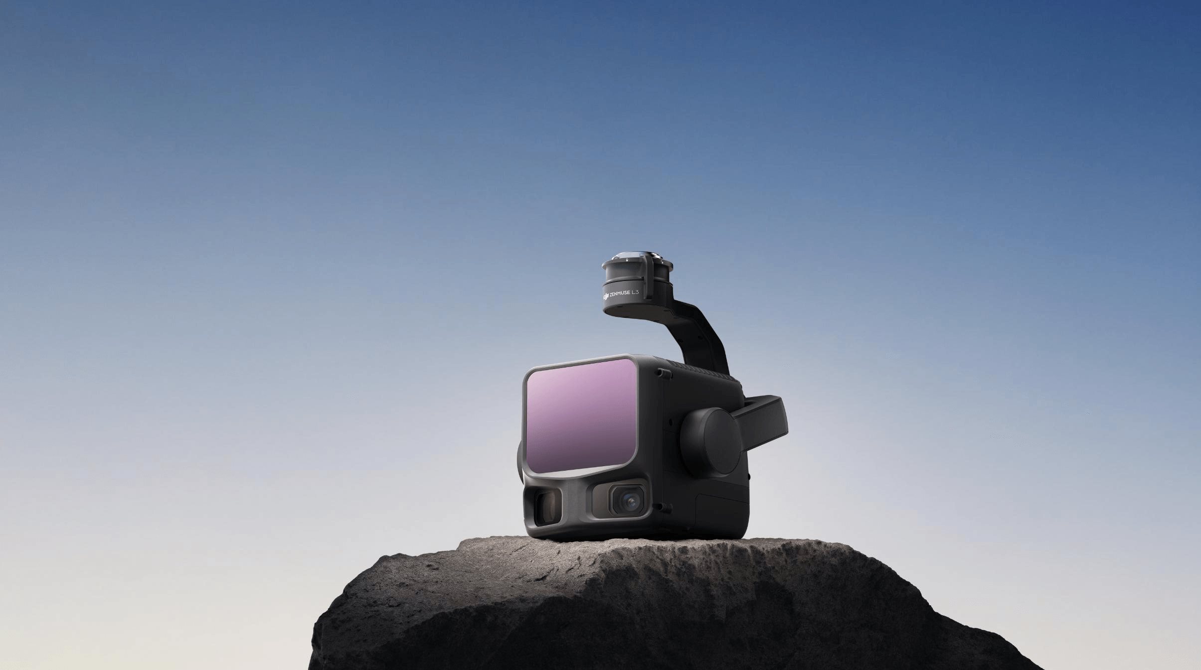
| RGB Camera Sensor | 4/3-inch CMOS, 100 MP resolution |
| Lens | Mechanical shutter, fixed-focus |
| IMU | High-precision, temperature-compensated |
| GNSS / RTK Support | Yes |
| Point Cloud Colorization | Real-time RGB mapping |
| Supported Software | DJI Terra, DJI Pilot 2 |
| Operating Temperature | -20 °C to +50 °C |
| Weight | Approx. 905 g |
| Power Consumption | 30 W (avg) |
| Application Fields | Surveying, Construction, Powerline Inspection, Forestry, Urban Planning |
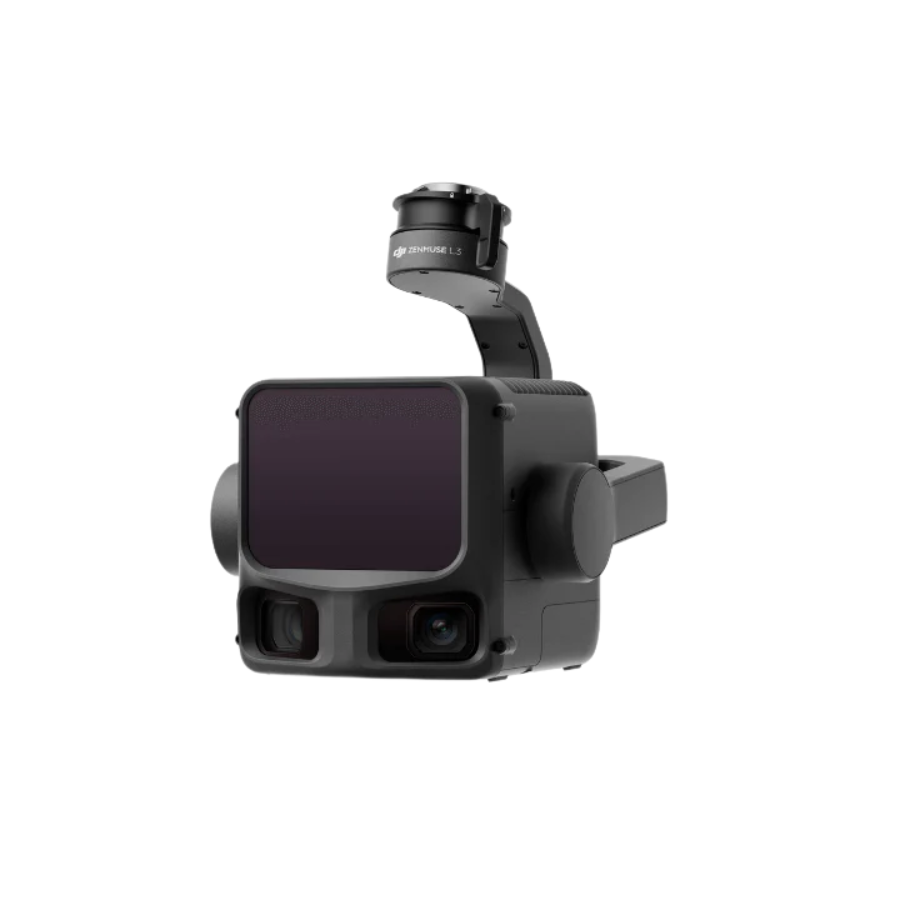
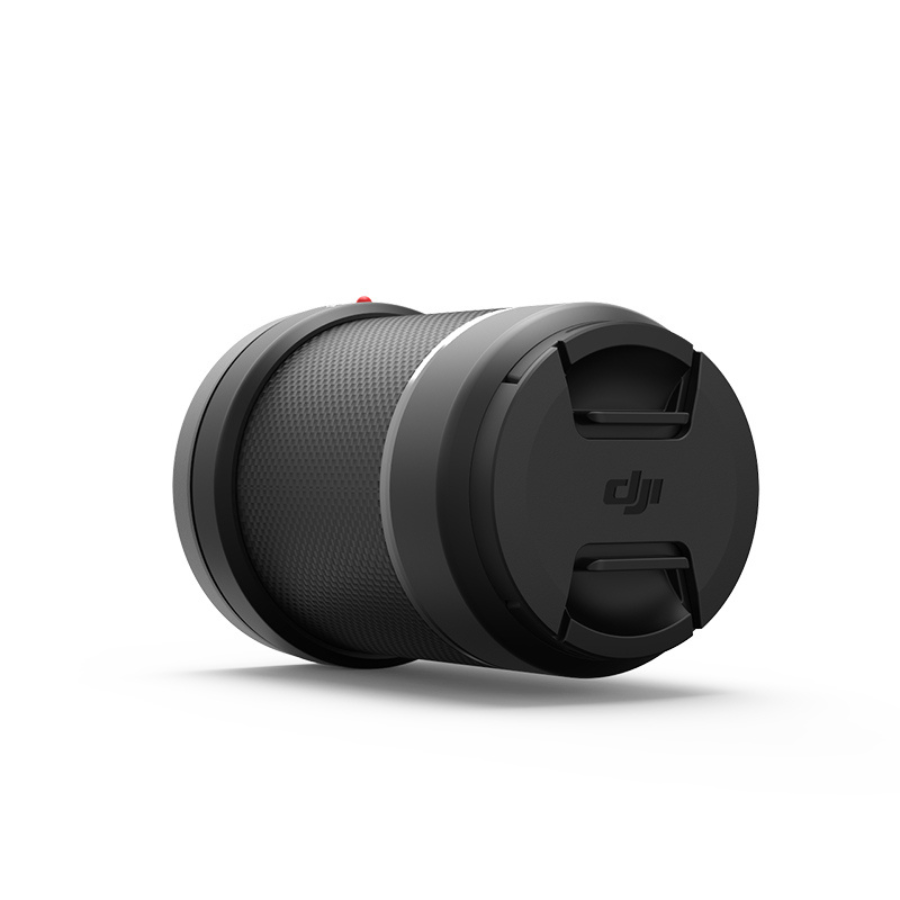
DJI Launches Zenmuse L3 — Its First Long-Range, High-Accuracy Aerial LiDAR System
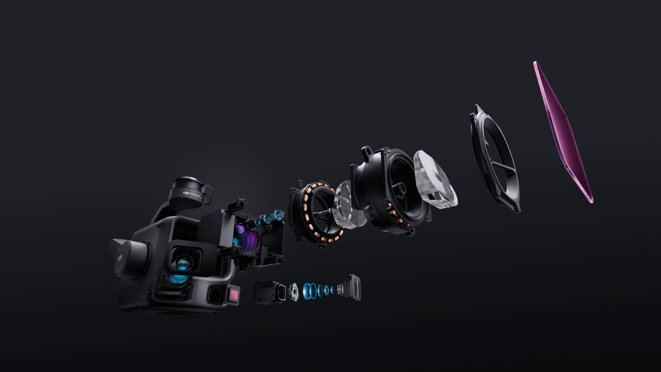
Zenmuse L3, a groundbreaking aerial LiDAR system that pushes the boundaries of range, precision, and efficiency. Designed for demanding geospatial applications, the Zenmuse L3 combines a 1535 nm long-range LiDAR sensor with dual 100MP RGB mapping cameras, delivering unmatched accuracy and wider visibility for professional mapping and surveying missions.
With a maximum detection range of 950 m, even on low-reflectivity surfaces (10%), and advanced penetration capabilities, the Zenmuse L3 redefines what’s possible in aerial data collection. Integrated with DJI’s D-RTK 3 Multifunctional Station and DJI Enterprise software suite, it offers a truly end-to-end geospatial workflow — from flight planning and data capture to analysis and deliverables generation.
High-Precision 1535 nm LiDAR for Unmatched Accuracy
The Zenmuse L3’s custom-built LiDAR system achieves 5 mm ranging repeatability at 150 m and a detection range of 950 m at 100 kHz pulse rate, even under bright ambient light. Operators can adjust the pulse rate to balance power output and accuracy across different environments. Vertical accuracy is equally impressive — 3 cm at 120 m, 5 cm at 300 m, and 10 cm at 500 m, supporting mapping scales from 1:500 to 1:2000.
Thanks to a 0.25 mrad laser beam divergence, the Zenmuse L3 can detect fine details like power lines and thin branches, ensuring reliable data in dense vegetation and complex terrains.
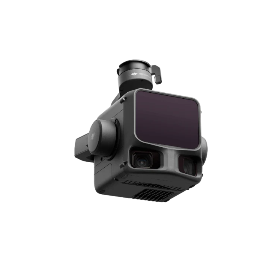
Dual 100MP RGB Cameras for Broader Coverage
Equipped with dual 100MP 4/3 CMOS sensors and mechanical shutters, the Zenmuse L3 captures high-fidelity imagery with a ground sample distance (GSD) of 3 cm at 300 m altitude. Its 107° horizontal field of view enables each shot to cover a larger area, increasing efficiency while maintaining precision for photogrammetry and mapping workflows.
2 Million pts/s Pulse Rate with 16 Returns
The Zenmuse L3 supports a maximum pulse rate of 2 million points per second and up to 16 returns, ensuring superior point cloud density and accuracy. Its new Star-Shaped scanning mode enhances coverage uniformity and improves data integrity in forested or urban areas, capturing more ground points for accurate terrain reconstruction.

High Efficiency — Cover Up to 100 km² per Day
When paired with the DJI Matrice 400, the Zenmuse L3 delivers outstanding efficiency. A single flight at 300 m altitude can map up to 10 km², while multiple missions can cover up to 100 km² per day. Both LiDAR and RGB data are captured simultaneously, generating multiple outputs — including Digital Orthophoto Maps (DOMs), Digital Elevation Models (DEMs), and more — even with a reduced 20% LiDAR side overlap.
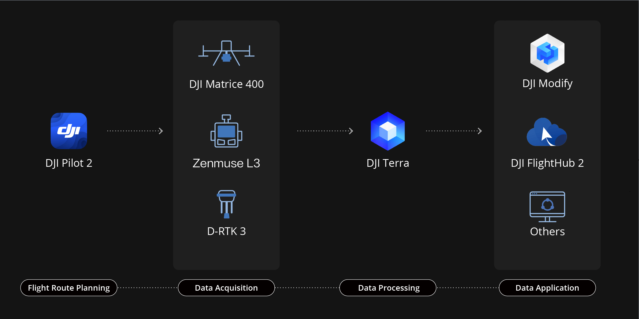
Seamless DJI End-to-End Integration
Zenmuse L3 integrates effortlessly within DJI’s enterprise ecosystem, working with DJI Pilot 2, DJI Terra, DJI Modify, and DJI FlightHub 2 for a complete workflow — from data acquisition to post-processing and mapping outputs. This unified platform makes aerial surveying faster, easier, and more precise than ever before.
Transforming the Future of Geospatial Mapping
The launch of the DJI Zenmuse L3 marks a new milestone in long-range, high-accuracy LiDAR technology. By combining extended range, superior precision, and dual-camera versatility, it empowers professionals across industries — from topographic surveys and emergency response to energy inspections, forestry, and heritage conservation.
With the Zenmuse L3, DJI continues to elevate geospatial innovation — enabling creators, engineers, and surveyors to see more, map faster, and measure with confidence.


There are no reviews yet.