search
0
inspection of transmission lines using drones banner

Revolutionize Your Industry and Streamline Operations with Cutting-Edge Technology

Innovative Solutions for Optimal Power Management

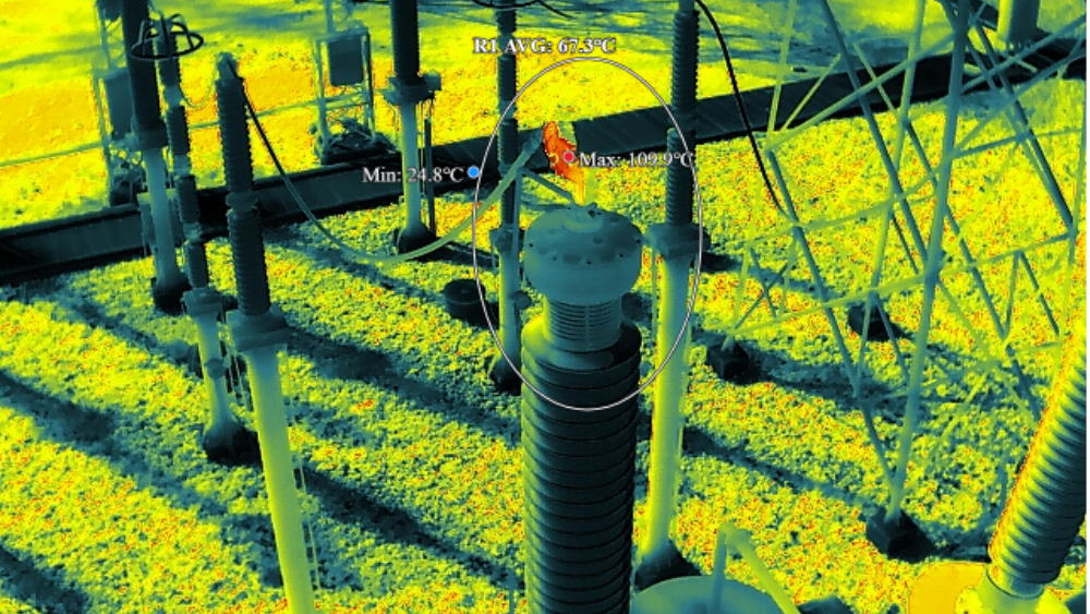
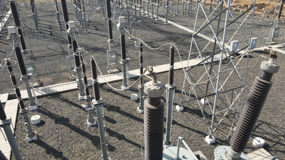
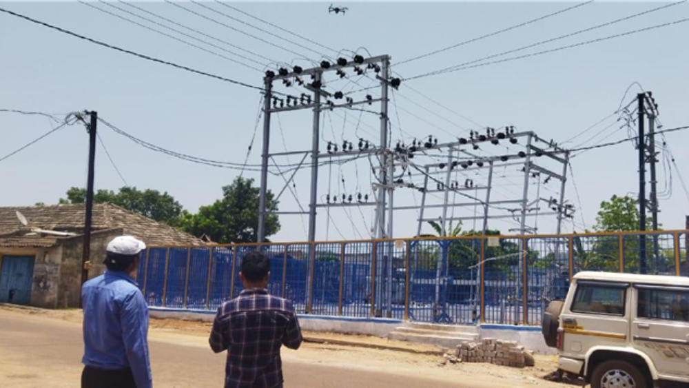
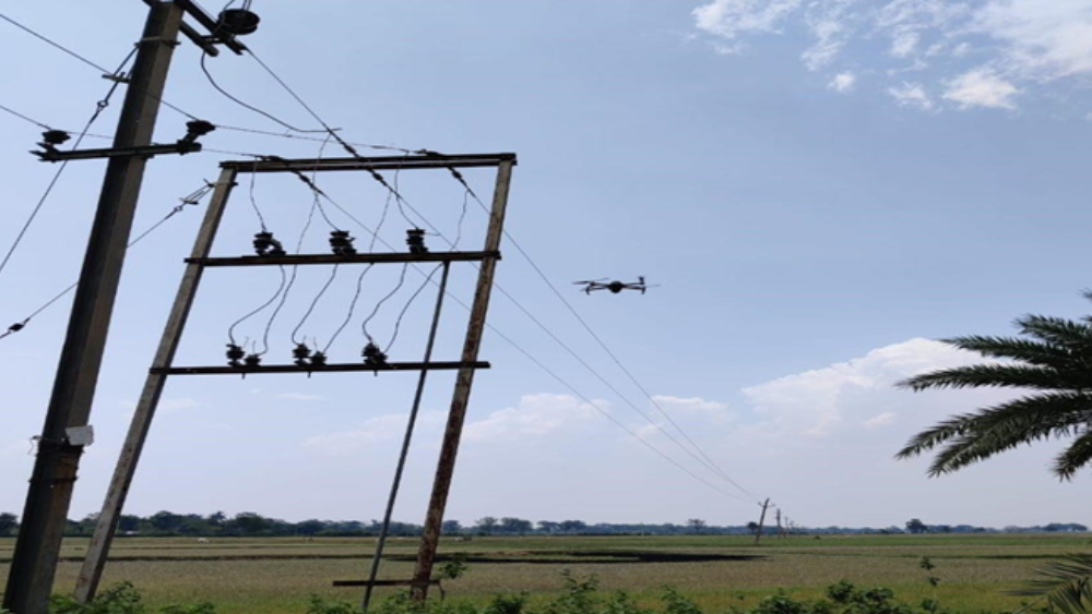
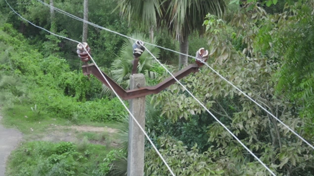
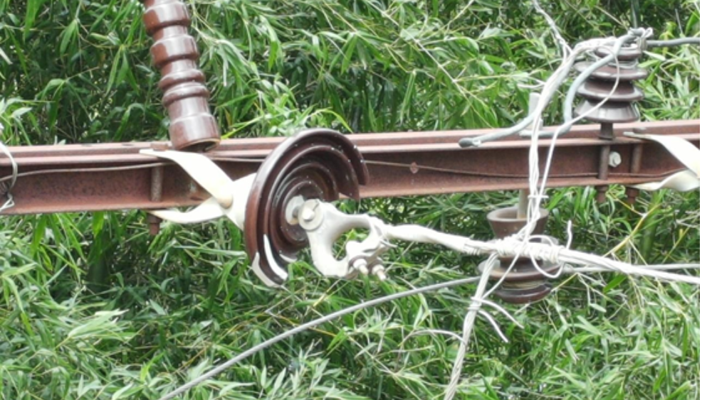
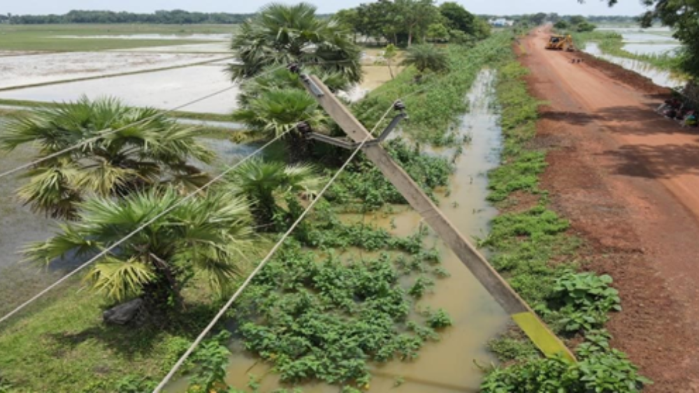
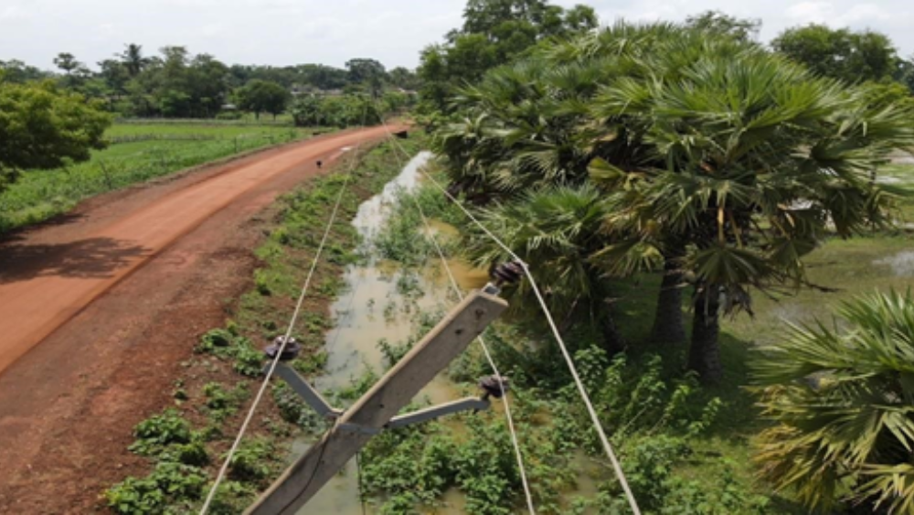
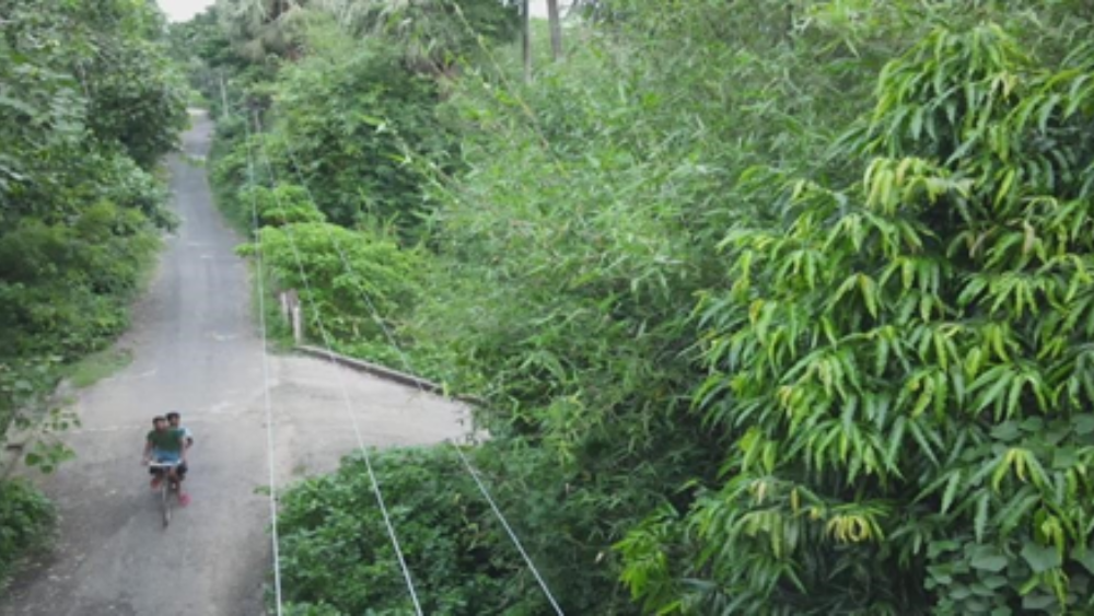
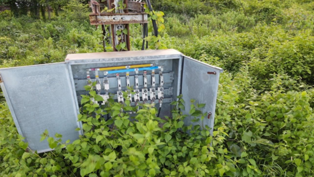
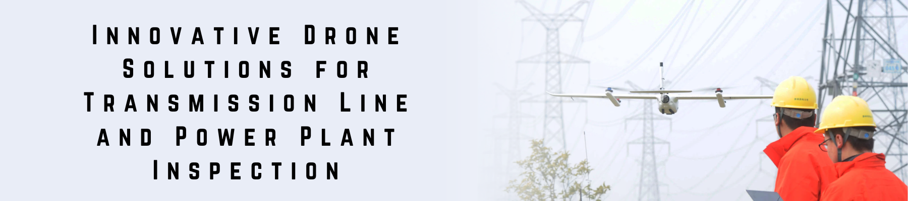
Xboom, a leading provider of drone services, is proud to offer a cutting-edge solution for the inspection and maintenance of transmission lines and power plants. With our state-of-the-art drone technology, we can quickly and efficiently inspect these critical assets and gather valuable data that can be used to identify potential issues such as corrosion, damage, or equipment failure. This information is then used by power companies and utility providers to make informed decisions about maintenance, safety, and production. With XBoom’s drone service, these organizations can reduce their reliance on traditional inspection methods and minimize the risk of safety incidents and unplanned outages. By utilizing our expertise and advanced technology, we are helping to ensure that the energy infrastructure remains reliable and efficient for years to come

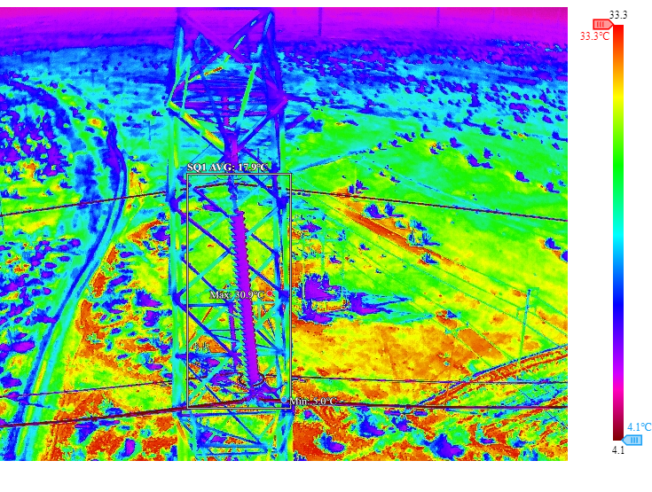
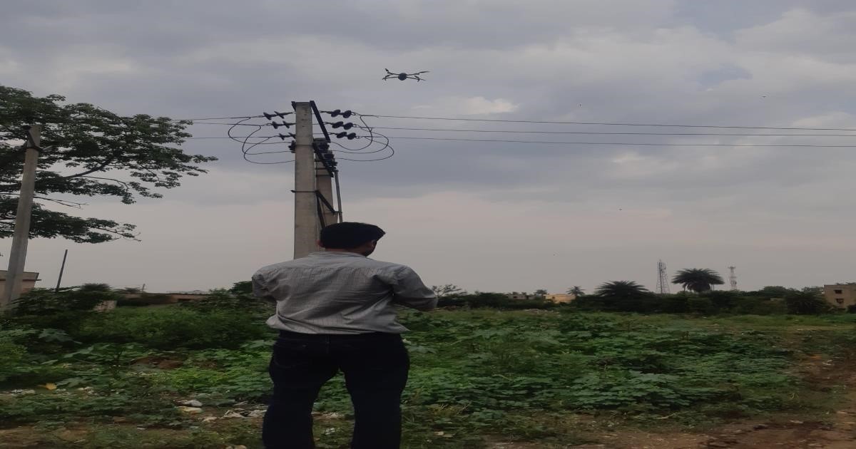
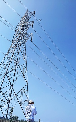
Powerline inspection using drone technology is a modern, efficient method to monitor and maintain electrical transmission and distribution lines. It leverages unmanned aerial vehicles (UAVs) equipped with high-tech sensors to collect detailed visual and thermal data—without interrupting power supply or putting human workers at risk.

Role of Thermal Images in Powerline Inspection

Thermal imaging plays a critical role in identifying issues that are otherwise invisible to the naked eye. Here’s how it helps:


Hotspot Detection
Detect overheating components such as transformers, connectors, or insulators—often early indicators of faults, overloads, or potential failures.


Preventive Maintenance
By identifying abnormal temperature patterns early, thermal imaging helps prevent power outages and extends the operational life of equipment.


Non-Contact, Safe Scanning
Inspections can be carried out from a safe distance without direct contact, significantly enhancing crew safety.


Nighttime Capability
Thermal cameras function effectively in low-light or night conditions, offering flexibility for around-the-clock inspections.

Drone Inspections for Distribution and Transmission Lines

Visual Inspections

Drones equipped with high-resolution cameras capture real-time images and videos of power lines, towers, and surrounding infrastructure. They can identify physical damage, corrosion, vegetation encroachment, and other potential hazards.

Thermal Imaging

Drones can be fitted with thermal cameras to detect hotspots in electrical components, which can indicate faults or inefficiencies.This proactive approach helps prevent outages and extends equipment life.

In power line inspection, thermal imaging by drone involves using drones equipped with infrared (thermal) cameras to detect abnormal heat patterns on electrical components such as conductors, insulators, transformers, and connectors.

An RGB image in power line inspection is a normal color photo taken by a drone to check the physical condition of power lines and equipment. It shows visible issues like damage, rust, broken parts, or nearby trees, helping inspectors find problems without climbing the structures.

Efficient Drone Inspections for 11kV/33kV  Distribution Lines – No Downtime Needed”
“Identify Faults, Wear & Overgrowth from the Air Safely

Drones are used to inspect 11kV and 33kV power distribution lines by flying along the lines and capturing images or videos of the poles, wires, and equipment.

PIN INSULATER TILTED

PIN INSULATER TILTED

DISK BROKEN

POLE TILTED

WIRE SAGGING

TREE TOUCHING

VEGETATION


Maximizing the Accuracy of Drone Survey Data with XBoom’s Advanced Techniques

At XBoom, we are committed to delivering highly accurate, reliable drone survey data by combining cutting-edge technology, skilled professionals, and rigorous quality control.


1. Equipment and Technology

We utilize the latest drone hardware and advanced software solutions to ensure top-tier data quality:

  • High-resolution cameras and sensors: Capture detailed imagery and measurements with precision.
  • Post-processing software: We employ tools like Pix4D, DJI Terra, and others to generate accurate 3D models and maps.

2. Pilot Expertise and Flight Planning

Our certified and experienced drone pilots play a crucial role in data accuracy:

  • Expert pilots: Skilled in various terrains and conditions to execute safe and effective flights.
  • Optimized flight planning: Tailored to maximize coverage and data integrity for each project.

3. Quality Control

Every project undergoes rigorous validation to maintain the highest standards:

  • Ground Control Points (GCPs) and checkpoints: Used to verify and calibrate data for absolute accuracy.
  • In-depth quality assurance: Ensures consistency and eliminates errors throughout the data pipeline.

4. Standards and Commitment

At XBoom, we are dedicated to exceeding industry benchmarks:

  • We maintain strict adherence to surveying and mapping standards.
  • Our commitment is to deliver high-precision, actionable data that empowers your projects.

Looking for assistance ?
Schedule a meeting with our team.

Close Menu
Call Us : 07965209652

Product Enquiry

Hit enter to search or ESC to close