
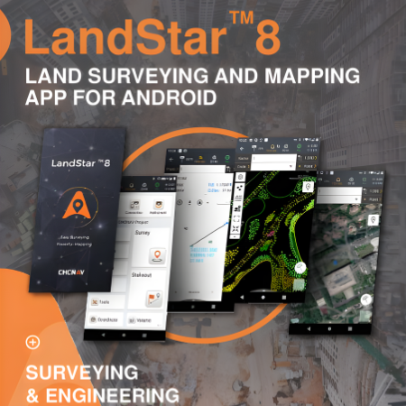
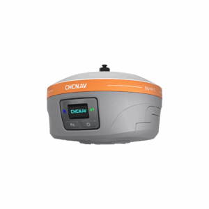
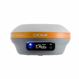
CHCNAV LandStar Land Surveying and Mapping App
-
Field-proven land surveying & mapping app for Android and CHCNAV controllers.
-
Supports high-precision construction surveying, control point measurement, GIS data collection, and surface/line stakeouts.
-
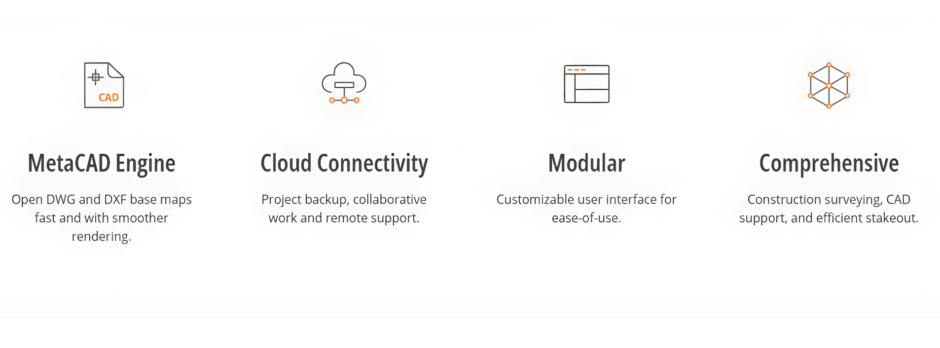
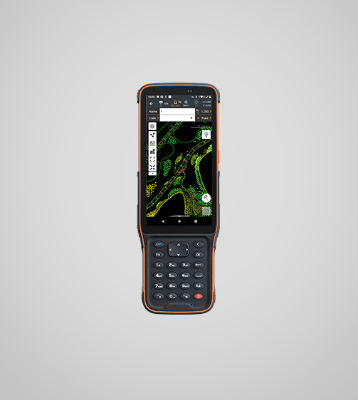
Built-in MetaCAD engine for fast, smooth rendering of large CAD files (DWG/DXF).
-
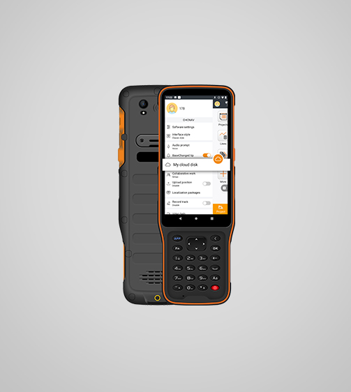
Cloud connectivity for project backup, collaboration, and remote support.
-
Modular, customizable UI to simplify the workflow for different users.
-
Import/export support for standard formats: SHP, DWG, DXF, KML, GPX, TIFF, JPG, MBTiles.
-
Supports over 35 languages.
- Trusted dealerDirect manufacturer partnership
- Pan-India deliveryInsured shipping, all states
- Post-sale supportTraining + service included
What makes it work
CHCNAV LandStar Land Surveying and Mapping App
| Category | Specification |
|---|---|
| Platform / OS | Android (version 6.0.1 and above) |
| Supported Languages | Over 35 languages |
| Connectivity | Bluetooth, Wi-Fi; cloud services for backup & remote support |
| Coordinate Systems / Geoid | Global coordinate systems library; geoid models supported |
| File Format Support | SHP, DWG, DXF, KML, GPX, TIFF, JPG, MBTiles |
| CAD Engine | MetaCAD graphics engine; supports DWG/DXF up to ~200 MB |
| Feature Coding | Quick Code (one-click feature coding), automatic line connection |
| Import / Export | Industry standard data formats, supports external CAD reference files |
| Site Calibration | Includes site-calibration wizard |
| COGO Tools | Earthwork, inverse, grid-to-ground, etc. |
| User Interface | Modular / customizable menu; hide unused features |
| Map Display | Online base maps: Google, Bing, WMS, WFS |
| Remote Tools | Share-code project transfer; cloud-based collaboration; remote technical support |
| Updates | Online push update of software; firmware update for receivers |
| User Help / Support | Embedded help manual; video tutorials; voice/audio prompts |
| Global TEC Map | Real-time global TEC (Total Electron Content) map support |
| Keyboard Support | Physical keyboard shortcuts supported on compatible controllers |
CHCNAV LandStar Highlights
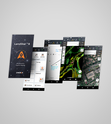
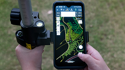
LandStar 8 is a powerful and reliable data collection app designed for Android devices and CHCNAV controllers. It simplifies high-precision surveying and mapping with streamlined workflows and a clean, intuitive interface. The software delivers all essential surveying tools, including construction layout, control point measurement, advanced CAD handling, and fast stakeout of points, lines, and surfaces. Its compatibility with industry-standard data formats ensures smooth importing and exporting, helping surveyors work efficiently from day one. With LandStar 8, you get a smart, responsive, and productive field solution built to enhance accuracy and boost on-site performance.
CHCNAV LandStar Features
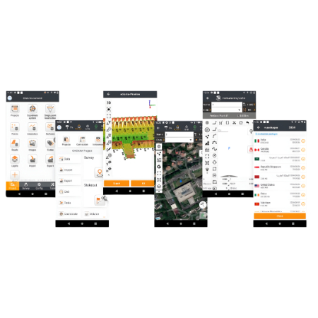
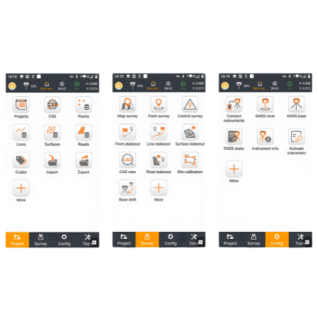
Comprehensive Surveying Features
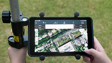
LandStar 8 equips you with everything needed for professional fieldwork. Perform construction surveying, measure control points, work with native CAD files, and stake out points, lines, and surfaces with speed and accuracy. The app also supports road construction tasks and efficient GIS data collection, giving you a complete toolkit for any surveying project.
Advanced CAD Mapping
With LandStar 8’s powerful MetaCAD graphics engine, you can open DWG and DXF files faster and enjoy smoother, more responsive rendering. The software handles DXF files up to 200 MB with ease, while smart tools like “Quick Code” automate feature coding to boost productivity and reduce repetitive work.
Efficient Project Management
LandStar 8 makes project setup simple. Copy your coordinate settings, control points, and stakeout data directly from another controller, then apply your preferred coordinate systems, geoid models, and code libraries. This streamlined approach helps you start working immediately and maintain consistency across projects.
Enhanced Data Import & Export
Seamlessly integrate LandStar 8 into your existing workflow. Its broad support for industry-standard import and export formats ensures smooth data sharing with CAD, GIS, and surveying software, making collaboration and reporting much easier.
Extended Cloud Connectivity
LandStar 8’s cloud-ready design enhances communication between the field and the office. Use cloud tools for project backup, team collaboration, data storage, and remote support to keep your operations running efficiently, no matter where you are working.
User-Friendly Interface
The software’s intuitive interface keeps your focus on what matters most. Large map windows and clean visuals highlight essential information while hiding unused features. This thoughtful design speeds up daily tasks and makes surveying more comfortable and efficient.
CHCNAV LandStar Land Surveying and Mapping App


The full sheet
Related products
-
·XBM·00
-
·XBM·01
-
·XBM·02
-
·XBM·03
There are no reviews yet.