


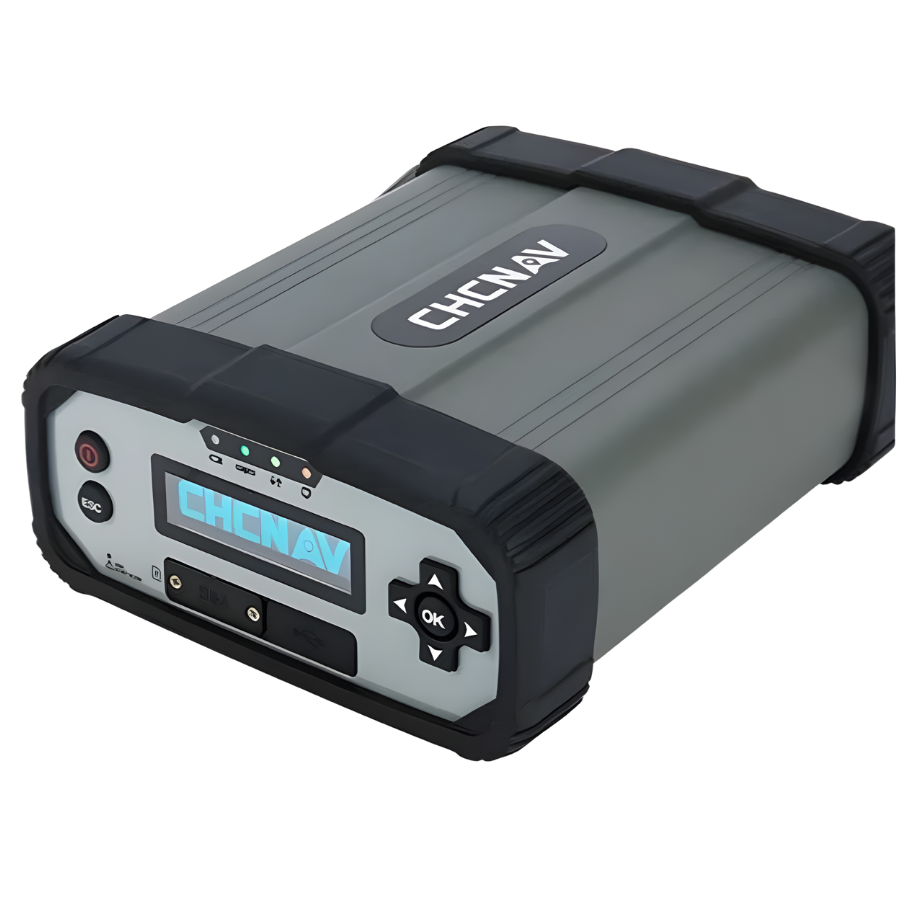
Description
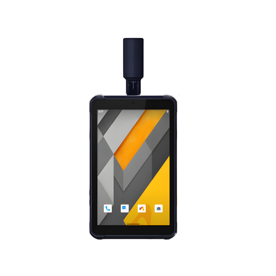
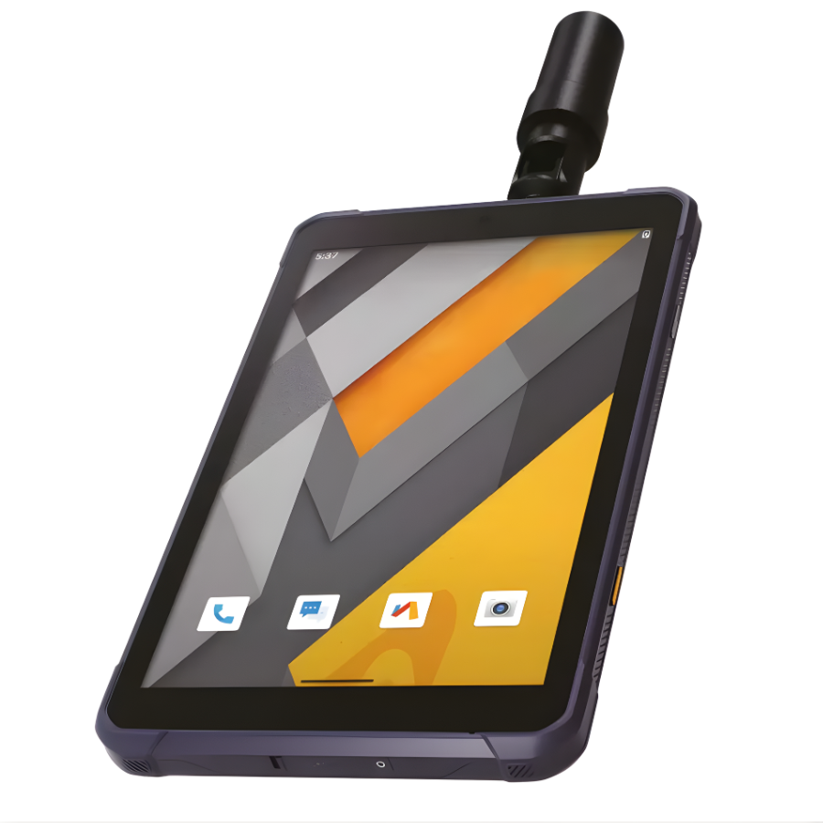
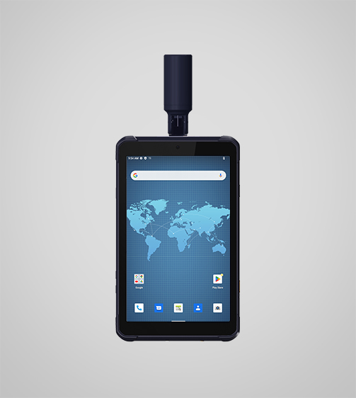
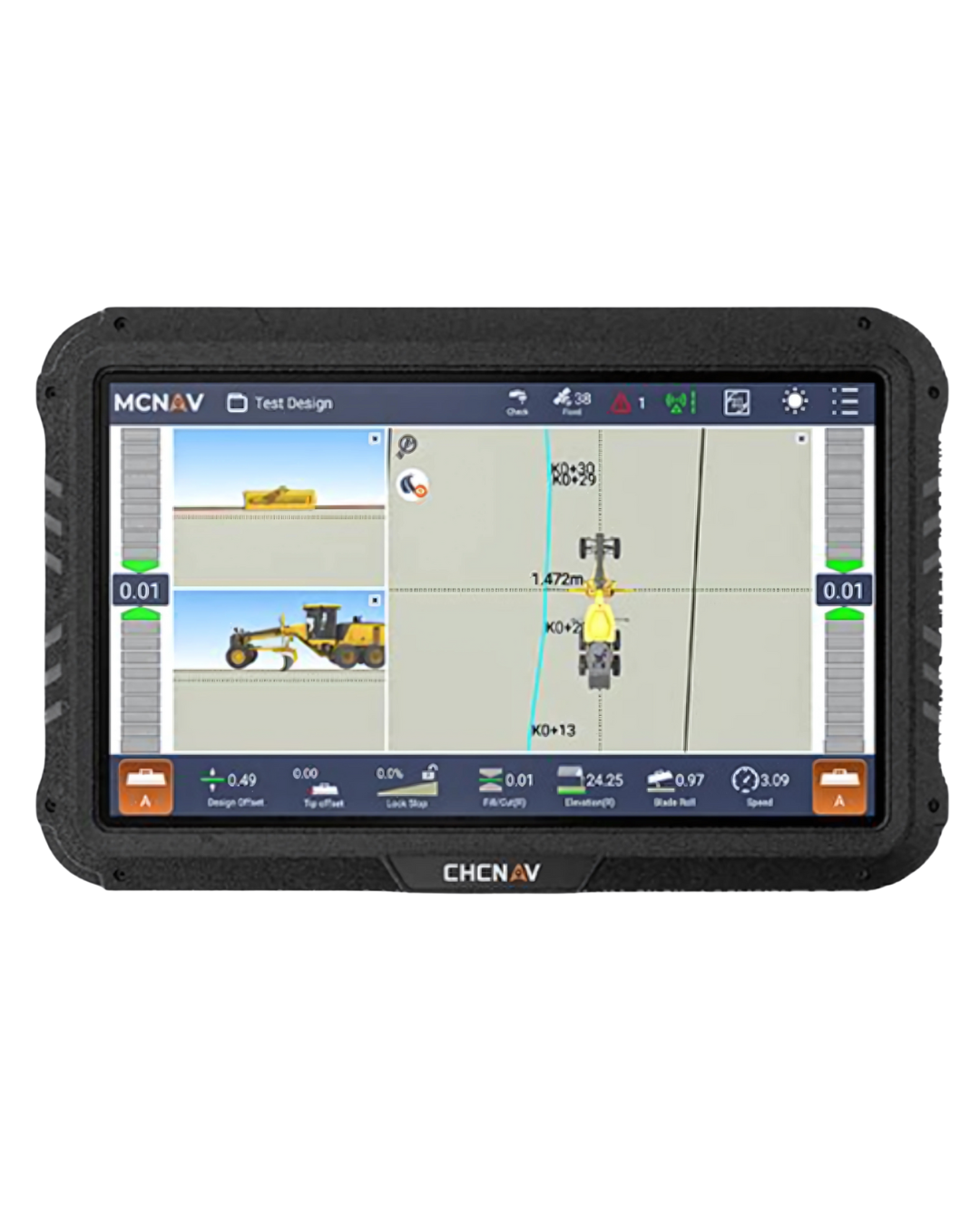
CHCNAV LT800H Rugged Tablet with GNSS RTK Positioning
| Category | Specification |
|---|---|
| Model | CHCNAV LT800H |
| Operating System | Android 12 (GMS Certified) |
| Processor | Octa-core 2.0 GHz |
| RAM | 8 GB |
| Internal Storage | 128 GB |
| Expandable Storage | microSD up to 256 GB |
| GNSS Module | 1408-channel GNSS |
| Supported Constellations | GPS, GLONASS, Galileo, BeiDou, QZSS, SBAS |
| RTK Accuracy | ~2 cm horizontal & vertical |
| Display Size | 8.1″ IPS panel |
| Display Resolution | 1920 × 1200 |
| Brightness | 600 nits sunlight readable |
| Glass Protection | Corning Gorilla Glass 3 |
| Touch Support | Stylus, glove, and wet-hand touch |
| Front Camera | 8 MP |
| Rear Camera | 16–18 MP (depending on version) |
| Cellular | 4G LTE (dual SIM) |
| Wi-Fi | 802.11 a/b/g/n/ac |
| Bluetooth | 5.1 |
| NFC | Yes |
| Ports | USB-C (OTG) |
| Battery Capacity | 9000 mAh Li-ion |
| Battery Life | Up to 8 hours |
| Rugged Rating | IP67 (waterproof & dustproof) |
| Drop Resistance | 1.2 m |
| Operating Temperature | –20°C to +60°C |
| Storage Temperature | –40°C to +70°C |
| Sensors | Gyroscope, e-compass, accelerometer, ambient light |
| Dimensions | 215.5 × 130 × 14.5 mm |
| Weight | ~570 g |
| Certifications | GMS, Android Enterprise Recommended |
| Typical Accessories | Charger, USB-C cable, stylus, GNSS antenna, protective case |
CHCNAV LT800H Highlights
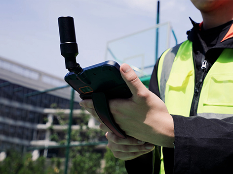
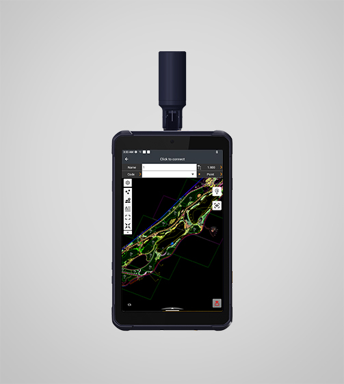
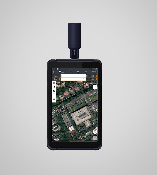
The LT800H RTK Android tablet boosts field productivity by delivering fast, high-accuracy GNSS performance. Built for centimeter to decimeter precision, it performs exceptionally well in GIS data collection, forensic mapping, construction layout, environmental monitoring, and landscaping tasks. Its bright 8.1-inch sunlight-readable display keeps maps, layers, and survey data sharp and easy to interpret—even under direct sunlight. Engineered with a tough IP67-rated rugged design, the LT800H stands up to dust, water, and demanding job sites, making it a dependable choice for teams working in the most challenging outdoor environments.
I am text block. Click edit button to change this text. Lorem ipsum dolor sit amet, consectetur adipiscing elit. Ut elit tellus, luctus nec ullamcorper mattis, pulvinar dapibus leo.
I am text block. Click edit button to change this text. Lorem ipsum dolor sit amet, consectetur adipiscing elit. Ut elit tellus, luctus nec ullamcorper mattis, pulvinar dapibus leo.
CHCNAV LT800H Main Features
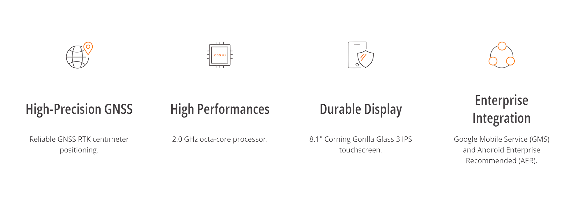


High-Precision GNSS Positioning
Experience true centimeter-to-decimeter accuracy with the LT800H’s advanced 1408-channel GNSS engine. By supporting GPS, GLONASS, Galileo, BeiDou, QZSS, and SBAS constellations, the tablet delivers strong RTK positioning and dependable performance even in challenging or obstructed environments.
High-Performance Processing
Work faster and more efficiently with the LT800H’s 2.0 GHz octa-core processor, built to handle large maps, heavy datasets, and complex applications without slowing down. This powerful hardware ensures smooth, uninterrupted data collection in the field.
Sunlight-Readable Display
Stay productive in any lighting condition with the LT800H’s 8.1-inch IPS touchscreen, protected by Corning Gorilla Glass 3. Its bright 600-nit display keeps GIS layers, detailed vector maps, and high-resolution images crisp and visible—even under direct sunlight.
GMS Certified for Compatibility
Enjoy seamless integration with leading enterprise and data-collection apps thanks to the LT800H’s Google Mobile Services (GMS) and Android Enterprise Recommended (AER) certifications. These standards ensure maximum software compatibility, enhanced security, and reliable performance across workflows.
Comprehensive Connectivity
Stay connected wherever you work. The LT800H features Wi-Fi, Bluetooth 5.1, NFC, and a built-in dual-SIM 4G modem that provides fast, stable communication. Field teams can share updates instantly and collaborate more efficiently on the move.
Durable, Field-Ready Design
Built for tough job sites, the LT800H features a rugged IP67-rated construction that resists dust, water, and accidental drops. Its durable build ensures long-term reliability and consistent performance in demanding field environments.
Use Cases


There are no reviews yet.