Mapping, photogrammetry, fleet management, live mission control and drone automation — curated for survey, inspection, agriculture, public safety and enterprise operations.
A simple hub for the software submenu — each card links to the respective xBoom product or category page.
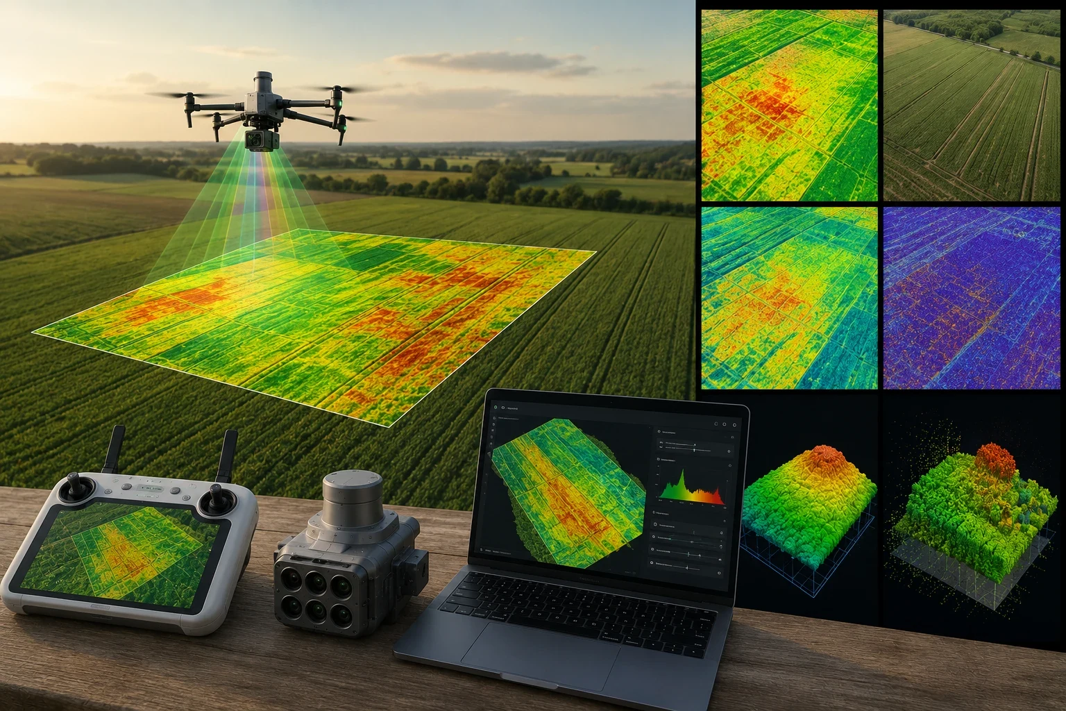
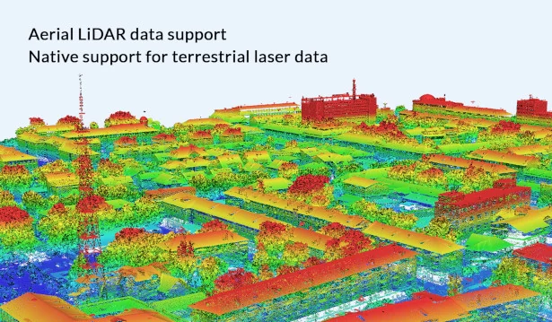
Professional DJI mapping software for 2D orthomosaics, 3D reconstruction, LiDAR point cloud processing, multispectral mapping and inspection route generation.
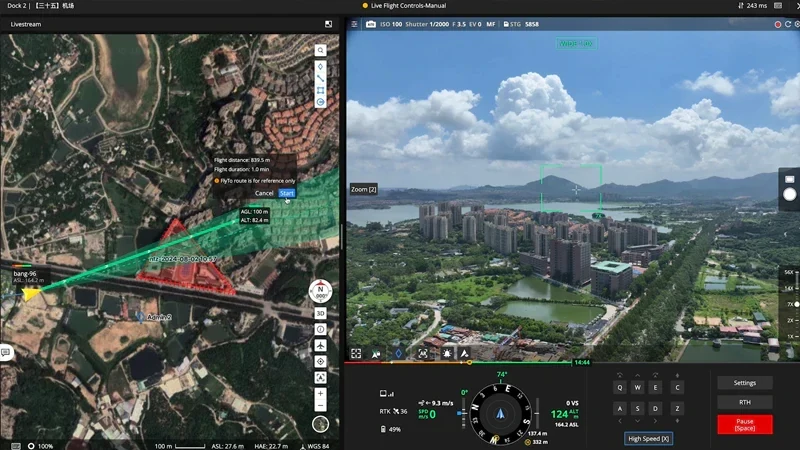
Cloud-based drone operations platform for fleet management, live streaming, cloud mapping, mission planning, team collaboration and real-time situational awareness.
Photogrammetric processing software for turning RGB, multispectral and thermal imagery into accurate 3D models, dense point clouds, orthomosaics and GIS-ready outputs.
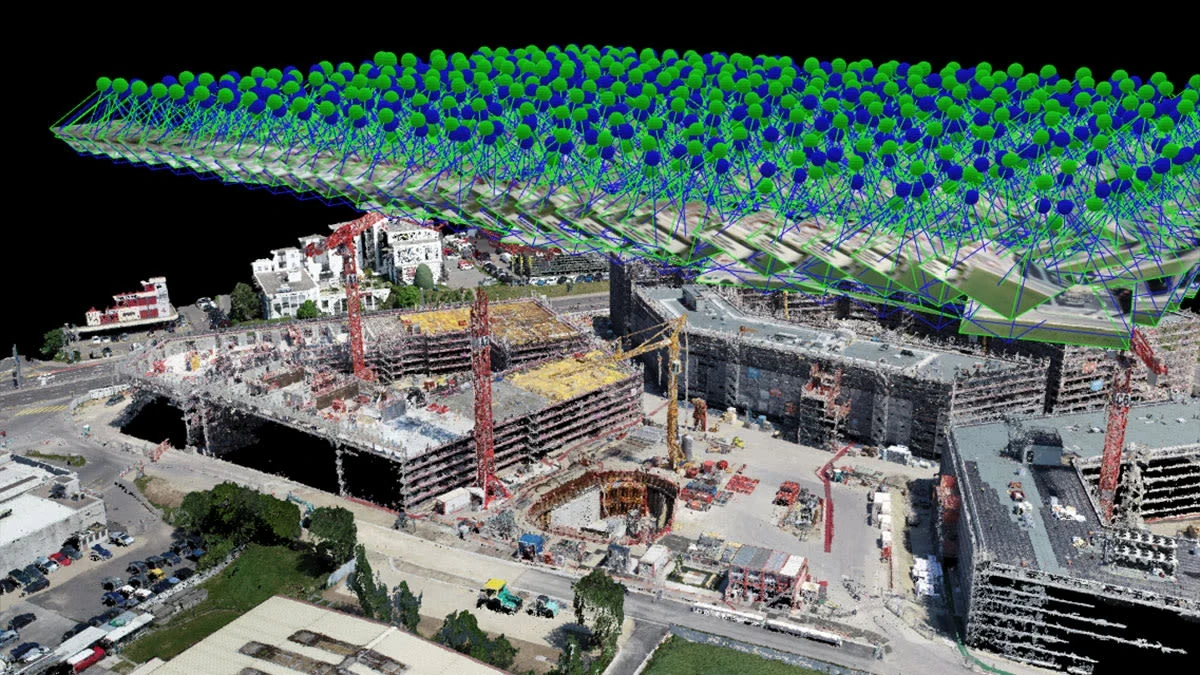
Industry-standard drone mapping software for 2D / 3D outputs, rayCloud validation, GCP workflows, volume measurements, GIS / CAD exports and field-ready processing.
Drone automation platform for automated mission planning, real-time data streaming, cloud-based fleet control, AI analytics, dock operations and scalable deployment.
Browse the complete xBoom drone software catalogue, including UgCS, Skylark, SkyHub software packages, drone mission ops tools and drone-show software.
DJI Terra is the platform our survey teams run every day — 2D orthomosaics, 3D reconstructions, LiDAR point-cloud processing and inspection route generation, end-to-end. Watch the official breakdown to see how the workflow comes together.
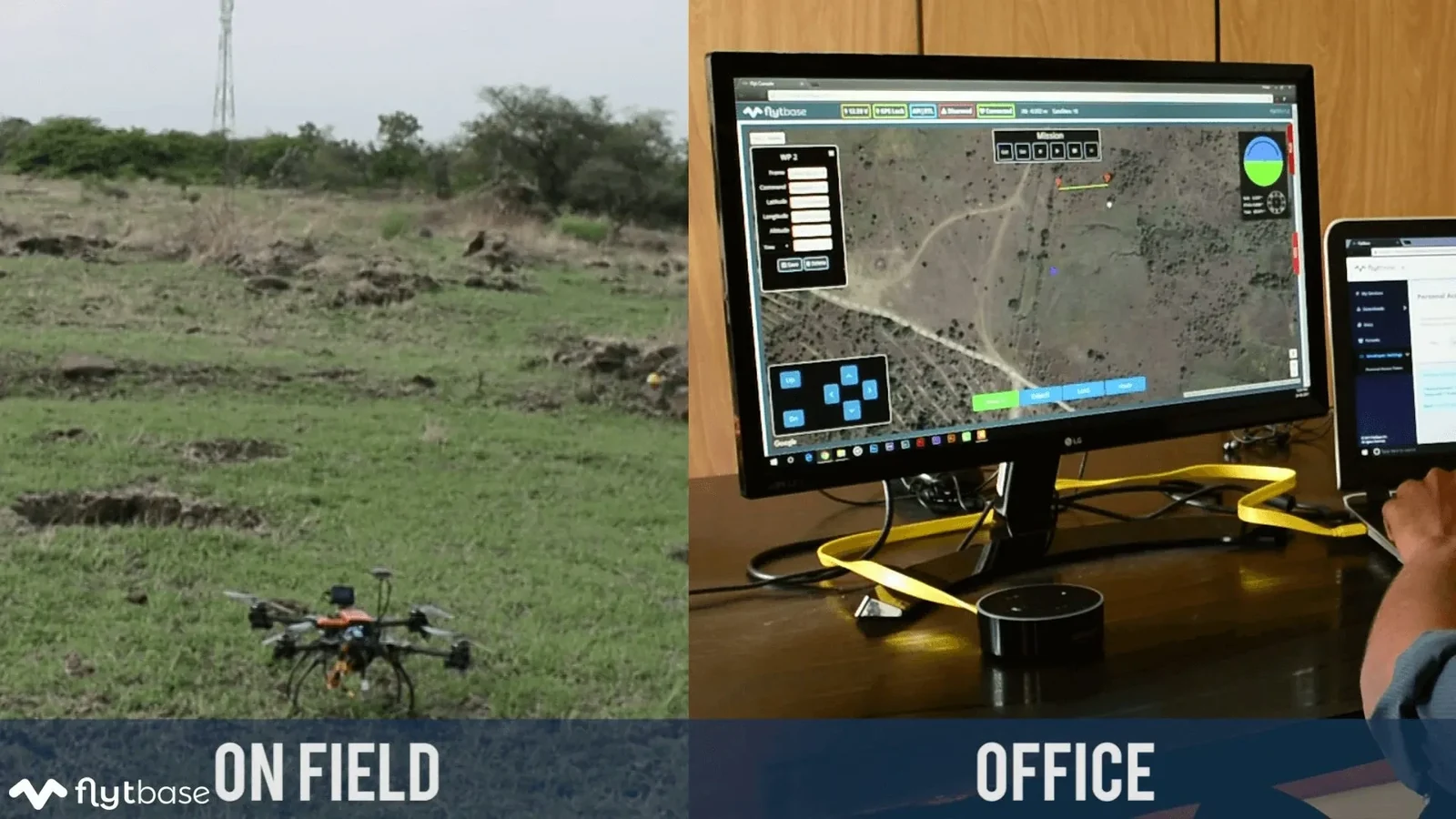
FlytBase is the enterprise drone-autonomy stack we deploy for security, industrial and inspection fleets — hardware-agnostic, cloud-connected and scalable from one dock to a hundred. Watch how autonomous docked drones run scheduled missions with no operator on site.
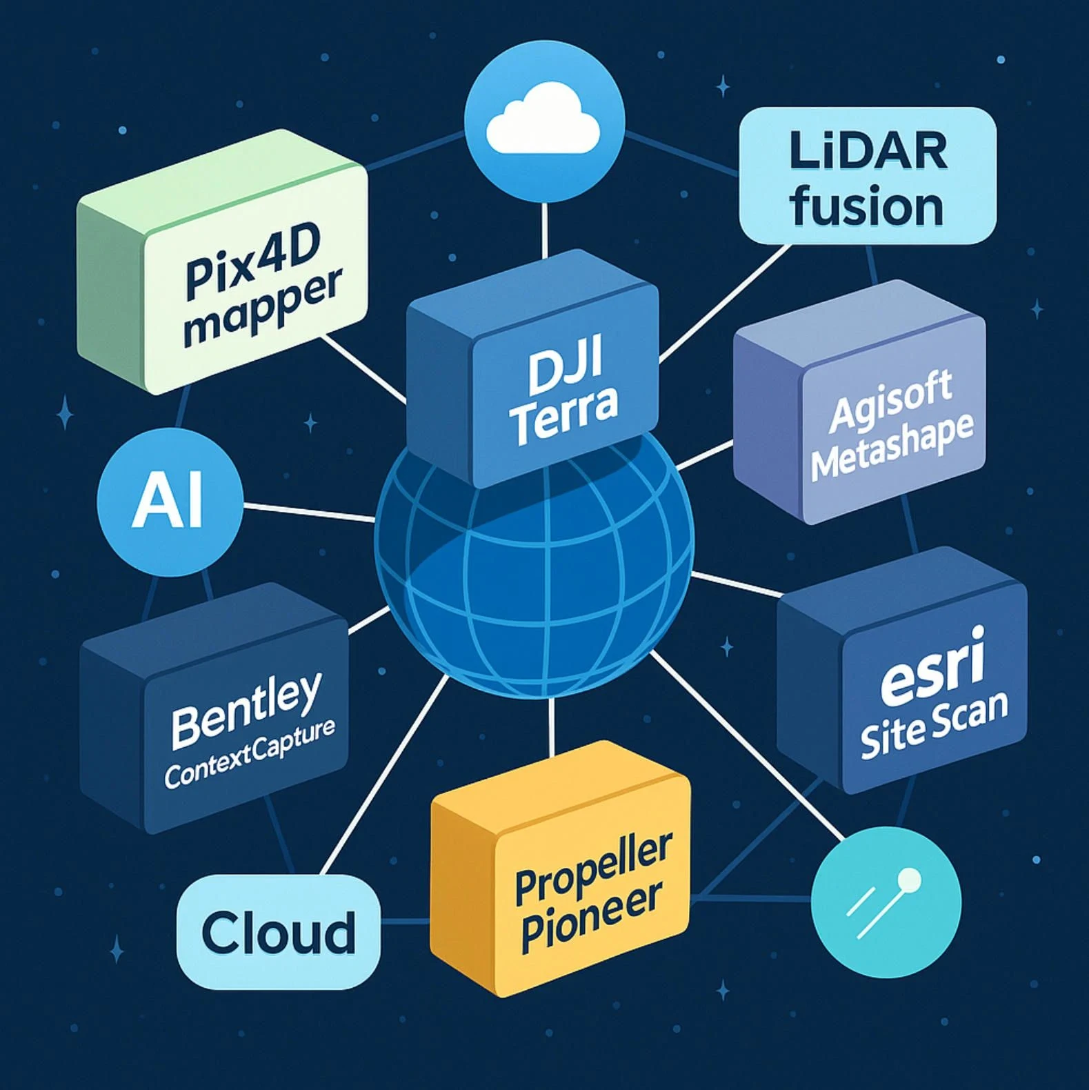
xBoom helps teams choose, license and operationalise the right software stack across field capture, processing, reporting, fleet control and automation.
Terra, Pix4D and Metashape for orthomosaics, 3D models, DEM / DTM and volume calculations.
Route planning, visual validation, point-cloud review and repeatable asset inspection outputs.
FlightHub 2 for live streaming, team collaboration, fleet visibility and mission coordination.
FlytBase for dock-based operations, automated missions, real-time data streaming and BVLOS workflows.
Use this table to route customers quickly from the submenu into the right product page.
Keep this page as a category hub, but sell xBoom's real value: the team can help customers choose, configure and deploy the stack.
Understand mapping, inspection, fleet or automation goal.
Match software to drone, sensor, accuracy and deliverables.
Help choose subscription, seats and deployment model.
Onboard field teams into capture, processing and reporting.
Keep missions running with workflow and technical support.
Tell us your drone, payload and required output. We'll recommend the right software combination.
Tell us the outcome you’re after — a photogrammetry pipeline for surveys, an autonomous dock rollout for security, or a mapping stack for agri. We’ll come back with a shortlist and a quote within one working day.

