
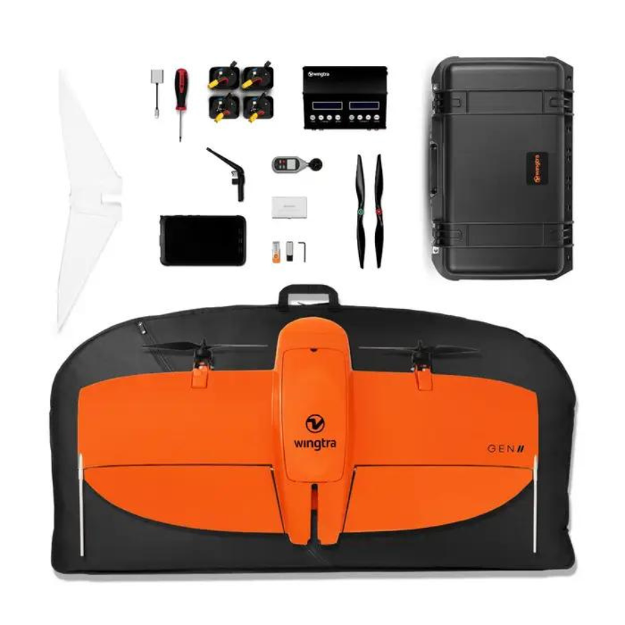
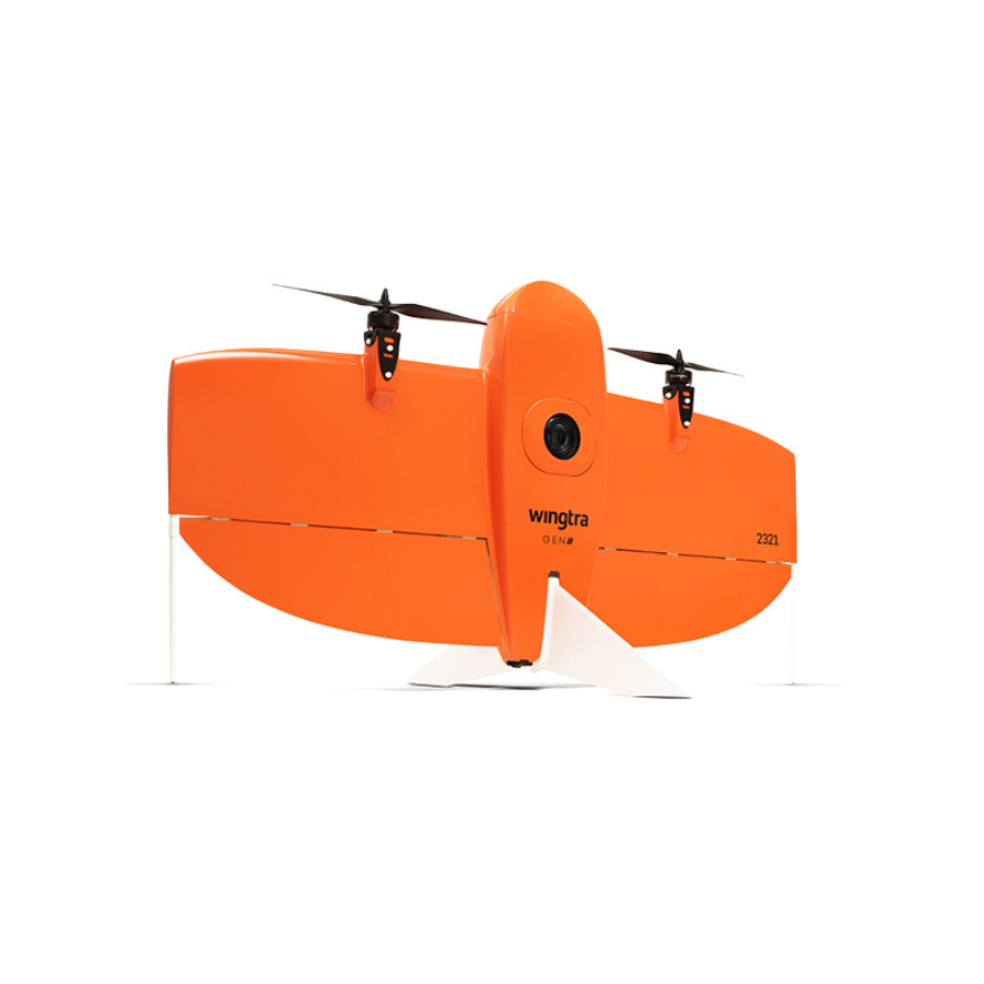
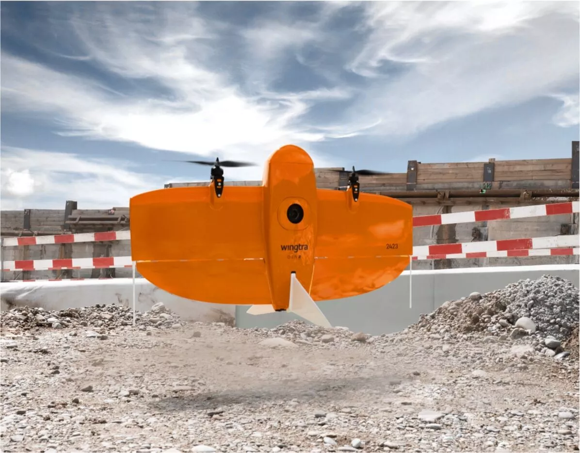
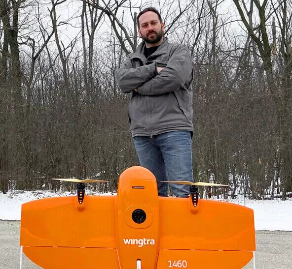
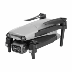
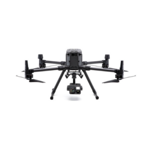
WingtraOne GEN II Drone
- Maximum flight time Up to 59 min
- Brand-new OBLIQUE payload integration for the best possible 3D map quality
- PPK on every drone, including with multispectral payloads
- Advanced electronic infrastructure
- Algorithms and services with self-diagnosis and fail-safes for reliable operations
- Trusted dealerDirect manufacturer partnership
- Pan-India deliveryInsured shipping, all states
- Post-sale supportTraining + service included
What makes it work
WingtraOne GEN II Drone
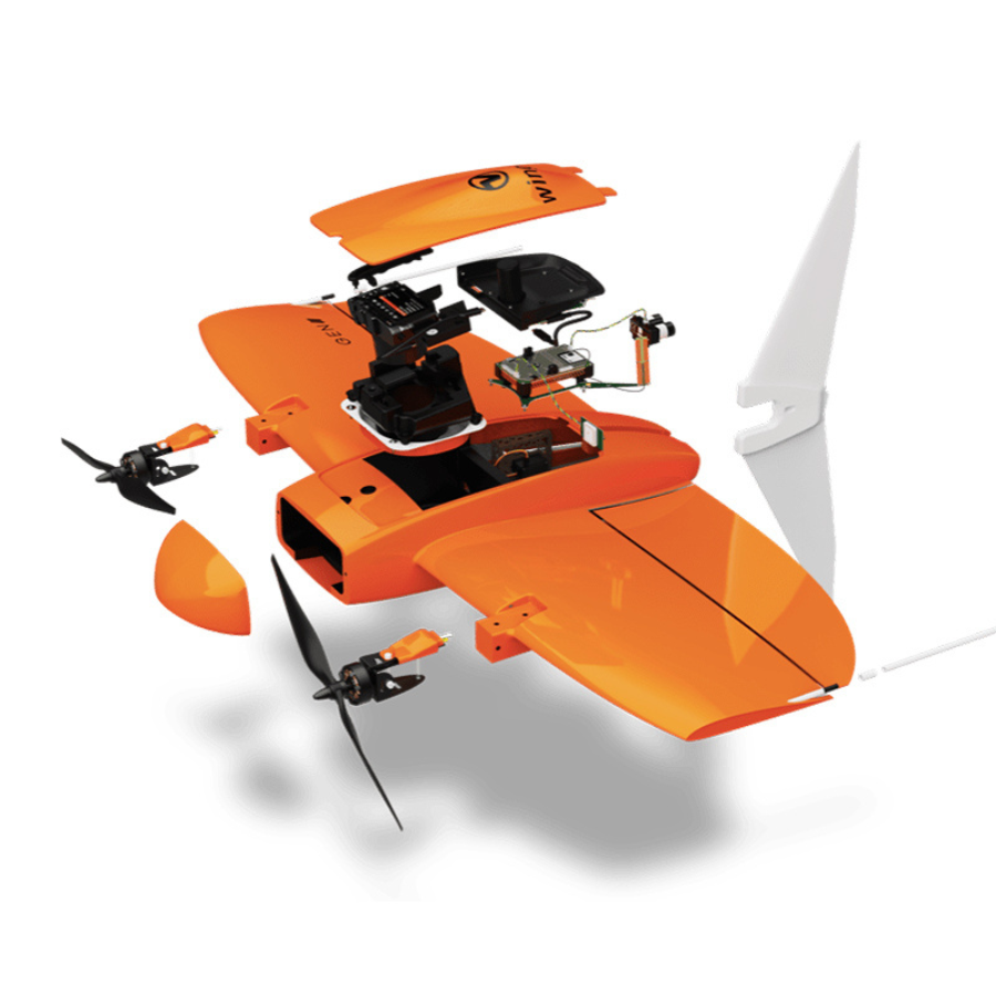
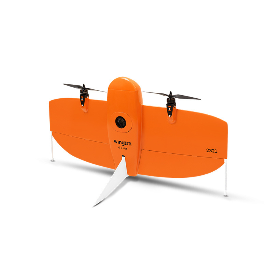
The WingtraOne GEN II is a fixed-wing drone designed for high-precision aerial mapping and surveying applications. It is equipped with a high-resolution camera that can capture images with up to 42 megapixels and a PPK (Post-Processed Kinematics) GPS system that provides accurate geotagging of the images. The drone is capable of covering large areas efficiently, with a flight time of up to 55 minutes and a maximum coverage of 1 km² per flight. Its vertical take-off and landing capability make it suitable for use in tight or inaccessible areas. The WingtraOne GEN II is also equipped with advanced safety features, including redundant sensors and fail-safe systems, to ensure reliable and safe operation.
Get Your Survey Data Faster
With the special features of the WingtraOne mapping drone, you can perform more work—whether it’s working on another project in the field or analysing data at the office—while spending less time flying.
“Two years ago, we utilised a multicopter drone to map the same road, covering 3 kilometres (1.8 km) of road every day. We currently use WingtraOne to travel the entire 22 km (14 mil) road in the same amount of time.
Survey more in a single flight
You may now take on enormous projects that were previously difficult to map with a drone, whether it be a roadway, an industrial complex, or a mine. You only need a few hours for it.
“With any other platform we have evaluated, we could not have finished a project this scale in a timely and cost-effective manner.”
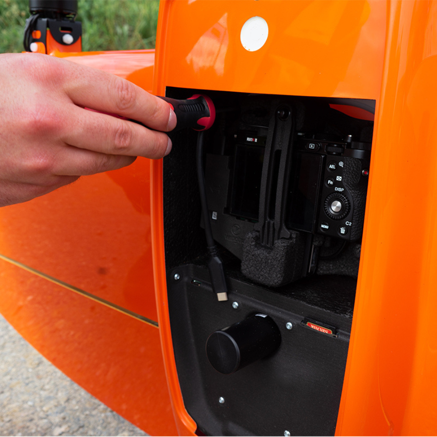
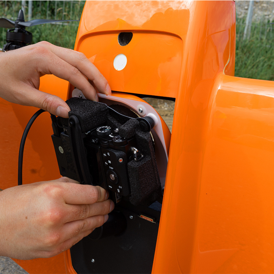
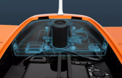
WingtraOne’s camera never touches the ground, preventing debris from damaging the lens and extending the life of the equipment.
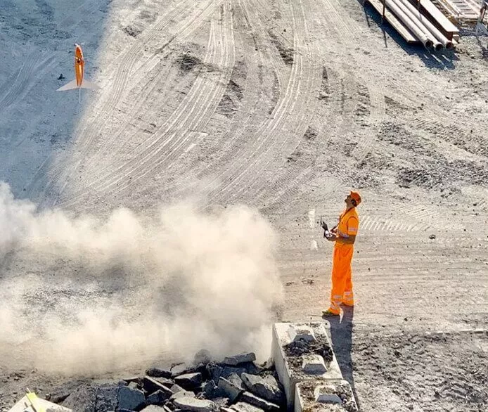
“Using a WingtraOne, we conducted a survey of 300 hectares (741 acres) in less than two hours. Due to their coverage restrictions or the necessity for takeoff and landing space, traditional drones would not have been able to complete this mapping operation.”
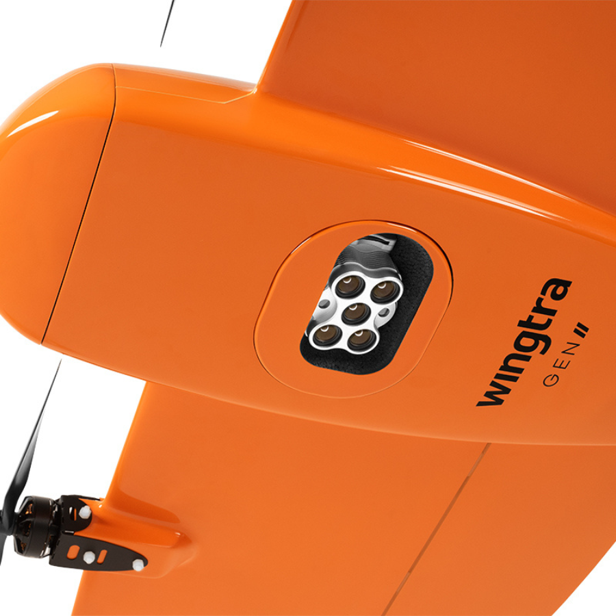
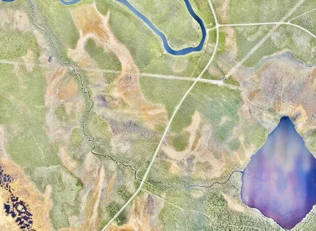
WingtraOne offers the best-in-class absolute horizontal accuracy, down to 1 cm (0.4 in), thanks to a built-in multi-frequency PPK GNSS receiver and a 42 Megapixel sensor (GCPs)
We always do ground control and a double and triple check because we are a surveying firm. But, we are finding less and less need to do so because WingtraOne data is always accurate enough to use directly without the requirement for GCPs.
A drone you can rely on
WingtraOne reliably produces high-quality data and runs safely under all circumstances.
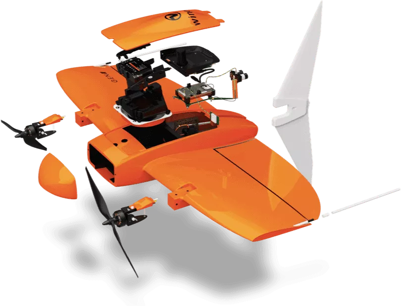
Specifications of WingtraOne GEN II
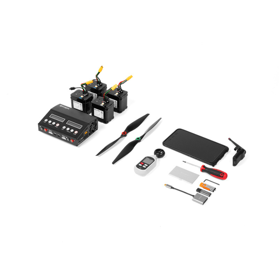
Hardware
- Drone type: Tailsitter vertical take-off and landing (VTOL) 4.5 kg (9.9 lb)
- Maximum take-off weight:5 kg (9.9 lb)
- Weight (empty):7 kg (8.1 lb)
- Maximum payload weight: 800 g (1.8 lb)
- Wingspan: 125 cm (4.1 ft)
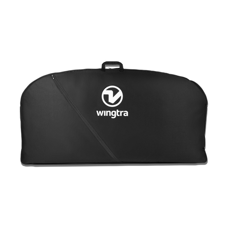
- Dimensions of WingtraOne: 125 × 68 × 12 cm (4.1 × 2.2 × 0.4 ft) (without middle stand)
- Dimensions of Pilot Box: 57× 37× 20 cm, 8.6 kg (1.8 × 1.2 × 1.0 ft, 19 lb)
- Battery capacity: Two 99 Wh batteries (required as a pair)
- Battery type: Li-ion, smart battery technology, UN3481 compliant
- Radio link: Bi-directional 10 km (6 mi) in direct line of sight, obstacles reduce the range
- Onboard GPS: Redundant, using GPS (L1, L2), GLONASS (L1, L2), Galileo (L1) and BeiDou (L1) | Frequencies range: 1227.6 MHz / 1242.9375-1251.6875 MHz / 1561,098 MHz / 1575,42 MHz / 1598.0625-1609.3125 MHz / 1602,00 MHz
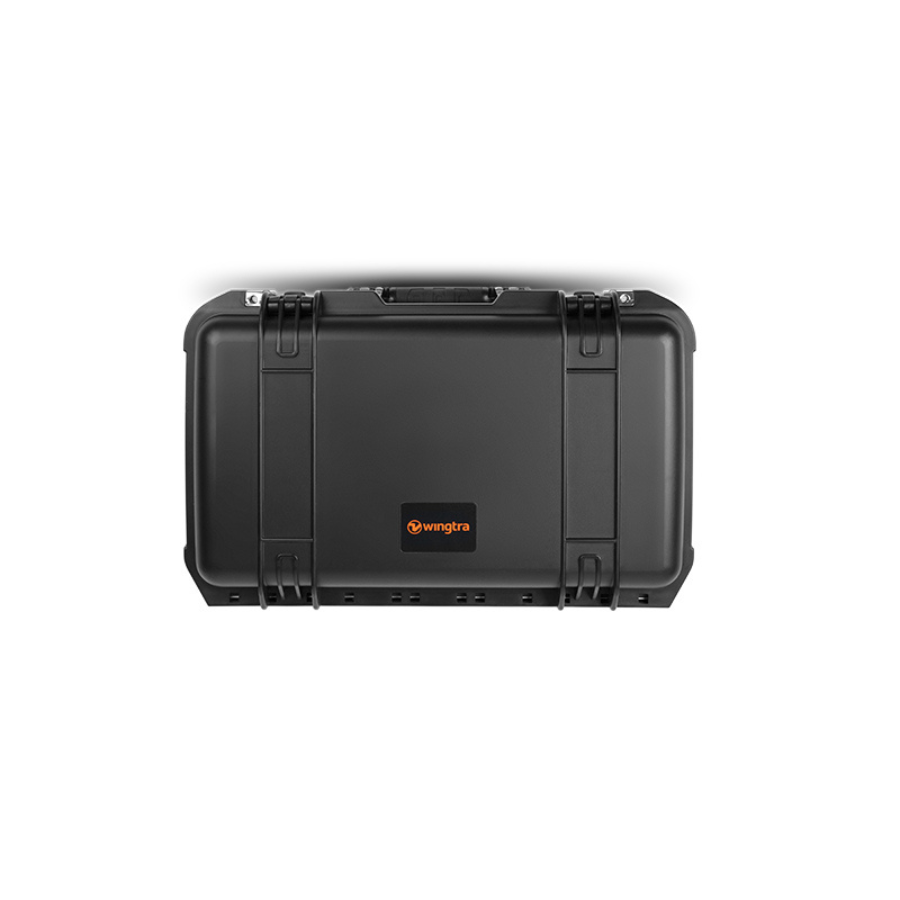
- Dimensions of travel hardcase (optional): 137 x 67 x 23 cm (54 x 26 x 9 in)
- Weight of travel hardcase including the drone:6 kg (41 lb)
Flying in wind
- WingtraOne can safely fly and capture data in sustained winds up to 12 m/s (27 mph) and gusts up to 18 m/s (40 mph).
- 12 m/s (27 mph) sustained wind at cruise height (120 m, 400 ft) corresponds to approximately 8 m/s (19 mph) measured on the ground with the wind measurement tool provided in the Wingtra pilot box.
- Max sustained wind (Wind measured by the drone in cruise height over more than 30 seconds):12 m/s | 43 km/h | 27 mph
- Max wind gusts (Brief increase in the speed of the wind for less than 30 seconds): 18 m/s | 65 km/h | 40 mph
- Max sustained wind on the ground (Wind measured on the ground by the wind tool provided in the Wingtra pilot box (average over 30 seconds): 8 m/s | 29 km/h | 19 mph
Operation
- Flight speed: Operational cruise speed – 16 m/s (35.8 mph) | Climb / sink cruise – 6 / 3 m/s (13.4 / 6.7 mph) | Climb / sink hover – 6 / 2.5 m/s (13.4 / 5.6 mph)
- Wind resistance: Max sustained wind – 12 m/s (27 mph) | Max wind gusts – 18 m/s (40 mph) 8/ms (19 mph) | Max sustained wind on the ground – 8/ms (19 mph)
- Maximum flight time: Up to 59 min
- Temperature: -10 to +40 °C (+14 to +104 °F)
- Maximum take-off altitude above sea level: 2500 m (8200 ft); with high-altitude propellers it is possible to take off from up to 4800 m (15,700 ft) and fly up to 5000 m (16,400 ft) AMSL
- Weather: IP54, not recommended to fly in fog, rain and snow
- Ground control points required: No (with PPK option); using 3 checkpoints to verify the accuracy is recommended
- Auto-landing accuracy: < 2 m (< 7 ft)
Flight time
WingtraOne GEN II
- Payload: Using a heavier payload reduces flight time. For example, when switching from the MicaSense RedEdge-MX camera to the heavier Sony RX1R II camera, the flight time reduces from 59 minutes to 54 minutes.
- Altitude above sea level: As the air gets thinner with increasing altitude above sea level, drone flight time is reduced. At the same time, WingtraOne will fly faster in high altitudes, which means that the coverage is only marginally reduced. For example, the RX1R II came- ra covers 400 ha (988 ac) in 54 minutes at 0-500 m (0-1640 ft) above sea level and 350 ha (865 ac) in 42 minutes at 2000 m (6562 ft) above sea level (with 3 cm (1.2 in)/px GSD).
- Transition height: Because the WingtraOne uses significantly more energy while hovering, the transition altitude affects flight time. A higher transition altitude will result in a reduced flight time.
- Wind: In stronger winds, drones consume more energy while flying and landing, which means missions will end up with shorter flight times.
- Temperature: As temperature influences air density, it impacts flight time directly. Generally, higher temperatures mean lower flight times.
- Payload RX1R II (a): Take-off altitude above sea level – 0-500 m/0-1640 ft | Max. flight time – 54 min | Cruise speed – 16 m/s/36 mph | Max coverage at GSD 3 cm/px (1.2 in/px) – 400 ha/990 ac | Max coverage at 120 m / 400 ft – 210 ha at GSD 1.5 cm/px/520 ac at GSD 0.6 in/px
- Payload RX1R II (b): Take-off altitude above sea level – 2000 m/6560 ft | Max. flight time – 42 min | Cruise speed – 18 m/s/40 mph | Max coverage at GSD 3 cm/px (1.2 in/px) – 350 ha/860 ac | Max coverage at 120 m / 400 ft – 180 ha at GSD 1.5 cm/px/440 ac at GSD 0.6 in/px
- Payload a6100 (a): Take-off altitude above sea level – 0-500 m/0-1640 ft | Max. flight time – 54 min | Cruise speed – 16 m/s/36 mph | Max coverage at GSD 3 cm/px (1.2 in/px) – 310 ha/770 ac | Max coverage at 120 m / 400 ft – 240 ha at 2.4 cm/px/600 ac at 0.93 in/px
- Payload a6100 (b): Take-off altitude above sea level – 2000 m/6560 ft | Max. flight time – 42 min | Cruise speed – 18 m/s/40 mph | Max coverage at GSD 3 cm/px (1.2 in/px) – 270 ha/670 ac | Max coverage at 120 m / 400 ft – 210 ha at 2.4 cm/px/520 ac at 0.93 in/px
- Payload RedEdge-MX (a): Take-off altitude above sea level – 0-500 m/0-1640 ft | Max. flight time – 59 min | Cruise speed – 16 m/s/36 mph | Max coverage at 120 m / 400 ft – 150 ha at 8.2 cm/px/380 ac at 3.2 in/px
- Payload RedEdge-MX (b): Take-off altitude above sea level – 2000 m/6560 ft | Max. flight time – 47 min | Cruise speed – 18 m/s/40 mph | Max coverage at 120 m / 400 ft – 130 ha at GSD 8.2 cm/px/320 ac at 3.2 in/px
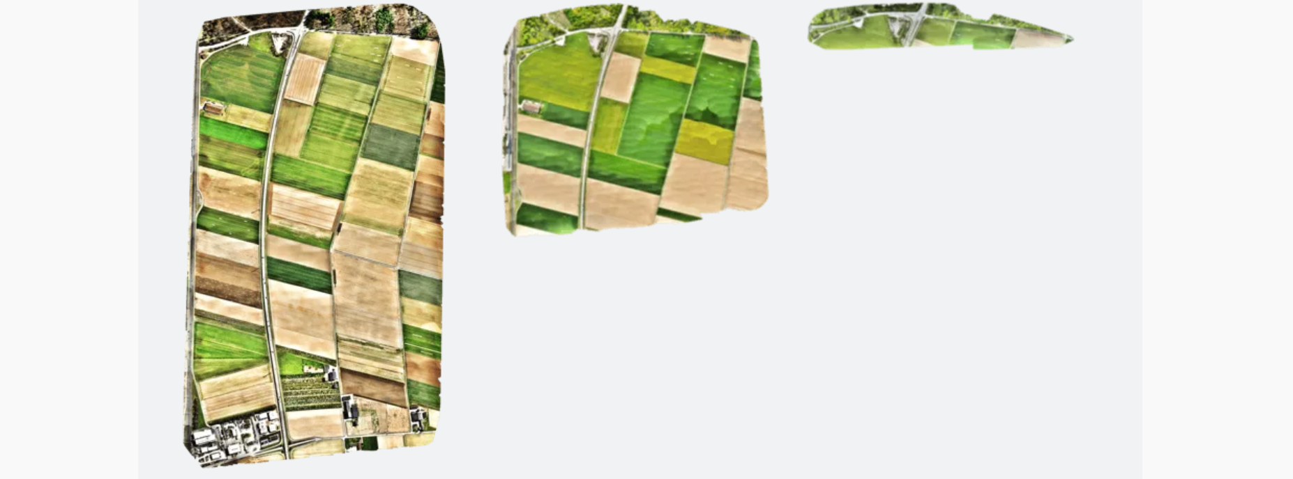
Coverage
- The RX1R II camera can cover 30 percent more area at 3 cm (1.2 in)/px GSD resolution than the a6100 camera in the same amount of time.
- On the other hand, if you need to fly at a limited altitude, for example at 120 m (400 ft), the a6100 covers more area than the RX1R II. The flight with the a6100 results in a GSD of 2.4 cm (0.93 in)/px, which is a lower resolution compared to the 1.5 cm (0.6 in)/px of the RX1R II. Considering this, it is really important to choose the right configuration for your use case and environment.
Job time
- An important point that tends to get missed when focusing on flight time numbers is that job time (and efficiency) is actually not about flight time, but rather about how fast you can acquire data on a given area. For example, compared to muliticopers, the WingtraOne can acquire data up to 8x faster. And compared to most fixed-wings it’s twice as fast. So in many cases, the right camera and settings can get you the data you need faster, and faster in fact means less flight time.
Data collection speed
WingtraOne GEN II
- Up to 8x faster than multicopter drones
- Up to 2x faster than standard fixed-wing drones
Results
- Maximum expected coverage in one flight at 120 m (400 ft) altitude above take-off point: RX1R II – 210 ha (520 ac) 1.5 cm (0.6 in)/px GSD | a6100 – 240 ha (600 ac) 2.4 cm (0.9 in)/px GSD
- Maximum expected coverage in one flight at 3 cm/px (1.2 in/px) GSD: RX1R II – 400 ha (988 ac) 234 m (768 ft) altitude | a6100 – 310 ha (766 ac)) 153 m (503 ft) altitude
- Lowest possible GSD: RX1R II – 0.7 cm (0.3 in)/px at 55 m (180 ft) altitude | a6100 – 1.2 cm (0.47 in)/px at 61 m (201 ft) altitude
- Mapping accuracy with PPK (w/o GCPs): Absolute accuracy (RMS) with RX1R II – horizontal down to 1 cm (0.4 in) | Relative accuracy – vertical down to 3 cm (1.2 in) down to 0.003 %
- Mapping accuracy w/o PPK (w/o GCPs): Absolute accuracy (RMS)/Relative accuracy – 3 to 5 m (9.8 to 16.4 ft) down to 0.15 %
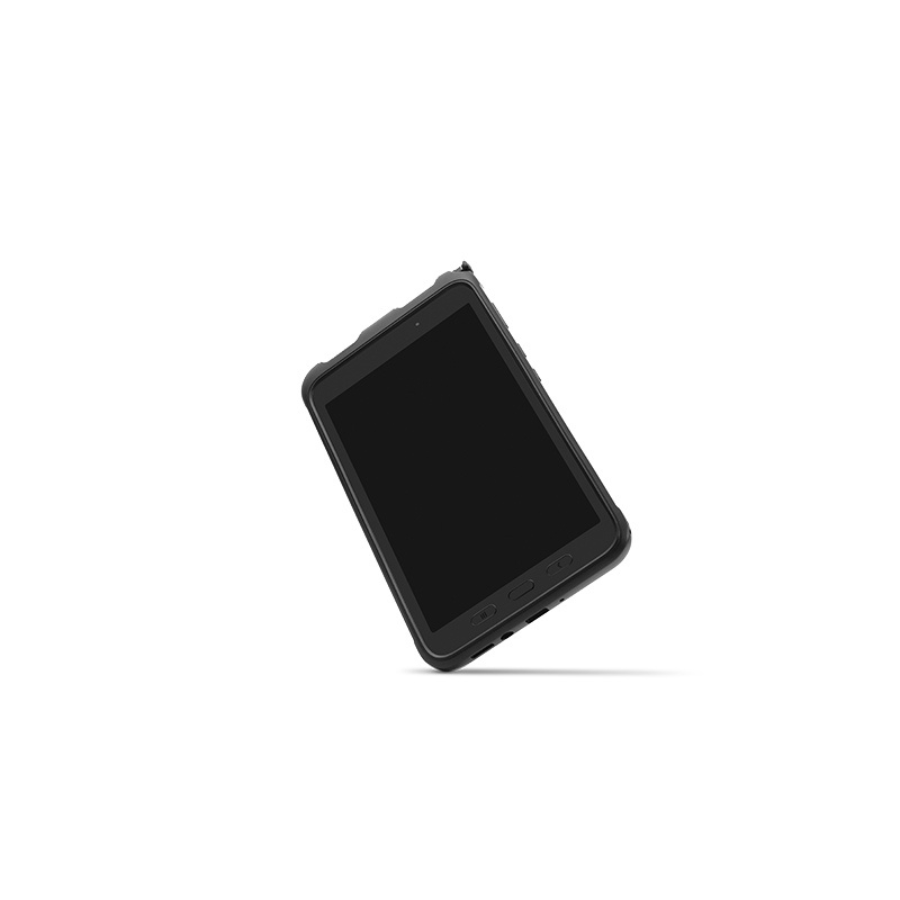
Software & tablet
- Flight planning & mission control software: WingtraPilot
- Tablet (supplied): Rugged Samsung Galaxy Tab Active 3, water and dust resistant, MIL-STD-810-certified, WingtraPilot pre-installed
Data link
WingtraOne GEN II
- Module name: WingtraOne Telemetry 2.4
- Main function: Telemetry connection for remote operation
- Frequency range telemetry:4016-2.4776 GHz
- Occupied bandwidth:0MHz
- Operation mode: FHSS (Frequency Hopping Spread Spectrum)
- Typical data rate:6 kb/s
- Transmission power (EIRP): 19,8 dBm
- Tested maximum range: 10 km (6 mi) indirect line of sight; keep in mind that obstacles reduce the range
- Channel spacing: 1,0Mhz
- Number of channels: 76
- Channel bandwidth: Low 400kHz | High 280kHz
- Method of modulation: GFSK
Battery
- Module name: Wingtra Battery 2
- Trade name: Lithium-ion battery
- Model number:00342.02
- Battery capacity: 99 Wh (a pair of batteries required)
- Battery type: Li-ion, smart battery technology, UN compliant ; suitable for carry-on luggage
- State-of-charge indicator: Integrated 5 level SoC indicator
- Smart charging: Auto cell balancing
- Rated energy content: 99 Wh
- Nominal voltage:4 V
- Rated charge:5 A, 16.8 V cutoff
- Rated discharge: 35 A, 12 V cutoff
- Cell type: Samsung_INR_18650_25R
- Configuration: 4s 3p configuration
- Charging time: 1h
- Maximum continuous discharge: 35 A
- Battery dimensions: 80 × 60 × 75 mm (3.15 × 2.36 × 2.95 in)
- Battery weight: 604 g (1.3 lb)
- Operating temperature (take-off): +10 to +40 °C (+50 to +104 °F)
- Operating temperature (in-flight): +10 to +60 °C (+50 to +140 °F) | The drone will automatically return to home in case the maximum battery temperature is exceeded during flight.
- Storage temperature (90% capacity recovery): +0 to +25 °C (+32 to +77 °F) yes
- Shock protection: yes
- Overvoltage protection: yes
- Undervoltage protection: yes
- Temperature protection: yes
- Short circuit protection: yes
- Material safety data sheet (MSDS): Available on request
Battery charger
- Module name: Wingtra Charger
- Charger type: Dual AC/DC lithium-ion charger
- Input voltage AC: 110-120 V / 220-240 V (manual switch), 50 / 60Hz
- Input power AC: 350 W
- Input voltage DC: 11 – 18 V (optional, e.g. for charging from car)
- Input power DC: 300 W (reduced power possible)
- Modes: Charge / storage / balance
- Charging cycle: Standard lithium-ion CC-CV cycle
- Charging time: 1 h
- Maximum charge current:5 A
- Charge end voltage:4 V (4.1 V per cell)
- discharge current: 0.6 A
- Discharge end voltage:7 V (30 % charge)
- Additional outputs: USB 5V / 2.1 A
- Dimensions: 190 × 140 × 70 mm (7.5 × 5.5 × 2.75 in)
- Weight: 1170 g (2.6 lb)
The full sheet
| Weight | 3.7 g |
|---|---|
| Dimensions | 140 × 68 × 24 in |
Related products
-
·AIR·00
Out of stock
 E88 Pro RC Mini Drone with 4K CameraOriginal price was: ₹4,761.₹2,856Current price is: ₹2,856. (Excl. GST)Notify me
 -
·XBM·01
 Autel EVO Lite 640T Enterprise Standard Bundle (6-inch Smart Controller)₹542,857 (Excl. GST)Add to cart
 -
·XBM·02
-
·AIR·03
 DJI MATRICE 300 RTK Drone CameraOriginal price was: ₹857,143.₹674,286Current price is: ₹674,286. (Excl. GST)Add to cart

There are no reviews yet.