

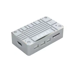
C-RTK 2 High-Precision RTK/PPK GNSS Module
- High-Precision RTK & PPK Positioning – Supports both real-time kinematic (RTK) positioning and post-processed kinematic (PPK) workflows for professional UAV surveying and mapping applications.
- Centimeter-Level RTK Accuracy – Delivers positioning accuracy of approximately 0.01 m + 1 ppm horizontal and 0.02 m + 1 ppm vertical under supported RTK conditions.
- Multi-Constellation, Multi-Frequency GNSS – Supports GPS, GLONASS, Galileo, BeiDou, QZSS, and SBAS systems for reliable satellite positioning.
- High-Performance ZED-F9P Receiver – Uses a 184-channel GNSS receiver for advanced multi-frequency positioning performance.
- Fast RTK Convergence – Supports RTK convergence in under 10 seconds under specified conditions, with navigation updates of up to 20 Hz.
- Integrated H7 Processing – Features an STM32H743 processor with 2MB Flash and 1MB RAM for onboard processing and positioning-related functions.
- Industrial-Grade Sensors – Integrates an ICM20689 accelerometer/gyroscope, RM3100 magnetometer, and ICP10111 barometer for additional onboard sensing.
- Designed for UAV Surveying & Mapping – Supports hot-shoe and shutter-trigger functions for compatible aerial mapping cameras and survey workflows.
- DroneCAN & PX4/ArduPilot Compatibility – Supports DroneCAN/UAVCAN communication and integration with compatible flight controllers running PX4 or ArduPilot firmware.
- Compact & Lightweight Design – Measures approximately 56 × 33 × 16.5 mm, weighs around 39 g, operates from 4.5–6V, and supports operating temperatures from -20°C to +85°C.
- Trusted dealerDirect manufacturer partnership
- Pan-India deliveryInsured shipping, all states
- Post-sale supportTraining + service included
What makes it work
C-RTK 2 GNSS Module
The C-RTK 2 GNSS Module is a genuine CUAV high-precision positioning module supporting both RTK and PPK workflows — centimeter-level accuracy for professional UAV survey and mapping, fully compatible with PX4 and ArduPilot.
RTK & PPK Support
184-Channel ZED-F9P
<10s Convergence
PX4 & ArduPilot Ready
Full Specifications
| Specification | Details |
|---|---|
| Product | C-RTK 2 GNSS Module — genuine CUAV hardware, clearly labeled “C-RTK 2” on the module itself |
| GNSS Receiver | u-blox ZED-F9P, 184-channel, multi-constellation: GPS, GLONASS, Galileo, BeiDou, QZSS, and SBAS |
| RTK Accuracy | Approximately 0.01m + 1ppm horizontal, 0.02m + 1ppm vertical (CEP) |
| GPS-Only Accuracy | Approximately 1.5m horizontal without RTK correction |
| RTK Convergence | Under 10 seconds under specified conditions |
| Navigation Update Rate | Up to 20Hz for RTK, up to 25Hz for raw data (5Hz default) |
| PPK Support | Full post-processed kinematic workflow, with raw-data logging to onboard TF card storage (up to 32GB) |
| Processor | STM32H743, 32-bit Arm Cortex-M7 @ up to 480MHz, 2MB flash, 1MB RAM |
| Onboard Sensors | ICM-20689 accelerometer/gyroscope, RM3100 magnetometer, ICP10111 barometer |
| xBoom SKU | xboom-145489 |
| Specification | Details |
|---|---|
| Flight Controller Link | DroneCAN/UAVCAN (recommended) or UART; plug-and-play with CUAV’s X7-series autopilots |
| Firmware Compatibility | PX4 and ArduPilot — one clarification: over DroneCAN, PX4 cannot read heading data from this module directly, so a UART2 connection is needed if heading output is required on PX4 |
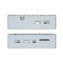
| Camera Interfaces | 1 hot-shoe input, 1 shutter-trigger in, 1 shutter-trigger out, for compatible mapping cameras |
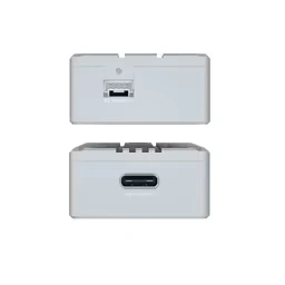
| Other Ports | 1 USB Type-C, 1 F9P USB, 1 F9P UART, 1 MMCX antenna connector |
| Power Input | 4.5-6V |
| Dimensions | Approximately 56 × 33 × 16.5mm |
| Weight | Approximately 39g |
| Operating Temperature | -20°C to 85°C |
Centimeter-Level Positioning for Serious Survey Work
C-RTK 2 GNSS Module: Genuine CUAV Hardware for RTK & PPK Surveying
This is a genuine CUAV module, clearly labeled “C-RTK 2” on the housing. At its core is a 184-channel u-blox ZED-F9P receiver delivering roughly 0.01m + 1ppm horizontal RTK accuracy with convergence in under 10 seconds — and unlike CUAV’s C-RTK 9Ps built earlier this session, this module also fully supports PPK (post-processed kinematic) workflows, logging raw GNSS data to onboard TF card storage for later correction. CUAV has stated this was the first PPK/RTK module in its lineup to add UAVCAN/DroneCAN support, connecting to a compatible flight controller over CAN or UART — and it’s plug-and-play with CUAV’s own X7-series autopilots.
For aerial survey and mapping work specifically, dedicated hot-shoe and shutter-trigger interfaces let it timestamp-tag captured images directly, and CUAV states that using C-RTK 2 for mapping can reduce the number of ground control points needed by more than 80% — commonly just 1-2 control points per square kilometer — with control-point-free mapping achievable when paired with a professional mapping camera. Onboard industrial-grade sensors (ICM-20689 IMU, RM3100 compass, ICP10111 barometer) round out a package built specifically for precision positioning, not just general flight control.
Centimeter-Level RTK
0.01m + 1ppm horizontal accuracy from a 184-channel receiver.
RTK & PPK Both Supported
Full post-processed kinematic workflow with onboard data logging.
Mapping-Camera Ready
Hot-shoe and shutter-trigger interfaces for survey workflows.
PX4 & ArduPilot Compatible
DroneCAN/UAVCAN or UART connection to your flight controller.
See Every Detail
Built for Real Survey Workflows
The module’s connector panel, showing multiple USB and interface ports for GPS, telemetry, and mapping-camera connections — the hardware needed for a genuinely professional survey setup.
Built for Precision Survey & Mapping
The C-RTK 2 GNSS Module brings genuine centimeter-level positioning to your survey and mapping builds.
🎯
184-Channel ZED-F9P
Multi-constellation GNSS for centimeter-level RTK accuracy.
📡
RTK & PPK Supported
Real-time correction or post-processed kinematic, your choice.
📷
Hot-Shoe & Shutter Trigger
Direct integration with compatible aerial mapping cameras.
🔗
DroneCAN/UAVCAN Ready
One of the first PPK/RTK modules with CAN bus support.
🧭
Industrial IMU & Compass
ICM-20689, RM3100, and ICP10111 for rich onboard POS data.
✅
PX4 & ArduPilot Ready
Plug-and-play with CUAV’s X7-series autopilots.
Built for Professional Survey & Mapping UAVs
The C-RTK 2 GNSS Module suits builders who need genuine centimeter-level positioning for serious survey work.
Aerial Survey & Mapping
Reduce ground control points with centimeter-accurate tagging.
Photogrammetry Projects
PPK logging pairs well with dedicated mapping cameras.
Multirotor & Fixed-Wing Survey
DroneCAN or UART integration into most PX4/ArduPilot builds.
Construction & Land Survey
Precision positioning for site progress and terrain mapping.
Precision Agriculture Mapping
Accurate field boundary and terrain data for ag applications.
UAV Research & Development
Well-documented, open-source-compatible positioning hardware.
See the C-RTK 2 in Use
A real unboxing, CUAV’s own official product walkthrough, and an unboxing of the closely-related C-RTK 2HP variant in the same family.


Frequently Asked Questions
Does the C-RTK 2 GNSS Module support PPK, not just RTK?
Is this compatible with PX4 and ArduPilot?
How much can this reduce ground control points for mapping?
What GNSS constellations does it support?
How fast does it achieve an RTK fix?
What’s the operating voltage and temperature range?
The full sheet
Related products
-
·XBM·00
Out of stock
-
·XBM·01
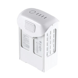
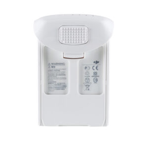 Intelligent Flight Battery - Phantom 4 SeriesOriginal price was: ₹21,186.₹18,262Current price is: ₹18,262. (Excl. GST)Add to cart
 -
·XBM·02
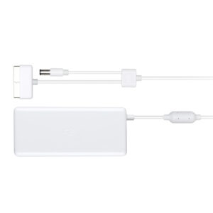
 Battery Charger – Phantom 4 SeriesOriginal price was: ₹6,694.₹6,609Current price is: ₹6,609. (Excl. GST)Add to cart
 -
·XBM·03
 DJI Motion controllerOriginal price was: ₹21,186.₹12,033Current price is: ₹12,033. (Excl. GST)Add to cart

There are no reviews yet.