
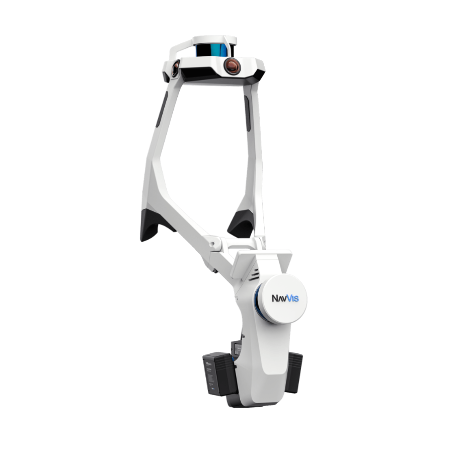
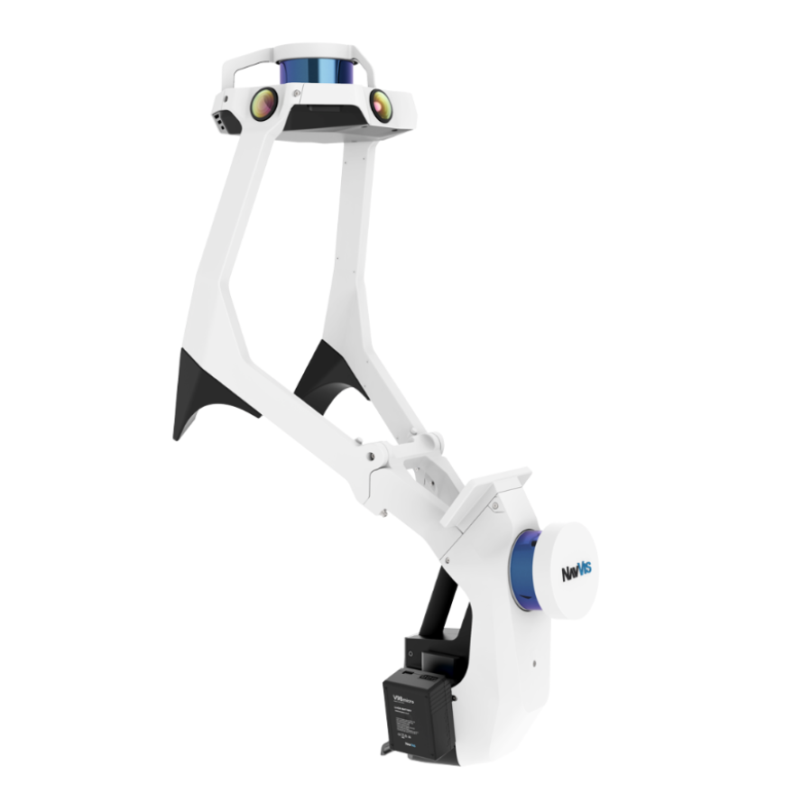
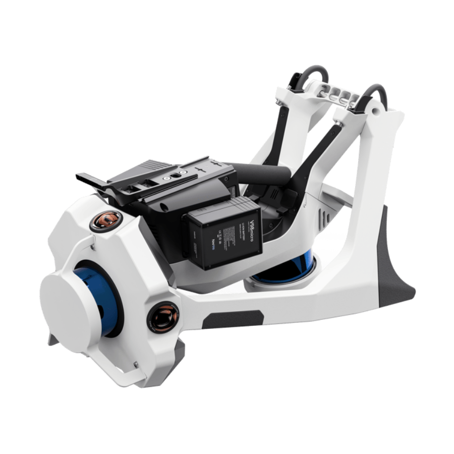
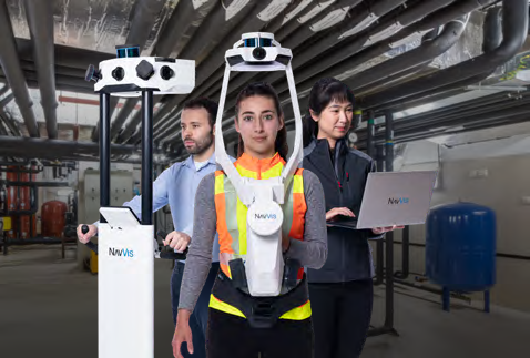
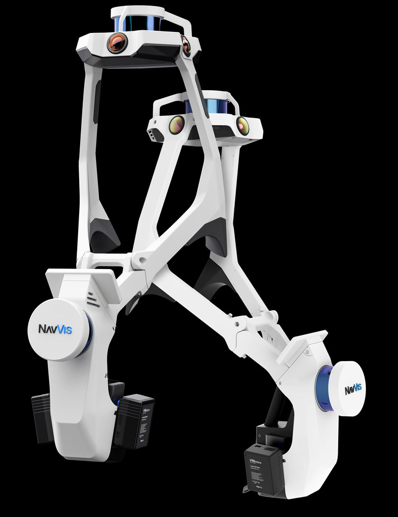
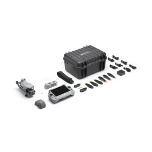
NaVvis VLX 2nd Generation
- Foldable, wearable hands-free mapping device
- High-quality reality capture with 6mm accuracy
- Dual LiDAR sensors with SLAM technology
- Survey-grade colorized/intensity point clouds
- Four cameras capture 360° panoramic images and walk throughs without any blind spots or operators in the field of view
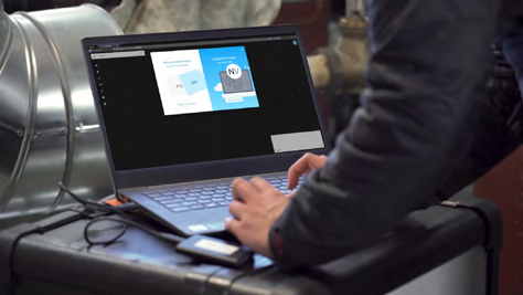
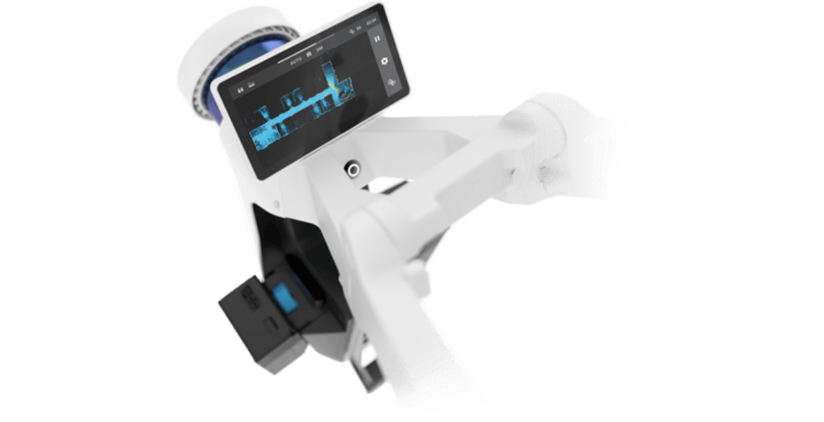
- Built-in touchscreen captures live scanning progress
- 10x faster in data acquisition than terrestrial scanners
- Trusted dealerDirect manufacturer partnership
- Pan-India deliveryInsured shipping, all states
- Post-sale supportTraining + service included
What makes it work
NaVvis VLX
A state-of-the-art virtual reality (VR) system for immersive training and simulation applications is the NaVvis VLX 2nd generation. This cutting-edge system offers users a seamless and captivating VR experience with advanced tracking technology, high-resolution displays, and a comfortable headset design. It can be utilised in a variety of fields, including, among others, aviation, defence, healthcare, and education. The second-generation NaVvis VLX is perfect for training programmes that call for practical experience without the dangers and expenses connected with in-person training. Shop now at XBOOM .

What is NavVis VLX?
Wearable mobile lidar scanners, or mobile mapping systems, are what NavVis VLX is. These 3D laser scanners collect information as you move about your environment. NavVisVLX is the quickest route to the most accurate spatial data thanks to its cutting-edge lidar scanning capabilities and unmatched SLAM technology.
Four cameras and two multi-layer LiDAR sensors make up the NavVis VLX. When compared to a terrestrial laser scanner, it can capture an immersive 360-degree panoramic view of the site and 1,000 to 4,5000 sqm of survey-grade data in a single dataset.
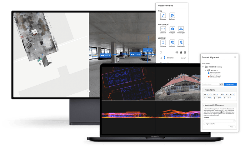
Reality capture workflow with NaVvis VLX 2nd Generation
A complete reality capture solution for laser scanning experts and engineers is made up of NavVis VLX and NavVis IVION. Utilise simple tools for creation, collaboration, and publication to manage your point clouds.
Capture
Use NavVis VLX in conjunction with any existing surveying tool in your toolbox, including total stations, GNSS rovers, terrestrial laser scanners, and unmanned aerial vehicles. Maintain your current behaviour, but perform it better.
Process
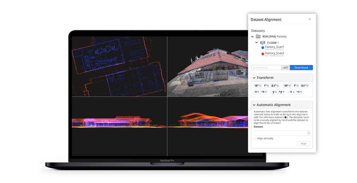
With survey-grade precision, process, georegister, and automatically align scan data from NavVis devices and other data sources. During post-processing, moving objects are automatically identified and eliminated.
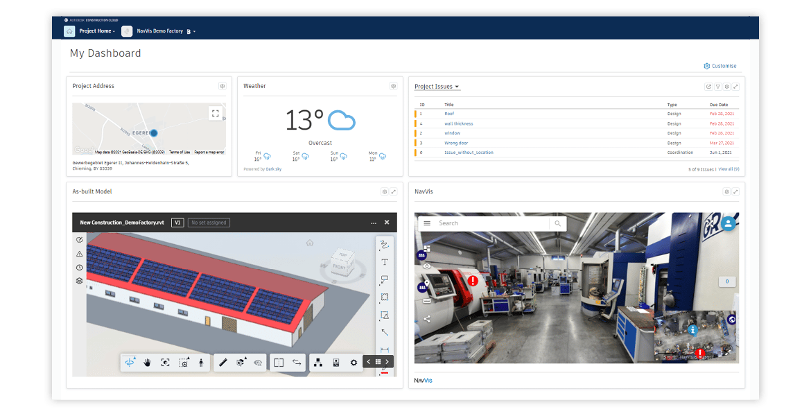
Collaborate and integrate
Point clouds and panoramic photos can be turned into intelligent places that can be accessed from any common web browser using NavVis IVION Core. Including download and crop features for third-party software.
The full sheet
Related products
-
·XBM·00
-
·XBM·01
 DJI Matrice 4TOriginal price was: ₹638,095.₹618,952Current price is: ₹618,952. (Excl. GST)Add to cart
 -
·XBM·02
-
·XBM·03

There are no reviews yet.