
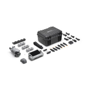
DJI Matrice 400 Worry-Free Plus Combo
- 3 months · ₹396,334
- 6 months · ₹198,167
- 9 months · ₹132,112
Select Snapmint at checkout · Available on orders above ₹3,000 · Subject to eligibility

- Trusted dealerDirect manufacturer partnership
- Pan-India deliveryInsured shipping, all states
- Post-sale supportTraining + service included
What makes it work
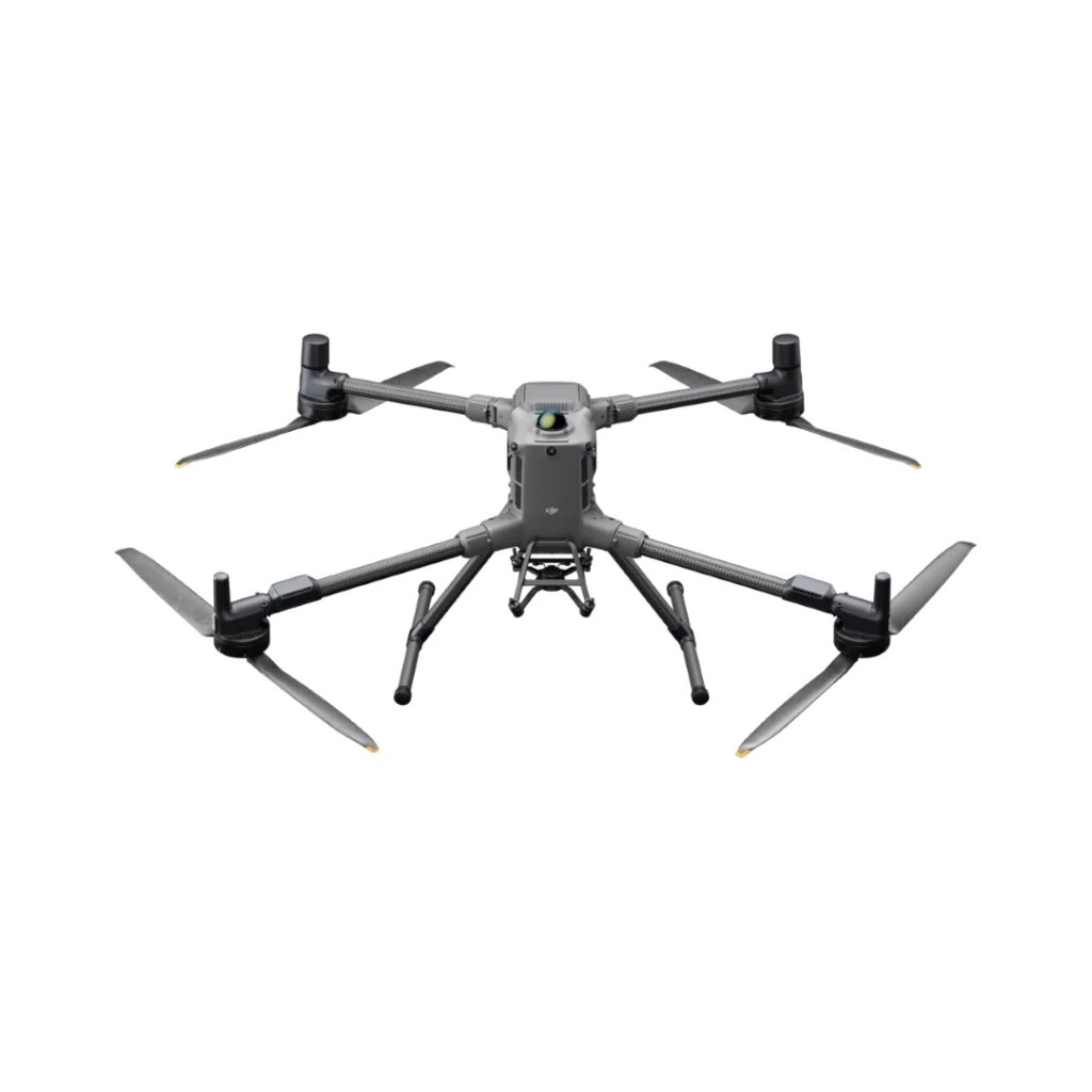
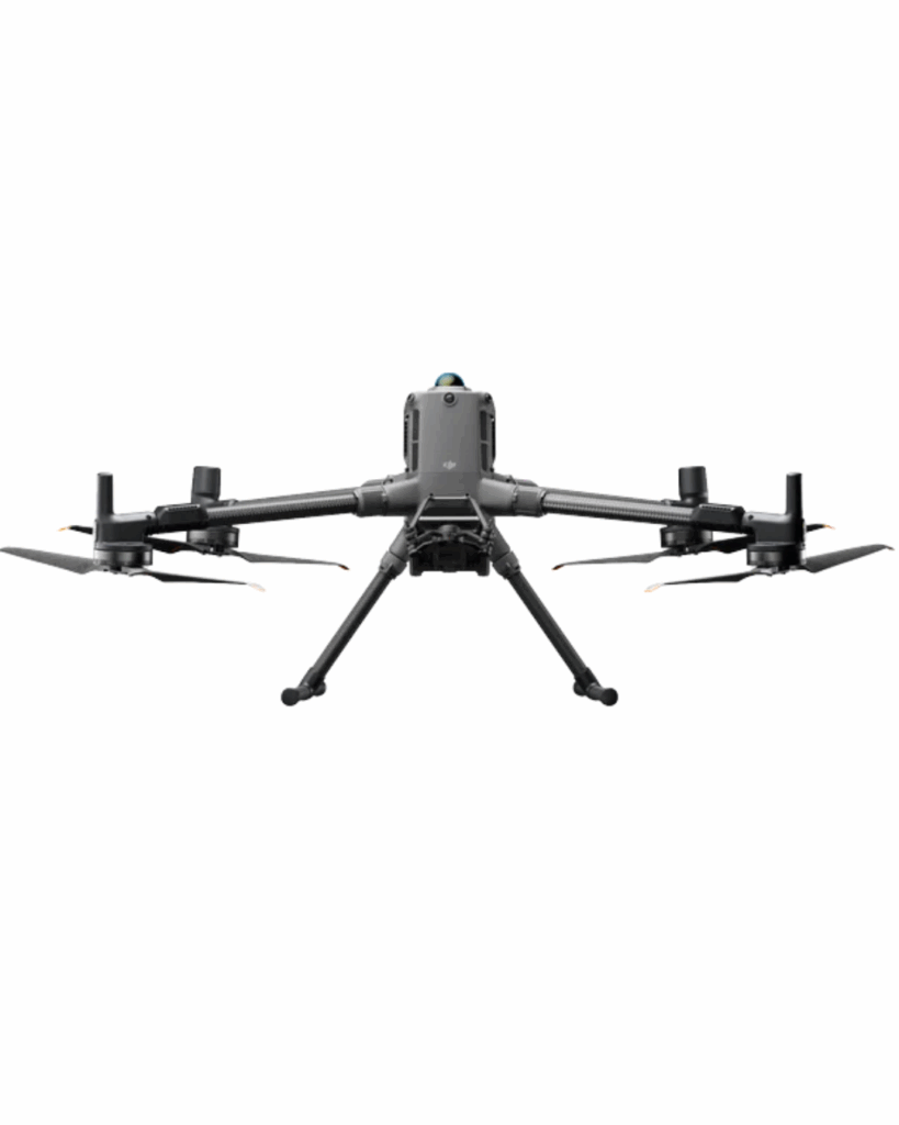
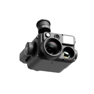
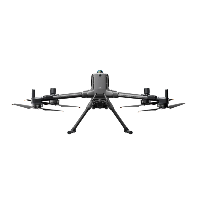
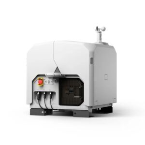
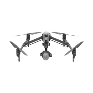
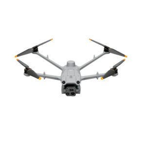
DJI Matrice 400: The Ultimate Enterprise Drone for India’s Industrial Needs
The DJI Matrice 400 is DJI’s flagship enterprise drone platform, engineered for powerful performance and mission-critical operations. It offers an extended 59-minute flight time, 6 kg maximum payload capacity, and features integrated rotating LiDAR and mmWave radar for precise obstacle detection—even around power lines. With O4 Enterprise Enhanced Video Transmission and Airborne Relay capabilities, it ensures stable connectivity and improved operational safety. Designed for versatility, it supports visible and thermal imaging, Smart Detection, AR projections, ship-based takeoffs and landings, and automated workflows—making it ideal for emergency response, power line inspections, aerial mapping, and AEC (Architecture, Engineering, and Construction) applications.
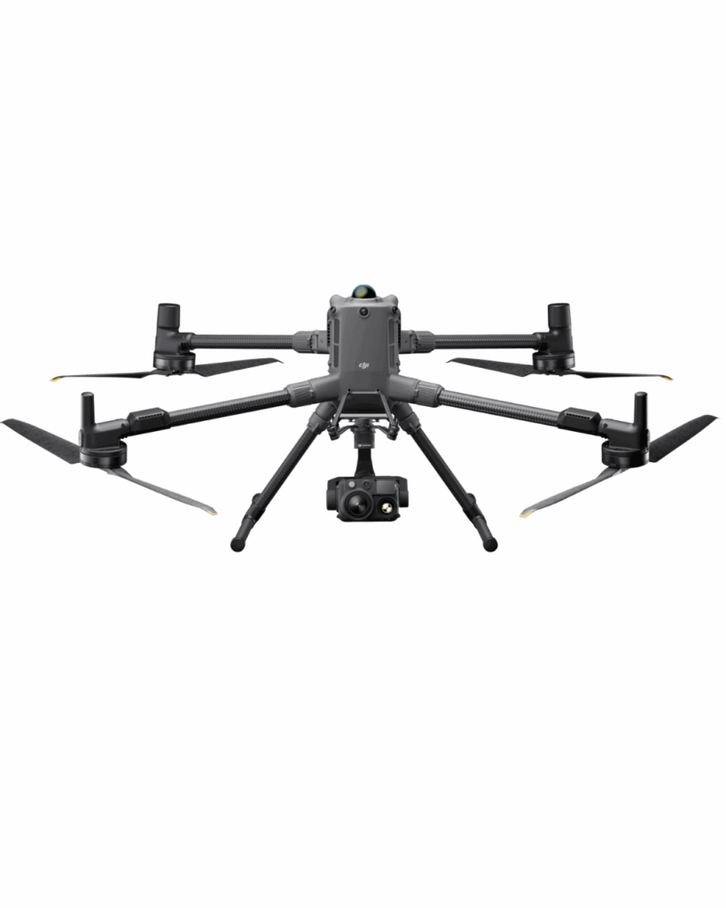
Payloads

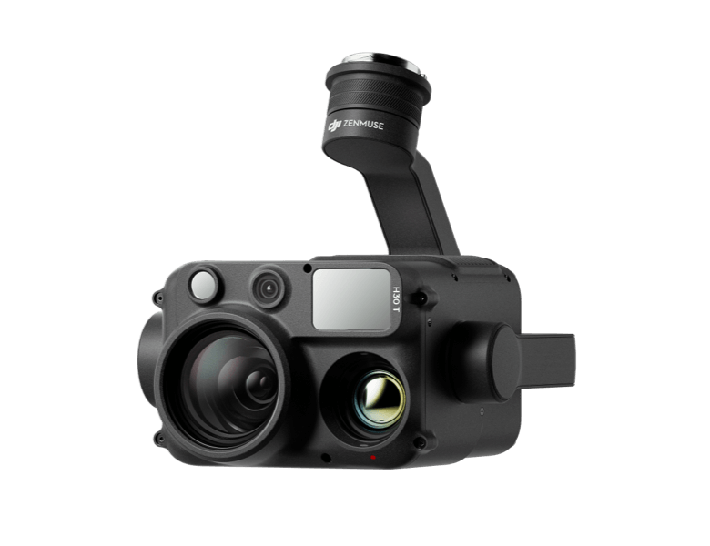
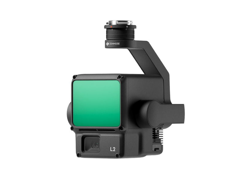
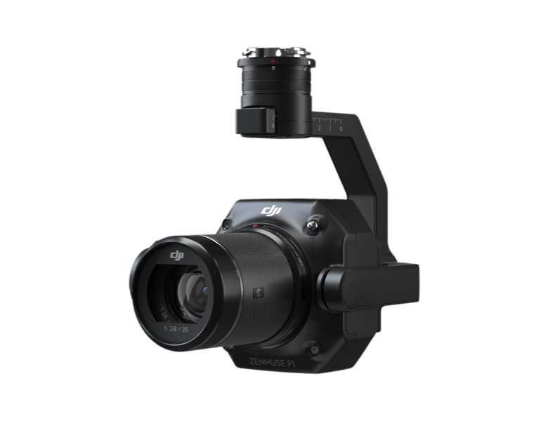
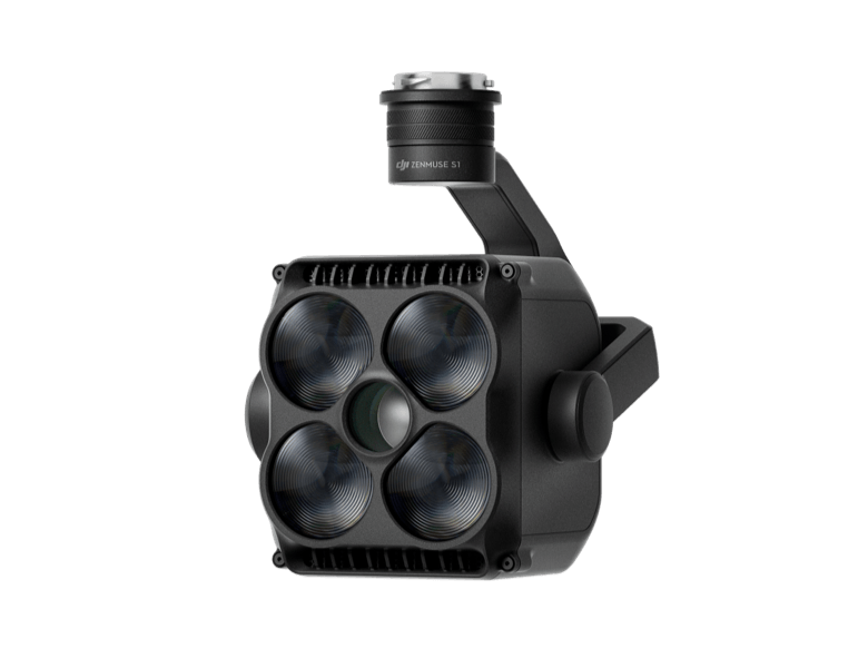
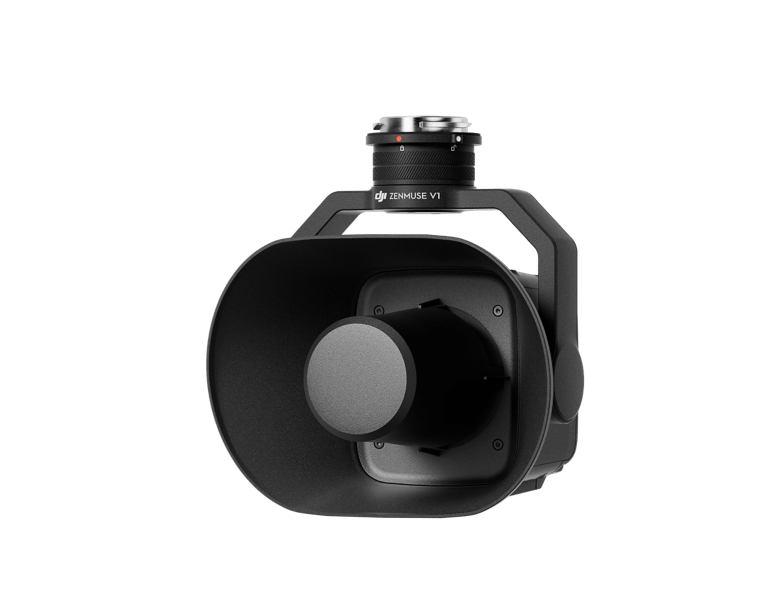
The Matrice 400 supports a range of payloads—including the Zenmuse H30 Series, L2, P1, S1 Spotlight, V1 Speaker, Manifold 3, and third-party options—allowing it to adapt to various tasks and fully leverage the DJI ecosystem’s capabilities.
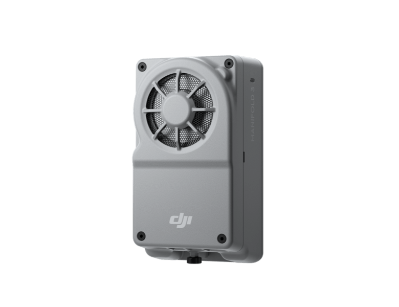
Mainfold 3
Manifold 3 packs an impressive 100 TOPS of computing power into a compact unit weighing about 120 g. It can be mounted onto Matrice 400 drone platform, optimizing efficiency across various operational missions with its robust processing.
Flight Time
Safe and Reliable Flight
Built to Withstand Harsh Environments
With an IP55 protection rating, the Matrice 400 is engineered to perform reliably in harsh environmental conditions, including heavy rain, dust, and strong winds. Its wide operating temperature range of -20°C to 50°C (-4°F to 122°F) ensures consistent performance in extreme climates—whether flying through freezing cold or under intense heat. This makes it the ideal choice for demanding missions across diverse terrains and weather conditions.
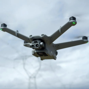
Power-Line-Level Obstacle Detection
The Matrice 400 sets a new benchmark in obstacle sensing by combining rotating LiDAR, high-precision mmWave radar, and full-color low-light fisheye vision sensors. This advanced system detects even thin, high-voltage power lines in complex terrains—day or night. Capable of penetrating fog and rain, it ensures superior situational awareness and flight safety in the most challenging environments.
Robust Video Transmission
O4 Enterprise
With a 10-antenna setup and high-gain phased array controller, the O4 system enables 40 km video transmission. Matrice 400 also supports sub-2G bands and dual DJI Cellular Dongle 2 for seamless network switching in urban or remote areas.
Airborne Relay
Enhanced Intelligence and Efficiency
Real-Time Terrain Follow
The Matrice 400 enables Real-Time Terrain Follow in any horizontal direction, available in both manual and automated flight modes. It maintains a stable altitude relative to the ground, ensuring consistent subject size during search and rescue and uniform GSD in mapping missions—reducing zoom adjustments and enhancing data accuracy and operational efficiency.
Takeoff and Landing on Ships
The Matrice 400 is built for maritime tasks like patrols and wind turbine inspections, with the ability to take off from stationary ships and land on moving vessels. It uses deck pattern recognition for safe, precise landings, ensuring reliable performance at sea.
DJI Matrice 400 — Specs
| Takeoff Weight (with propellers) | Without Batteries: 5020±20 g With Batteries: 9740±40 g The actual product weight may vary due to differences in batch materials and external factors. |
| Max Takeoff Weight | 15.8 kg |
| Dimensions | Unfolded: 980×760×480 mm (L×W×H) (with landing gear) Folded: 490×490×480 mm (L×W×H) (with landing gear and gimbal) Maximum dimensions excluding propellers. Aircraft carrying case dimensions: 779×363×528 mm (L×W×H) |
| Max Payload | 6 kg The 6 kg payload is measured at the third gimbal connector under sea level conditions. Payload capacity decreases as altitude increases. For details, refer to the official user manual. |
| Propeller Size | 25 inches |
| Diagonal Wheelbase | 1070 mm |
| Max Ascent Speed | 10 m/s |
| Max Descent Speed | 8 m/s |
| Max Horizontal Speed (at sea level, no wind) | 25 m/s |
| Max Takeoff Altitude | 7000 m |
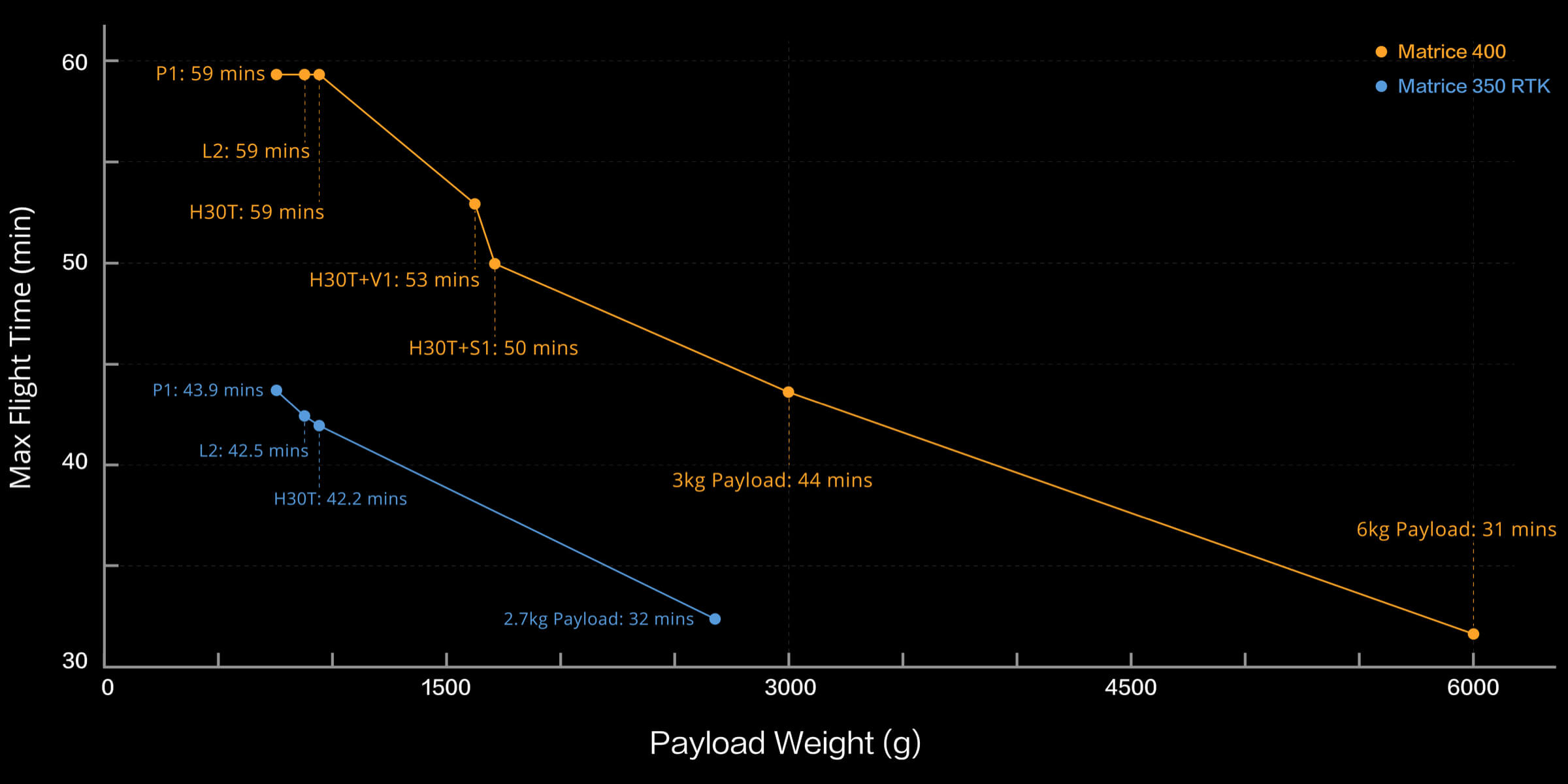
| Max Flight Time (no wind) | 59 minutes Measured with the aircraft flying forward at a constant speed of 10 m/s in a windless environment at sea level, carrying only the H30T (total weight 10,670 g), and from 100% battery level until 0%. Data is for reference only. Actual experience may vary depending on the environment, usage, and firmware version. |
| Max Hover Time (no wind) | 53 minutes Measured with the aircraft hovering in a windless environment at sea level, carrying only the H30T (total weight 10,670 g), and from 100% battery level until 0%. Data is for reference only. Actual usage time may vary depending on the environment, usage, and firmware version. |
| Max Flight Distance (no wind) | 49 km Measured by the aircraft flying forward at a constant speed of 17 m/s in a windless environment at sea level, carrying only the H30T (total weight 10,670 g), and from 100% battery level until 0%. Actual experience may vary depending on the environment, usage, and firmware version. |
| Max Wind Speed Resistance | 12 m/s Max wind speed resistance during takeoff and landing. |
| Max Yaw Angular Velocity | Yaw: 100°/s |
| Max Pitch Angle | 35° |
| Operating Temperature | -20° to 50° C (-4° to 122° F) (without solar radiation) |
| Global Navigation Satellite System (GNSS) | GPS + Galileo + BeiDou + GLONASS* * GLONASS is supported only when the RTK module is enabled. Equipped with standard airborne ADS-B In receiver and dual antennas, supporting reception up to 20 km. |
| Hovering Accuracy Range (with moderate or no wind) | Vertical: ±0.1 m (with vision positioning) ±0.5 m (with satellite positioning) ±0.1 m (with RTK positioning) Horizontal: ±0.3 m (with vision positioning) ±0.5 m (with satellite positioning) ±0.1 m (with RTK positioning) |
| RTK GNSS Accuracy | RTK Fix: 1 cm + 1 ppm (horizontal), 1.5 cm + 1 ppm (vertical) |
| RTK Heading | Supports RTK heading with an accuracy better than 2° |
| Airborne ADS-B In | Equipped with standard airborne ADS-B In receiver and dual antennas, supporting reception up to 20 km. |
| Internal Storage | N/A |
| Ports | USB-C Debug Port × 1: USB 2.0 E-Port V2 × 4: At the lower part of the drone, with 120W single-port power Cellular Dongle 2 Interface × 2: On the underside of the drone |
| Propeller Model | 2510F |
| Beacon | Built into the aircraft |
| Ingress Protection Rating | IP55 The rating is not permanently effective and may decrease due to product wear and tear. |
| Motor Model | 7510 |
| Maximum Payload for Single Gimbal Connector | 1400 g If exceeds 950 g, the gimbal damper lifespan will decrease from 1000 hours to 400 hours. |
| Maximum Payload for Dual Gimbal Connector | 950 g per mount |
| Maximum Payload for Third Gimbal Connector | 3 kg for quick-release port, 6 kg for screw lock fastening |
| Maximum Payload for Zenmuse L3 Gimbal Connector | 2100 g If exceeds 1600 g, the gimbal damper lifespan will decrease from 1000 hours to 400 hours. |
| Sensing Type | Omnidirectional binocular vision system (surround view provided by full-color fisheye vision sensors) Horizontal rotating LiDAR, upper LiDAR, and downward 3D infrared range sensor Six-direction mmWave radar |
| Forward | Measurement Range: 0.4-21 m Detection Range: 0.4-200 m Field of View (FOV): 90° (horizontal), 90° (vertical) |
| Backward | Measurement Range: 0.4-21 m Detection Range: 0.4-200 m Field of View (FOV): 90° (horizontal), 90° (vertical) |
| Lateral | Measurement Range: 0.6-21 m Detection Range: 0.5-200 m Field of View (FOV): 90° (horizontal), 90° (vertical) |
| Downward | Measurement Range: 0.5-19 m The FOV to the front and rear is 160° and 105° to the right and left. |
| Operating Environment | Forward, Backward, Left, Right, and Upward: Delicate texture on the surface, adequate light. Downward: The ground has rich textures and sufficient lighting conditions*, with a diffuse reflection surface and a reflectivity greater than 20% (such as walls, trees, people, etc.). * Sufficient lighting conditions refer to an illuminance not lower than that of a nighttime city light scene. |
| Rotating LiDAR | Standard Measurement Range: 0.5-100 m @ 100,000 lux with 10% reflectivity target Measurement Range for Power Line: 35 m @ 30° @ 10,000 lux for 21.6 mm steel-core aluminum stranded wire with a relative body tilt angle of 30° to the left and right Field of View (FOV): 360° (horizontal), 58° (vertical) Point-Frequency: 520,000 points/second Laser Wavelength: 905 nm Eye Safety Level: Class 1 (IEC60825-1:2014), eye-safe |
| Upper LiDAR (3D ToF) | 0.5-25 m at night (reflectivity > 10%) The FOV to the up and down is 60° and 60° to the right and left. |
| Downward 3D Infrared Range Sensor | Measurement Range: 0.3-8 m (reflectivity > 10%) The FOV to the front and rear is 60° and 60° to the right and left. |
| mmWave Radar | Measurement Range for Power Line: 36 m for a 12mm steel-core aluminum stranded wire 50 m for a 21.6mm steel-core aluminum stranded wire FOV: ± 45° (horizontal and vertical) The mmWave radar function may be unavailable or restricted in some countries or regions. Refer to local laws and regulations for more information. |
| Resolution | 1080p |
| Field of View (FOV) | DFOV: 150° HFOV: 139.6° VFOV: 95.3° |
| Frame Rate | 30fps |
| Night Vision | Starlight Grade |
| Video Transmission System | DJI O4 Enterprise Enhanced Video Transmission System |
| Live View Quality | Remote Controller: 3-channel 1080p/30fps |
| Operating Frequency and Transmitter Power (EIRP) | 902-928 MHz: < 30 dBm (FCC), < 16 dBm (MIC) 1.430-1.444 GHz: < 35 dBm (SRRC) 2.4000-2.4835 GHz: < 33 dBm (FCC), < 20 dBm (CE/SRRC/MIC) 5.150-5.250 GHz: < 23 dBm (FCC/CE) 5.725-5.850 GHz: < 33 dBm (FCC), < 14 dBm (CE), < 30 dBm (SRRC) Operating frequency allowed varies among countries and regions. Refer to local laws and regulations for more information. |
| Max Transmission Distance (unobstructed, free of interference) | 40 km (FCC) 20 km (CE/SRRC/MIC) Measured in an unobstructed environment free of interference. The above data shows the farthest communication range for one-way, non-return flights under each standard. During your flight, please pay attention to RTH reminder on the DJI Pilot 2 app. |
| Max Transmission Distance (with interference) | Strong interference (dense buildings, residential areas, etc.): approx. 1.5-6 km Medium interference (suburban counties, city parks, etc.): approx. 6-15 km Weak interference (open spaces, remote areas, etc.): approx. 15-40 km Data is tested under FCC standard in unobstructed environments of typical interference. Only to serve as a reference and provides no guarantee as to the actual flight distance. |
| Max Download Speed | Standard Mode: 80Mbps Downlink Playback Download: < 25 MBps Single-Channel Bitrate: ≤ 12 Mbps The above data was measured under conditions where the aircraft and remote controller were in close proximity without interference. |
| Antenna | WLAN Antenna × 8: 6 vertically polarized antennas and 2 horizontally polarized antennas sub2G Antenna × 2: 2 vertically polarized antennas 4G Antenna × 4 Operating Mode: 2T4R |
| Others | Supports Dual Control Mode and 2-channel Cellular Dongle 2 |
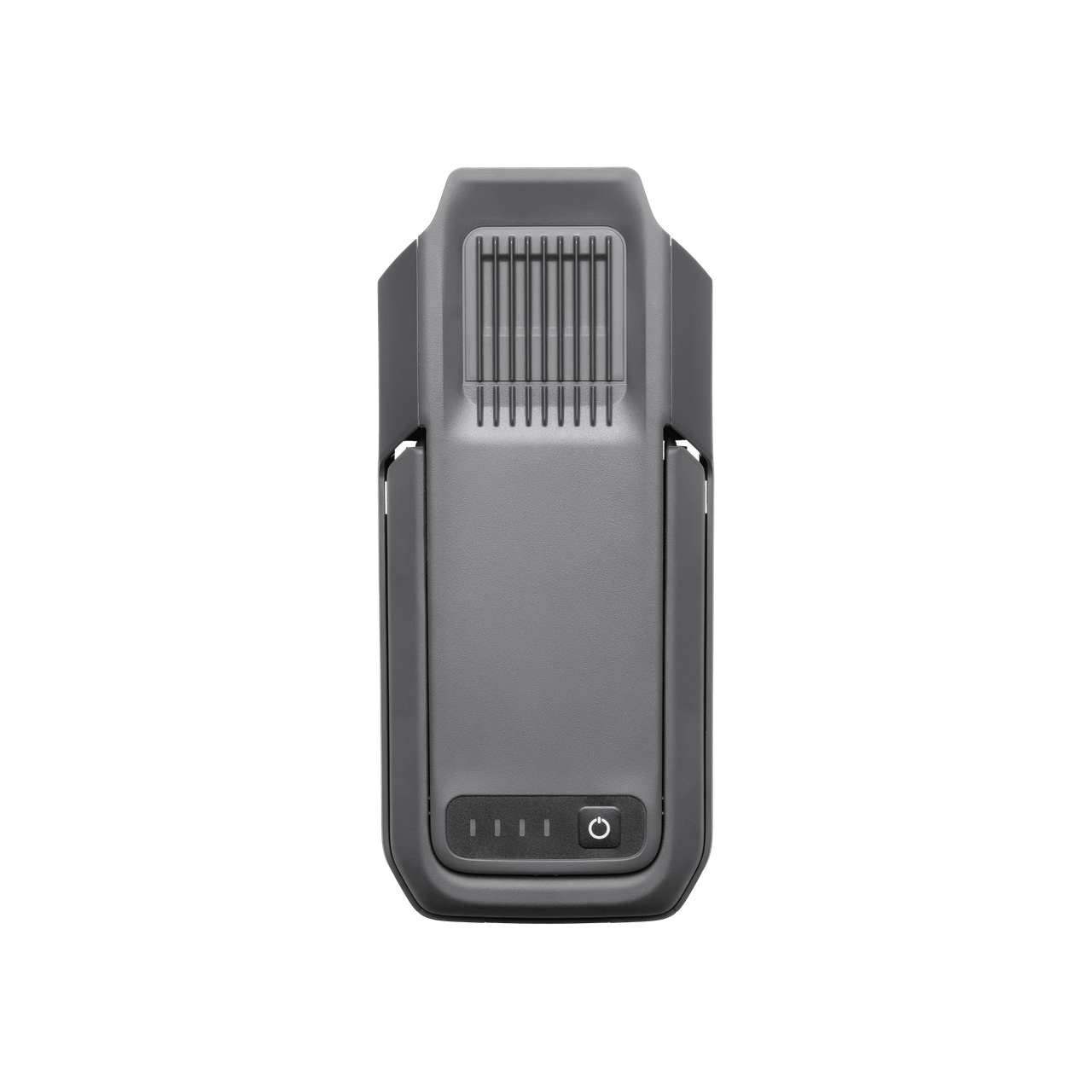
| Model | TB100 |
| Capacity | 20254 mAh |
| Standard Voltage | 48.23 V |
| Max Charging Voltage | 54.6 V |
| Cell Type | Li-ion 13S |
| Energy | 977 Wh |
| Weight | 4720 ± 20 g |
| Charging Temperature | 5° to 45° C (41° to 113° F) |
| Discharging Temperature | -20° to 75° C (-4° to 167° F) |
| Battery Heating | Single Battery: Support Onboard: Support Battery Station: Support |
| Discharge Rate | 4C |
| Max Charging Power | 2C |
| Low-Temperature Charging | Supports low-temperature self-heating charging |
| Cycle Count | 400 |
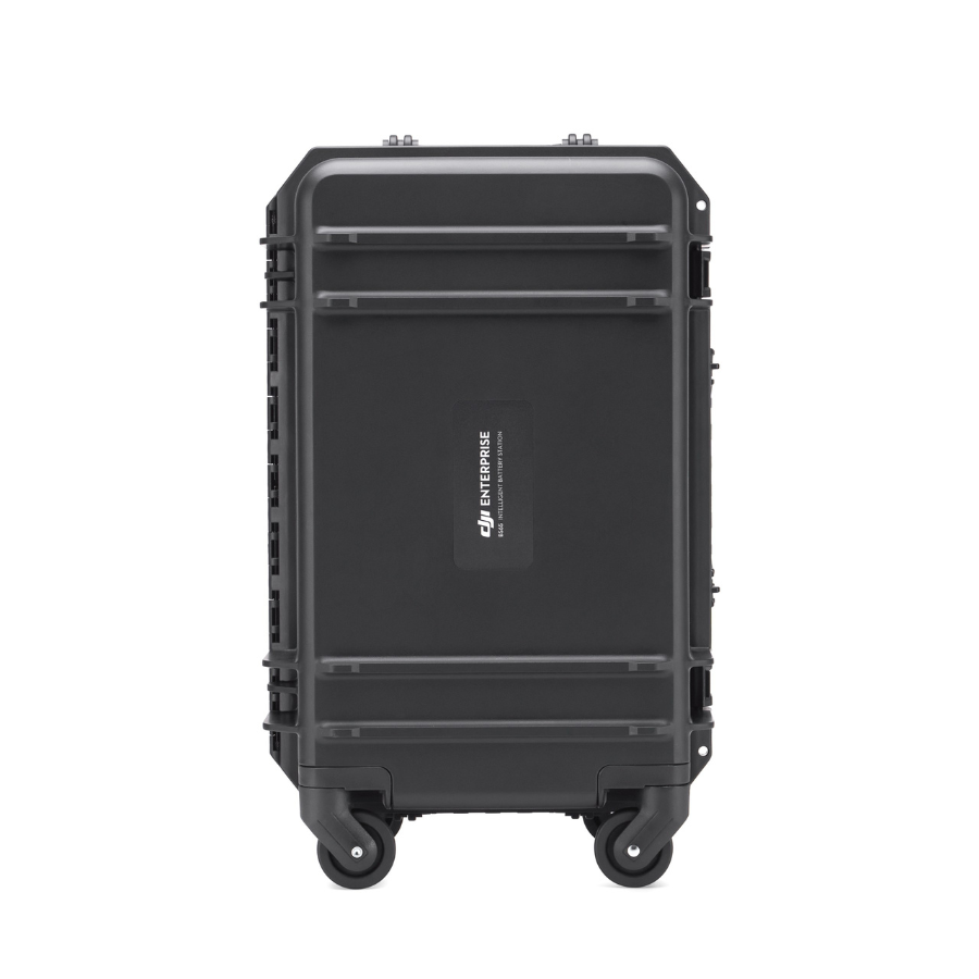
| Model | BS100 |
| Net Weight | 11.8 kg |
| Dimensions | 605×410×250 mm (L×W×H) |
| Supported Batteries | TB100 Intelligent Flight Battery, TB100C Tethered Battery WB37 Battery |
| Operating Temperature | -20° to 40° C (-4° to 104° F) |
| Input | 100-240 V (AC), 50-60 Hz, 10 A |
| Output | TB100 Battery Interface: 100-110 V: Approx. 1185 W 110-180 V: Approx.1474 W 180-240 V: Approx. 2184 W WB37 Battery Interface: 100-240 V: Approx. 52 W USB-C: 5.0 V 3.0 A, 9.0 V 3.0 A, 12.0 V 3.0 A, 15.0 V 3.0 A, 20.0 V 3.25 A |
| Number of Charging Channels | Three TB100 and two WB37 batteries |
| Charging Mode | Ready-to-Fly Mode 90%; Standard Mode 100% Supports Fast Charging Mode and Silent Mode |
| Charging Time | TB100/TB100C Battery From 0% to 100%: 220 V: 45 minutes (Fast Charging Mode); 110 minutes (Silent Mode) 110 V: 70 minutes (Fast Charging Mode); 110 minutes (Silent Mode) Charging time is measured in a test environment with a temperature of 25° C (77° F). |
| Video Transmission System | DJI O4 Enterprise Enhanced Video Transmission System |
| Max Transmission Distance (unobstructed, free of interference) | 40 km (FCC) 20 km (CE/SRRC/MIC) Measured in an unobstructed environment free of interference. The above data shows the farthest communication range for one-way, non-return flights under each standard. During your flight, please pay attention to RTH reminder on the DJI Pilot 2 app. |
| Video Transmission Operating Frequency and Transmitter Power (EIRP) | 902-928 MHz: < 30 dBm (FCC), < 16 dBm (MIC) 2.400-2.4835 GHz: < 33 dBm (FCC), < 20 dBm (CE/SRRC/MIC) 5.150-5.250 GHz: < 23 dBm (FCC/CE) 5.725-5.850 GHz: < 33 dBm (FCC), < 14 dBm (CE), < 30 dBm (SRRC) Operating frequency allowed varies among countries and regions. Refer to local laws and regulations for more information. |
| Antenna | 2.4GHz/5.8GHz Multi-Beam High-Gain Antenna: 2T4R sub2G Module: 2T2R |
| Enhanced Transmission | Supports DJI Cellular Dongle 2 |
| Wi-Fi Protocol | Wi-Fi Direct, Wireless Display, IEEE 802.11 a/b/g/n/ac/ax Supports 2×2 MIMO Wi-Fi, dual-band simultaneous (DBS) support for dual MAC, with data rates up to 1774.5 Mbps (2×2 + 2×2 11ax dual-band simultaneous) |
| Wi-Fi Operating Frequency | 2.4000-2.4835 GHz 5.150-5.250 GHz 5.725-5.850 GHz 5.2 and 5.8GHz frequencies are prohibited in some countries. In some countries, the 5.2GHz frequency is only allowed for use in indoor. Refer to local laws and regulations for more information. |
| Wi-Fi Transmitter Power (EIRP) | 2.4 GHz: < 26 dBm, < 20 dBm (CE/SRRC/MIC) 5.1 GHz: < 23 dBm (FCC/CE/SRRC/MIC) 5.8 GHz: < 23 dBm (FCC/SRRC), < 14 dBm (CE) |
| Bluetooth Protocol | Bluetooth 5.2 |
| Bluetooth Operating Frequency | 2.400-2.4835 GHz |
| Bluetooth Transmitter Power (EIRP) | < 10 dBm |
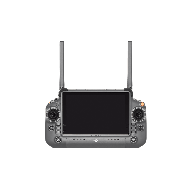
| Screen Resolution | 1920 × 1200 |
| Screen Size | 7.02 inches |
| Screen Frame Rate | 60fps |
| Brightness | 1400 nits |
| Touchscreen Control | 10-Point Multi-Touch |
| Built-in Battery | 2S2P High Energy Density 18650 Lithium-ion Battery (6500 mAh @ 7.2 V) 46.8 Wh |
| External Battery | Optional, WB37 (4920 mAh @ 7.6 V) 37 Wh |
| Charging Type | Supports PD fast charging, with a maximum 20V/3.25A USB Type-C charger |
| Storage Capacity | RAM 8G + ROM 128G UFS + expandable storage via microSD card |
| Charging Time | 2 hours for internal battery; 2 hours for internal plus external batteries. When remote controller is powered off and using a standard DJI charger. |
| Internal Battery Runtime | 3.8 hours |
| External Battery Runtime | 3.2 hours |
| Output Port | HDMI 1.4 |
| Indicators | Status LED, battery level LED, connection status LED; brightness adjustable according to ambient light. |
| Speaker | Supports buzzer |
| Audio | Array MIC |
| Operating Temperature | -20° to 50° C (-4° to 122° F) |
| Storage Temperature | Within one month: -30° to 45° C (-22° to 140° F) One to three months: -30° to 35° C (-22° to 113° F) Three months to one year: -30° to 30° C (-22° to 86° F) |
| Charging Temperature | 5° to 40° C (41° to 104° F) |
| Supported Aircraft Model | Matrice 400 |
| Global Navigation Satellite System | GPS + Galileo + BeiDou |
| Dimensions | 268×163×94.5 mm (L×W×H) Width including external antenna folded, thickness including handle and controller sticks. |
| Weight | 1.15 kg (without external battery) |
| Model | TKPL 2 |
| System Version | Android 11 |
| External Interfaces | HDMI 1.4, SD 3.0, USB-C with OTG support, max 65W PD charging, USB-A with USB 2.0 support |
| Accessories | Strap/waist support |
| DJI Products Compatible With Matrice 400 | Gimbal Cameras: Zenmuse L3, Zenmuse H30, Zenmuse H30T, Zenmuse L2 and Zenmuse P1 Accessories: Zenmuse S1 (drone spotlight), Zenmuse V1 (drone speaker), Manifold 3, DJI RC Plus 2 sub2G SDR Module*, DJI Cellular Dongle 2 RTK Station: D-RTK 3 Multifunctional Station, D-RTK 2 Mobile Station Ecosystem Accessories: DJI X-Port DJI E-Port V2 Development Kit DJI E-Port V2 Coaxial Cable Kit DJI SKYPORT V3 Adapter Set DJI SKYPORT V3 Coaxial Cable Kit * Operating frequency allowed varies among countries and regions. Refer to local laws and regulations for more information. |
| Note | The terms HDMI, HDMI High-Definition Multimedia Interface, HDMI Trade dress and the HDMI Logos are trademarks or registered trademarks of HDMI Licensing Administrator, Inc. |
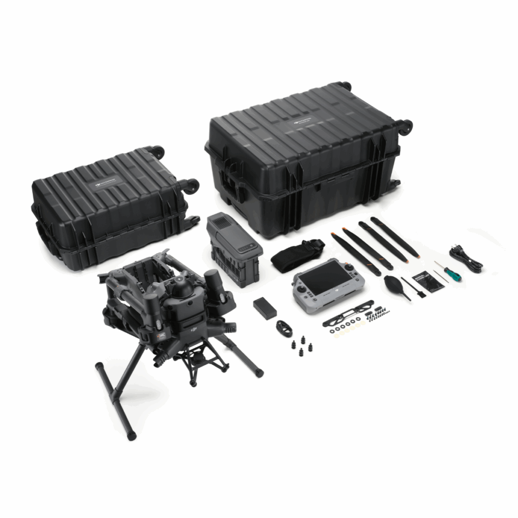
In the Box
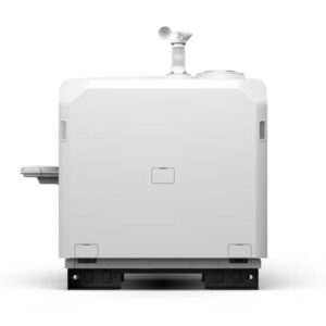
DJI Matric 400
x 1
TB100 Intelligent Flight Battery
x 1
BS100 Intelligent Battery Station
x 1
DJI RC Plus 2 Enterprise Enhanced
x 1
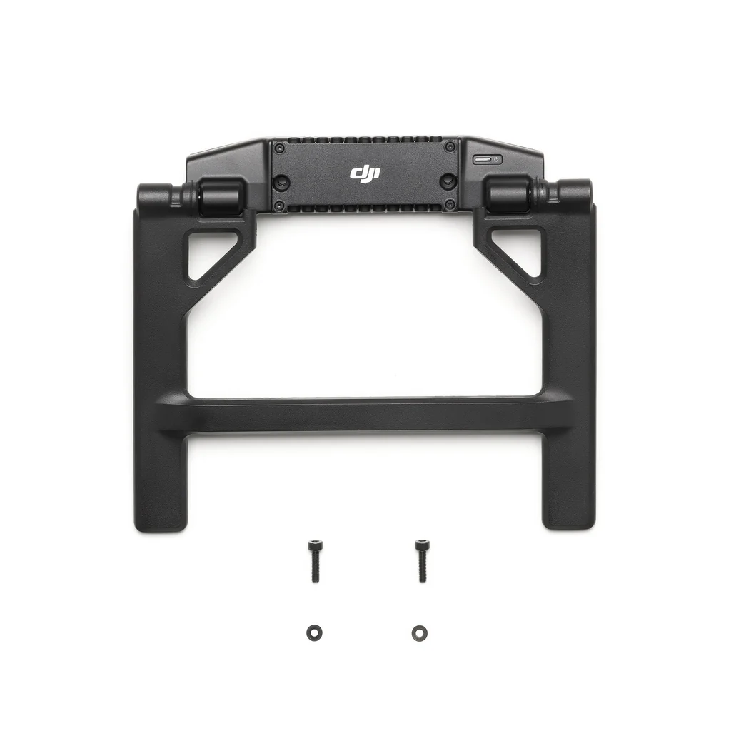
DJI RC Plus 2 sub2G SDR Module
x 1
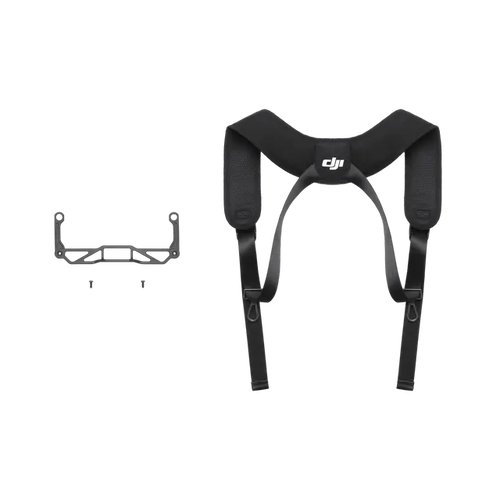
DJI RC Plus 2 Strap and Bracket Kit
x 1
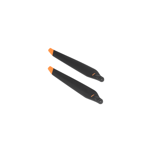
DJI Matric 400 Propellers
x 1
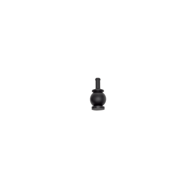
DJI Matice 400 Gimbal Dampers
x 1

Carrying Case
x 1
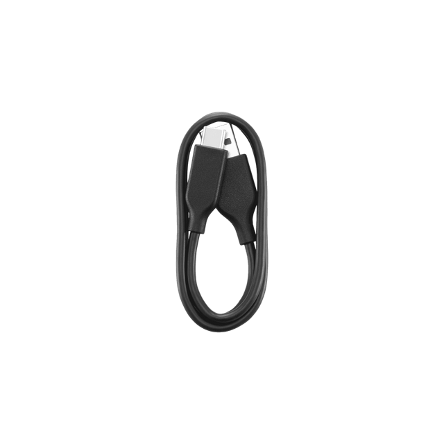
USB Cable
x 1
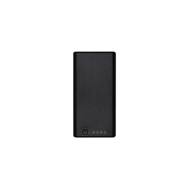
WB37 Battery
x 1
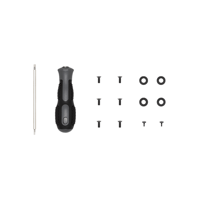
Screws and Tools
x 1
FAQ’s on DJI Matrice 400
What is the maximum payload capacity of the DJI Matrice 400 RTK?
The Matrice 400 RTK supports a maximum payload of 6 kg, measured at the third gimbal connector under sea-level conditions. Payload capacity may reduce at higher altitudes.
How long can the Matrice 400 RTK fly on a full charge?
Under ideal conditions with no wind, the M400 can achieve a maximum flight time of 59 minutes and a hover time of up to 53 minutes, using TB100 batteries and carrying the H30T payload.
Is the DJI Matrice 400 RTK waterproof?
Yes, the drone has an IP55 ingress protection rating, making it resistant to dust and water jets from any direction. However, it is not fully waterproof or submersible.
What is the maximum flight altitude and wind resistance of the M400?
The drone can operate at a maximum takeoff altitude of 7,000 meters and can withstand wind speeds up to 12 m/s during takeoff and landing.
What types of sensors and positioning systems are included?
The M400 is equipped with omnidirectional sensing, including binocular vision, LiDAR, infrared, and mmWave radar. It supports RTK GNSS (GPS, Galileo, BeiDou, and GLONASS when RTK is active), enabling centimeter-level positioning accuracy.
Which payloads and gimbal cameras are compatible with the DJI Matrice 400?
It supports Zenmuse H30, H30T, P1, and L2 gimbal cameras. Additionally, it is compatible with Zenmuse accessories like S1 (spotlight) and V1 (loudspeaker), as well as DJI’s custom payload ecosystem via E-Port V2 and SkyPort V3.
The full sheet
Related products
-
·XBM·00
-
·XBM·01
 DJI Matrice 4T ComboOriginal price was: ₹705,713.₹699,999Current price is: ₹699,999. (Excl. GST)Add to cart
 -
·AIR·02
-
·AIR·03

There are no reviews yet.