
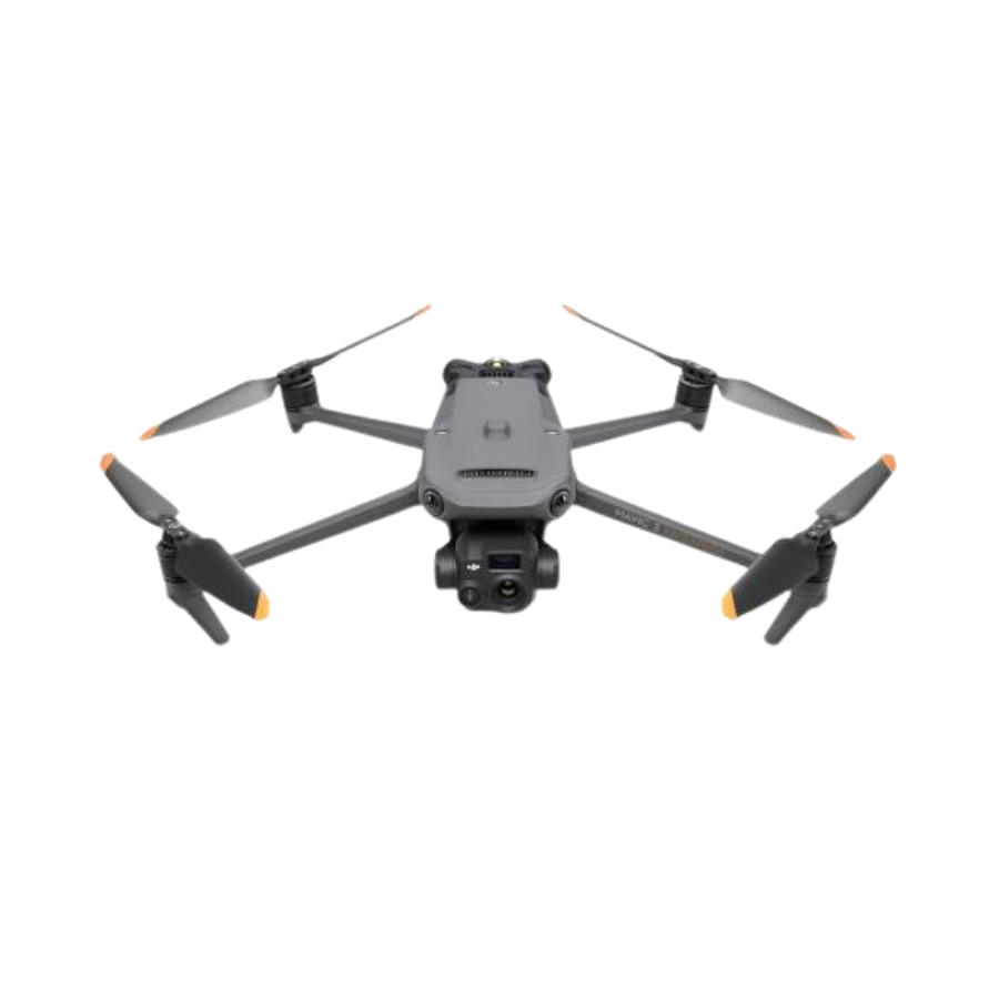
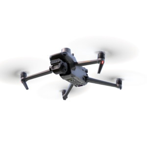
DJI Mavic 3T Advance
-
Professional thermal drone designed for public safety, inspection, and emergency response
-
Integrated thermal, wide, and telephoto camera system
-
High-precision positioning with RTK support
-
Long flight time with enhanced transmission range
-
Advanced obstacle avoidance and intelligent flight modes
- 3 months · ₹163,492
- 6 months · ₹81,746
- 9 months · ₹54,498
Select Snapmint at checkout · Available on orders above ₹3,000 · Subject to eligibility
- Trusted dealerDirect manufacturer partnership
- Pan-India deliveryInsured shipping, all states
- Post-sale supportTraining + service included
What makes it work
DJI Mavic 3T Advance
The DJI Mavic 3T Advance is a triple-camera thermal drone built for public safety and inspection.
Full Specifications
| Specification | Details |
|---|---|
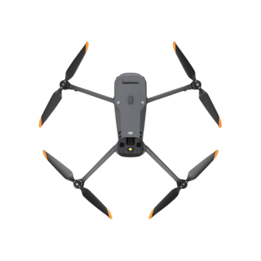
| Aircraft Weight | Approx. 920g (with propellers, no accessories) |
| Max Takeoff Weight | Approx. 1050g |
| Dimensions (Folded) | 221 × 96.3 × 90.3 mm |
| Dimensions (Unfolded) | 347.5 × 283 × 107.7 mm |
| Max Flight Time | Up to 45 minutes (standard battery, no wind) |
| Max Flight Speed | 15 m/s in Normal Mode; up to 21 m/s forward in Sport Mode |
| Max Wind Resistance | 12 m/s (Level 5) |
| Operating Temperature | -10°C to 40°C |
| Specification | Details |
|---|---|
| GNSS | GPS + Galileo + BeiDou + GLONASS |
| RTK Support | Supported — up to ±0.1m horizontal accuracy with RTK module engaged |
| Max Transmission Range | Up to 15km (FCC regions; lower in CE/SRRC/MIC regions per local regulation) |
| Obstacle Sensing | Omnidirectional obstacle sensing |
| Specification | Details |
|---|---|
| Wide Camera Sensor | 1/2-inch CMOS, 48MP effective |
| Wide Camera Lens | FOV 84°, 24mm equivalent, f/2.8, max image 8000×6000 |
| Telephoto Camera Sensor | 1/2-inch CMOS, 12MP effective |
| Telephoto Zoom | Up to 56× hybrid zoom (162mm equivalent) |
| Thermal Camera Resolution | 640 × 512 @ 30Hz |
| Temperature Measurement | Spot Meter, Area Measurement, Isotherm display |
| Temperature Range | -20°C to 150°C (high-temperature mode up to 500°C) |
| Gimbal | 3-axis mechanical stabilisation (tilt, roll, pan) |
| Video Resolution | 4K (3840×2160) up to 30fps, H.264 |
| Photo / Video Formats | JPEG, RAW photos; MP4, MOV video |
| Specification | Details |
|---|---|
| Battery Type | DJI Intelligent Flight Battery |
| Battery Capacity | 5000mAh |
| Charging Time | Approx. 90–96 minutes with fast charger |
| Specification | Details |
|---|---|
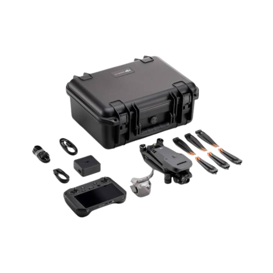
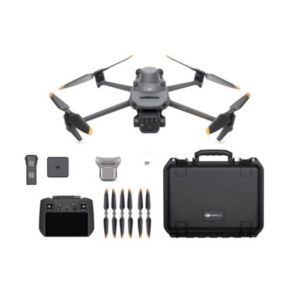
| In the Box | DJI Mavic 3T Aircraft, Smart Controller with built-in high-bright display and microphone, Intelligent Flight Battery, gimbal protector, spare propellers, charging cables, and a hard protective carrying case |
A Thermal Drone Built for Every Response
Three Cameras, One Compact Enterprise Airframe
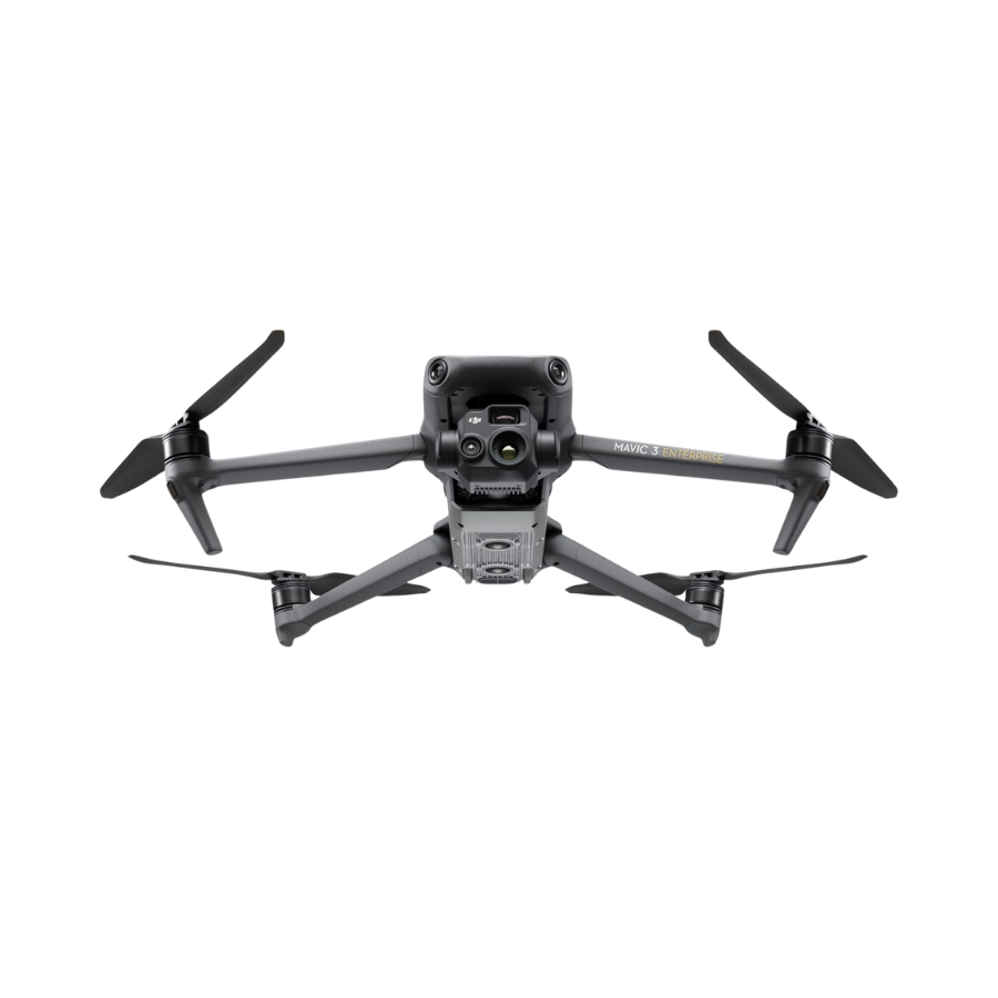
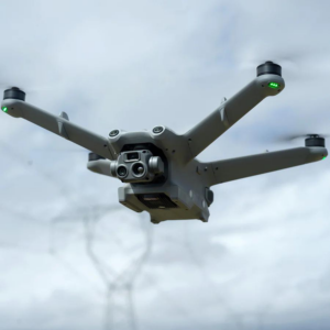
The DJI Mavic 3T Advance pairs a 48MP wide camera and a 12MP telephoto camera capable of up to 56× hybrid zoom with a dedicated 640×512 thermal camera — all on a single 3-axis gimbal, in a folding airframe that weighs approximately 920g. It's built on the proven Mavic 3 Enterprise platform: fast, stable, and rated for up to 45 minutes of flight time per battery.
The thermal camera isn't just a heat-vision overlay — it supports Spot Meter and Area Measurement temperature readings plus an Isotherm display mode, letting operators identify hotspots, missing persons, or equipment faults at a glance and quantify them numerically rather than just visually. With RTK support engaged, the same aircraft can also deliver centimetre-level positioning accuracy for mapping and inspection work.
640×512 Radiometric Thermal
Spot Meter and Area Measurement modes turn heat signatures into readable temperature data, with an Isotherm display to highlight a specific temperature band at a glance.
56× Hybrid Zoom Telephoto
Identify details from a safe standoff distance — read a license plate, inspect a rooftop, or confirm a hotspot's source without flying dangerously close.
RTK-Ready Precision
With the RTK module engaged, positioning accuracy tightens to roughly ±0.1m horizontally — built for mapping, surveying, and repeatable inspection flight paths.
Omnidirectional Obstacle Sensing
Sensors covering all directions help the aircraft avoid obstacles automatically, adding a margin of safety during fast-moving search-and-rescue or inspection operations.
Built for Public Safety, Inspection & Emergency Response
Whether it's locating a missing person after dark, checking a structure for hotspots after a fire, or inspecting a power line or rooftop from a safe distance, the Mavic 3T Advance is designed to get airborne quickly and deliver actionable imagery immediately — thermal, wide, and zoomed-in detail from the same aircraft, without swapping payloads.
See Every Detail
Everything in the Advance Package
The Advance package pairs the Mavic 3T aircraft with a Smart Controller featuring a built-in high-bright display and microphone, spare propellers, a gimbal protector, charging cables, and a hard protective case — ready to deploy straight from the box.
Three Cameras, One Flight
Wide, telephoto, and thermal imaging on a single gimbal — switch between them mid-flight without changing payloads.
640×512
Radiometric Thermal
Identifies heat signatures for search and rescue, firefighting, and equipment inspection. Spot Meter and Area Measurement modes convert what you see into actual temperature readings.
48MP Wide
56× Hybrid Tele
The wide camera captures high-resolution detail for documentation and mapping, while the telephoto camera zooms in on distant subjects — useful for reading details from a safe standoff distance.
Every Tool for Professional Operations
The DJI Mavic 3T Advance is built on the Mavic 3 Enterprise platform, with the payload and precision that public safety and inspection teams need.
Radiometric Thermal Imaging
640×512 thermal resolution at 30Hz with Spot Meter and Area Measurement modes for quantified, not just visual, temperature data.
56× Hybrid Zoom Telephoto
Inspect and identify details from a safe standoff distance with the 12MP telephoto camera's combined optical and digital zoom.
RTK-Ready Positioning
Engage the RTK module for centimetre-level positioning accuracy, ideal for mapping, surveying, and repeatable inspection flight paths.
Omnidirectional Obstacle Sensing
Sensors covering every direction help the aircraft avoid obstacles automatically during fast-paced or low-visibility operations.
Up to 15km Transmission
A long-range transmission link keeps the video feed and controls stable well beyond visual range, subject to local regulation.
45-Minute Max Flight Time
Extended air time per battery means more ground covered per sortie, whether searching a wide area or completing a full site inspection.
12 m/s Wind Resistance
Rated to fly in Level 5 winds, giving operators a wider window to respond when conditions aren't ideal.
Smart Controller Included
A built-in high-bright display and microphone mean no phone pairing required — power on and fly straight out of the case.
Foldable, Case-Ready Design
Folds down to 221×96.3×90.3mm and travels in the included hard case, ready to deploy on short notice.
Built for Professional & Public Safety Teams
The DJI Mavic 3T Advance is designed for teams that need thermal, zoom, and mapping-grade precision from a single, fast-deploying aircraft.
Search & Rescue
Thermal imaging helps locate missing persons in low light or dense terrain, while the telephoto camera confirms details from a safe distance.
Firefighting & Emergency Response
Spot Meter and Area Measurement readings help identify hotspots and reignition risks that aren't visible to the naked eye.
Building & Infrastructure Inspection
Identify insulation gaps, electrical faults, and structural heat anomalies from the air, with 56× zoom for close visual confirmation.
Mapping & Surveying
RTK support delivers the positioning accuracy needed for reliable orthomosaics and repeatable survey flight paths.
Wildlife & Conservation Surveys
Thermal detection reveals animals hidden by vegetation or darkness, supporting population counts and anti-poaching patrols.
Security & Perimeter Patrol
Long transmission range and omnidirectional sensing support night-time patrols over large sites and facilities.
See the DJI Mavic 3T in Action
Watch real-world thermal detection, search-and-rescue scenarios, and hands-on reviews from operators putting the Mavic 3T to work.
Frequently Asked Questions
What does the thermal camera actually measure?
What's the difference between Normal Mode and Sport Mode speed?
Do I need the RTK module for accurate positioning?
How far can the telephoto camera zoom in?
What's included in the DJI Mavic 3T Advance package?
How long can it fly, and how far can it transmit?
The full sheet
Related products
-
·AIR·00
-
·AIR·01
-
·XBM·02
-
·AIR·03


There are no reviews yet.