
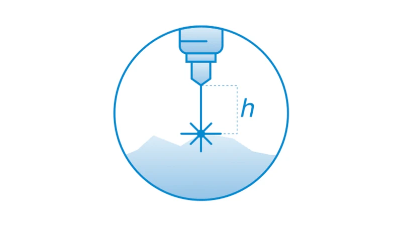
SkyHub software package for True Terrain Following
- Follows terrain with very high precision at low altitude using an altimeter sensor
- Supports DJI M400, DJI M350 RTK and DJI M300 RTK
- Also works with Pixhawk-compatible autopilots (Cube, etc.) running ArduCopter firmware
- Requires the SkyHub on-board computer, UgCS ground control software and a compatible radar or laser altimeter (NRA24 or SF30D)
- Laser altimeters can be used in any country but are less reliable in diverse conditions and over water, ice, snow and sand under bright sun
- New customers are advised to order a combo of software, hardware and training. Customers must check whether a 24 GHz altimeter is allowed in their country
- Trusted dealerDirect manufacturer partnership
- Pan-India deliveryInsured shipping, all states
- Post-sale supportTraining + service included
What makes it work
SkyHub Software Package for True Terrain Following
Allows following terrain with very high precision on low altitude using an altimeter sensor.
Supported on DJI M400, DJI M350 RTK and DJI M300 RTK, and on Pixhawk-compatible autopilots (Cube, etc.) with ArduCopter firmware.

What You Need
The package works together with the following components.
SkyHub On-Board Computer
The SkyHub on-board computer is required.
Compatible Altimeter
A compatible altimeter (radar or laser) is required: radar NRA24 or laser SF30D.
UgCS Ground Control Software
UgCS ground control software is required.
Recommended Combo
For new customers, it is recommended to order a combo consisting of software, hardware, and training.
Supported Drones and Altimeter Notes
Supported Drones and Autopilots
- DJI M400
- DJI M350 RTK
- DJI M300 RTK
- Pixhawk-compatible autopilots (Cube, etc.) with ArduCopter firmware
Altimeter Notes
Laser altimeter: can be used in any country, but works less reliably in diverse environmental conditions and over highly reflective surfaces such as water, ice, snow and sand under bright sun.
It is the customer's responsibility to check the possibility to use a 24Ghz altimeter in a particular country.
Specifications
| Product | SkyHub software package for True Terrain Following |
|---|---|
| Brand | SPH Engineering |
| SKU | IS-SW-SKYHUB-TTF |
| Type | Software |
| Function | Follows terrain with very high precision at low altitude using an altimeter sensor |
| Requires | SkyHub on-board computer; compatible altimeter (radar or laser); UgCS ground control software |
| Altimeters | Radar (NRA24) or laser (SF30D) |
| Supported drones and autopilots | DJI M400; DJI M350 RTK; DJI M300 RTK; Pixhawk-compatible autopilots (Cube, etc.) with ArduCopter firmware |
Documentation and Support
Frequently Asked Questions
What does the SkyHub software package for True Terrain Following do?
It allows following terrain with very high precision on low altitude using an altimeter sensor.
What else do I need to use it?
It requires the SkyHub on-board computer, a compatible altimeter (radar or laser) and UgCS ground control software.
Which drones and autopilots are supported?
DJI M400, DJI M350 RTK, DJI M300 RTK, and Pixhawk-compatible autopilots (Cube, etc.) with ArduCopter firmware.
Can I use a 24 GHz altimeter in any country?
It is the customer's responsibility to check the possibility to use a 24Ghz altimeter in a particular country.
What should I know about the laser altimeter?
A laser altimeter can be used in any country, but works less reliably in diverse environmental conditions and over highly reflective surfaces such as water, ice, snow and sand under bright sun.
Is there a recommended way for new customers to order?
Yes. For new customers, it is recommended to order a combo consisting of software, hardware, and training.
The full sheet
Related products
-
·XBM·00
-
·XBM·01
-
·XBM·02
 PIX4D Drone Based Mapping SoftwarePrice range: ₹6,350 through ₹477,966 (Excl. GST)Select options This product has multiple variants. The options may be chosen on the product page
-
·XBM·03



There are no reviews yet.