

Unitree - 2D LiDAR Single Sensor
- Designed for Unitree Robots – Compatible with Unitree Go1 Edu, AlienGo, and B1 robots for enhanced environmental perception and autonomous navigation.
- Advanced 2D Laser Scanning – Provides accurate 2D environmental scanning to improve robotic awareness and real-time obstacle detection.
- Supports Map Building – Enables robots to generate and maintain detailed maps of indoor environments for intelligent navigation.
- Improves Positioning Accuracy – Enhances robot localization by providing reliable spatial data for more precise movement and navigation.
- Optimized for Navigation Planning – Supplies real-time environmental information to assist with efficient path planning and route optimization.
- Dynamic Obstacle Avoidance – Helps robots detect and avoid moving or stationary obstacles, improving operational safety and navigation performance.
- Professional Installation Included – Unitree installs the LiDAR with a dedicated protective mounting bracket to ensure secure integration and reliable operation.
- Protective Mounting Solution – Includes a robust protection bracket to safeguard the LiDAR sensor during demanding robotic operations.
- Ideal for Research & Automation – Suitable for robotics research, autonomous inspection, education, industrial automation, and AI development projects.
- OEM Unitree Accessory – Designed to integrate seamlessly with supported Unitree robot platforms while maintaining reliable performance and compatibility.
- Trusted dealerDirect manufacturer partnership
- Pan-India deliveryInsured shipping, all states
- Post-sale supportTraining + service included
What makes it work
Unitree 2D LiDAR Single Sensor
The Unitree 2D LiDAR Single Sensor is a genuine Slamtec mapping LiDAR, professionally installed by Unitree with a protective bracket for the Go1 EDU, AlienGo, and B1 platforms.
Onboard SLAM Mapping
Go1 EDU / AlienGo / B1
Professional Install Included
Protective Bracket
Full Specifications
| Specification | Details |
|---|---|
| Product | Unitree 2D LiDAR Single Sensor — a genuine Slamtec 2D mapping LiDAR (RPLIDAR/Mapper series), professionally installed by Unitree |
| Compatible Platforms | Unitree Go1 EDU, AlienGo, and B1 |
| Measuring Range | 0.1m to 40m |
| Sampling Frequency | 32,000 samples/second |
| Scan Rate | 10Hz rotational speed, 10Hz data refresh rate |
| Angular Resolution | 0.36° |
| Range Resolution / Accuracy | 1cm range resolution; accuracy of approximately 3cm (range), under 2cm (mapping) |
| Maximum Mapping Area | Up to 300m x 300m, at 0.05m mapping resolution |
| Inertial Navigation | Built-in 9-DOF (9 degrees of freedom) IMU |
| xBoom SKU | xboom-144927 |
| Specification | Details |
|---|---|
| Connectivity | Ethernet (802.3/802.3u) and WiFi (802.11a/b/g/n/ac) |
| System Voltage | 5V, 650mA to 1300mA current draw |
| Power Consumption | Approximately 3.25W to 6.5W |
| Dimensions | Approximately 77.1mm x 57mm x 65.5mm |
| Weight | Approximately 163g |
| Installation | Professionally installed by Unitree with a dedicated protective mounting bracket |
| Capabilities | Map building, real-time localization, navigation planning, and dynamic obstacle avoidance, all processed onboard |
Mapping and Navigation, Built In
Unitree 2D LiDAR Single Sensor: Genuine Slamtec Mapping Hardware
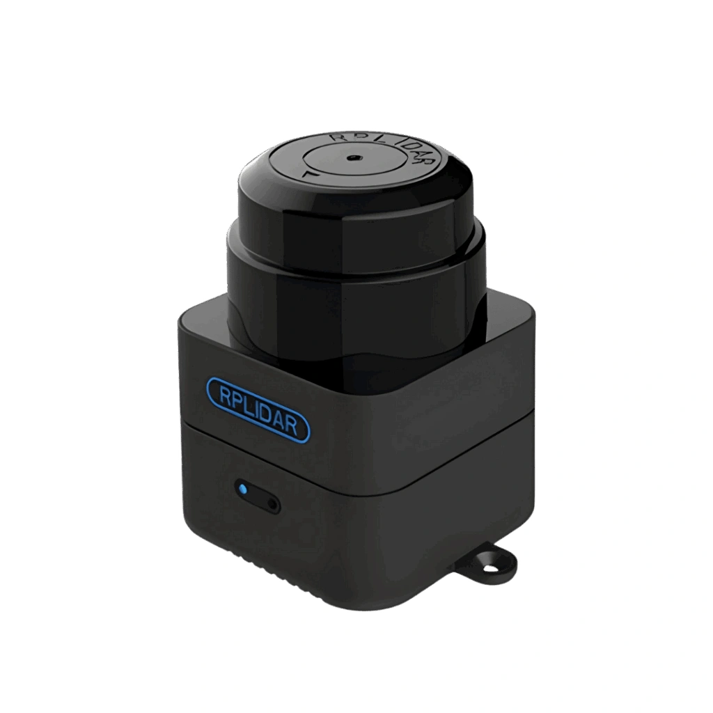
This is a genuine Slamtec 2D LiDAR sensor — visibly branded “RPLIDAR” on the housing — professionally installed by Unitree with a protective mounting bracket onto the Go1 EDU, AlienGo, or B1 platform. Unlike a simple raw laser scanner, this unit handles map building, real-time localization, and navigation planning onboard, using its own SLAM engine and a built-in 9-DOF inertial navigation system, and can scan out to 40m at a 10Hz refresh rate with 0.36° angular resolution.
That onboard processing is what lets it directly support dynamic obstacle avoidance and detailed indoor mapping without necessarily needing a separate compute stack just to make sense of the raw scan data. It’s worth noting this sensor is built for Unitree’s earlier-generation quadrupeds — the Go1 EDU, AlienGo, and B1 — rather than the current Go2 platform, so it suits teams already running one of these three robots.
Onboard Map Building
Real-time SLAM mapping and localization processed on the sensor itself.
0.1-40m Measuring Range
Wide-enough coverage for both close-range and larger indoor spaces.
Built-In 9-DOF IMU
Inertial navigation support for reliable positioning while moving.
Professional Install Included
Unitree fits the sensor with a dedicated protective bracket.
See Every Detail
Real Mapping Output, Not Just a Render
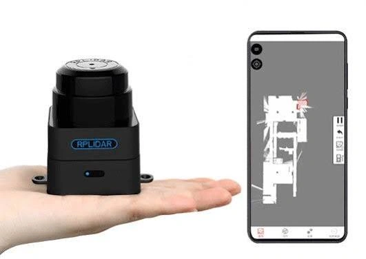
The sensor shown at true scale in a hand, alongside a live 2D point-cloud map generated from its own scan data on a connected phone — genuine proof this sensor’s mapping and localization output works in practice.
Built for Real Indoor Navigation
The Unitree 2D LiDAR Single Sensor brings genuine mapping and navigation capability to compatible Unitree platforms.
🗺️
Onboard SLAM Map Building
Generates and maintains detailed indoor maps without external processing.
📏
0.1-40m Measuring Range
Covers both close-range detail and larger indoor spaces reliably.
🚧
Dynamic Obstacle Avoidance
Detects moving and stationary obstacles for safer navigation.
🎯
0.36° Angular Resolution
Fine-grained scan detail for accurate positioning and mapping.
🔌
WiFi + Ethernet Output
Real-time map and localization data over WiFi or a wired connection.
🔧
Professionally Installed
Fitted by Unitree with a protective bracket for reliable operation.
Built for Teams Running a Go1 EDU, AlienGo, or B1
The Unitree 2D LiDAR Single Sensor suits operators who need reliable indoor mapping and navigation on a compatible Unitree platform.
Indoor Map Building
Generate detailed maps of indoor environments for navigation.
Robotics Research
Reliable spatial data for localization and navigation experiments.
Industrial Automation
Path planning and obstacle avoidance for automated facility tasks.
Autonomous Inspection
Navigate and inspect indoor facilities without manual control.
Education & AI Development
A hands-on platform for teaching SLAM and navigation concepts.
Fleet Navigation Upgrades
Add reliable navigation to an existing Go1 EDU, AlienGo, or B1 fleet.
See the 2D LiDAR Mapping in Use
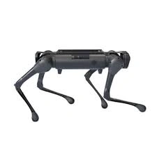
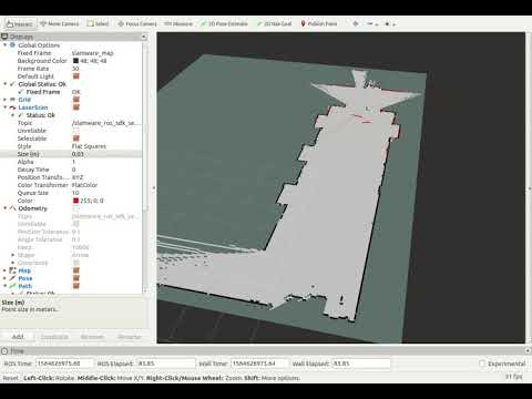
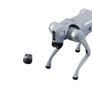
A look at Unitree’s LiDAR-equipped platforms, plus dedicated demos of this exact Slamtec Mapper sensor family in action.




There are no reviews yet.