

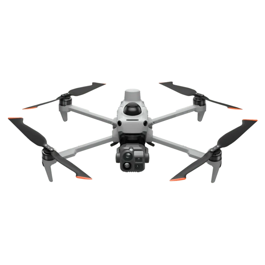
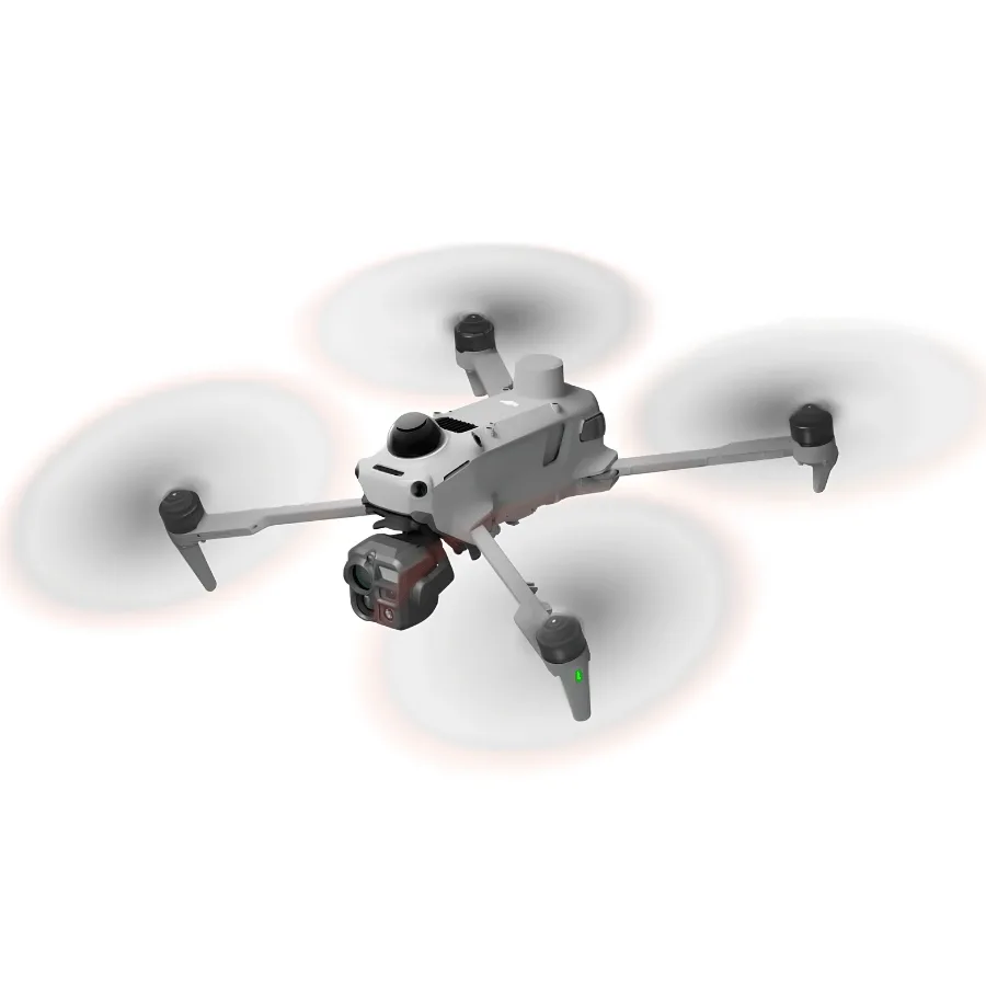
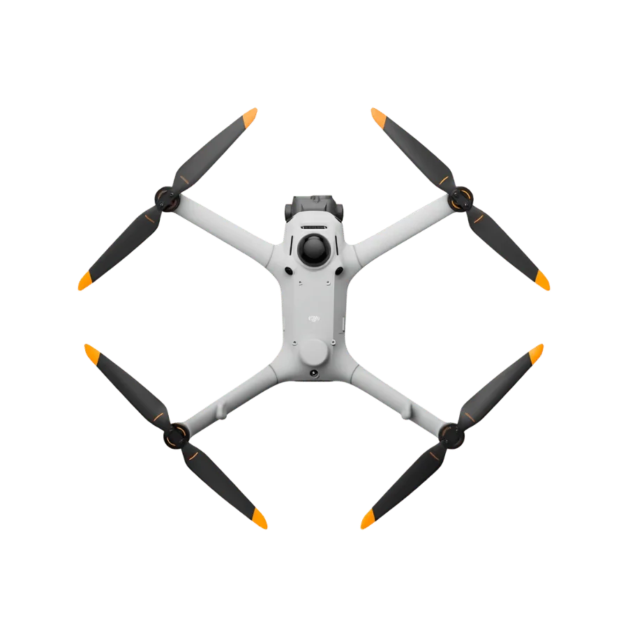
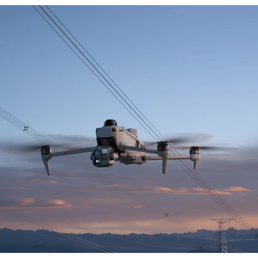
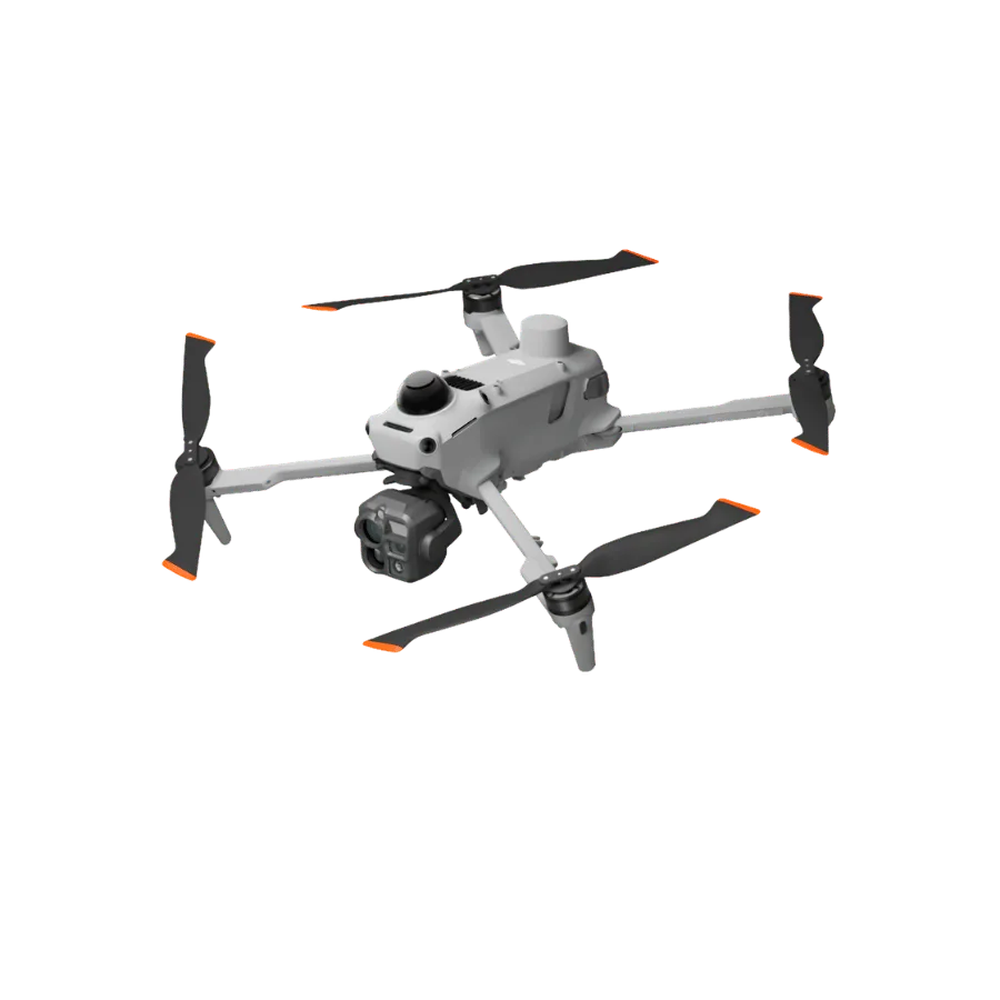
Matrice 5T Enterprise Drone
-
50 MP wide, medium telephoto and telephoto cameras with up to 176× hybrid zoom.
-
Laser rangefinder with a measurement range of up to 3,000 m.
-
LiDAR, mmWave radar and omnidirectional vision sensing with IP55 protection.
-
Up to 59 minutes of flight time with a 215.2 Wh battery (no wind).
-
O4 Enterprise Enhanced video transmission up to 40 km (IC) with multiple relay modes.
-
Open-edge AI supporting over 20 target detection types and custom Pilot 2 plugins.
-
Maximum horizontal speed of 23 m/s.
-
Operating temperature range from -20°C to 50°C.
This drone is sold only for Research & Development (R&D) and Defence/Security purposes within India. The buyer is responsible for complying with the Drone Rules, 2021 (as amended), DGCA guidelines and all applicable Government of India norms, including registration on the Digital Sky Platform and obtaining a Unique Identification Number (UIN). Xboom Utilities may refuse, hold or cancel any order that does not meet these conditions.
Read the full Drone Sales Disclaimer & Compliance Notice- Trusted dealerDirect manufacturer partnership
- Pan-India deliveryInsured shipping, all states
- Post-sale supportTraining + service included
What makes it work
Matrice 5T
Highly Versatile Compact Flagship
Always in Its Element
Matrice 5T integrates LiDAR, mmWave radar, and vision sensing with IP55 rating, excelling in emergency response, inspection, and surveying even in harsh environments. 1K thermal and enhanced night vision reveal detail day and night. Up to 59-min flight time and relay modes extend reach, while open onboard AI and Pilot 2 plugin support power smart on-site workflows.
Highlights
- 1K Thermal Imaging, Enhanced Night Vision
- Open Edge AI, On-Site Intelligence
- O4 Enterprise Transmission, Multiple Relay Modes
- Powerful Propulsion, Extended Flight Time
- Next-Generation Core Accessories
- Omnidirectional Sensing, IP55 Rating
- High-Accuracy Surveying, Rapid Modeling
- Multi-Mission Adaptability, Custom Pilot Plugins
1K Thermal Imaging, Enhanced Night Vision
Infrared Thermal Camera, Native 1K Resolution
Featuring a native 1280×1024 resolution, the thermal camera quadruples the pixel count of standard 640×512 sensors. Enable UHR Infrared Image for real-time 2560×2048 footage at 30 fps. Even against complex backgrounds, heat anomalies remain clearly defined.
Wide-Angle Camera, Full-Color Night Vision
A large 1/0.98-inch sensor and fast f/1.8 aperture capture more light. Backed by AI low-light enhancement, ISO sensitivity reaches 1,600,000, delivering vivid full-color imagery in conditions as dark as 0.01 lux.
Medium Telephoto, Mid-Range Precision
Equipped with a 50 MP sensor and 3× optical zoom, the camera resolves sharp details at medium range. During power line or bridge inspections, it can detect pins and cracks from 10 meters away and clearly read instrument data at substations.
Telephoto Camera, Monochrome Night Vision
With an 11× optical and 176× hybrid zoom, the 50 MP sensor reads license plates from up to 400 m away. An RYYB array offers greater light sensitivity per unit area than a standard RGGB array, for better low-light performance. Adjusting the IR cut filter further lowers the operational lux threshold.
Ranging and View Assist
Laser Range Finder
With a maximum measurement range of 3 km, the system supports pinpointing, line drawing, and area calculation to quickly mark assets or measure wildfire perimeters.
NIR Auxiliary Light
An NIR illuminator provides up to 100 m of effective illumination, complementing the telephoto camera's monochrome night vision for clearer close-up detail.
Dual-Light Fusion
Thermal and visible feeds fuse on the remote, enabling temperature checks and alerts directly on the visible view. A dial quickly adjusts the fusion ratio. Split screens display up to 3 simultaneous feeds from wide, tele, thermal, map, and Vision Assist.
Omnidirectional Sensing, IP55 Rating
Built for Challenging Conditions
As a compact enterprise flagship, Matrice 5T features an IP55 rating, allowing it to operate in challenging conditions including dust and rain. It also performs reliably across a broad temperature range of -20° to 50° C (-4° to 122° F).
Wire-Level Obstacle Sensing
For the first time in a compact enterprise drone, LiDAR, mmWave radar, and an omnidirectional vision system are integrated. LiDAR identifies thin obstacles at night, detecting power lines up to 32 m away. In fog, rain, or dust, mmWave radar cuts through interference to sense its surroundings.
Low-Light Flight Safety
The omnidirectional low-light sensing system uses full-color fisheye sensors to maintain visual positioning in conditions as dark as 0.5 lux, while Vision Assist now provides full-color imagery for enhanced situational awareness. In dim urban areas, vision and LiDAR work together for reliable sensing; in pitch-black wilderness, LiDAR takes over to detect obstacles ahead.
Weak-GNSS Positioning and Operation
In weak-GNSS environments such as under bridges, in deep canyons, or between urban high-rises, Matrice 5T fuses visual and radar data to map surroundings in real time. This delivers reliable positioning for smooth flight operations.
Airspace Awareness
Built-in ADS-B and RID receivers enable Matrice 5T to detect nearby manned and unmanned aircraft in real time, issuing timely alerts. In congested airspace or multi-drone environments, this provides operators with comprehensive situational awareness, helping prevent collisions and maintain safe separation.
Open Edge AI, On-Site Intelligence
Over 20 Target Detection Types
Built-in AI models detect over 20 target types for broad scenario adaptability. By analyzing thermal and visible feeds in parallel on a split screen, the system swiftly locks onto vehicles, vessels, fires, and other target types. Open onboard computing supports third-party models, allowing flexible deployment of custom algorithms.
FlightHub 2 Multimodal Cloud Detection
When Pilot 2 is connected to FlightHub 2, cloud computing enables target searches using text or image prompts. The multimodal LLM accurately interprets prompts, detects objects, and triggers alerts, providing comprehensive situational awareness across all scenarios.
AI Patrol Routes
Simply outline an area on the map, and the system automatically generates an efficient patrol route. It detects targets in real time and executes custom actions like hovering, capturing photos, recording video, or broadcasting audio. Post-flight, it compiles results into detailed reports, greatly automating routine inspections.
O4 Enterprise Transmission, Multiple Relay Modes
O4 Enterprise Enhanced Video Transmission System
Leveraging the sub2G frequency band and a high-gain smart antenna array on the remote, O4 Enterprise Enhanced transmits up to 40 km. Adaptive multi-band switching resists urban interference. Dual built-in Cellular Dongle 2 modules enable automatic switching to the optimal network link, maintaining signal stability despite physical obstructions.
Multiple Relay Modes
Single-Relay, Dual-Controller
A single relay drone provides signal extension for one operational aircraft, expanding the overall operational range.
Single-Relay, Single-Controller
One remote controls both the relay and operational aircraft. The relay intelligently adjusts its attitude and hover position to maintain an optimal link.
1 Relay, 2 Controller, 3 Aircraft
A single relay drone simultaneously relays data for two operational aircraft, making it ideal for large-scale, coordinated multi-drone operations.
Dual-Relay, Dual-Controller
Two relay drones transmit data sequentially to the operational aircraft, further extending the operational range.
Robust Power, Extended Endurance
59-Min Max Flight Time
Equipped with a 215Wh high-energy-density battery, the aircraft delivers prolonged hover times. A single takeoff covers a broader operational area, reducing battery swaps and site transfers.
Comes With Low-Noise Propellers
The standard propellers feature a bionic "bat-wing" swept tip design to optimize airflow and vortex structures, reducing flight noise to as low as 80 dB(A) while boosting aerodynamic efficiency.
23m/s Max Flight Speed
In emergencies, Matrice 5T powers on and takes off in just 10 seconds. It rapidly reaches the scene to deliver critical live feeds, providing valuable time for subsequent command and dispatch.
Reliable Power Redundancy
Single-axis thrust increases by 98% over Matrice 4T. A phase-loss algorithm detects anomalies in milliseconds. Even with a phase-loss fault, the affected arm still outputs 50% of its max thrust for stable hovering and a safe landing.
High-Accuracy Surveying, Rapid Modeling
High-Accuracy Surveying
Paired with Terra, Matrice 5T delivers centimeter-level surveying accuracy without requiring GCPs. It handles both routine inspections and high-precision aerial mapping.
2D Thermal Mapping
Terra stitches thermal images using visible-light positioning as a reference to create 2D thermal orthomosaics. Read temperatures and mark anomalies directly, improving efficiency for large-scale solar and grid inspections.
Rapid On-Site Modeling
During flight, the remote receives images in real time to rapidly generate local point clouds or 2.5D models. Direct annotation and measurement are supported on 2.5D models. Processing 200 photos takes just 8 minutes.
Smart 3D Capture
Build a rough model on the remote to auto-plan precise routes that closely follow the subject's surface. Complete detailed modeling in one flight, and view virtual routes and waypoint photos to assess safety and coverage.
Versatile Applications, Custom Pilot Plugins
Foreground Stabilization
A built-in AI foreground segmentation model separates targets from backgrounds during telephoto shooting. This reduces interference, keeping subjects in sharp focus with clear details.
Power Line Inspection
Matrice 5T uses its top-mounted LiDAR to detect and lock onto power and ground wires, automatically flying laterally along the line. This efficiently identifies grid hazards like broken strands or suspended foreign objects.
Boat Launch
For maritime patrols and inspections, Matrice 5T supports taking off from moving vessels. Upon mission completion, it recognizes the landing point pattern on the deck to land.
Pilot 2 Custom Plugins
Developers can integrate custom capabilities into Pilot 2 as floating windows, eliminating the need to build standalone apps. By leveraging existing features, teams can focus on their core business functions.
Software Designed for Industries
Pilot 2
Automate tasks with Cruise, FlyTo, Smart Track, and POI. A split screen displays preset combinations of wide, tele, thermal, map, and Vision Assist feeds, minimizing switching between views. Open plugins integrate third-party capabilities directly.
FlightHub 2
Offers cloud-based aircraft and gimbal control, remote takeoff and landing, FlyTo Task, and Smart 3D Capture, geometric, and slope route planning. A multimodal LLM searches for targets using text or images. Simultaneous live feeds keep air and ground teams synchronized in multi-drone cooperation.
Terra
Outputs 2D, 3D, and point cloud models for GIS, emergency response, and construction. Offline visible light PPK and D-RTK 3 imports improve reconstruction accuracy for GCP-free operations. It also enables 2D thermal mapping, rolling-shutter reconstruction, and video frame reconstruction for advanced surveying tasks.
DTAT 3.0
After completing thermal imaging operations with Matrice 5T, you can use the DTAT 3.0 thermal analysis tool to mark, analyze, and process images, detecting abnormal temperature points.
User Data Security
- Media Data Encryption
- Local Data Mode
- One-Tap Clear Logs
- AES-256 Video Transmission Encryption
Open Developer Ecosystem
Intelligent Algorithm Developer
Provides model training tools and third-party developer certification process to access onboard computing capabilities, helping expand the application of intelligent algorithms across drone use cases.
MSDK
Mobile SDK V5 lets developers build custom apps or use a plugin architecture to leverage core Pilot 2 features. It comes with fully open-source, production-level code samples with core modules adapted from Pilot 2.
PSDK
E-Port V3 supports encrypted authentication to verify third-party payloads and secure data transmission, expanding Matrice 5T applications.
Cloud API
With Pilot 2's built-in Cloud API (MQTT-based protocol) you can directly connect Matrice 5T to third-party cloud platforms. Access the drone's hardware, live video streams, and photo data without having to develop an app.
Service and Support
Purchase Matrice 5T to enjoy a complimentary first year of either Care Enterprise Plus or the Official Extended Warranty Service.
Care Enterprise Plus
Comprehensive Protection | Professional Quality Assurance | Exclusive Service | Service Starts with Activation. Free Repairs: unlimited number of free repairs within coverage. Coverage for Your Whole Fleet: shared coverage for maximum protection. Flyaway Coverage: 1 time/year, worry-free operation. Battery Replacement: maintain long-lasting flight performance. Free Two-Way Shipping: hassle-free repair with free shipping both ways. Expert Service: swift response from technical experts.
Official Extended Warranty Service
In addition to the standard warranty, an extra one-year extended warranty service is provided. During the service period, the main parts remain covered by the official warranty, with support from professional engineers. Official Service: support provided by a professional engineering team. Quality Repair: original parts, quality assurance.
Next-Generation Core Accessories
Matrice 5T features a new remote, a 515W fast charging system, and next-gen speaker and spotlight payloads. Sized similarly to the Matrice 4 Series, the carrying case is easy to carry with one hand.
Application Scenarios
- Public Safety
- Power Line Inspection
- Geographic Information
- Oil and Gas
- Renewable Energy
- Water Conservation
- Building Inspection
- Roads and Bridges
Technical Specifications
| Takeoff Weight (with propellers) | 2239 gThe standard weight of the aircraft (including the battery, propellers, and a microSD card). The actual product weight may vary due to differences in batch materials and external factors. |
|---|---|
| Max Takeoff Weight | 2639 g |
| Dimensions | Unfolded: 408×507×191 mm (L×W×H) (with landing gear and gimbal)Folded: 335×155×203 mm (L×W×H) (with landing gear and gimbal)Maximum dimensions excluding propellers. |
| Max Payload | 400 g |
| Propeller Size | 14.2 inches |
| Diagonal Wheelbase | 572 mm |
| Max Ascent Speed | 10 m/s |
| Max Ascent Speed With Accessories | 10 m/s"Accessories" refers to the AS2 Speaker and AL2 SpotLight. |
| Max Descent Speed | 8 m/s |
| Max Descent Speed With Accessories | 8 m/s"Accessories" refers to the AS2 Speaker and AL2 SpotLight. |
| Max Horizontal Speed (at sea level, no wind) | 23 m/s23 m/s flying forward, 19 m/s flying sideways, 20 m/s flying backward (Sport mode)Measured in a controlled wind tunnel environment under conditions equivalent to a windless environment at sea-level altitude. |
| Max Takeoff Altitude | 7000 m |
| Max Operating Altitude With Accessories | 4500 m"Accessories" refers to the AS2 Speaker and AL2 SpotLight. |
| Max Flight Time (no wind) | 59 minMeasured in a controlled wind tunnel environment under conditions equivalent to a windless environment at sea-level altitude, with the aircraft flying forward at approximately 9 m/s without payloads until reaching 0% battery level. Data is for reference only. Actual flight time may vary depending on the flight mode, accessories, and environment. Please pay attention to reminders in the app. |
| Max Hover Time (no wind) | 54 minMeasured in a controlled wind tunnel environment under conditions equivalent to a windless environment at sea-level altitude, with the aircraft hovering without payloads until reaching 0% battery level. Data is for reference only. Actual hover time may vary depending on the flight mode, accessories, and environment. Please pay attention to reminders in the app. |
| Max Flight Distance (no wind) | 45 kmMeasured in a controlled wind tunnel environment under conditions equivalent to a windless environment at sea-level altitude, with the aircraft flying forward at approximately 15 m/s without payloads until reaching 0% battery level. Data is for reference only. Actual flight distance may vary depending on flight mode, accessories, and environment. Please pay attention to reminders in the app. |
| Max Wind Speed Resistance | 12 m/sMax wind speed resistance during takeoff and landing. |
| Max Pitch Angle | 32° |
| Operating Temperature | -20° to 50° C (-4° to 122° F) (without solar radiation) |
| GNSS | GPS + Galileo + BeiDou + GLONASS + QZSS |
| Hovering Accuracy Range (windless or breezy) | Vertical:±0.1 m (with vision positioning)±0.5 m (with GNSS positioning)±0.1 m (with RTK positioning)Horizontal:±0.3 m (with vision positioning)±0.5 m (with GNSS positioning)±0.1 m (with RTK positioning) |
| RTK GNSS Accuracy | RTK Fix:1 cm + 1 ppm (horizontal), 1.5 cm + 1 ppm (vertical) |
| Ports | E-Port × 3: Supports official and third-party accessories |
| Propeller Model | 1460F |
| Beacon | Built into the aircraft |
| Ingress Protection Rating | IP55 |
| Image Sensor | Wide:1/0.98-inch CMOS, Effective Pixels: 50 MPMedium Telephoto:1/1.28-inch CMOS, Effective Pixels: 50 MPTelephoto:1/1.5-inch CMOS, Effective Pixels: 50 MP |
|---|---|
| Lens | Wide:DFOV: 85.7°Equivalent Focal Length: 23.5 mmAperture: f/1.8Focus Range: 0.6 m to ∞Medium Telephoto:DFOV: 35°Equivalent Focal Length: 70 mmAperture: f/2.88Focus Range: 3 m to ∞Telephoto:DFOV: 9.7°Equivalent Focal Length: 252 mmAperture: f/2.8Focus Range: 5 m to ∞ |
| ISO Range | Normal Mode: ISO 100 to ISO 25600Night Scene Mode:Wide: ISO 100 to ISO 1638400Medium Telephoto: ISO 100 to ISO 1638400Telephoto: ISO 100 to ISO 1638400 |
| Shutter Speed | 2 s to 1/8000 s |
| Max Photo Size | Wide: 8192×6144Medium Telephoto: 8192×6144Telephoto: 8192×6144 |
| Min Photo Interval | 0.5 s |
| Still Photography Modes | Wide:Single: 12 MP/50 MPInterval: 12 MP/50 MPJPEG: 0.5/0.7/1/2/3/5/7/10/15/20/30/60 sSmart Shooting: 12 MPPanorama: 12 MP (source image); 110 MP (stitched image)Medium Telephoto:Single: 12 MP/50 MPInterval: 12 MP/50 MPJPEG: 0.5/0.7/1/2/3/5/7/10/15/20/30/60 sSmart Shooting: 12 MPTelephoto:Single: 12 MP/50 MPInterval: 12 MP/50 MPJPEG: 0.5/0.7/1/2/3/5/7/10/15/20/30/60 sSmart Shooting: 12 MP |
| Video Codec and Resolution | Video Coding Format: H.265Bitrate Mode: CBR, VBRResolution:4K: 3840×2160@30fpsFHD: 1920×1080@30fps |
| Max Video Bitrate | H.265: 40Mbps |
| Supported File System | exFAT |
| Photo Format | JPEG/DNG (RAW) |
| Video Format | MP4, TS |
| Digital Zoom | Telephoto:16× (176× hybrid zoom) |
| Infrared Illumination | FOV: 5.2° to 6.6° |
|---|
| Laser Rangefinding | Measurement Range: 3000 m (1 Hz, 25% reflectivity, 8km visibility)Oblique Incidence Range: 1200 m (1:10 slope, 1 Hz, 25% reflectivity, 8km visibility)Blind Zone: 1 mDistance Measurement Accuracy (1-10 Hz, 20-90% reflectivity):Systematic Error:< 0.1 m (distance of 1 to 12 m)< 0.3 m (distance of 12 to 100 m)< 1 m (distance of 100 to 3000 m)Random Error: < 0.1 m (1σ)Laser Safety: Class 1 (IEC 60825-1:2014), eye-safe |
|---|
| Thermal Imager | Uncooled vanadium oxide (VOx)DO NOT expose the infrared camera lenses to strong sources of energy such as the sun, lava, or a laser beam. Otherwise, the camera sensor may be burned leading to permanent damage. |
|---|---|
| Resolution | 1280×1024 |
| Pixel Pitch | 8 μm |
| Frame Rate | 30 Hz |
| Lens | DFOV: 45°Equivalent Focal Length: 53 mmAperture: f/0.85Focus Range: 10 m to ∞ |
| Sensitivity (NETD) | ≤50 mK@f/1.0 (at an ambient temperature of 25° C/77° F) |
| Temperature Measurement Method | Spot Meter, Area Measurement |
| Temperature Measurement Range | High Gain Mode: -20° to 150° C (-4° to 302° F)Low Gain Mode: 0° to 550° C (32° to 1022° F) |
| Palette | White Hot/Black Hot/Tint/Iron Red/Hot Iron/Arctic/Medical/Fulgurite/Rainbow 1/Rainbow 2 |
| Photo Format | JPEG (8-bit), R-JPEG (16-bit), DLT-664 |
| Video Resolution | 1280×1024@30fps2560×2048@30fps (UHR Infrared Image enabled) |
| Video Bitrate | 12 Mbps (H.265 1280×1024@30fps)24 Mbps (H.265 2560×2048@30fps) |
| Video Format | MP4 |
| Still Photography Modes | UHR Infrared Image Enabled: 2560×2048Normal Shooting: 1280×1024JPEG: 0.5/0.7/1/2/3/5/7/10/15/20/30/60 s |
| Photo Resolution | 2560×2048 (UHR Infrared Image enabled)1280×1024 (UHR Infrared Image disabled) |
| Digital Zoom | 32× |
| Infrared Wavelength | 8-14 μm |
| Infrared Temperature Measurement Accuracy | High Gain: ±2° C or ±2%, whichever is greaterLow Gain: ±5° C or ±3%, whichever is greater |
| Stabilization System | 3-axis (tilt, roll, pan) |
|---|---|
| Structural Range | Gimbal Mechanical Limits:Tilt: -145° to 125°Roll: -53° to 53°Pan: -75° to 75°Soft Limits:Tilt: -135° to 115°Roll: -48° to 48°Pan: -60° to 60° |
| Controllable Rotation Range | Tilt: -90° to 90°Pan: Not controllable |
| Max Control Speed (tilt) | 100°/s |
| Angular Vibration Range | ±0.007° |
| Pan Axis | Not controllable via remote controllerControllable via MSDK |
| Operating Temperature | -20° to 50° C (-4° to 122° F) (without solar radiation) |
| Sensing Type | 6-Directional Fisheye Vision System (4 upward, 2 downward)Horizontal Rotating LiDARThree-Directional mmWave Radar (forward, upward, and downward)Downward ToF Infrared Sensor |
|---|---|
| Forward | Binocular Vision SystemMeasurement Range: 0.15-12 mDetection Range: 0.15-200 mFOV: 90° (horizontal), 130° (vertical)LiDARObstacle Avoidance Range: 0.5-32 mFOV: 90° (horizontal), 59° (vertical)mmWave RadarSmall Obstacle Detection Range: 40 m (facing a 10mm black insulated wire)FOV: 90° (horizontal), 90° (vertical)Comprehensive Obstacle Avoidance PerformanceEffective Obstacle Avoidance Speed: Flight speed ≤ 21 m/s |
| Backward | Binocular Vision SystemMeasurement Range: 0.15-12 mDetection Range: 0.15-200 mFOV: 90° (horizontal), 126° (vertical)LiDARObstacle Avoidance Range: 0.5-32 mFOV: 90° (horizontal), 59° (vertical)Comprehensive Obstacle Avoidance PerformanceEffective Obstacle Avoidance Speed: Flight speed ≤ 21 m/s |
| Lateral | Binocular Vision SystemMeasurement Range: 0.18-8 mDetection Range: 0.18-200 mFOV: 90° (horizontal), 90° (vertical)LiDARObstacle Avoidance Range: 0.5-32 mFOV: 90° (horizontal), 59° (vertical)Comprehensive Obstacle Avoidance PerformanceEffective Obstacle Avoidance Speed: Flight speed ≤ 21 m/s |
| Upward | mmWave RadarSmall Obstacle Detection Range: 20 m (facing a 10mm black insulated wire)FOV: 90° (front/back), 90° (left/right)Effective Obstacle Avoidance Speed: Flight speed ≤ 10 m/s |
| Downward | Binocular Vision SystemMeasurement Range: 0.13-8 mDetection Range: 0.25-200 mFOV: 150° (front/back), 150° (left/right)mmWave RadarSmall Obstacle Detection Range: 20 m (facing a 10mm black insulated wire)FOV: 90° (front/back), 90° (left/right)Comprehensive Obstacle Avoidance PerformanceEffective Obstacle Avoidance Speed: Flight speed ≤ 8 m/s |
| Operating Environment | Forward, Backward, Left, Right, and Upward:Rich textures on the surface, adequate light.Downward:The ground has rich textures and sufficient lighting conditions*, with a diffuse reflection surface and a reflectivity greater than 20% (such as walls, trees, people, etc.).* Sufficient lighting conditions refer to an illuminance not lower than that of a nighttime city light scene. |
| Rotating LiDAR | Standard Measurement Range:110 m (10% reflectivity, 100,000 lux)Measurement Range for Power Line:32 m (35,000 lux for 21.6mm steel-core aluminum stranded wire with a relative body tilt angle of 30° to the left and right)19 m (35,000 lux for 11.0mm contaminated insulated wire with a relative body tilt angle of 30° to the left and right)Field of View (FOV):360° (horizontal), 59° (vertical)Point Rate: 250,000-460,000 points/secondLaser Wavelength: 940 nmLaser Safety: Class 1 (IEC60825-1:2014), eye-safe |
| mmWave Radar | Upward and Downward:Small Obstacle Detection Range: 20 m (facing a 10mm black insulated wire)FOV: 90° (horizontal), 90° (vertical)Forward:Small Obstacle Detection Range: 40 m (facing a 10mm black insulated wire)FOV: 90° (horizontal), 90° (vertical)The mmWave radar function may be unavailable or restricted in some countries or regions. Refer to local laws and regulations for more information. |
| Video Transmission System | O4 Enterprise Enhanced Video Transmission System |
|---|---|
| Live View Quality | Remote Controller: 3-channel 1080p@30fps |
| Operating Frequency | 902-928 MHz1.430-1.444 GHz2.400-2.4835 GHz5.725-5.850 GHz5.150-5.250 GHzAllowed operating frequencies vary by country and region. Refer to local laws and regulations for more information. |
| Transmitter Power (EIRP) | 902-928 MHz: < 30 dBm (IC), < 16 dBm (MIC)1.430-1.444 GHz: < 35 dBm (SRRC)2.400-2.4835 GHz: < 33 dBm (IC), < 20 dBm (CE/SRRC/MIC)5.150-5.250 GHz: < 23 dBm (IC/CE)5.725-5.850 GHz: < 33 dBm (IC), < 14 dBm (CE), < 30 dBm (SRRC)Allowed operating frequencies vary by country and region. Refer to local laws and regulations for more information. |
| Max Transmission Distance (unobstructed, free of interference) | 40 km (IC)20 km (CE/SRRC/MIC)Measured in an unobstructed environment free of interference. The above data shows the farthest communication range for one-way, non-return flights under each standard. During your flight, pay attention to the RTH reminder on the Pilot 2 app. |
| Max Transmission Distance (with interference) | Strong interference (dense buildings, residential areas, etc.): approx. 1.5-6 km (IC); approx. 0.7-3 km (CE)Medium interference (suburban counties, city parks, etc.): approx. 6-15 km (IC); approx. 3-7 km (CE)Weak interference (open spaces, remote areas, etc.): approx. 15-40 km (IC); approx. 7-20 km (CE)Data is tested in unobstructed environments of typical interference. Data is for reference only and provides no guarantee of actual flight distance. |
| Max Download Speed | Standard Mode: 20 MB/s (aircraft media/logs)Playback Download: < 12 MbpsSingle-Channel Bitrate: ≤ 12 MbpsThe above data was measured under conditions where the aircraft and remote controller were in close proximity without interference. |
| Latency (depending on environmental conditions and mobile device) | 130 msMeasured under near-field, interference-free conditions when shooting with the 1× camera. |
| Antenna | SDR Antenna × 6: 2 vertically polarized antennas and 4 horizontally polarized antennasSub2G Antenna × 2: 2 vertically polarized antennas4G Antenna × 4Operating Mode: 2T4RWi-Fi Antenna × 1: 1 vertically polarized antenna |
| Others | Two built-in Cellular Dongle 2 modules, supporting dual SIMs (one eSIM and one physical nano-SIM card). |
| Supported SD Cards | U3/Class10/V30 or above is required, or use a memory card from the recommended list. |
|---|---|
| Recommended microSD Cards | Lexar Professional SILVER PLUS 64GB U3 A2 V30 microSDXCLexar Professional SILVER PLUS 128GB U3 A2 V30 microSDXCLexar Professional SILVER PLUS 256GB U3 A2 V30 microSDXCLexar Professional SILVER PLUS 512GB U3 A2 V30 microSDXC |
| Capacity | 10073 mAh |
|---|---|
| Nominal Voltage | 21.36 V |
| Max Charging Voltage | 25.8 V |
| Cell Type | Li-ion 6S |
| Energy | 215.2 Wh (Rated) |
| Weight | 768 g |
| Charging Temperature | 5° to 40° C (41° to 104° F) |
| Discharge Rate | 4C |
| Max Charging Rate | 1.8C |
| Low-Temperature Charging | Supports low-temperature self-heating charging |
| Cycle Count | 200 |
| Input | 100-240 V (AC), 47-63 Hz, max 7 A |
|---|---|
| Output | 14.9-26.4 V, max 22 AMax Output Power: 515 W |
| Rated Power | 515 W |
| Input | 14.9-26.4 V, max 22 A |
|---|---|
| Output | Battery Port: 15 V to 25.8 VUSB-C Port: 5 V/9 V/12 V/15 V/20 V/28 V |
| Rated Power | 515 W |
| Charging Type | Sequential charging of three batteriesSupports Standard Mode (100% SOC) and Standby Mode (95% SOC) |
| Compatible Battery | Matrice 5 Series Battery |
| Charging Temperature | 5° to 40° C (41° to 104° F) |
| Model | TKPL 3 |
|---|---|
| Screen Resolution | 1920×1440 |
| Screen Size | 7.44 inches |
| Screen Refresh Rate | 60 Hz |
| Brightness | 2000 nits |
| Touchscreen Control | 10-point multi-touch |
| Built-in Battery | 6933 mAh (99.01 Wh) |
| Dimensions | 225×156×85 mm (L×W×H)Measured with the Antenna Panel folded. |
| Antenna | 4T4R, built-in high-gain smart antenna array |
| Video Transmission Operating Frequency | 902-928 MHz2.400-2.4835 GHz5.150-5.250 GHz5.725-5.850 GHzAllowed operating frequencies vary by country and region. Refer to local laws and regulations for more information. |
| Wi-Fi Protocol | Wi-Fi Direct, Wireless Display, IEEE 802.11a/b/g/n/ac/axSupport 2 × 2 MIMO Wi-Fi |
| Wi-Fi Operating Band | 2.400-2.4835 GHz5.150-5.250 GHz5.725-5.850 GHzThe 5.8GHz and 5.2GHz bands are prohibited in some countries and regions. In certain areas, the 5.2GHz band is restricted to indoor use only. Refer to local laws and regulations for more information. |
| Bluetooth Protocol | Bluetooth 5.4 |
| Bluetooth Operating Frequency | 2.400-2.4835 GHz |
| Bluetooth Transmitter Power (EIRP) | < 10 dBm |
| GNSS | GPS + Galileo + BeiDou + GLONASS |
| Audio | Array MIC |
| Video Output Port | HDMI 1.4 |
| Weight | 1240 g |
| System Version | Android 16 |
| External Interfaces | HDMI 1.4, SD 3.0, nano-SIM card slot, USB-C, and E-Port |
| Ingress Protection Rating | IP54 |
| Weight | 175 g |
|---|---|
| Dimensions | Unfolded: 200×78×58 mm (L×W×H)Folded: 104×82×58 mm (L×W×H) |
| Max Power | 60 W |
| Max Illuminance | Flood: 2.5±0.3 lux@100 m*Spot: 10.0±0.5 lux@100 m** The data was measured in a laboratory environment with the spotlight installed separately on the aircraft at an ambient temperature of 25° C (77° F). |
| Effective Illumination Angle | Flood: 24.5° (10% relative illuminance)Spot: 14.5° (10% relative illuminance) |
| Effective Illumination Area | Flood: 1500 square meters @100 m (10% relative illuminance)Spot: 500 square meters @100 m (10% relative illuminance) |
| Operating Mode | Lighting, Strobe |
| Gimbal Mechanical Range | Tilt: -170° to 120° |
| Gimbal Controllable Rotation Range | Tilt: -90° to 90° |
| Operating Temperature | -20° to 50° C (-4° to 122° F) |
| Ingress Protection Rating | IP55 |
| Weight | 194 g |
|---|---|
| Dimensions | 96×70×66 mm (L×W×H) |
| Max Power | 35 W |
| Max Volume | At 1 meter, it can reach 120 decibels (120 dB@1 m)Data measured in a laboratory environment at 25° C (77° F). Actual conditions may vary slightly due to software version, audio source, specific environment, and other factors. Actual performance may vary depending on usage conditions. |
| Effective Broadcast Distance | 400 mData measured in a laboratory environment at 25° C (77° F). Actual conditions may vary slightly due to software version, audio source, specific environment, and other factors. Actual performance may vary depending on usage conditions. |
| Broadcast Mode | Real-time broadcasting (supports echo suppression), recorded broadcasting, media import (supports simultaneous transmission and playback), text-to-speech |
| Operating Temperature | -20° to 50° C (-4° to 122° F) |
| Ingress Protection Rating | IP55 |
| Strobe Light Color | Red, Blue, Green, White, Yellow |
Frequently Asked Questions
What is the Matrice 5T?
Matrice 5T is a highly versatile compact flagship enterprise drone that integrates LiDAR, mmWave radar and vision sensing with an IP55 rating, 1K thermal imaging and enhanced night vision, built for emergency response, inspection and surveying.
What is the maximum flight time of the Matrice 5T?
The maximum flight time is 59 min and the maximum hover time is 54 min (no wind), with a 215.2 Wh battery. Data is measured in a controlled wind tunnel environment and may vary with flight mode, accessories and environment.
What cameras does the Matrice 5T have?
It has a wide camera (1/0.98-inch CMOS, 50 MP), a medium telephoto camera (1/1.28-inch CMOS, 50 MP), a telephoto camera (1/1.5-inch CMOS, 50 MP) and an infrared thermal camera with 1280×1024 resolution, plus a laser rangefinder with a 3000 m measurement range.
How far can the Matrice 5T transmit video?
With O4 Enterprise Enhanced Video Transmission the maximum transmission distance is 40 km (IC) or 20 km (CE/SRRC/MIC) when unobstructed and free of interference.
What is the ingress protection rating and operating temperature?
The aircraft has an IP55 rating and operates from -20° to 50° C (-4° to 122° F), without solar radiation.
The full sheet
Related products
-
·AIR·00
-
·AIR·01


-
·AIR·02

-
·AIR·03

 DJI Mavic 3 Thermal Enterprise Drone (TE)Original price was: ₹552,381.₹528,571Current price is: ₹528,571. (Excl. GST)Add to cart



There are no reviews yet.