


Description
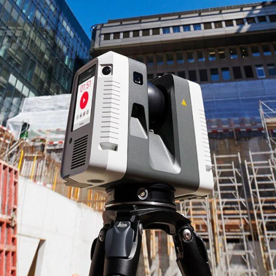
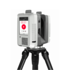
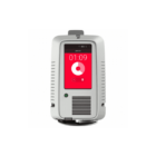
Leica RTC360 3D Laser Scanner
The Leica RTC360 Laser Scanner ushers in a new era of efficiency in 3D reality capture technology, boasting a remarkable capacity to measure up to 2 million points per second. This capability, combined with its advanced High Dynamic Range (HDR) imaging system, enables the production of detailed, color 3D point clouds in under two minutes. The scanner’s utilization of Visual Inertial System (VIS) technology facilitates automated, targetless field registration, streamlining the process from data capture to office transfer and significantly reducing fieldwork duration to enhance productivity.
The quality of the data captured by the RTC360 is notably high, with low noise contributing to sharper, more detailed scans. These high-resolution scans offer a wealth of information and are immediately usable across various applications. Integrated with the Cyclone FIELD 360 software, the scanner not only simplifies the registration process directly in the field but also delivers exceptional precision. This accuracy is verifiable on-site, ensuring that professionals have confidence in the data quality before leaving the site, thereby optimizing the workflow and maximizing operational efficiency.
Fast, agile and precise 3D reality capture solution
The Leica RTC360 3D reality capture solution empowers users to document and capture their environments in 3D, improving efficiency and productivity in the field and in the office through fast, simple-to-use, accurate, and portable hardware and software. The RTC360 3D laser scanner is the solution for professionals to manage project complexities with accurate and reliable 3D representations and discover the possibilities of any site.
Highly portable, highly automated, intuitive and designed for maximum productivity, the RTC360 solution efficiently combines the RTC360 a high-performance 3D laser scanner, Leica Cyclone FIELD 360 mobile-device app for edge computing for automatically registering scans in real time, and Leica Cyclone REGISTER 360 office software to integrate your 3D model seamlessly into your workflow.
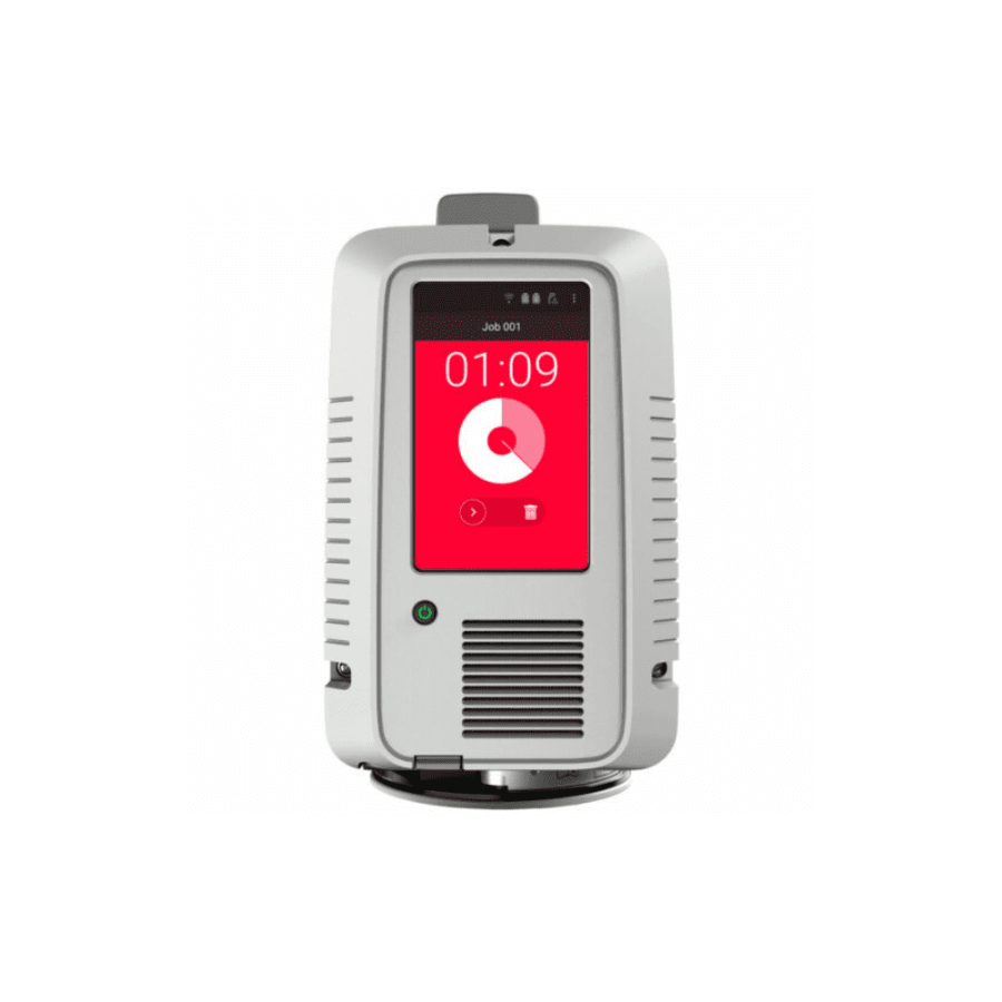
Capture scans, including enriching High-Dynamic Range (HDR) imagery, in less than two minutes.
Automatically record your moves from station to station to pre-register your scans in the field without manual intervention.
Augment your data capture with information tags illustrating the opportunities for better planning, reflect site reality, and boost your teams’ situational awareness.
Fast: The new Leica RTC360 laser scanner makes 3D reality capture faster than ever before. With a measuring rate of up to 2 million points per second and advanced HDR imaging system, the creation of coloured 3D point clouds can be completed in under two minutes. Plus, automated targetless field registration (based on VIS technology) and the seamless, automated transfer of data from site to office reduce time spent in the field and further maximise productivity.
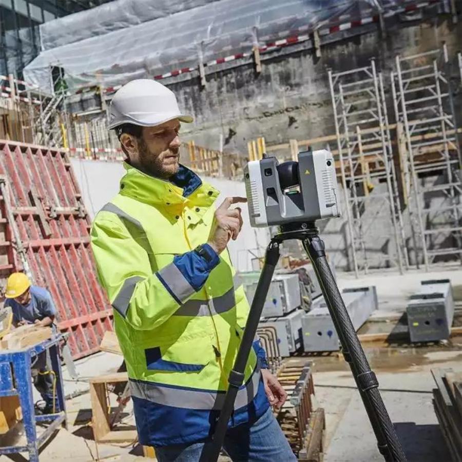
Agile: Small and lightweight, the Leica RTC360 scanner’s portable design and collapsible tripod mean it’s compact enough to fit into most backpacks, ready to be taken anywhere. Once on-site, easy-to-use, one-button operation makes for fast, hassle-free scanning.
Precise: Low noise data allows for better images, resulting in crisp, high-quality scans that are rich in detail and ready for use in a range of applications. Combined with Cyclone FIELD 360 software for automated registration in the field, the Leica RTC360 scanner offers outstanding precision that can be checked on-site.
Pre-registraton in the field: As part of the RTC360 solution, the Cyclone FIELD 360 app links the 3D data acquisition in the field with the laser scanner and data registration in the office with Cyclone REGISTER 360. On-site the user can automatically capture, register and examine scan and image data. The user interface combines easy handling of complex calculations with a graphical user guidance that offers a remarkable user experience, also for novice users.
Specifications
Product Specifications
| Leica RTC360 Product Specifications | |
| 3D Laser Scanner | High-speed 3D laser scanner with integrated HDR spherical imaging system and Visual Inertial System (VIS) for real-time registration |
| Data acquisition | < 2 min for complete full-dome scan and spherical HDR image at 6mm @ 10m resolution |
| Real time registration | Automatic point cloud alignment based on real-time tracking of scanner movement between setups based on Visual Inertial System (VIS) by the video-enhanced inertial measurement unit |
| Double scan | Automatic removal of moving objects |
| Distance measurement | High-speed, high dynamic time of flight enhanced by Waveform Digitizing (WFD) technology |
| Laser Class | 1 (in accordance with IEC 60825-1:2014), 1550nm (invisible) |
| Field of view | 360° (horizontal) / 300° (vertical) |
| Range | Min. 0.5 – up to 130 m |
| Speed | Up to 2‘000‘000 pts/sec |
| Resolution | 3 user-selectable settings (3/6/12mm @ 10m) |
| Accuracy * | Angular accuracy 18” Range accuracy 1.0 mm + 10 ppm 3D point accuracy 1.9 mm @ 10 m 2.9 mm @ 20 m 5.3 mm @ 40 m |
| Range noise * ** | 0.4 mm @ 10 m, 0.5 mm @ 20 m |
| Camera | 36 MP 3-camera system captures 432 MPx raw data for calibrated 360° x 300° spherical image |
| Speed | 1 minute for full spherical HDR image at any light condition |
| HDR | Automatic, 5 brackets |
| Visual Inertial System | Video enhanced inertial measuring system to track the movement of the scanner position relative to the previous setup in real-time |
| Tilt | IMU-based, Accuracy: 3‘ for any tilt |
| Additional sensors | Altimeter, Compass, GNSS |
| On scanner | Touch-screen control with finger touch, full-color WVGA graphic display 480 x 800 pixels |
| Mobile devices | Leica Cyclone FIELD 360 app for iPad or Android tablets including: – Remote control of scan functions – 2D & 3D data viewing – Tagging – Automatic alignment of scans |
| Wireless | Integrated wireless LAN (802.11 b/g/n) |
| Data storage | Leica MS256, 256GB exchangeable USB 3.0 flash drive |
| Housing | Aluminum frame and side covers |
| Dimensions | 120mm x 240mm x 230mm / 4.7‘‘ x 9.4‘‘ x 9.1 |
| Weight | 5.35 kg / 11.7 lbs, nominal (w/o batteries) |
| Mounting mechanism | Quick mounting on 5/8“ stub on lightweight tripod / optional tribrach adapter/survey tribrach adapter available |
| Internal battery | 2 x Leica GEB361 internal, rechargeable Li-Ion batteries. Duration: Typically up to 4 hours Weight: 340 g per battery |
| External | Leica GEV282 AC adapter |
| Operating temperature | 5° to +40° C |
| Storage temperature | 40° to +70° C |
| Operating low temperatures **** | 10° to +40°C |
| Dust/Humidity *** | Solid particle/liquid ingress protection IP54 |
FAQs for Leica RTC360 3D Laser Scanner
1. What is the Leica RTC360 3D Laser Scanner used for?
The Leica RTC360 is a cutting-edge 3D laser scanner designed for professionals in architecture, engineering, construction, and public safety. It captures high-resolution 3D images of complex environments and structures quickly and accurately, facilitating the creation of detailed digital twins for various applications such as building information modeling (BIM), forensic analysis, and heritage preservation.
2. How fast can the Leica RTC360 capture a scene?
The RTC360 is renowned for its speed and efficiency, capable of capturing a full 360-degree scan in under two minutes. Its advanced technology allows for rapid acquisition of data, making it one of the fastest 3D scanners available on the market, ideal for projects requiring quick turnaround times.
3. What is the accuracy of the Leica RTC360?
The scanner boasts an impressive accuracy, with the ability to capture details up to 1 mm at distances of up to 10 meters. This precision makes it suitable for applications where detail and accuracy are paramount, ensuring that the digital representations are as close to reality as possible.
4. Can the Leica RTC360 be used in difficult lighting conditions?
Yes, the RTC360 is equipped with HDR imaging technology, allowing it to capture high-quality scans even in challenging lighting conditions. Whether in bright sunlight or in poorly lit interiors, the scanner adjusts to provide clear and detailed images.
5. Is the Leica RTC360 easy to transport?
Designed with portability in mind, the RTC360 is lightweight and compact, making it easy to transport between sites. It comes with a carrying case that protects the device during transit, ensuring it can be used in various locations without issue.
6. How does the RTC360 handle data processing?
The RTC360 features Leica’s unique Visual Inertial System (VIS), which enables automatic pre-registration of scans on-site. This significantly speeds up the post-processing workflow, as the bulk of the data alignment is done during the scanning process, reducing the need for intensive manual data manipulation afterward.
7. What software is compatible with the RTC360?
Leica Geosystems provides a suite of software solutions designed to work seamlessly with the RTC360, including Leica Cyclone REGISTER 360 for data processing and Leica JetStream for high-speed data visualization. Additionally, it supports a wide range of third-party software, making it versatile for various project requirements.
8. Can the Leica RTC360 operate in extreme weather conditions?
The RTC360 is built to be robust and can operate in a wide range of environmental conditions. It is rated with an IP54 for dust and water resistance, making it capable of working in both dusty environments and light rain.
9. What type of maintenance does the Leica RTC360 require?
Regular maintenance of the RTC360 involves keeping the lenses clean and ensuring the firmware is up to date. Leica Geosystems provides detailed guidelines for the care and maintenance of the scanner to ensure it operates at peak performance.
10. How can I get training or support for the Leica RTC360?
Leica Geosystems offers comprehensive training and support for the RTC360 through a global network of service centers and authorized dealers. Training sessions are available both in-person and online, covering operation, data processing, and best practices to maximize the scanner’s potential.


There are no reviews yet.